Archive for category Rented locally
Namibia 2025
Posted by Peter in Rented locally on December 24, 2025
This was our first trip with Great Road Journeys; we had booked for 2026 but whilst in Romania we had an email from Steve saying there was a cancellation for 2025 and would we like to go – so we did!
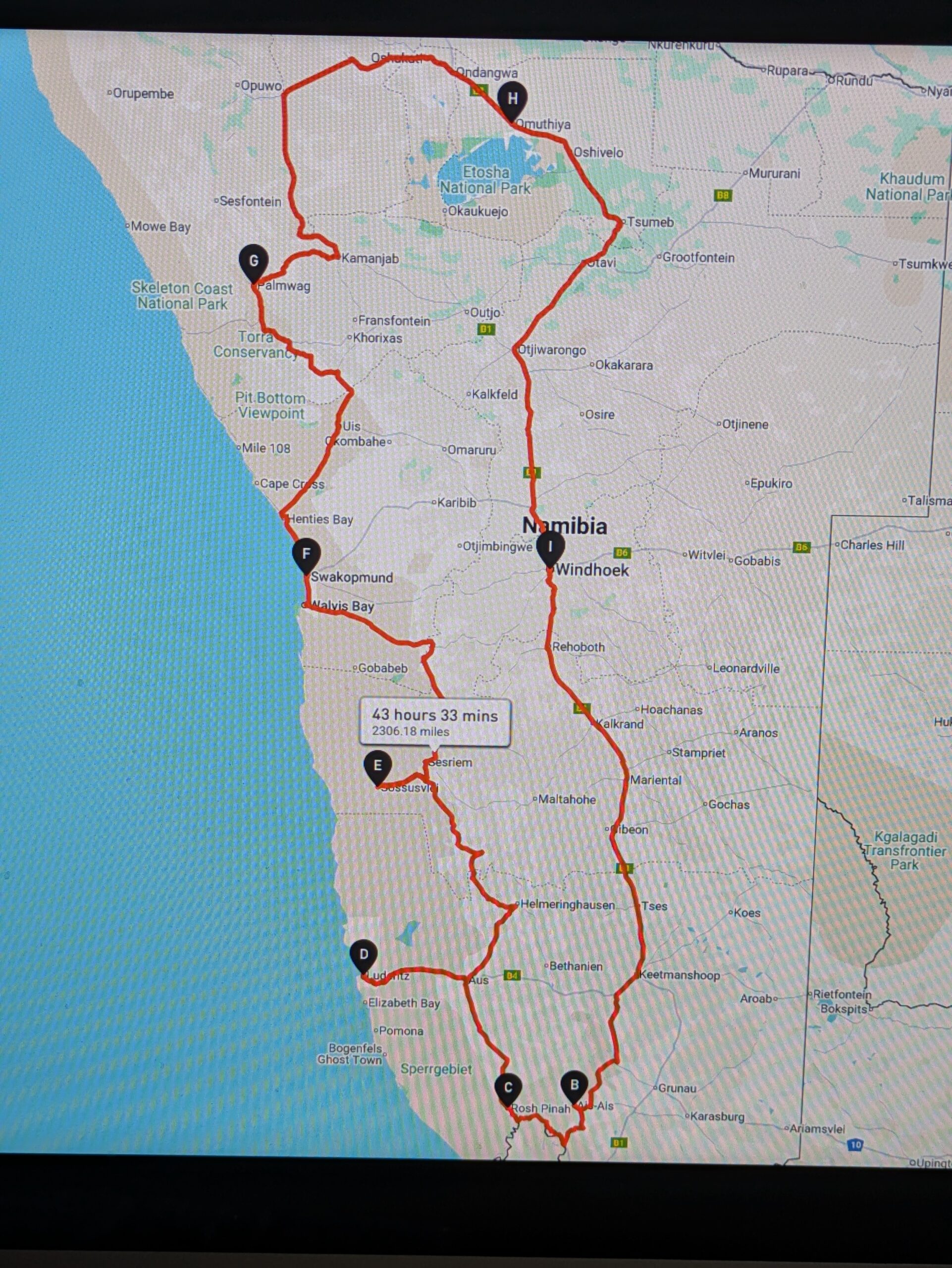
The Route
At Windhoek hotel
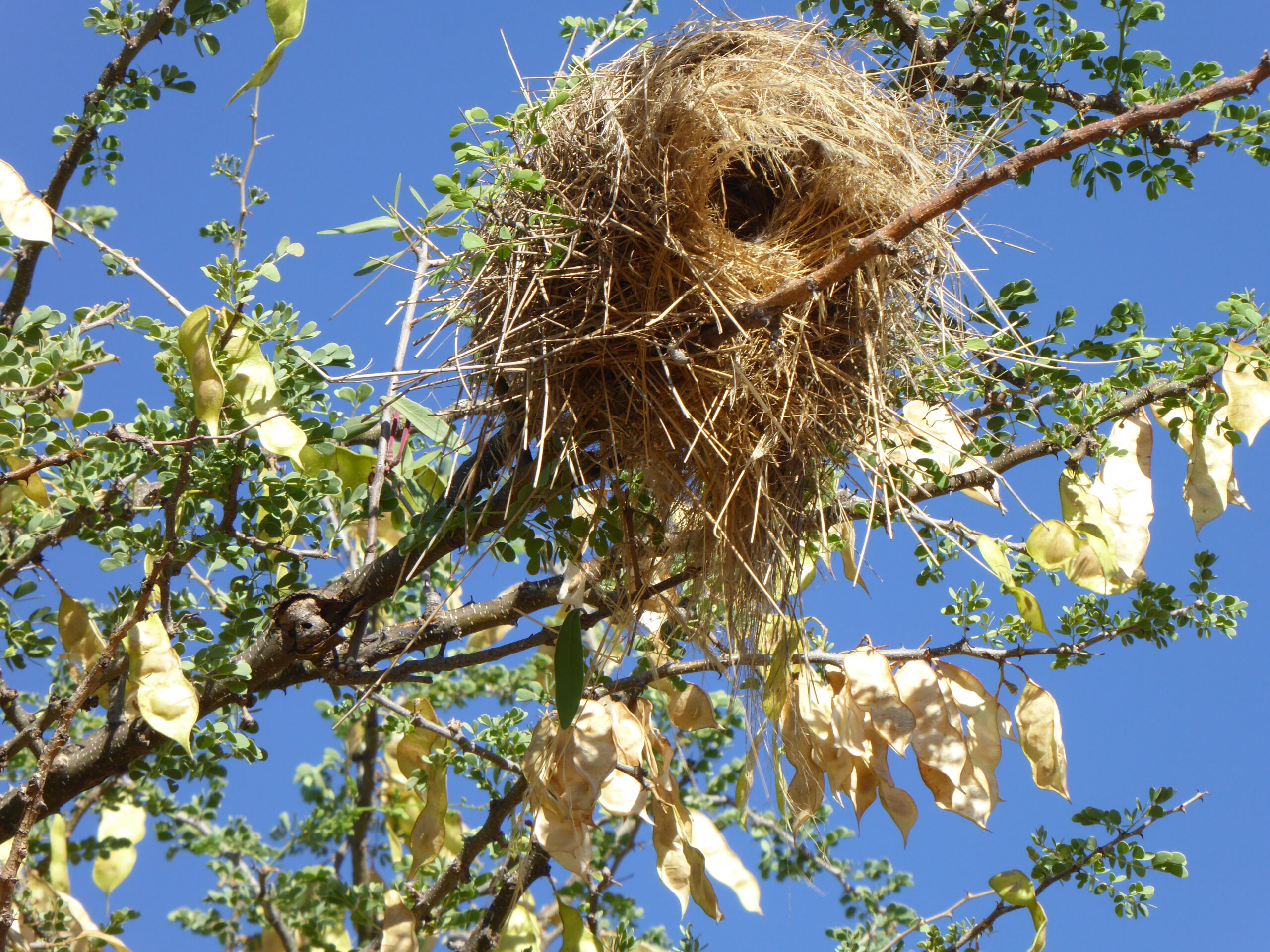
Nest at Windhoek hotel
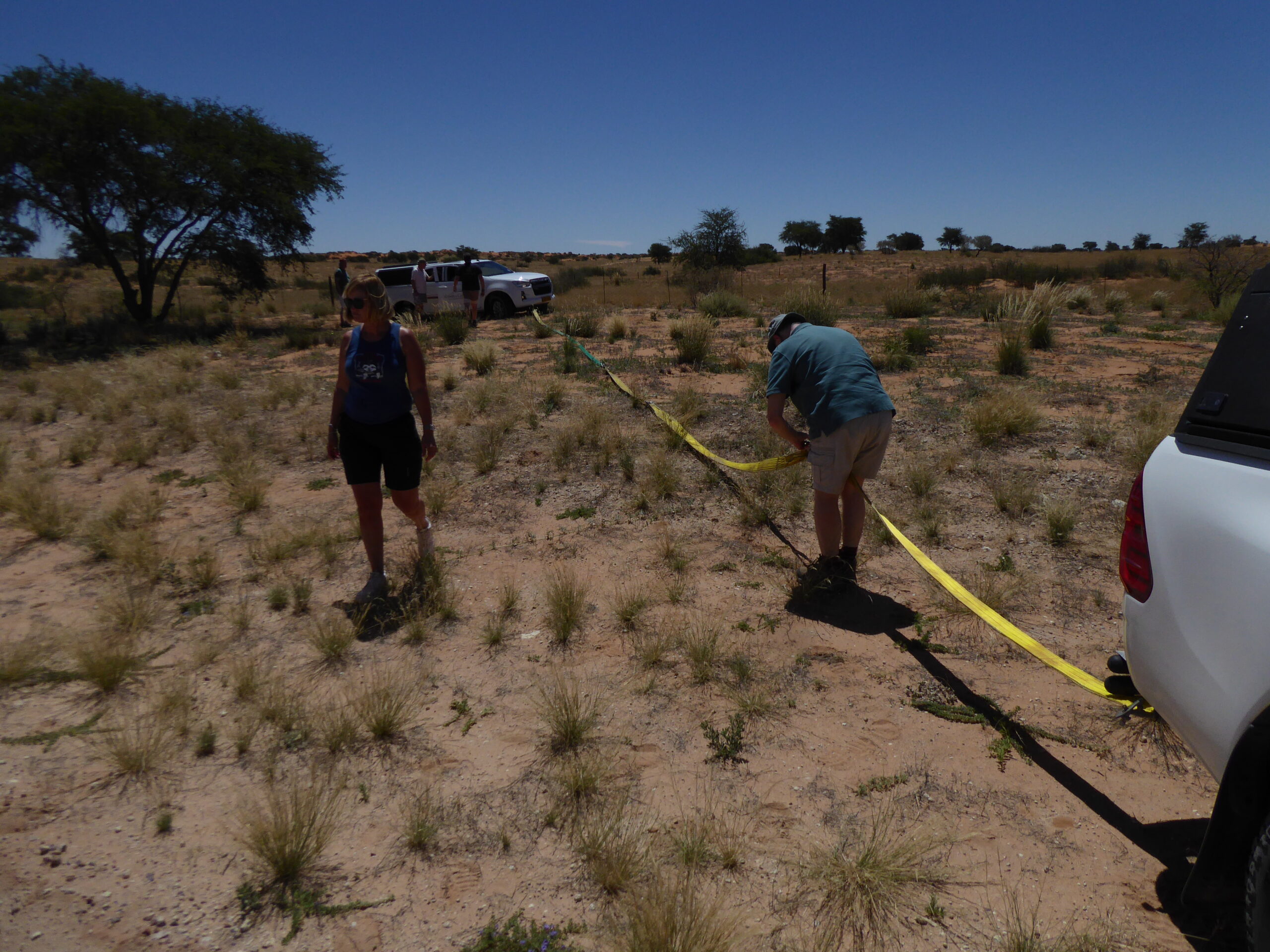
The first day saw us start in a local supermarket, primarily to buy water but also any snacks or lunches we might want. Then a fairly gentle drive to a game park just north of Mariental – and a load more instructions on the use of 4WD and the penalties we might incur if we left 4WD engaged for too long! Each car had been equipped with a tool bag including a length of tow rope and
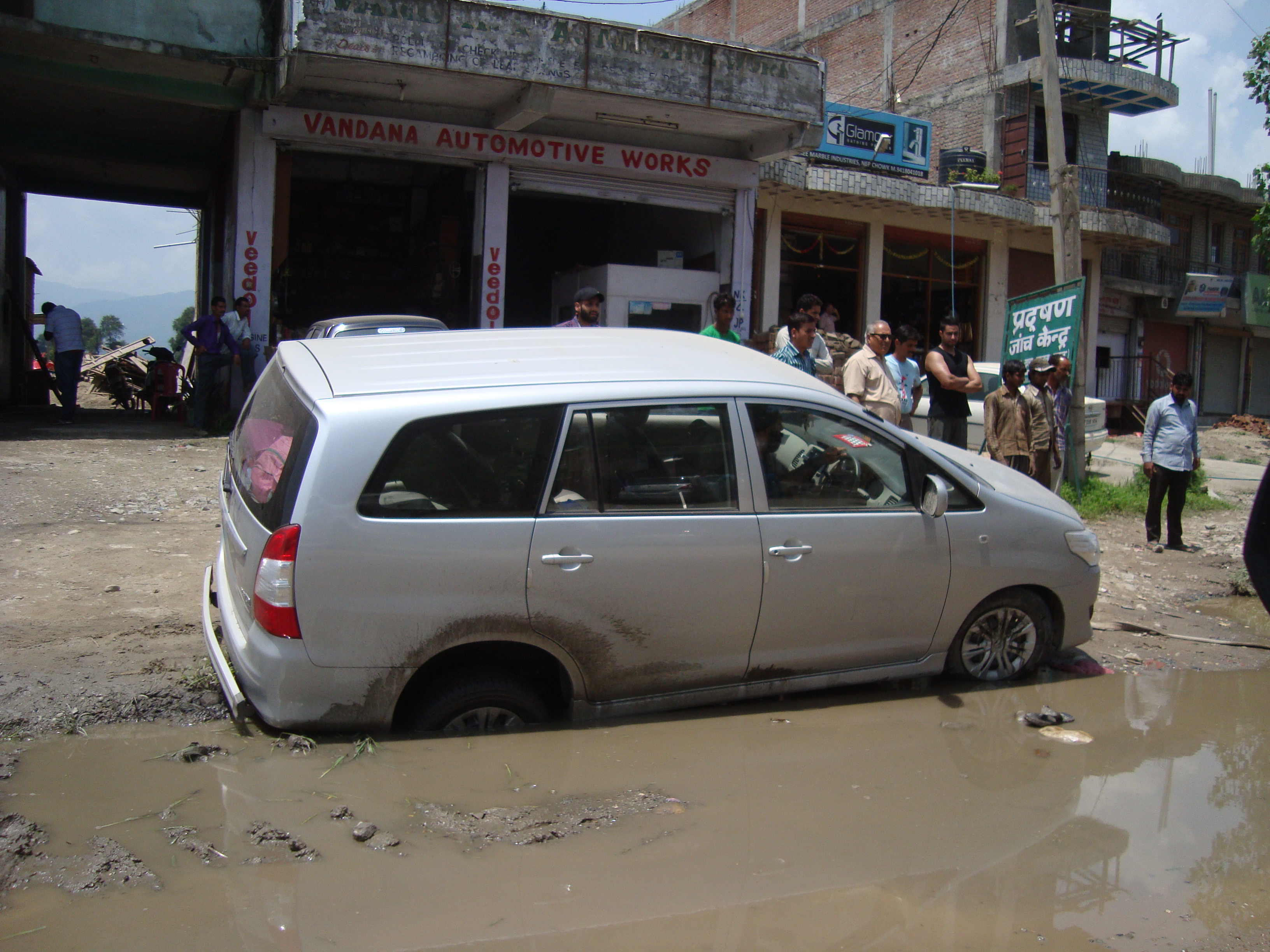
Stuck at lunch
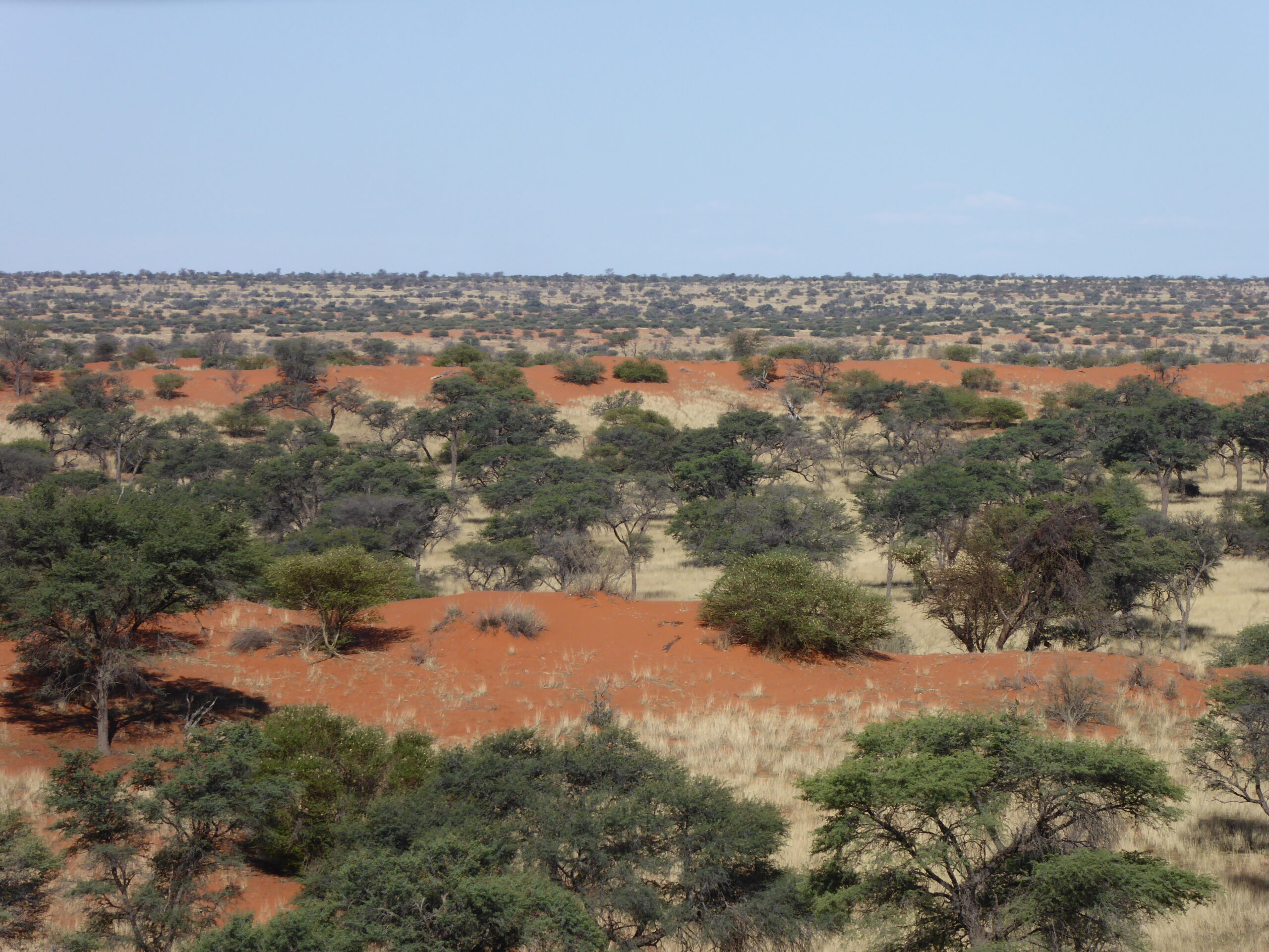
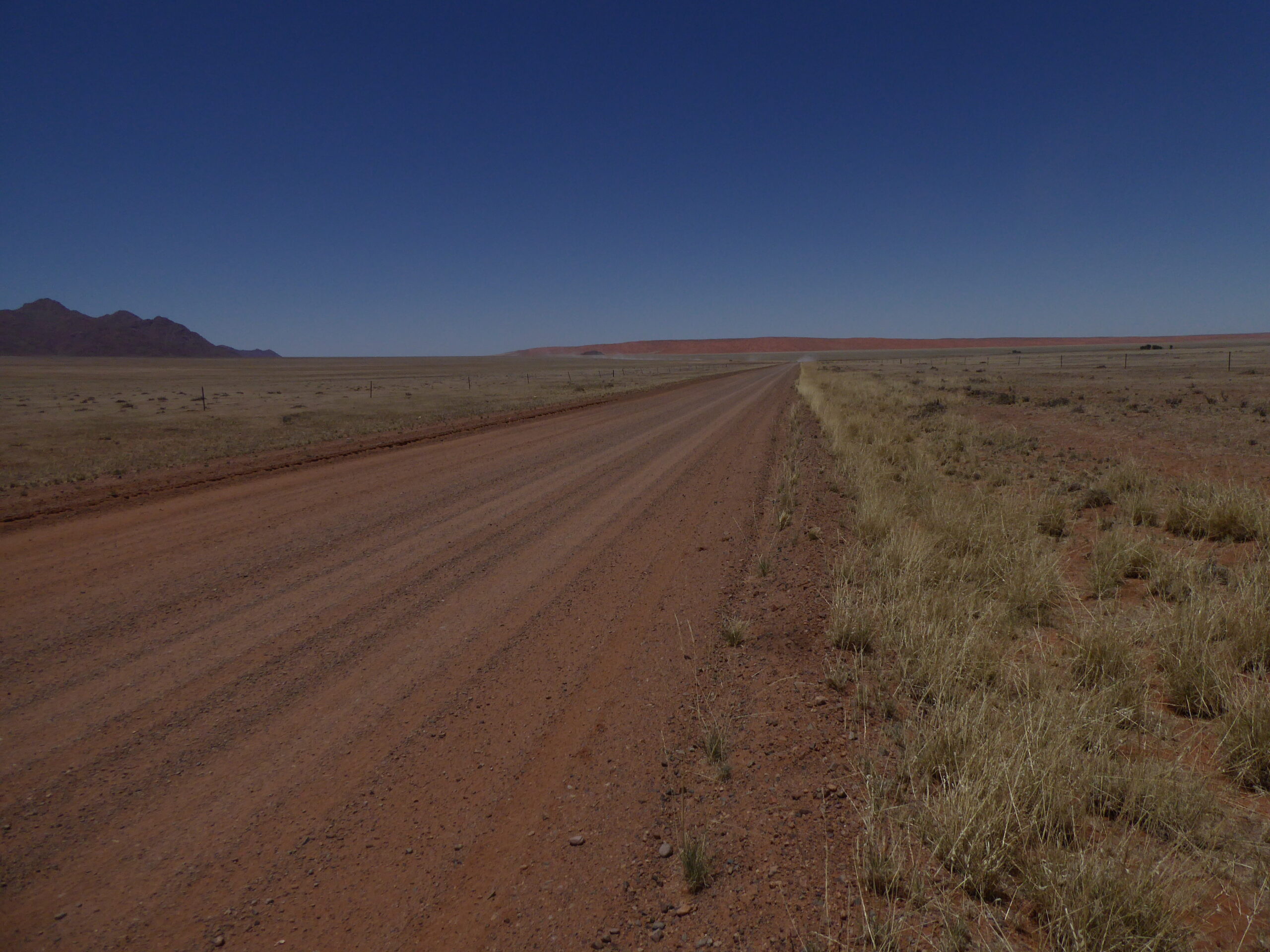
Landscape
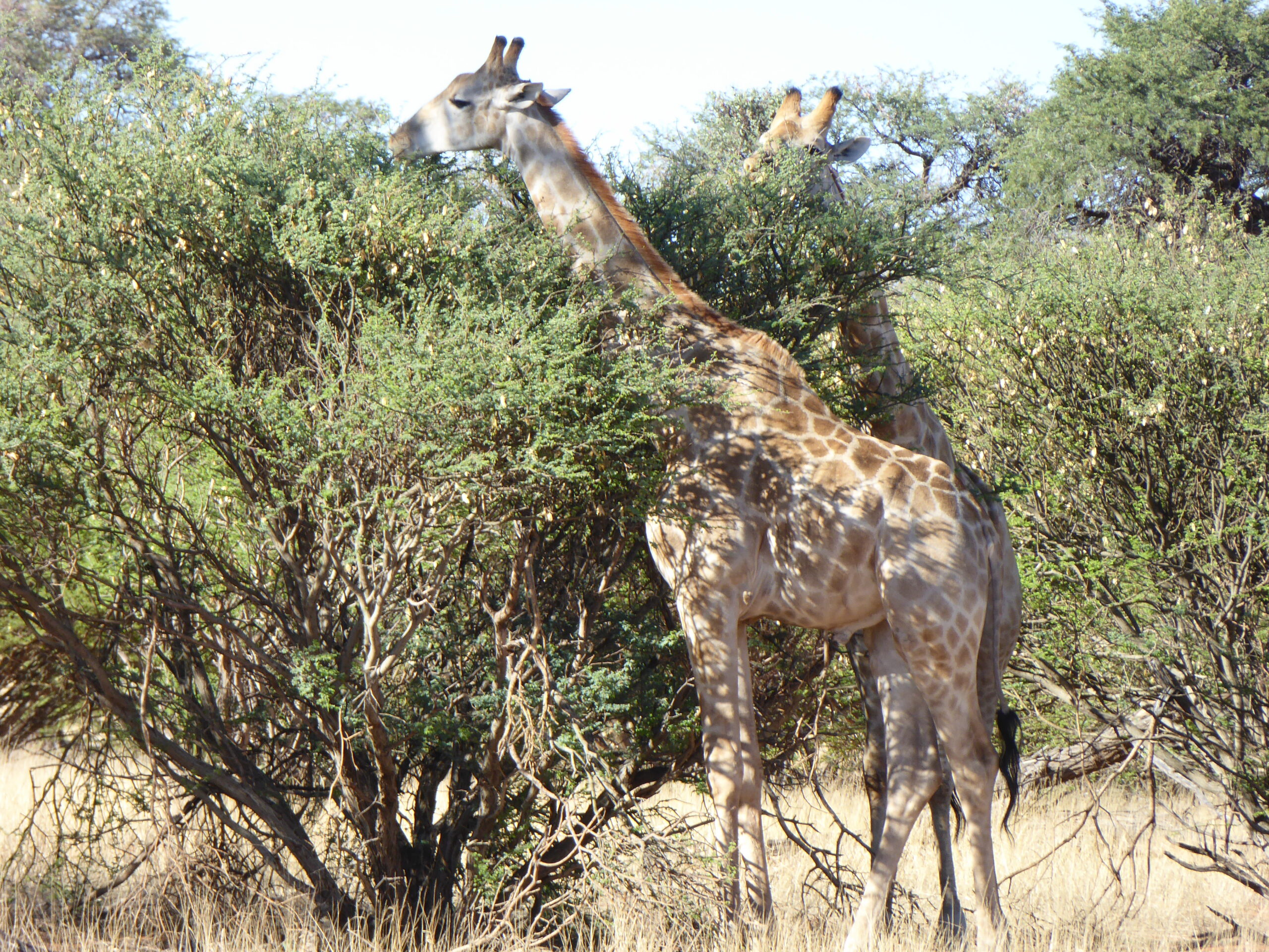
Two giraffe
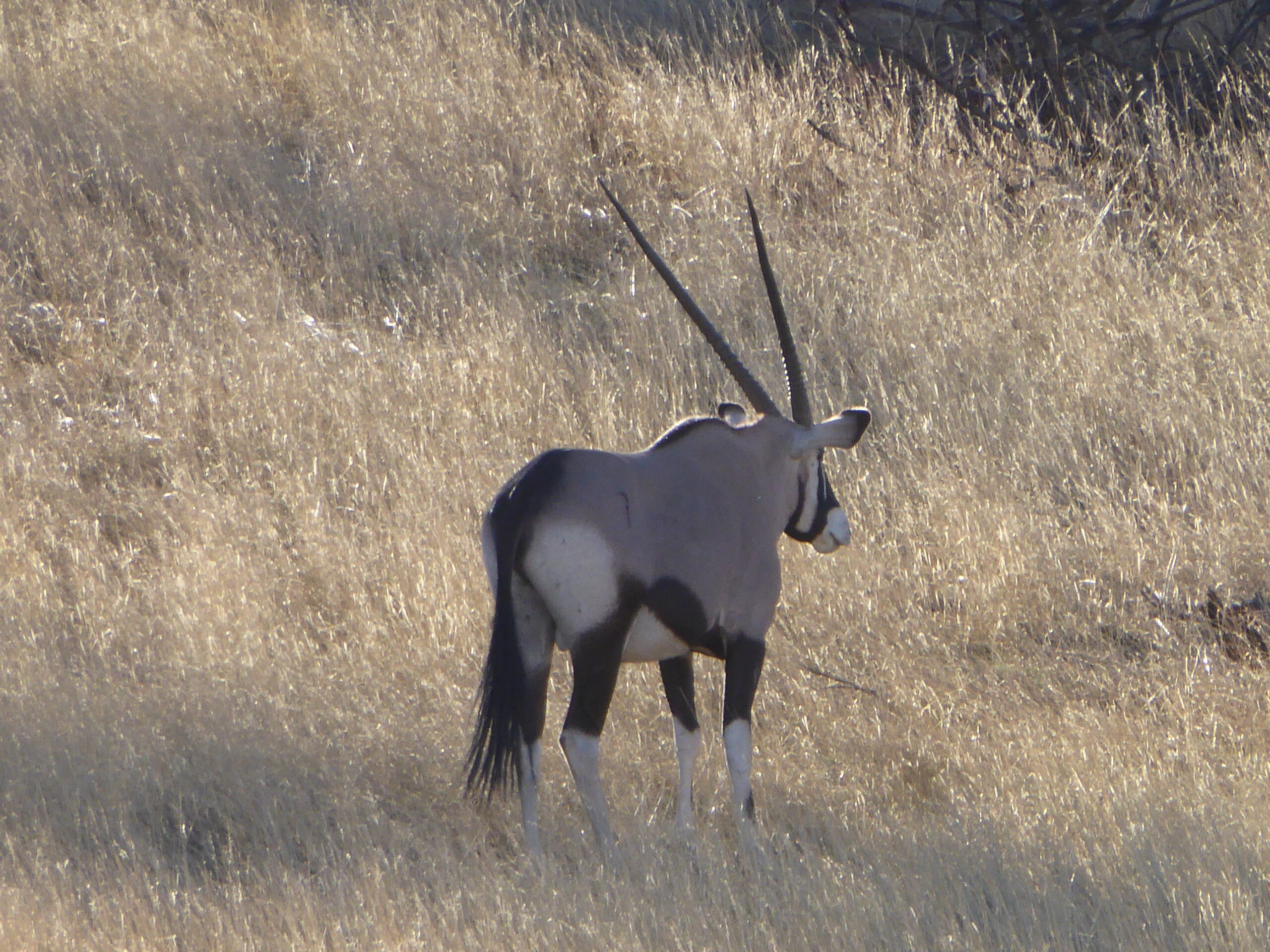
Shy Oryx
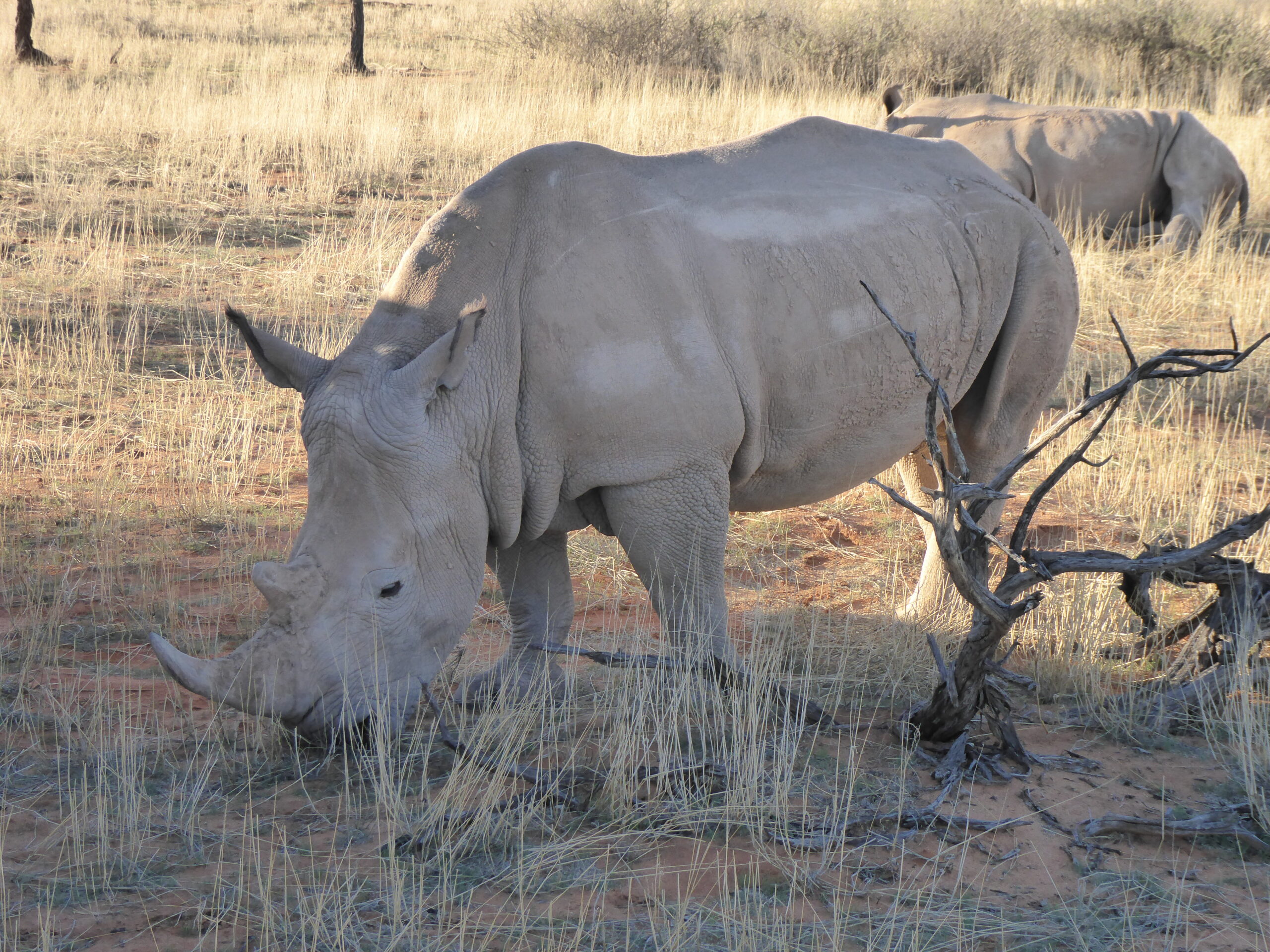
Rhino
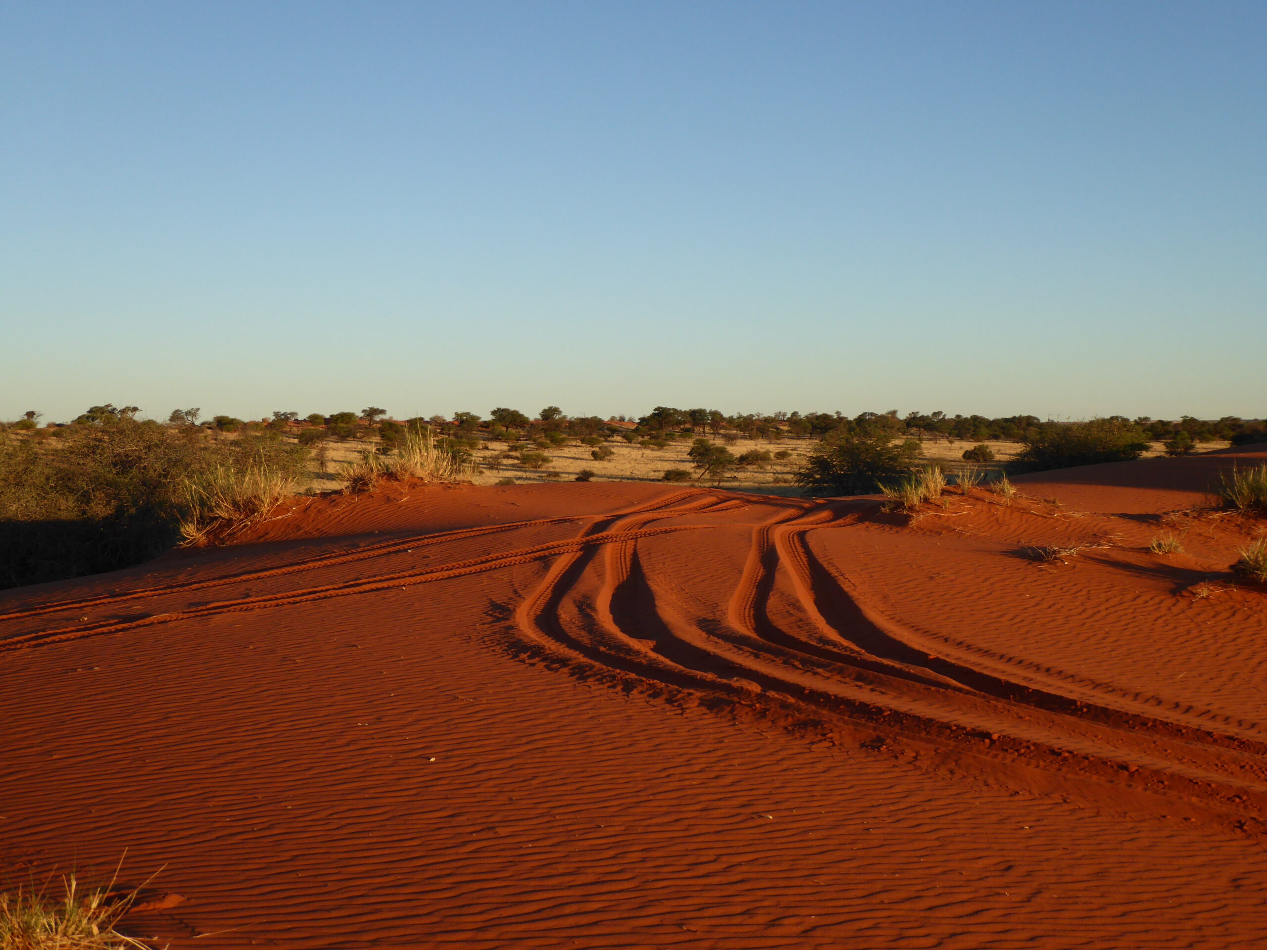
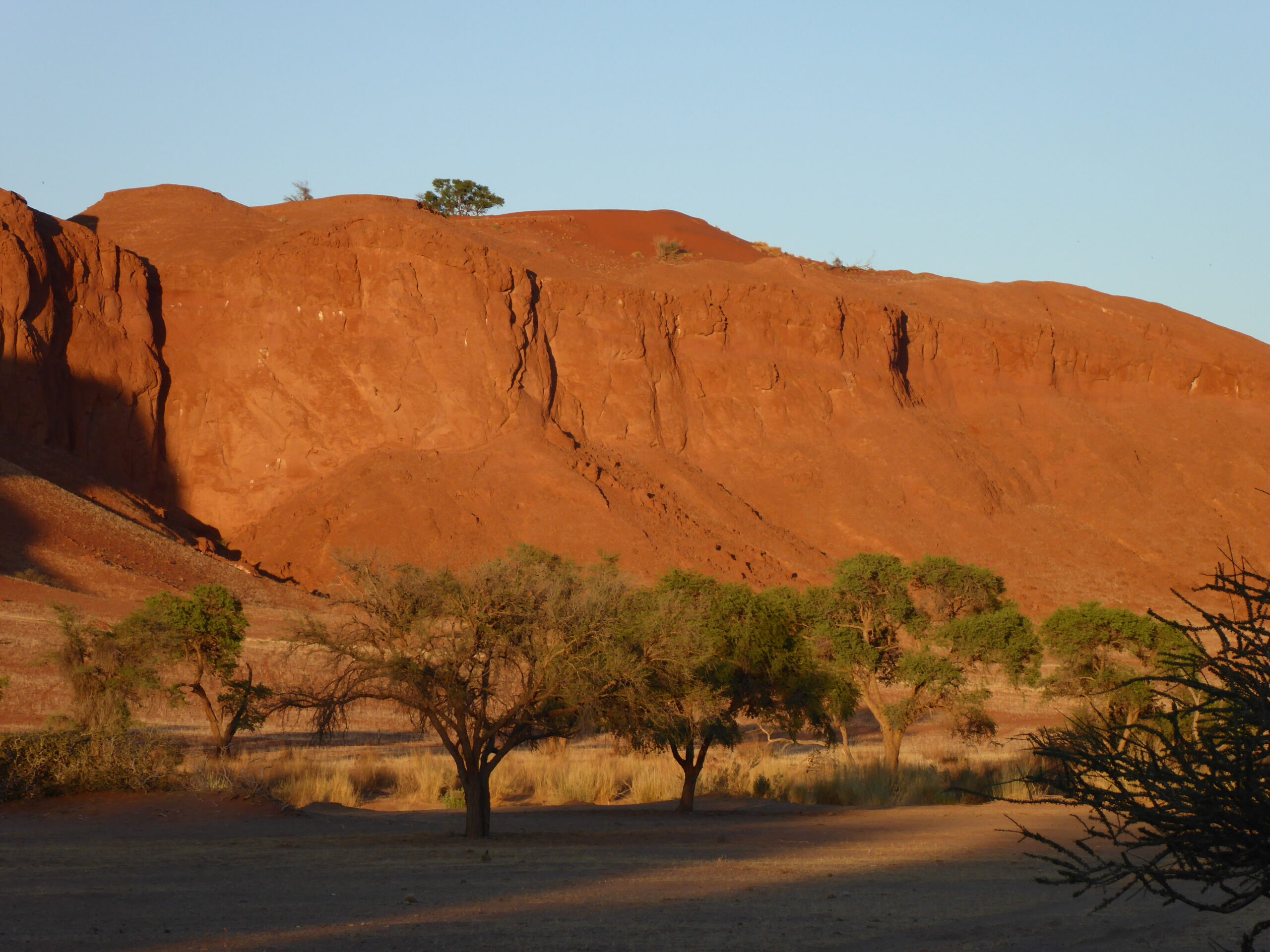
Red earth
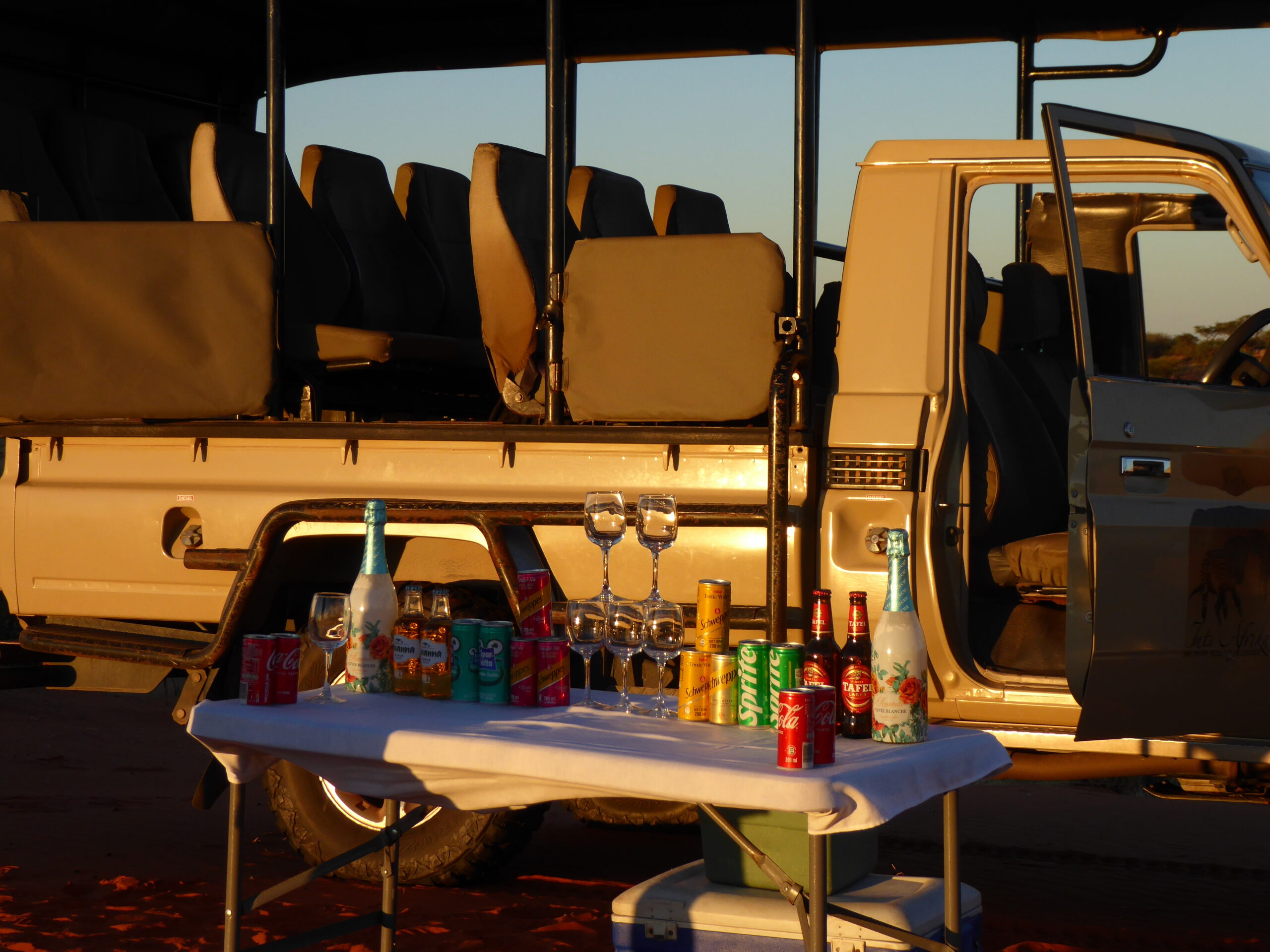
Drinks Table
We continued south with an overnight stop at near Fish River Canyon. First stop was an oddball coffee stop at Garas Rest camp with all sorts of junk art
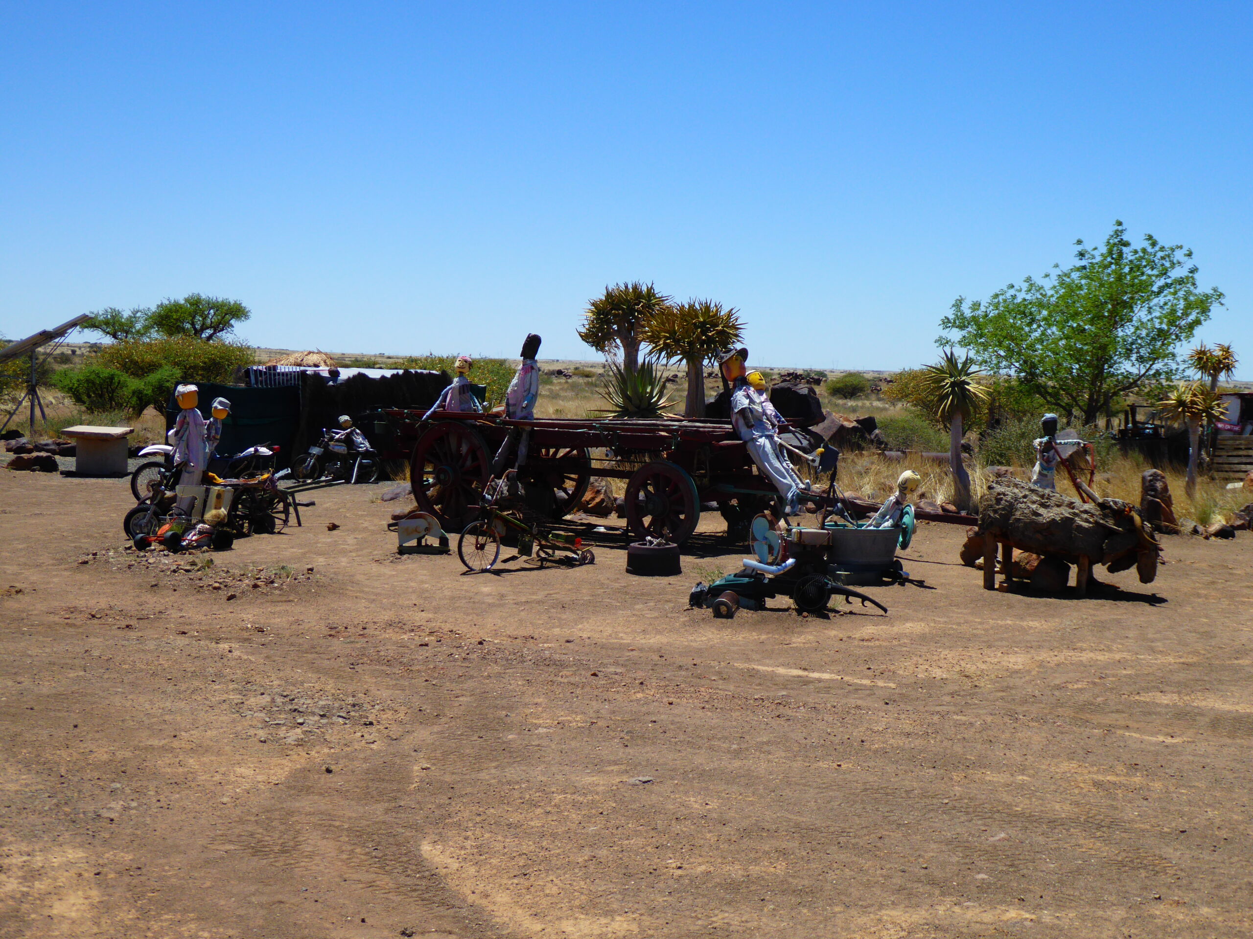
Garas rest camp
Canyon Rest Camp
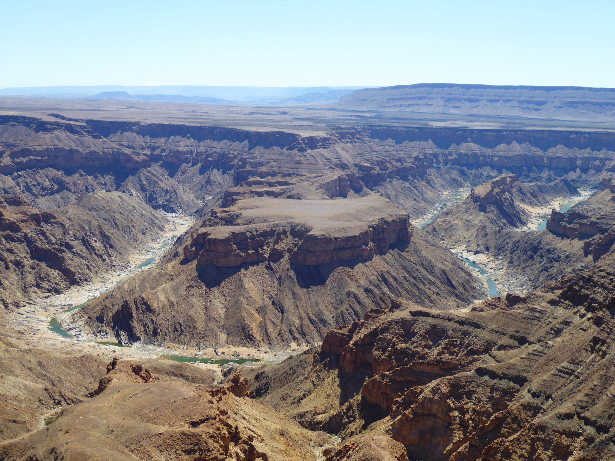
Fish River Canyon
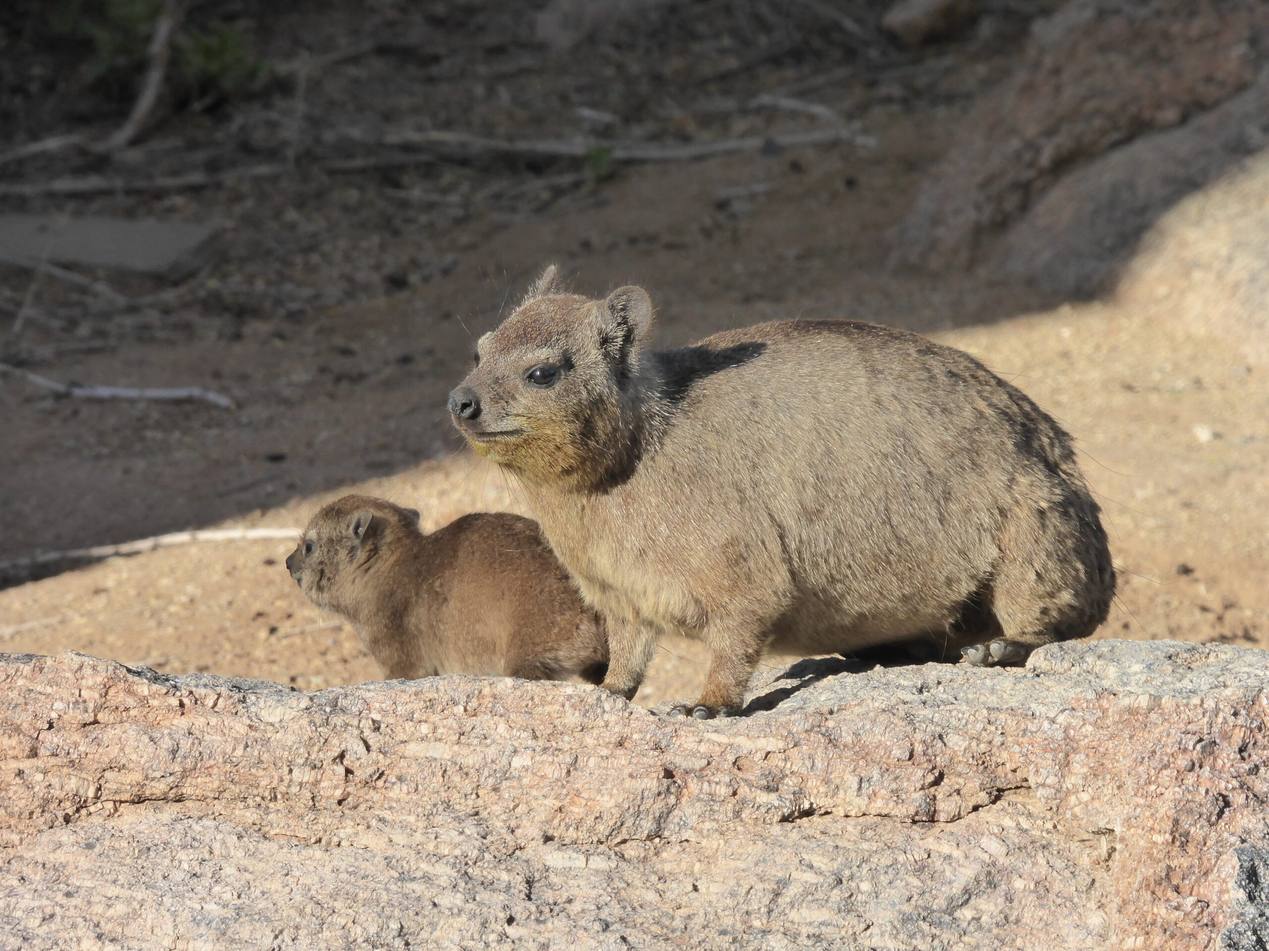
Rock Dassie at Canyon Lodge
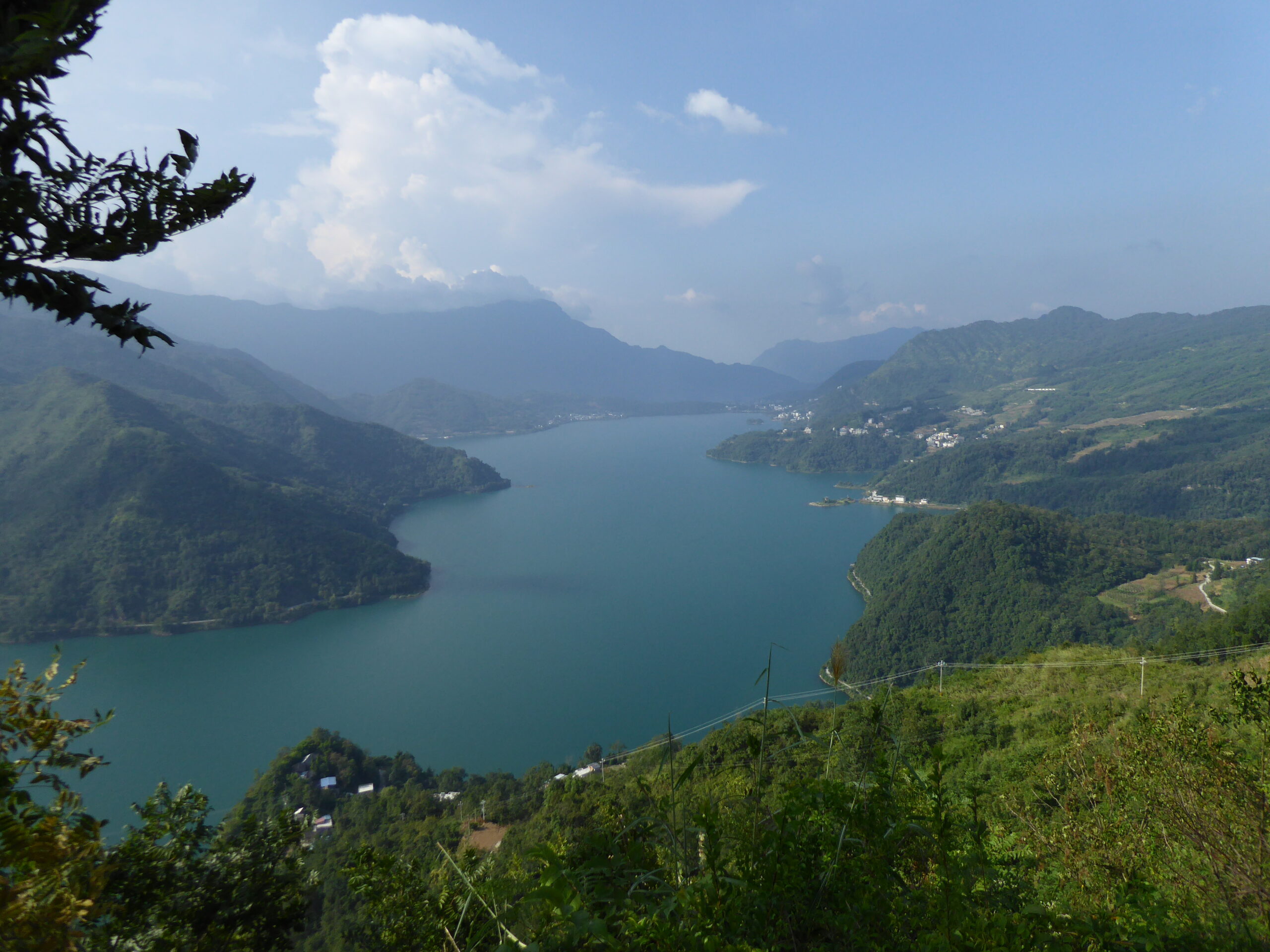
Now nearly at our furthest point south, after the arid waste near Fish River we meet the relative greenery of Orange River.
Leaving Fish River area
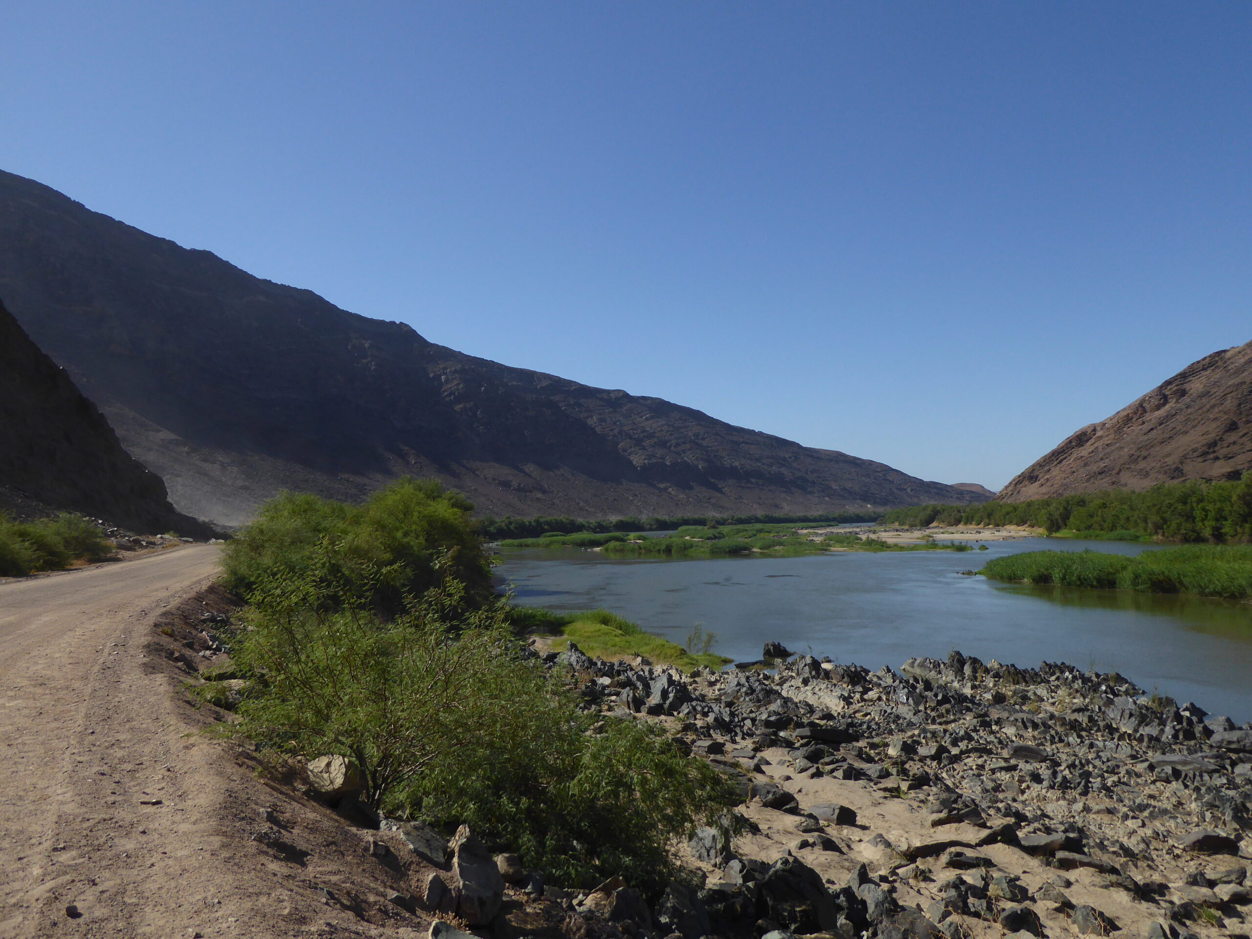
Orange River
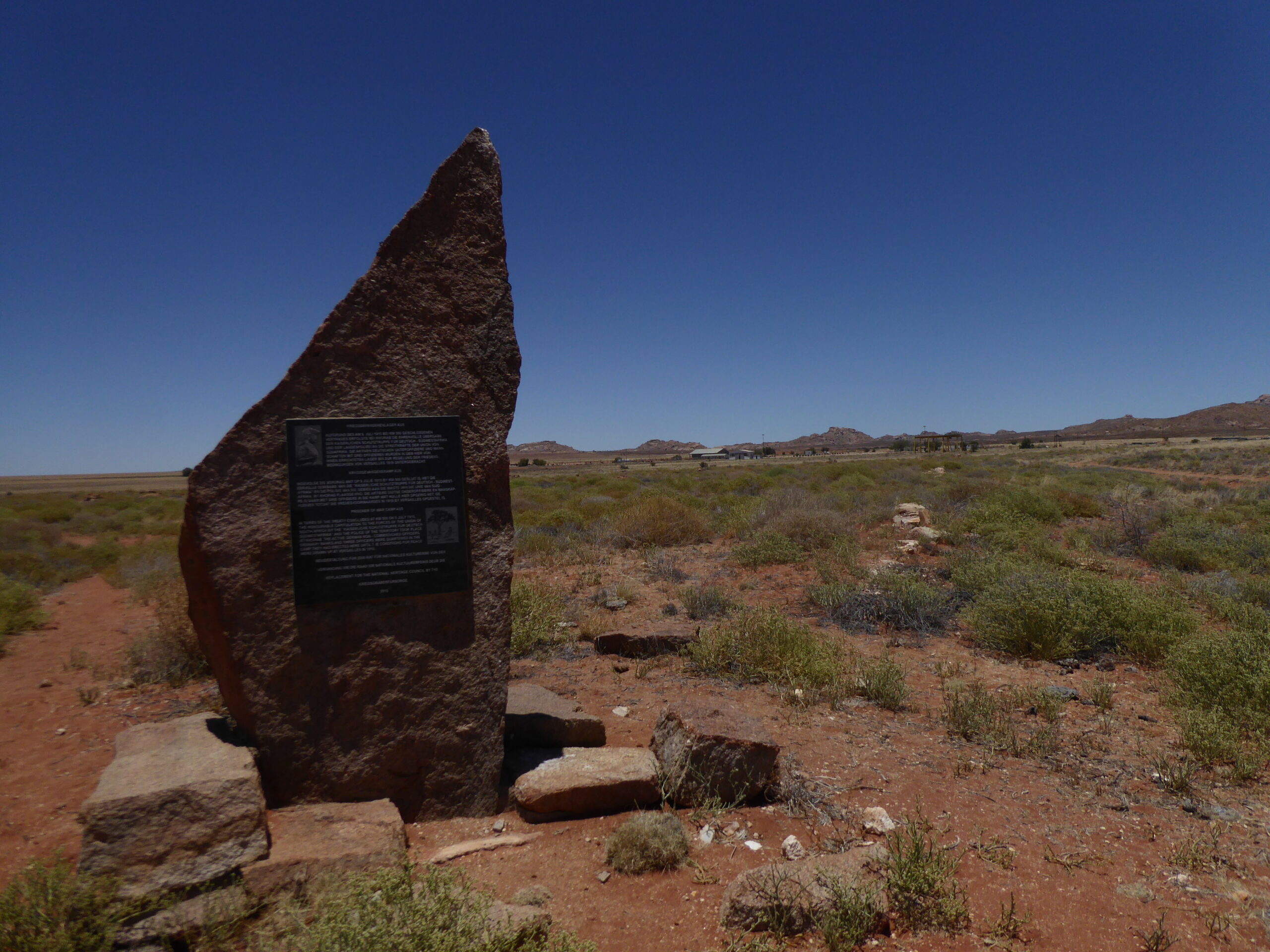
Memorial plaque at Aus POW camp
An early start for our visit to the deserted diamond mining town of Kolmanskop. Once the richest place in the country, it was abandoned in c.1955 when the water supply was switched off
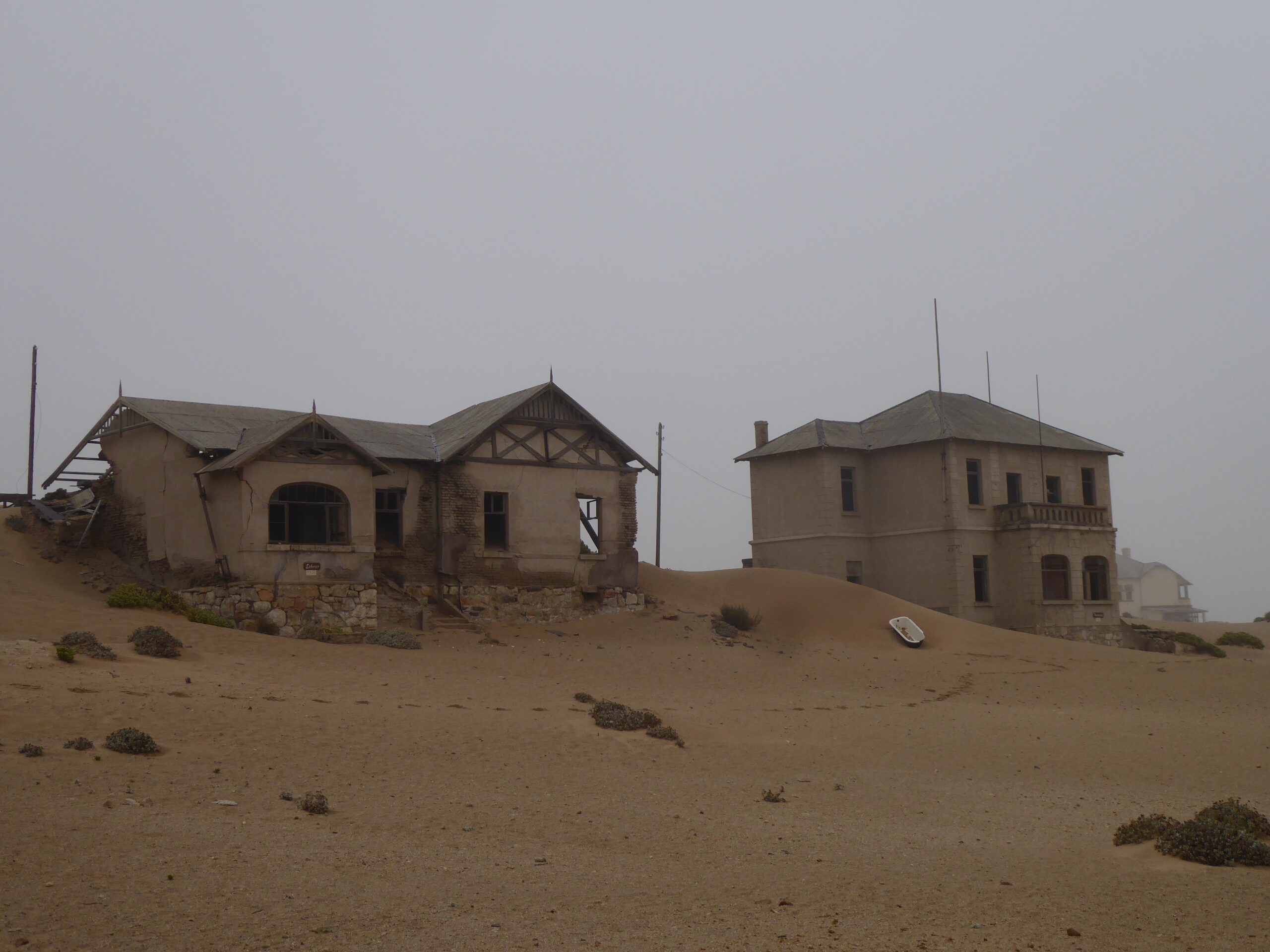
Managers’ houses at Kolmanskop
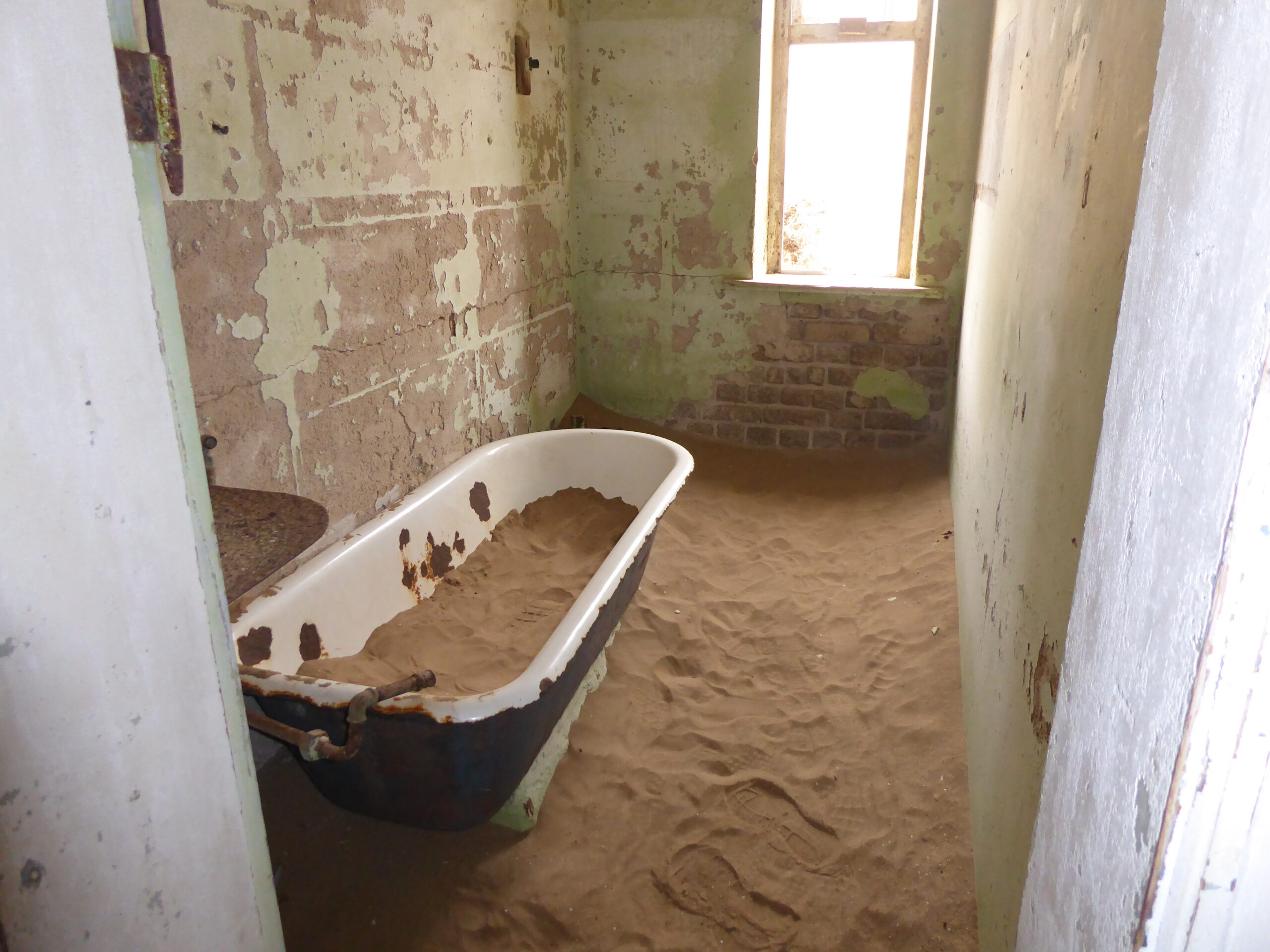
Inexorable sand
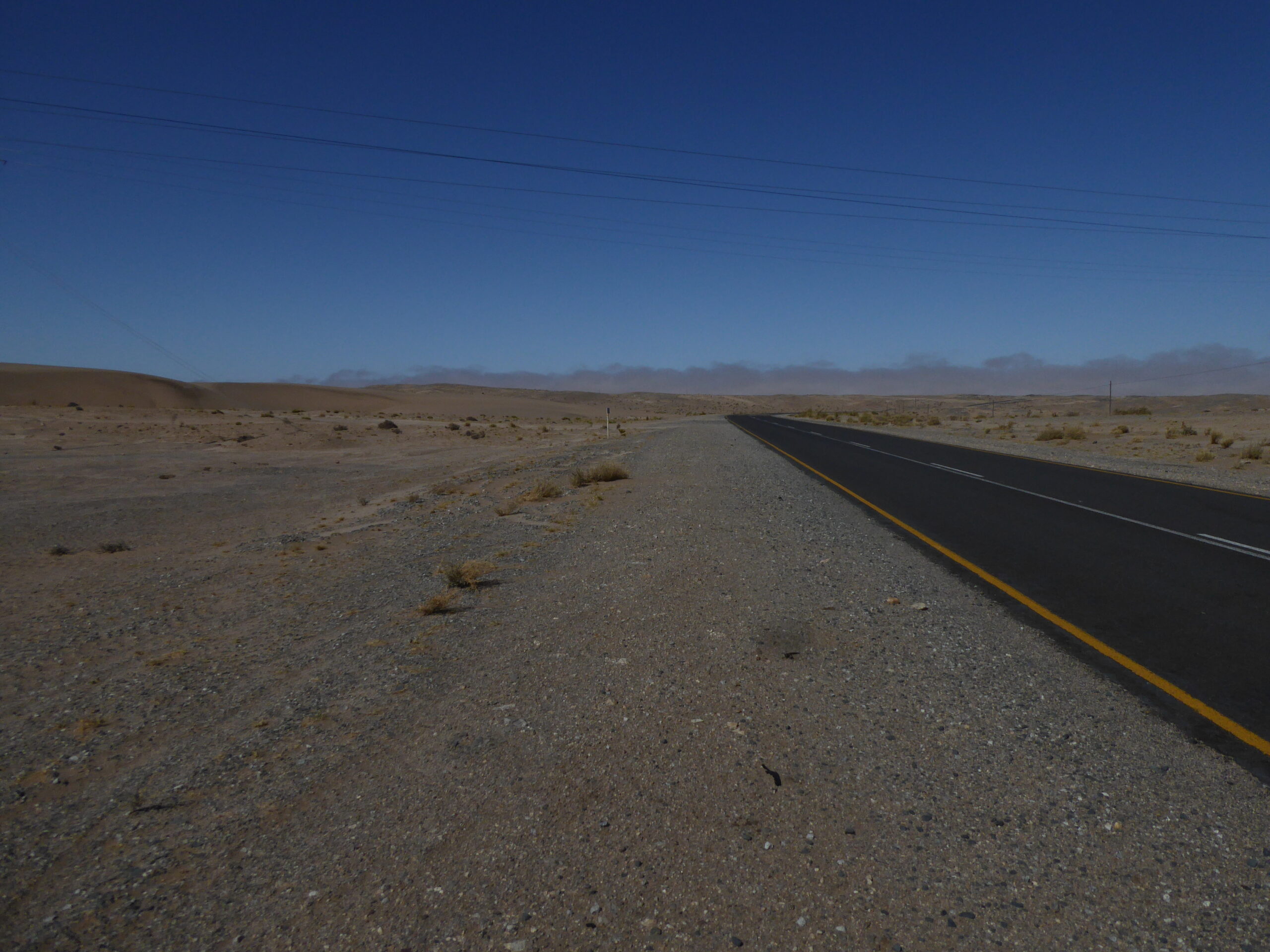
Heading West from Kolmanskop
The Road to Sossusvlei
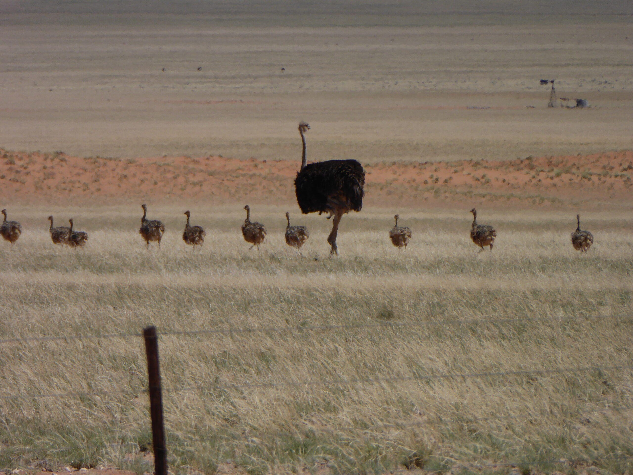
Ostrich and family
Our stop in Sossusvlei was to enable the energetic to get to Big Daddy sand dune (the biggest) at an acceptably cool time in the early morning – walk up and slip/slide down – as the next night’s hotel was only 50 odd km away. No way Allison could have managed the dune so after trekking in the Sesriem Canyon, we decided on a trip into the countryside and found the Neuras Winery.
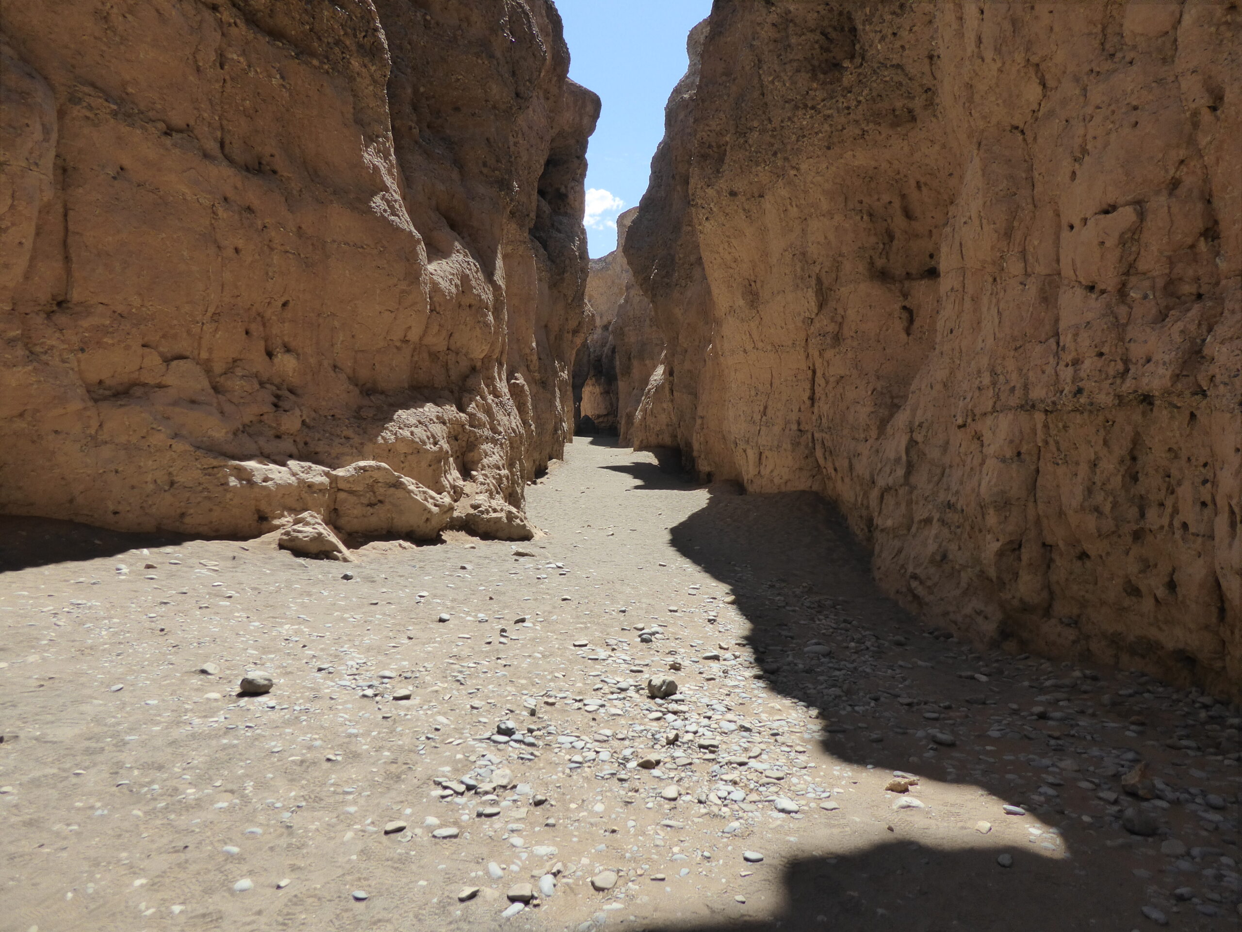
Sesriem Canyon
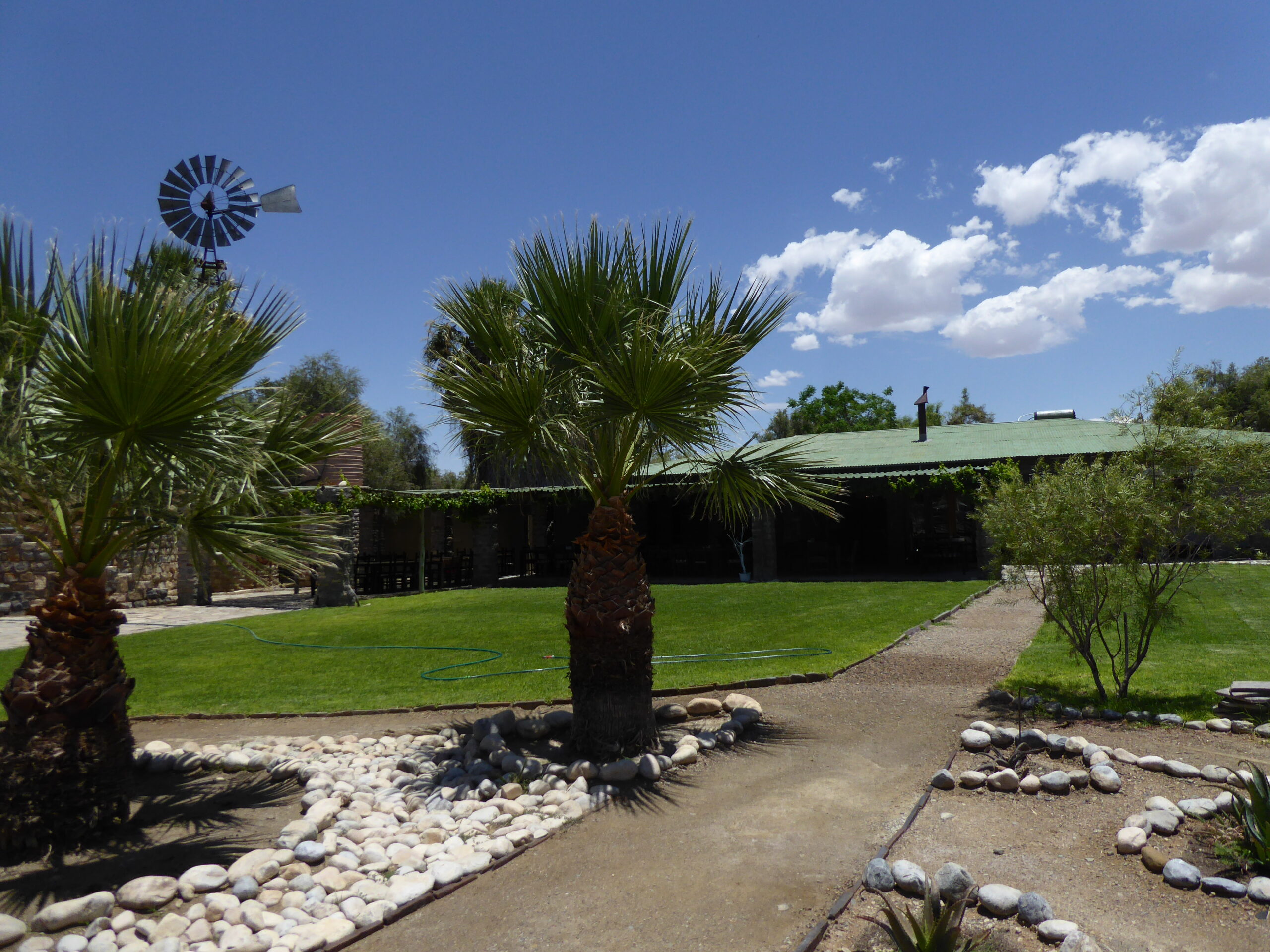
Neuras winery reception
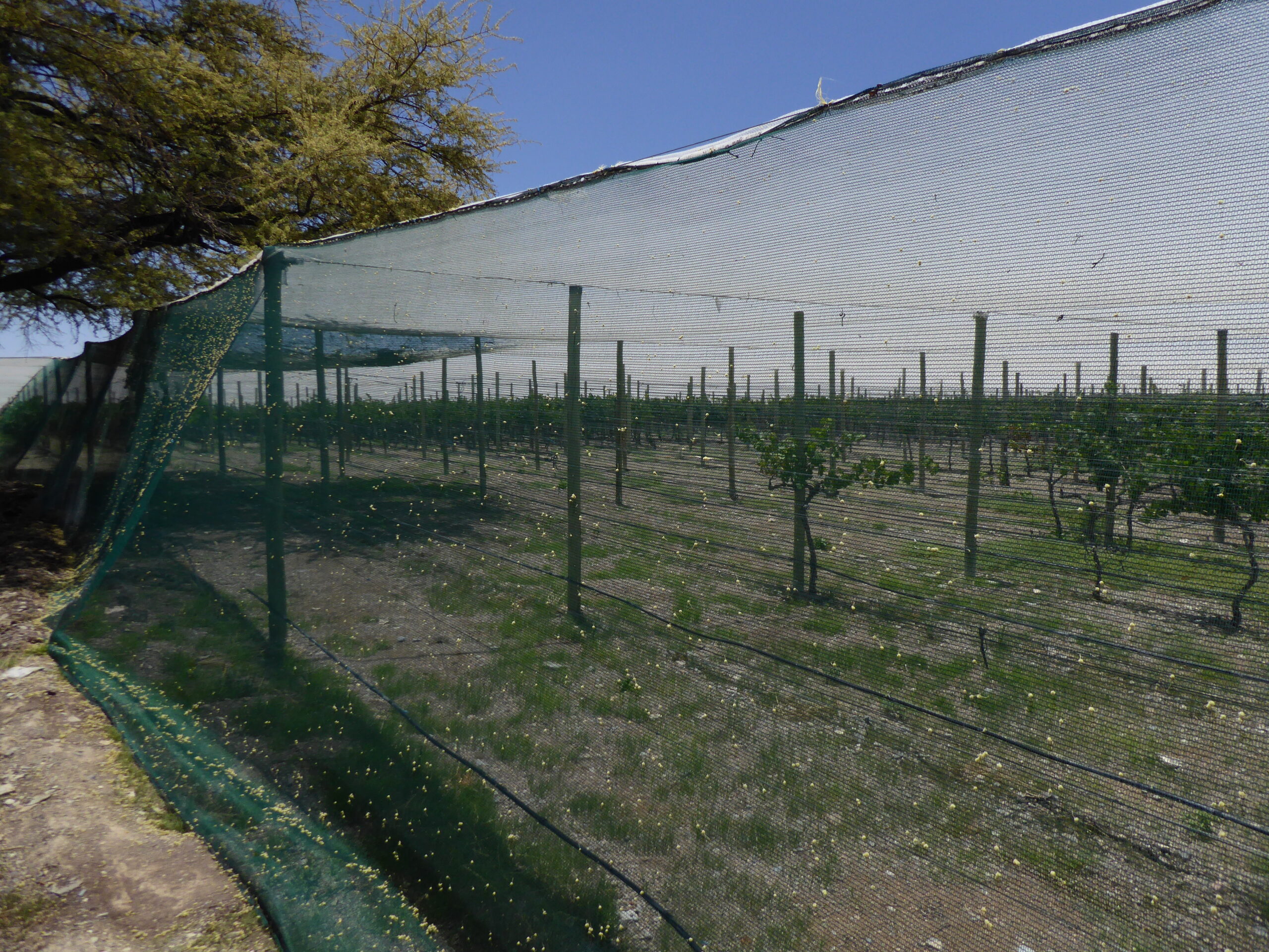
Covered vineyard
Roadside cliffs
Next day was a straight forward half day run of 300km into Swakopmund, past the once strategically important harbour of Walvis Bay.
Swakopmund main street
On board with David to the right
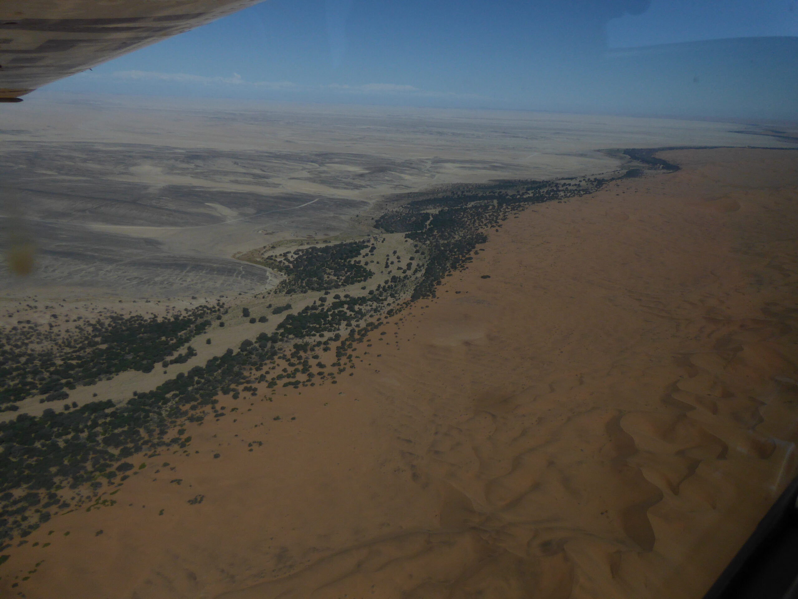
River boundary
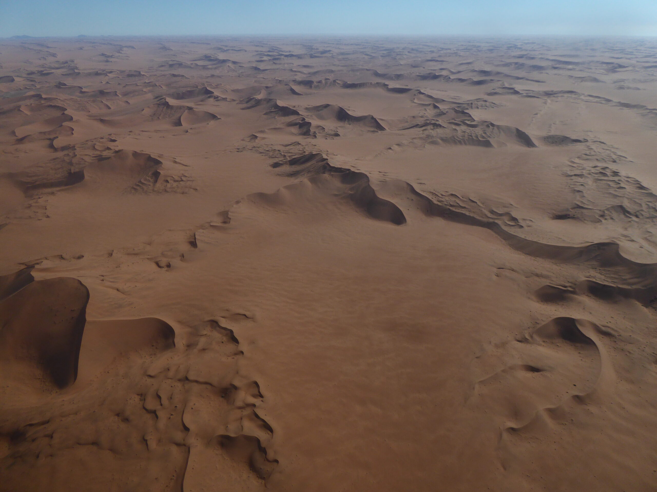
Dunes from above
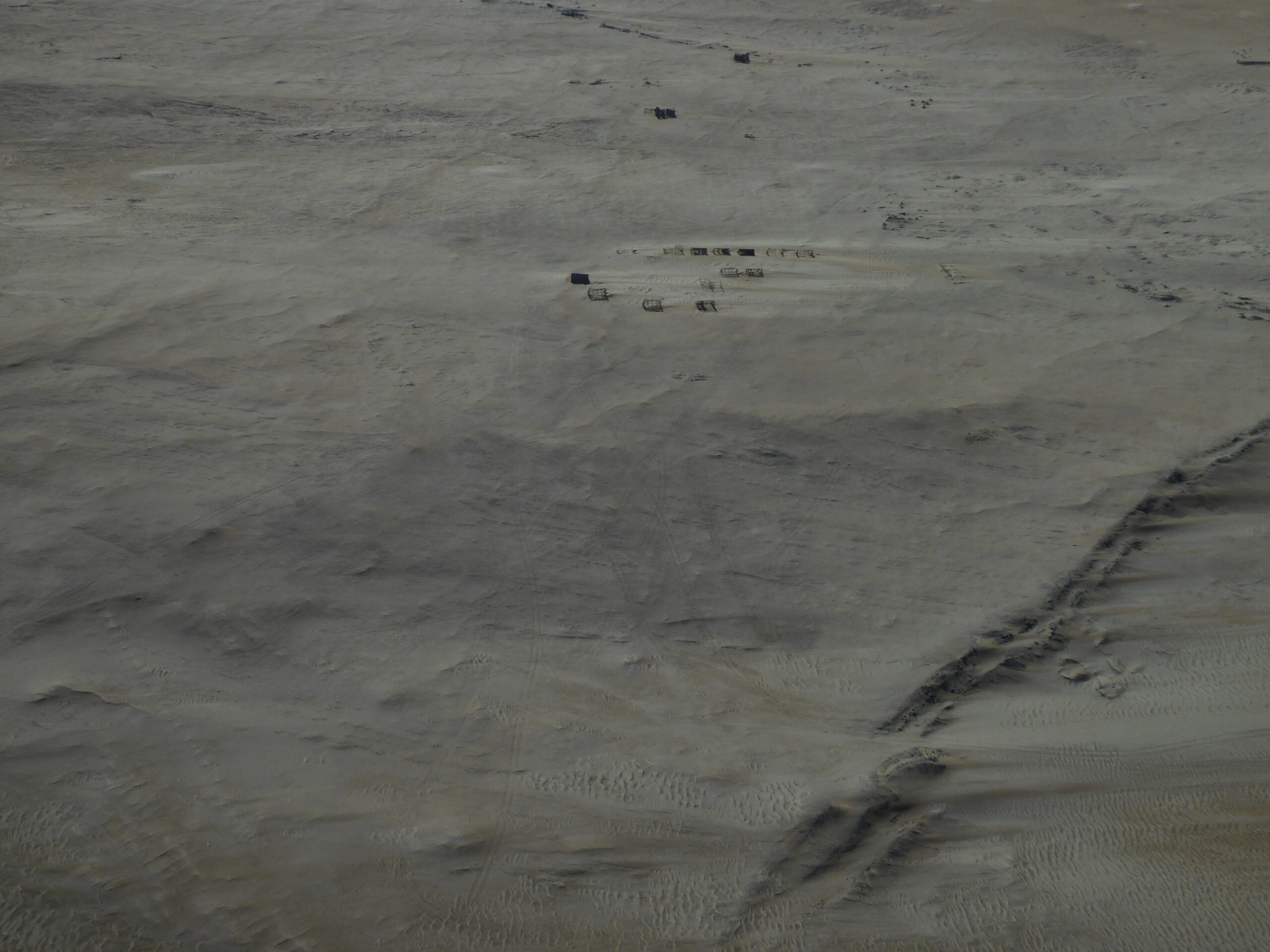
Mining settlement
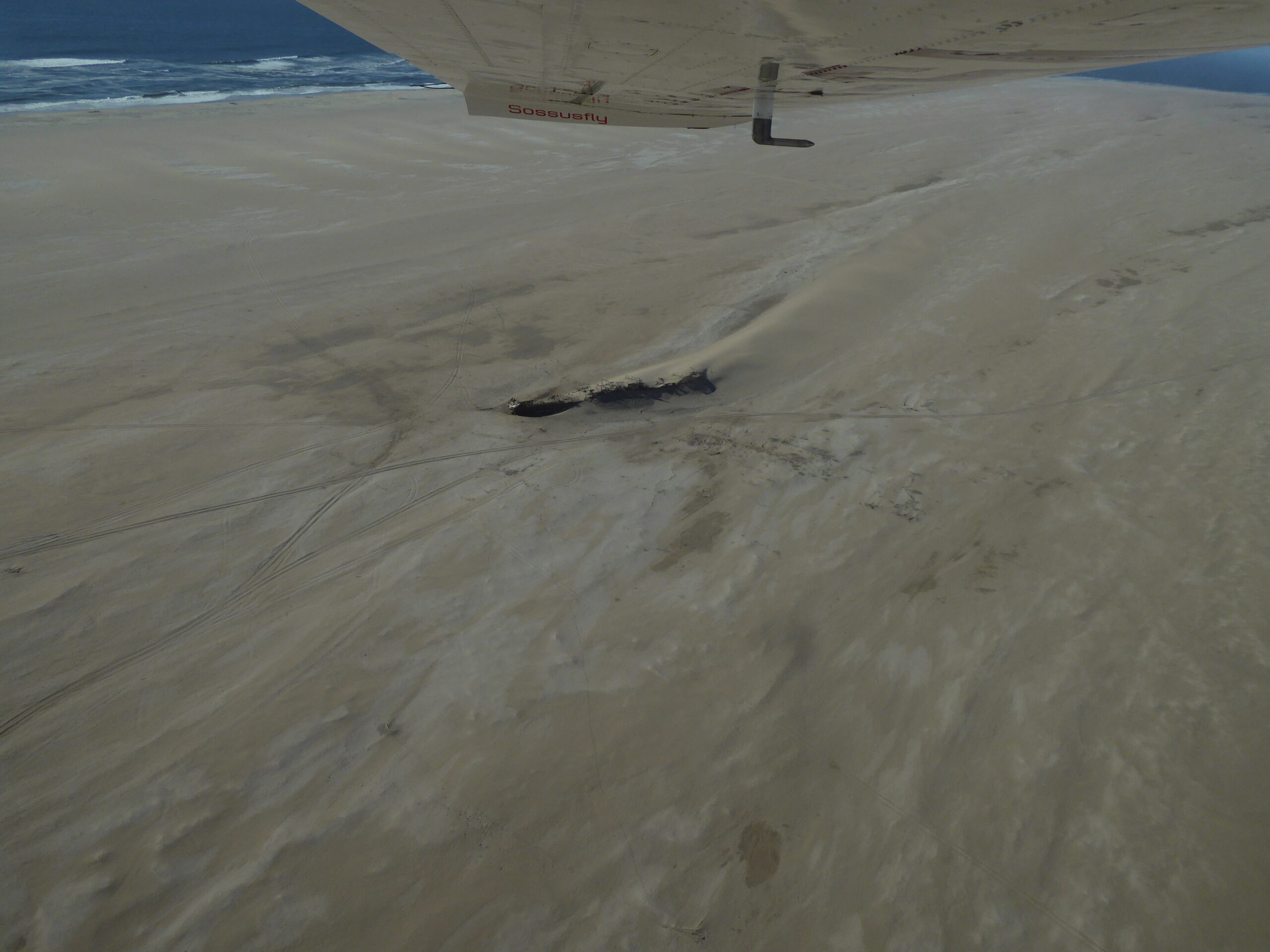
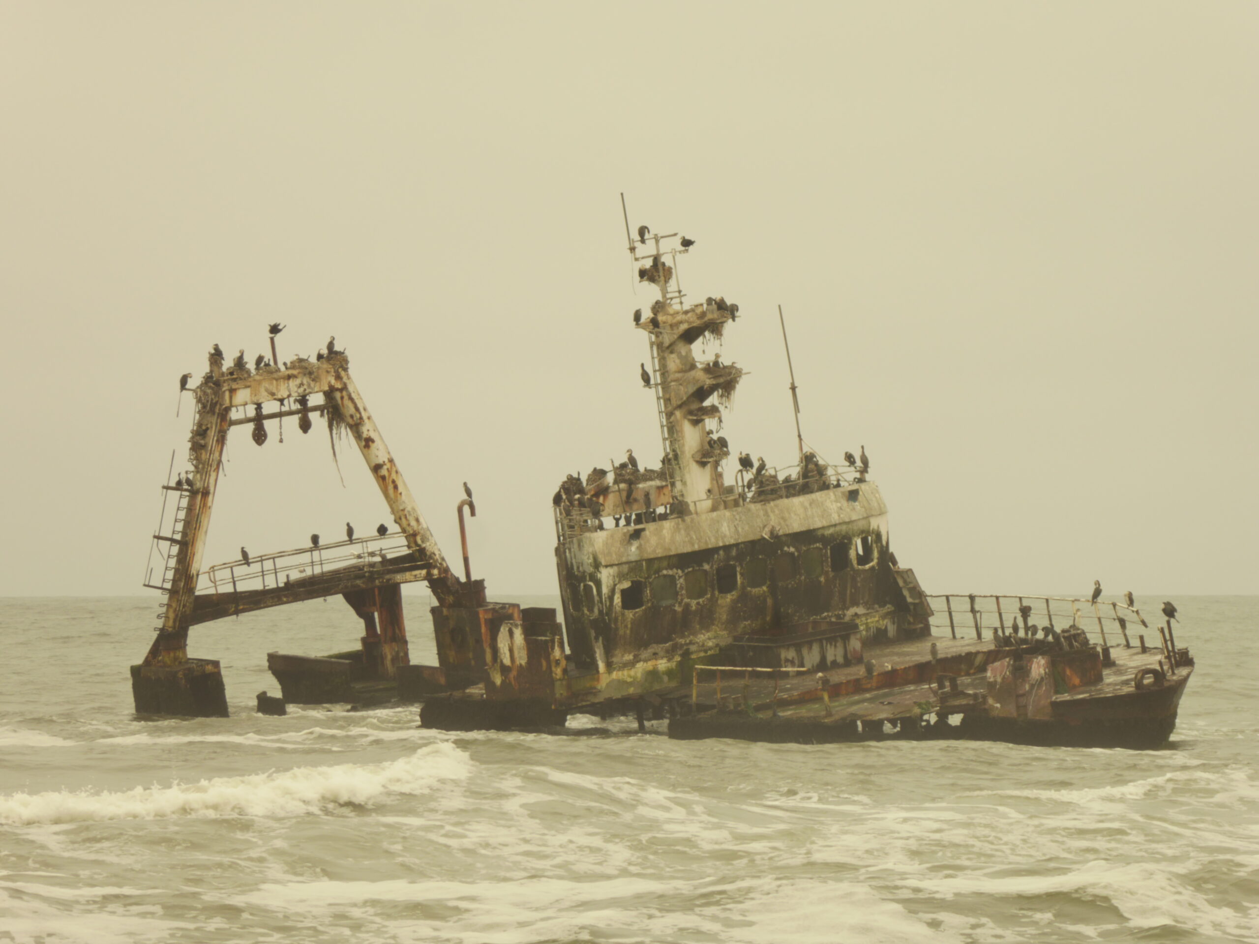
Eduard Bohlen with the sea just visible
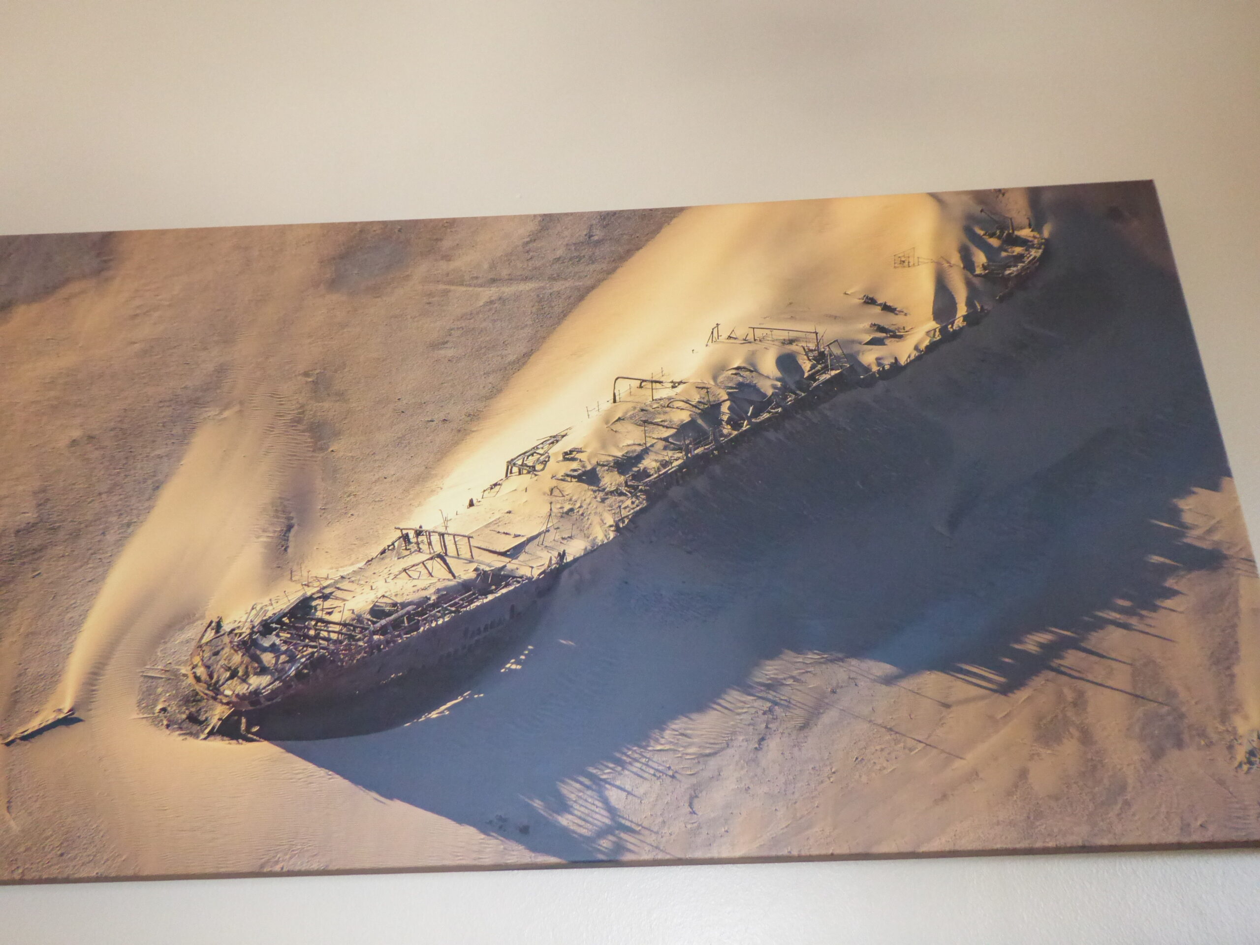
Office picture of the Eduard Bohlen
We had been warned about security – having seen the door and window grilles, we were aware of an issue; if we went out to eat in the evening fairly close to the hotel we should be ok but any further away, unless in a large group we should get a taxi back. We ate close by. Next day we started at Walvis Bay on a catamaran trip to see whales, dolphins, seals etc. Our guide had already made friends with the local birdlife
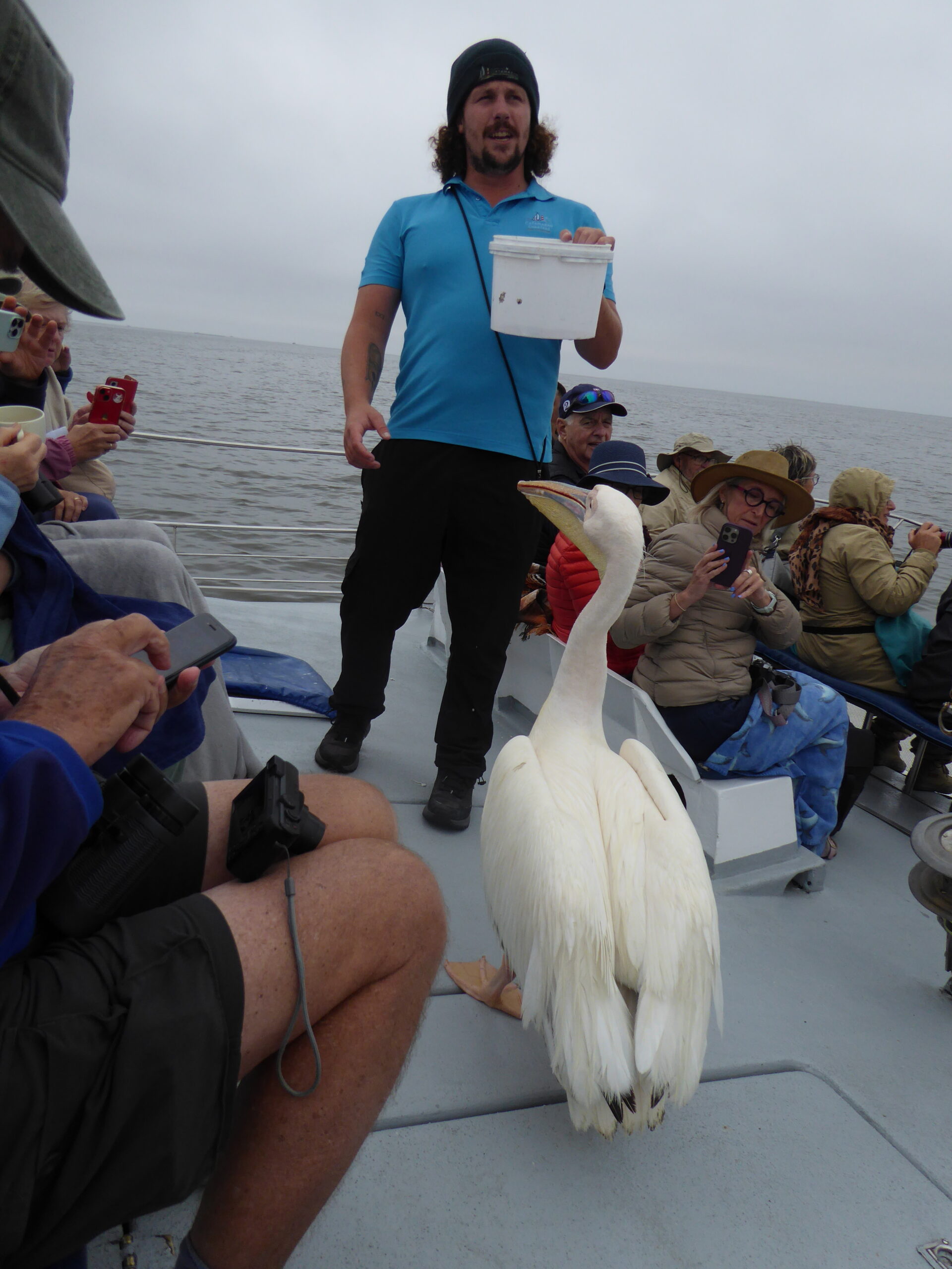
feathered friend
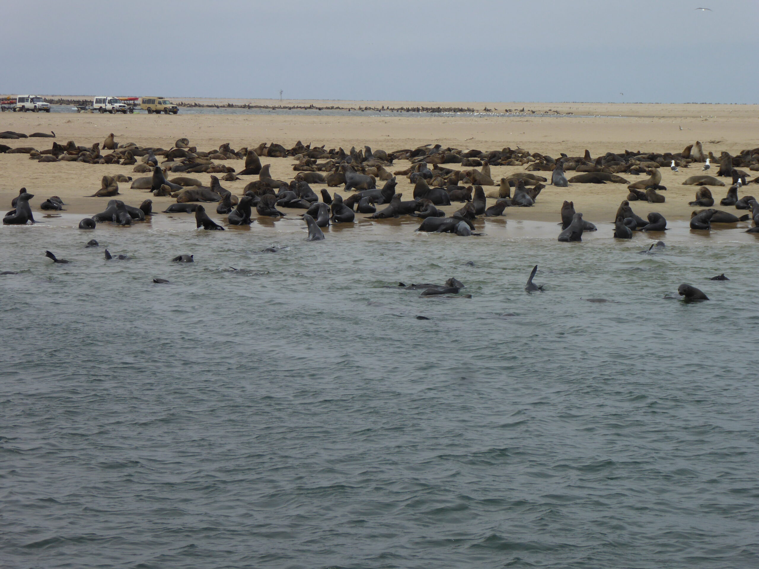
Seal Colony
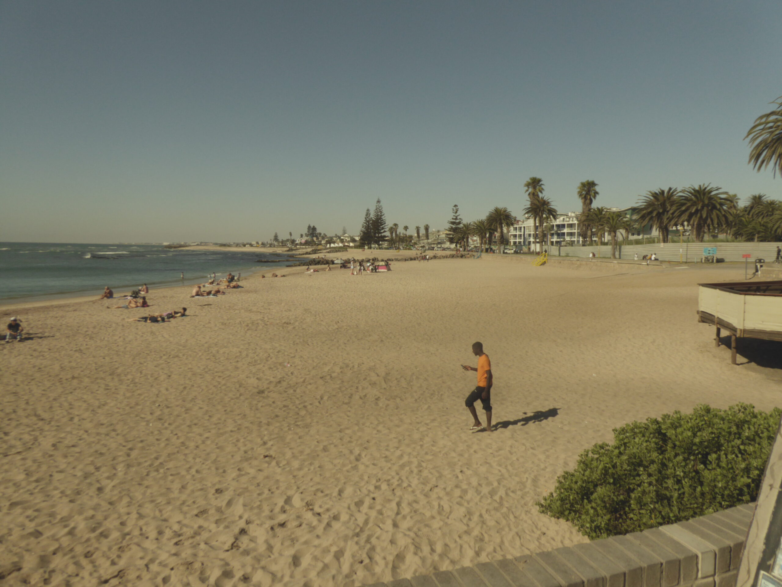
Swakopmund beach
Next day we continued north, passing but not seeing the Skeleton Coast.
2008 shipwreck
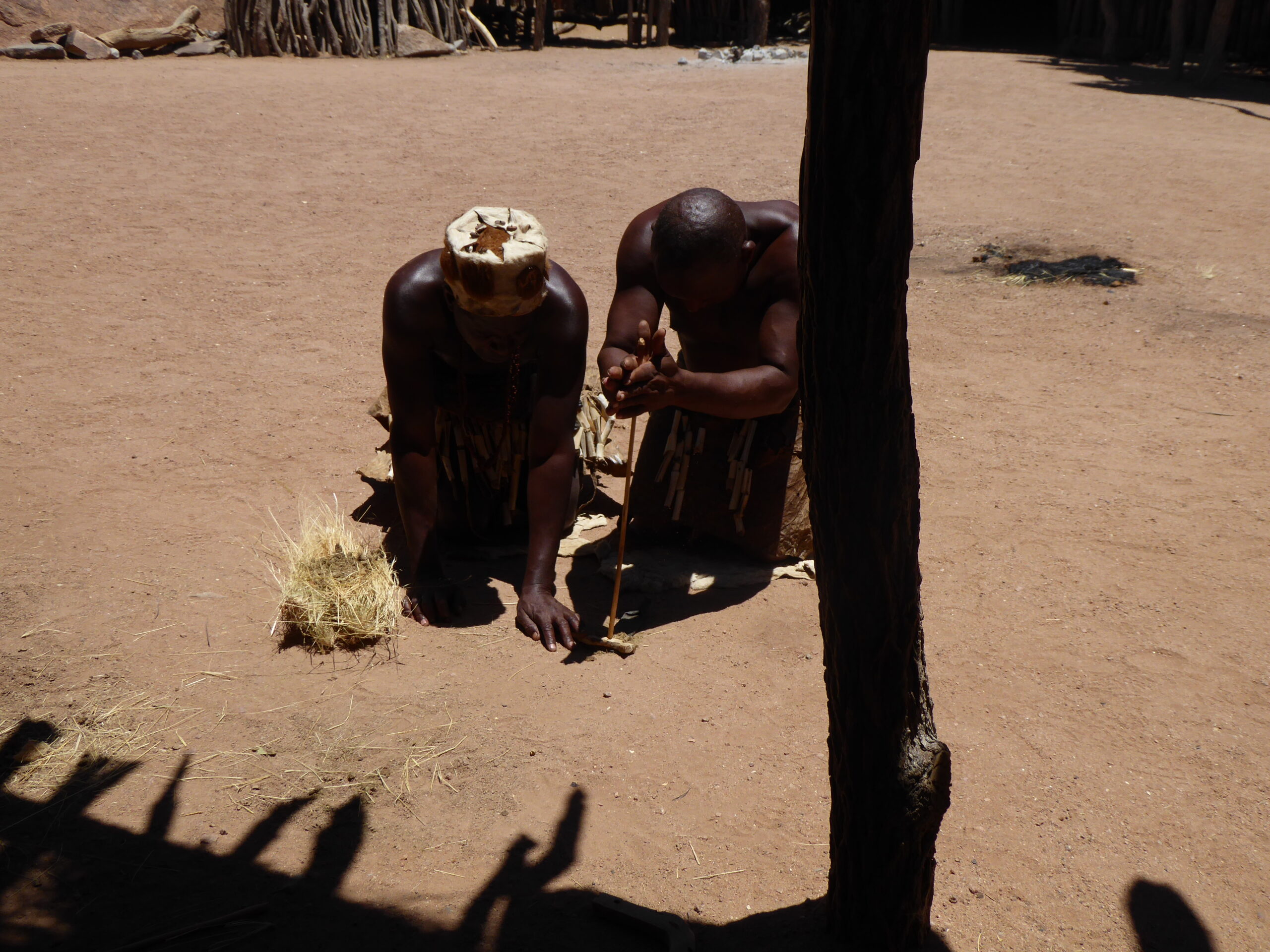
Fire lighting
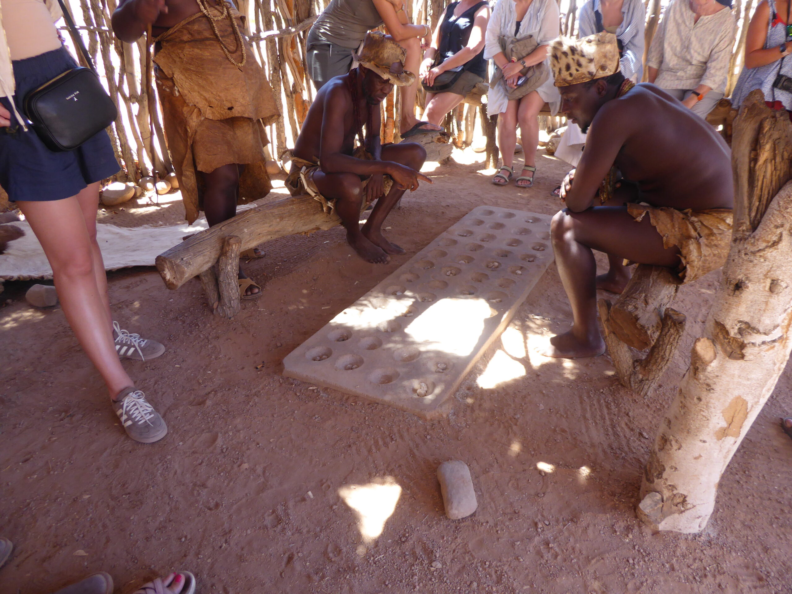
“board” game with pebbles
We decided to miss the Twyfelfontein Rock Art as Allison would find the walking difficult so instead took the deviation to the petrified forest – which she didn’t go to either!
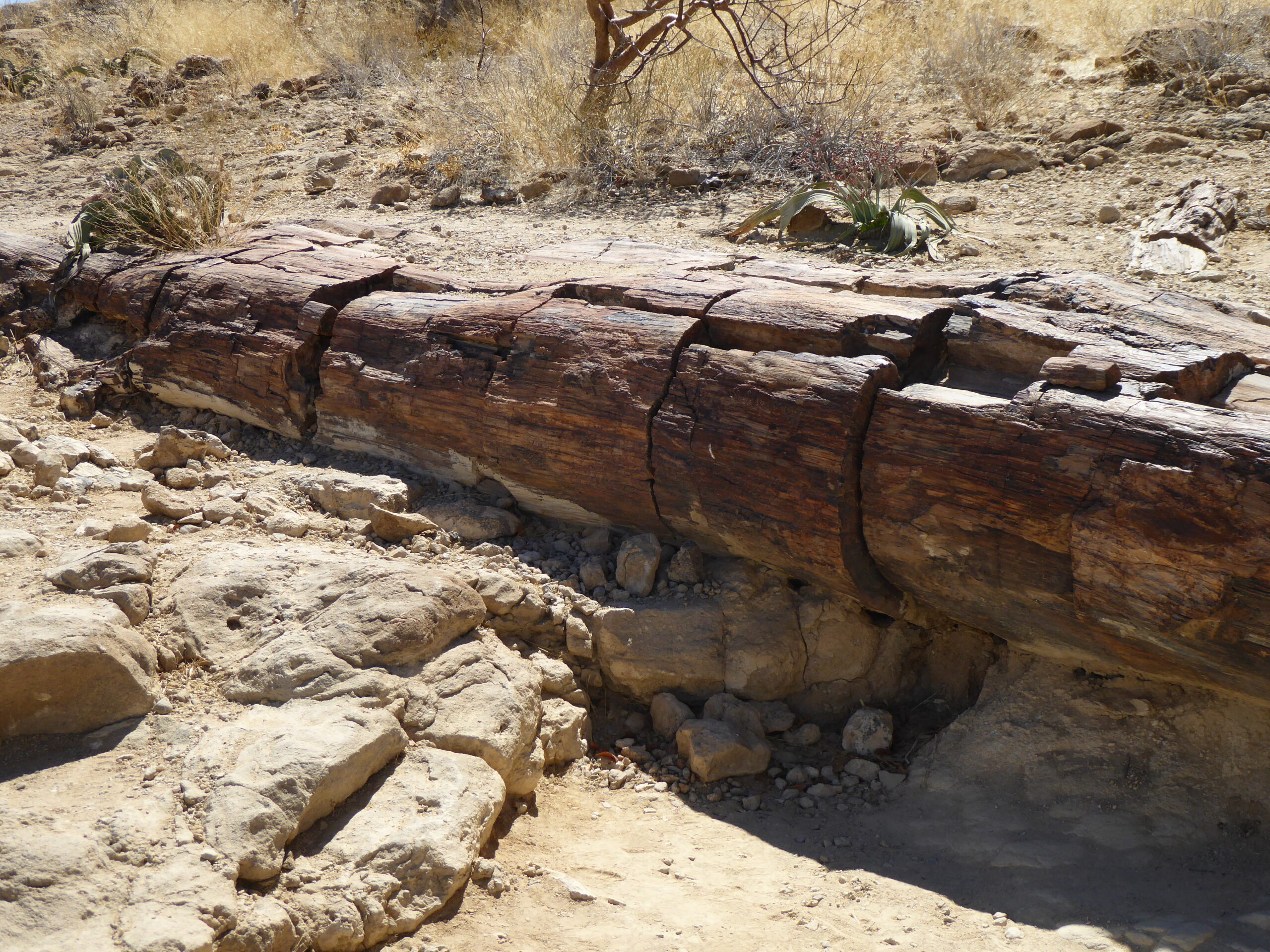
Petrified forest
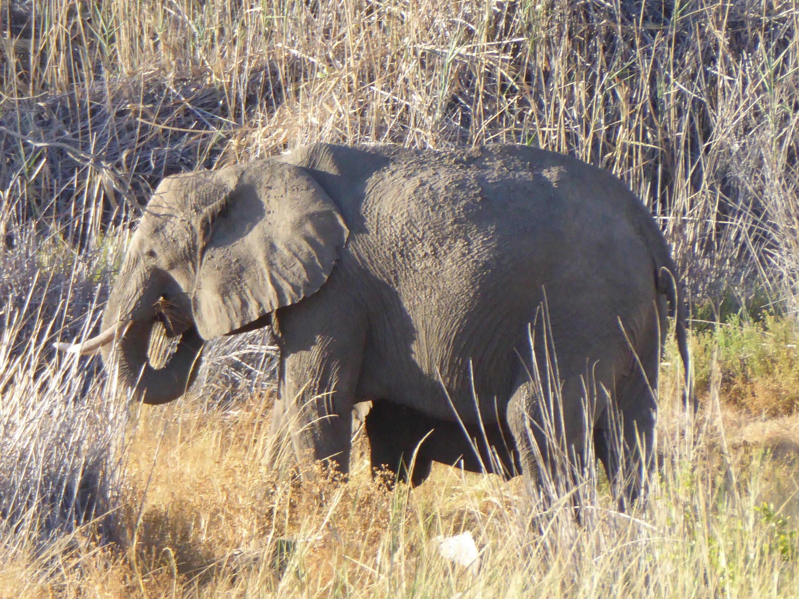
Elephant
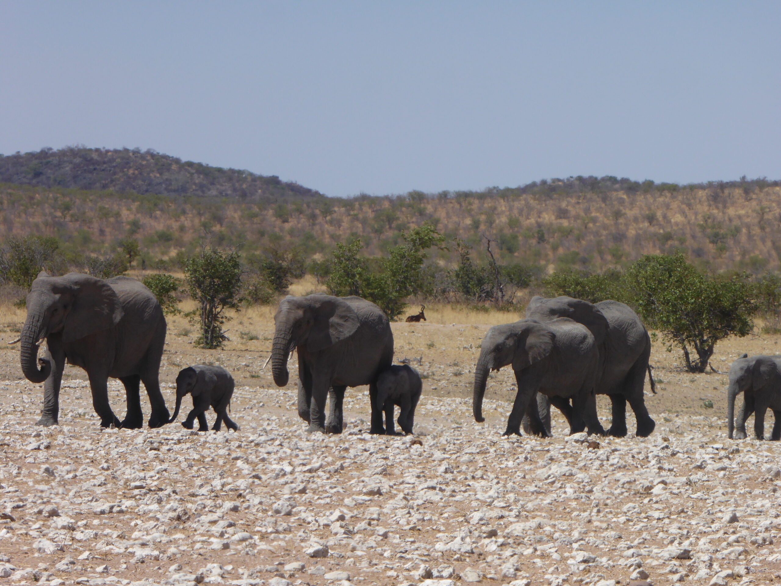
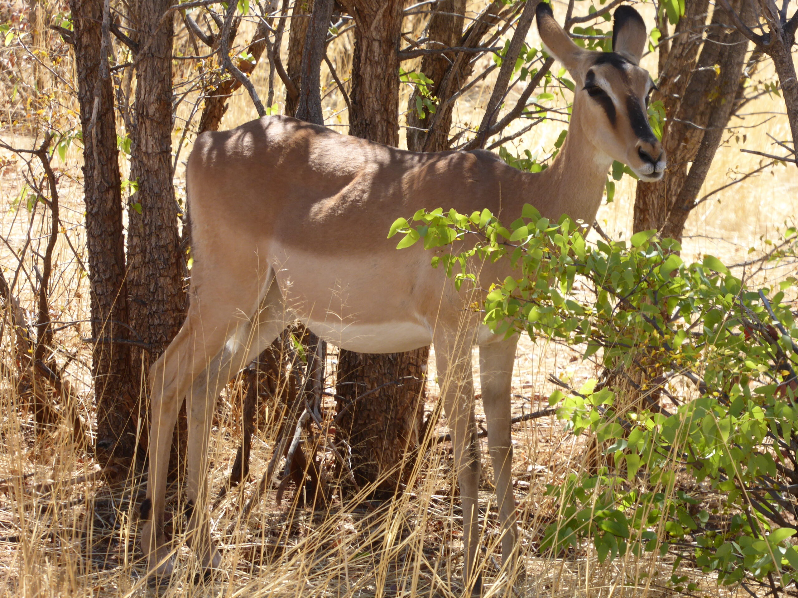
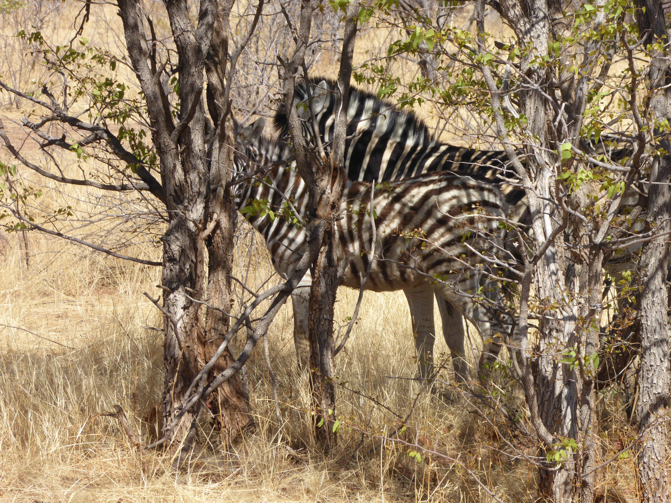
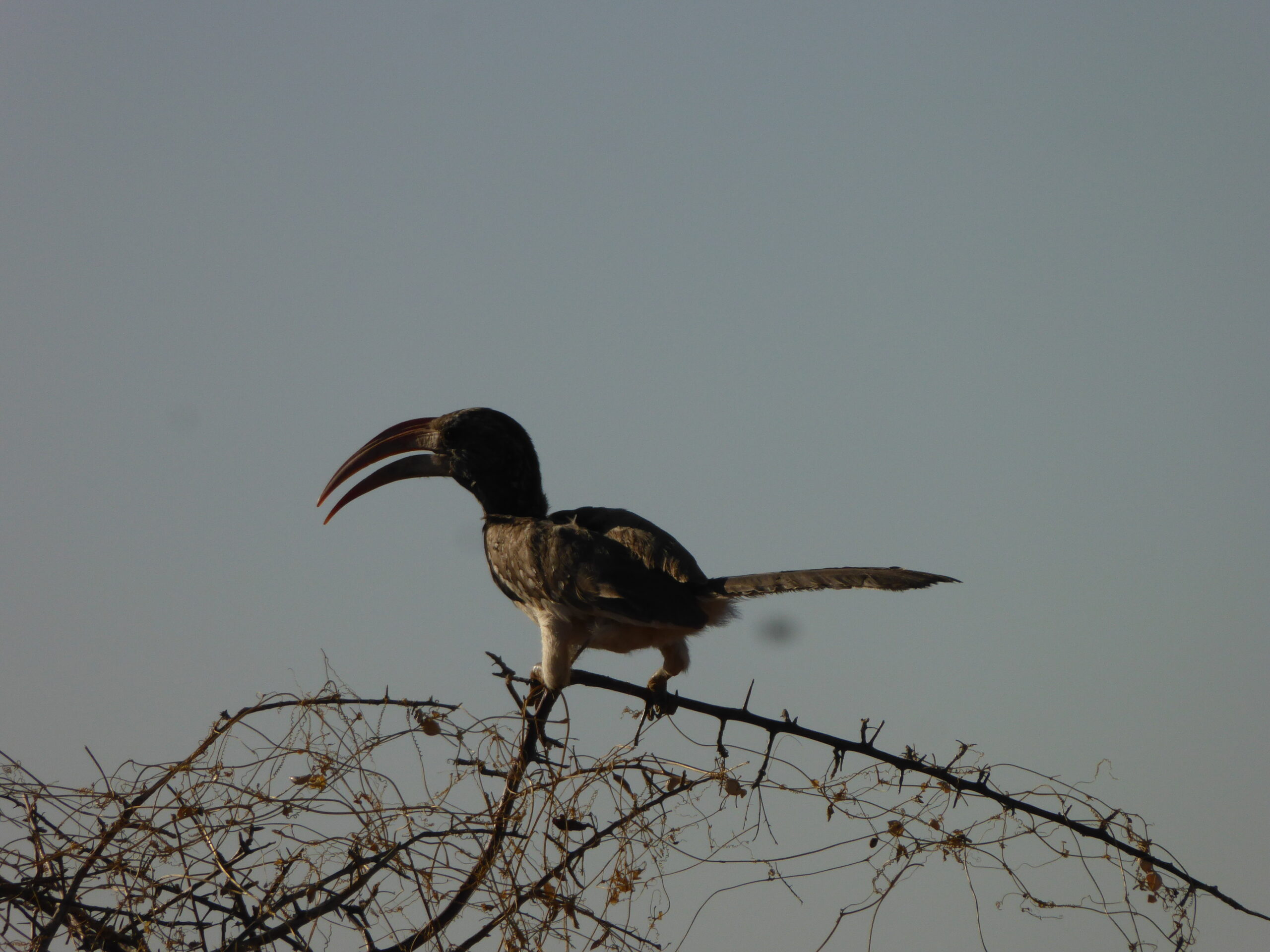
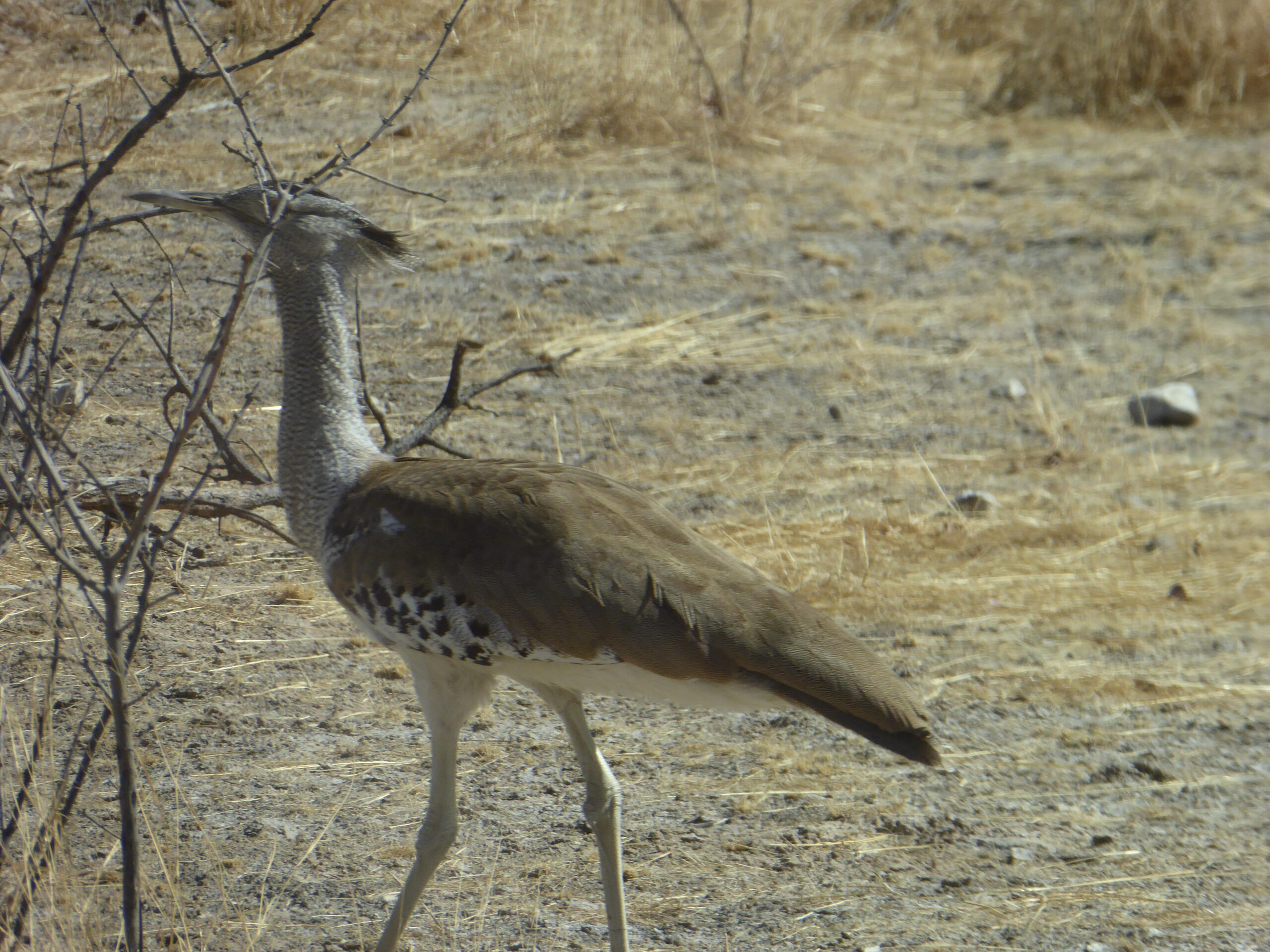
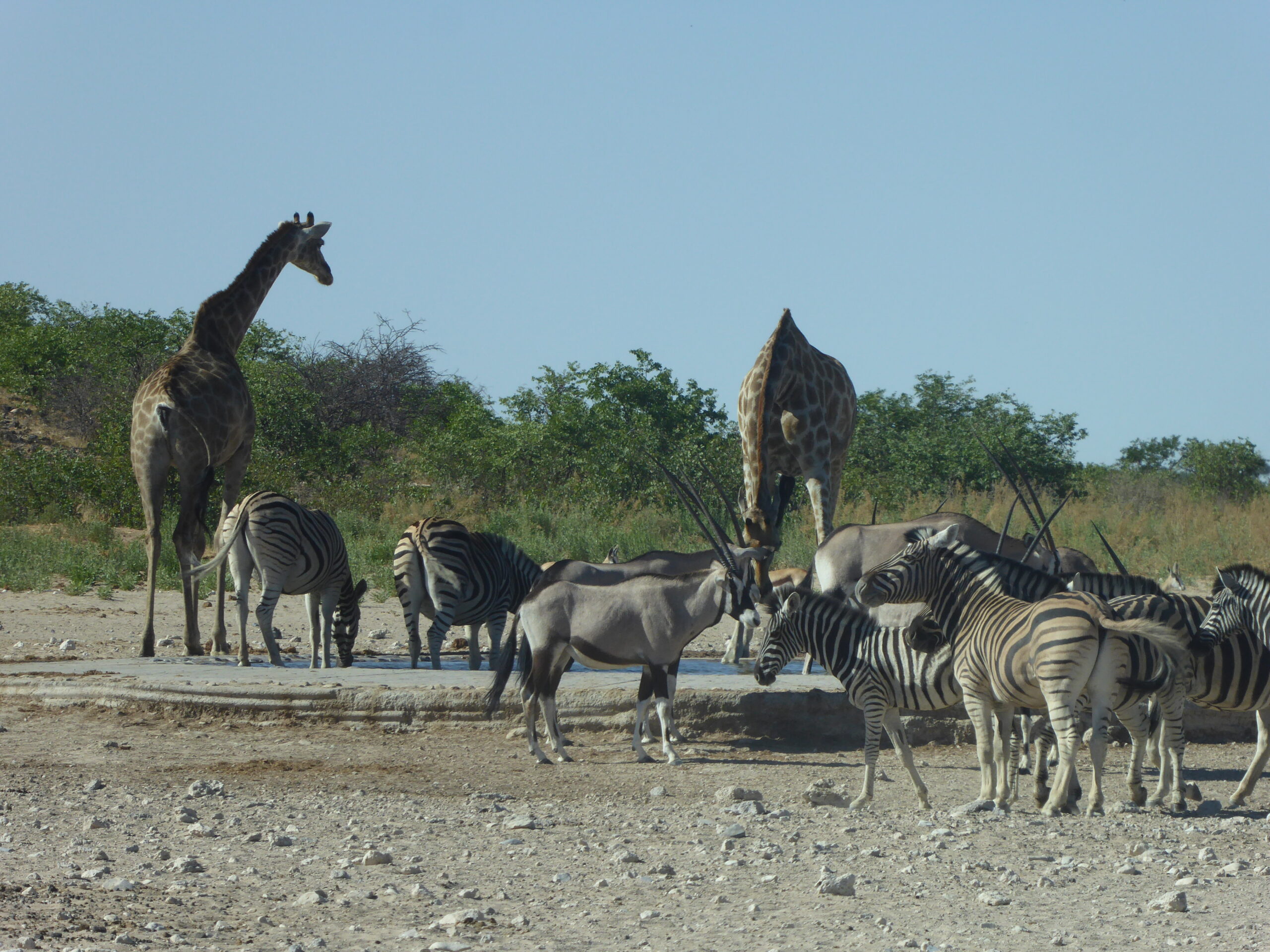
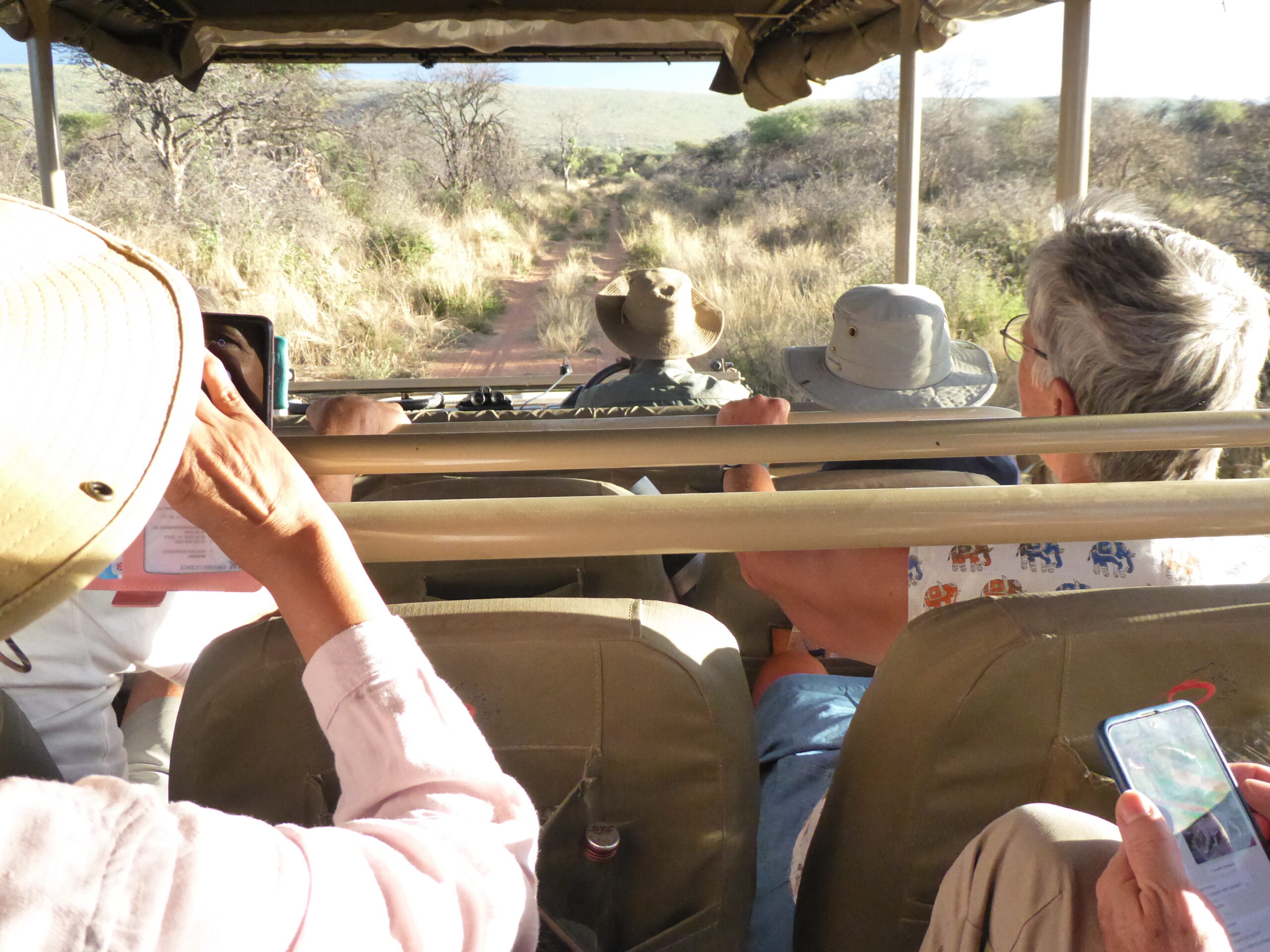
The next section was through Etosha Reserve; we would stay 2 nights in different hotels as we meander through from west to east with no particular route to follow (apart from using only proper roads – gravel of course with a 60kph maximum speed). We arrived early afternoon with 48 hour tickets and soon realised that the only viable place to see the animals was at water holes, some natural and often dry and others man-made and generally with water.
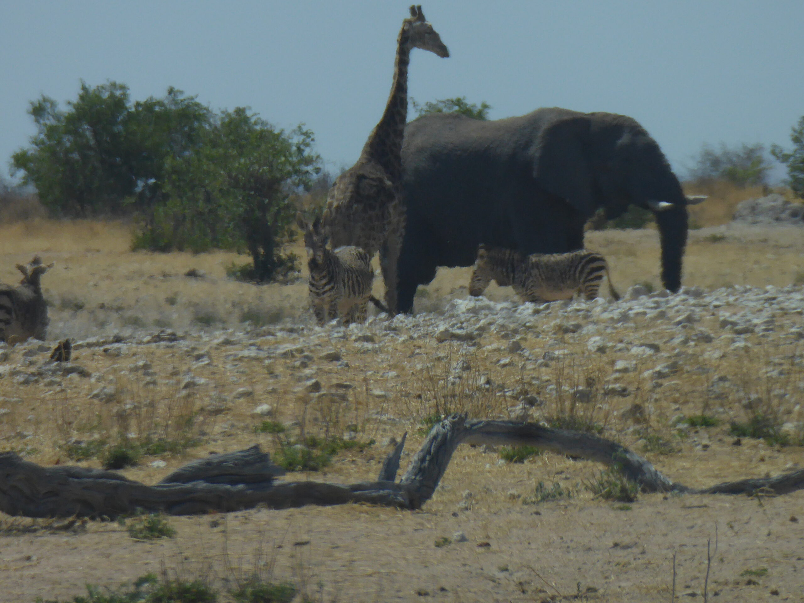
Elephant, giraffe and zebra
family visit
Seeking shelter – Springbok
Camouflage
At the hotel Dolomite
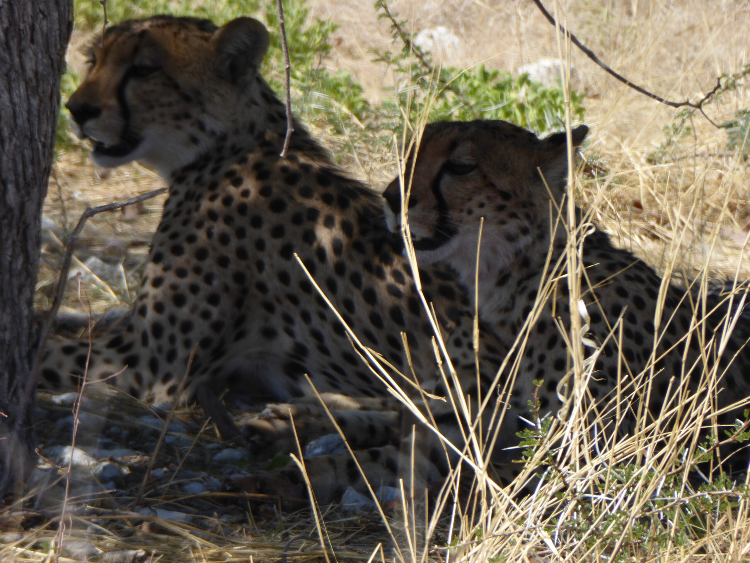
Cheetahs in the shade at the roadside
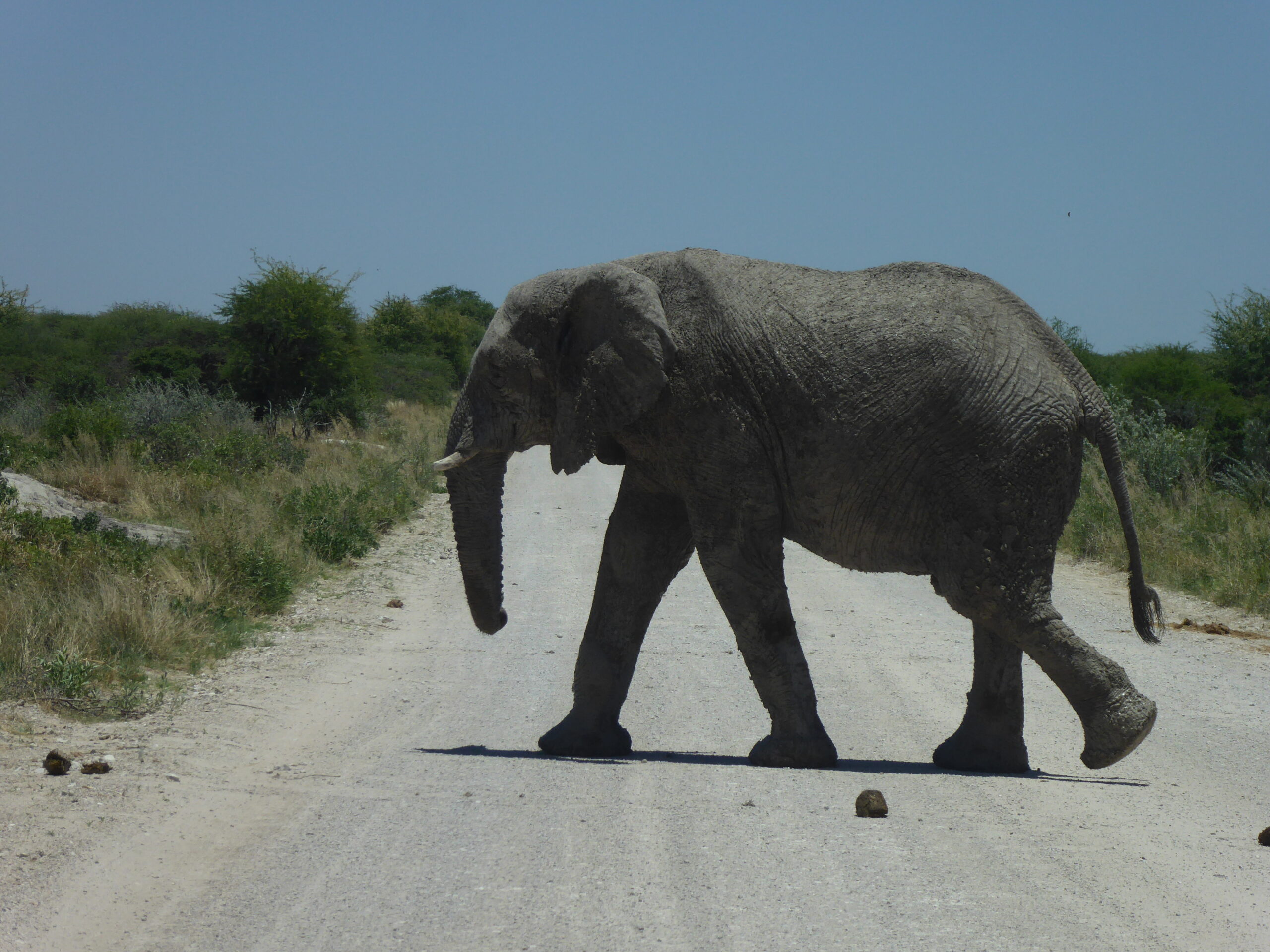
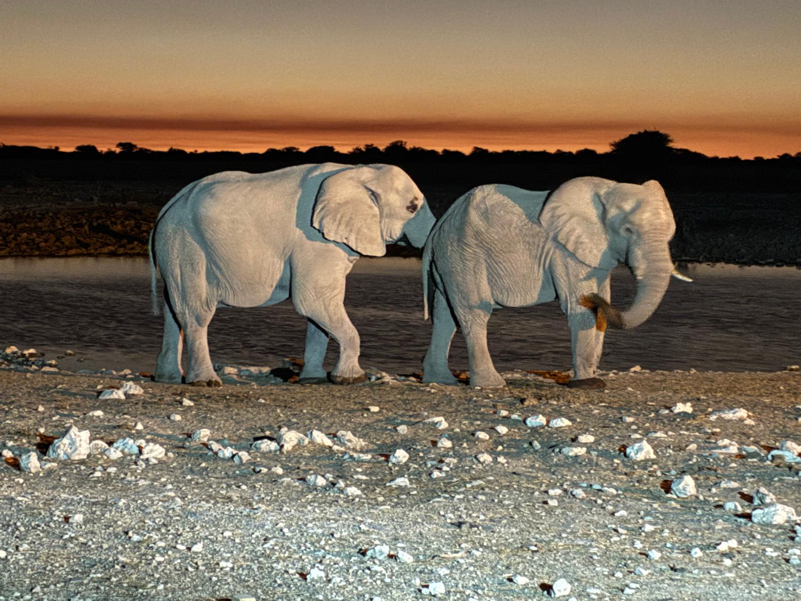
Elephant in the road
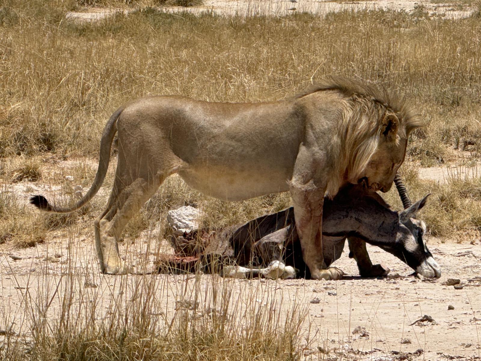
Lion wins!
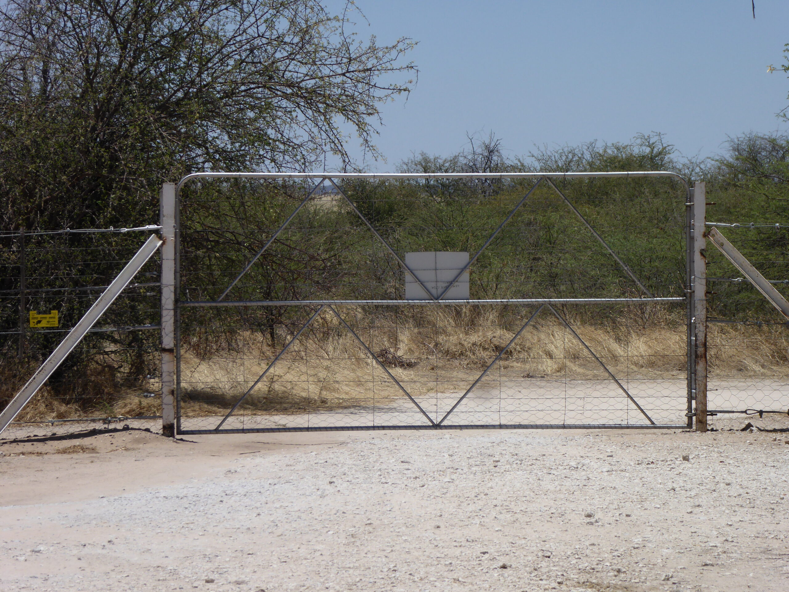
gate at rest area
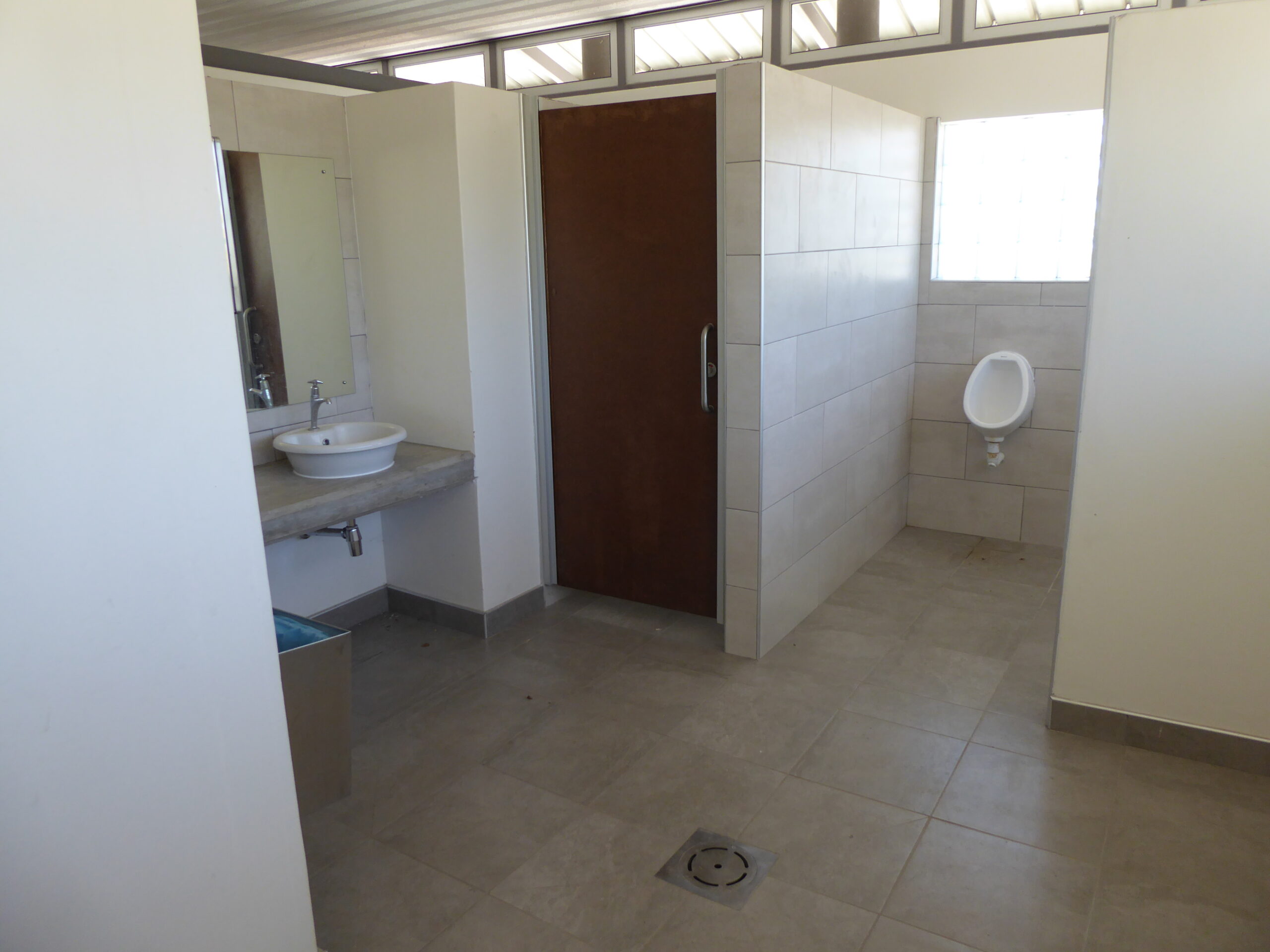
toilet block
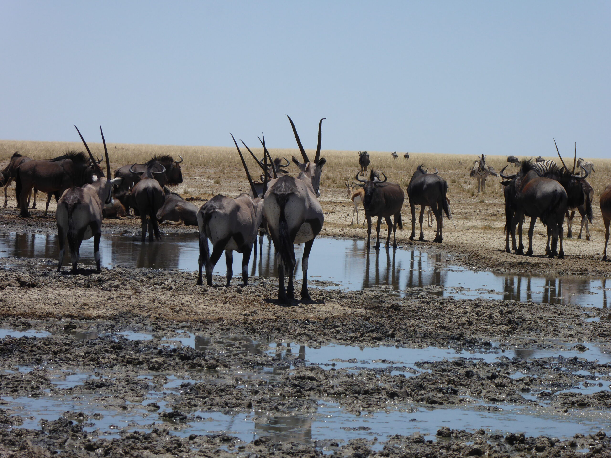
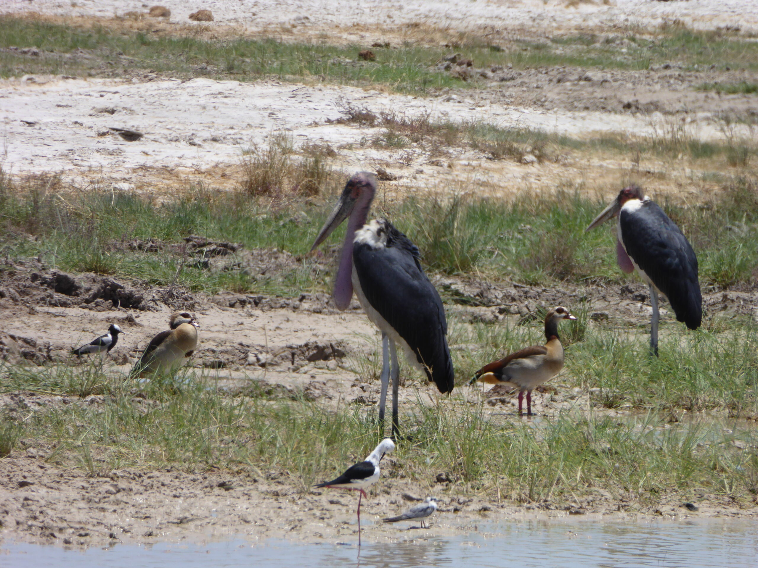
wildebeest and oryx
Continuing south vis Tsumeb, we visited the museum, mainly of German relics including many rescued from nearby Lake Otjikoto where the fleeing Germans dumped their supplies during WW1.
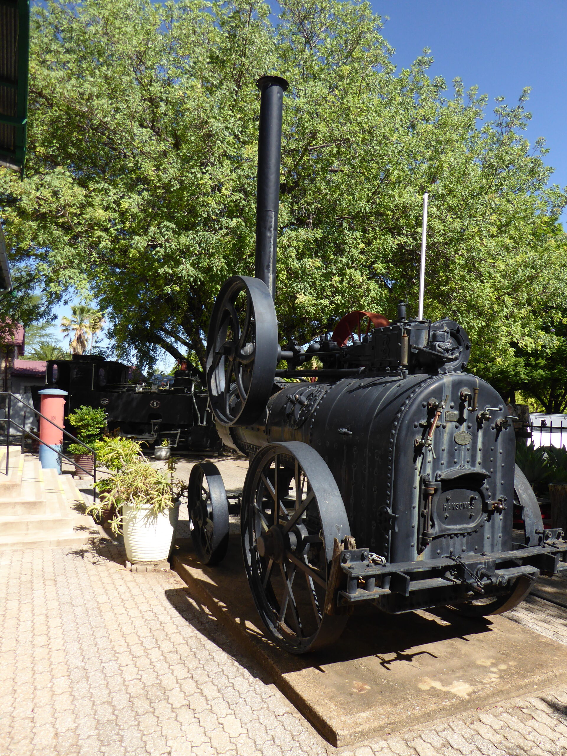
At Tsumeb museum – a Ransomes engine
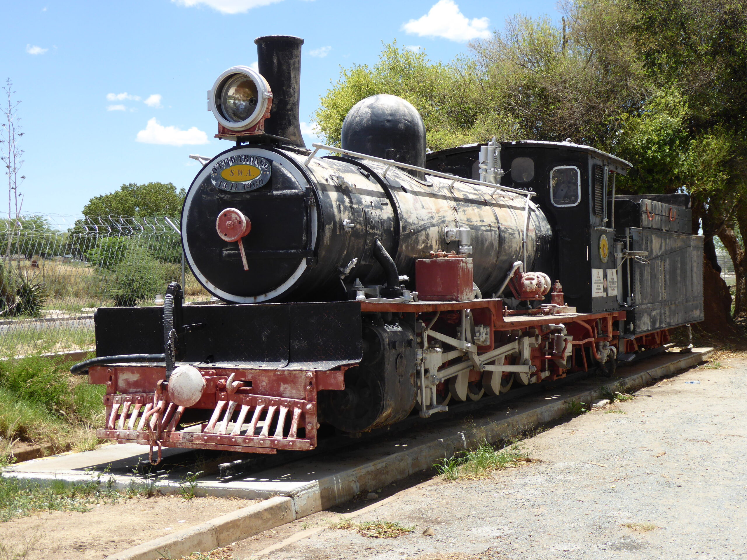
Slowly decaying – the cab roof rotting away
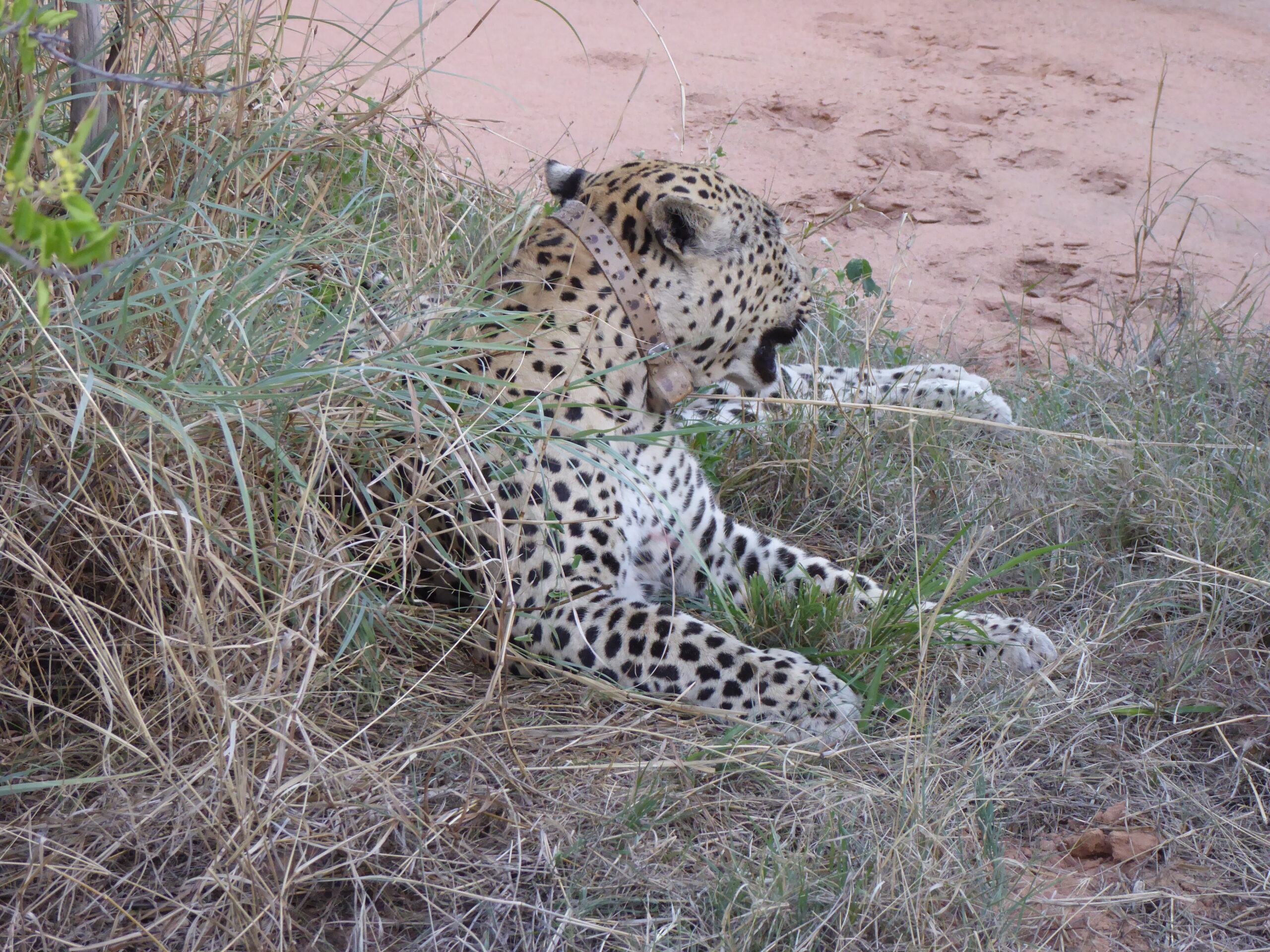
Sleepy Leopard
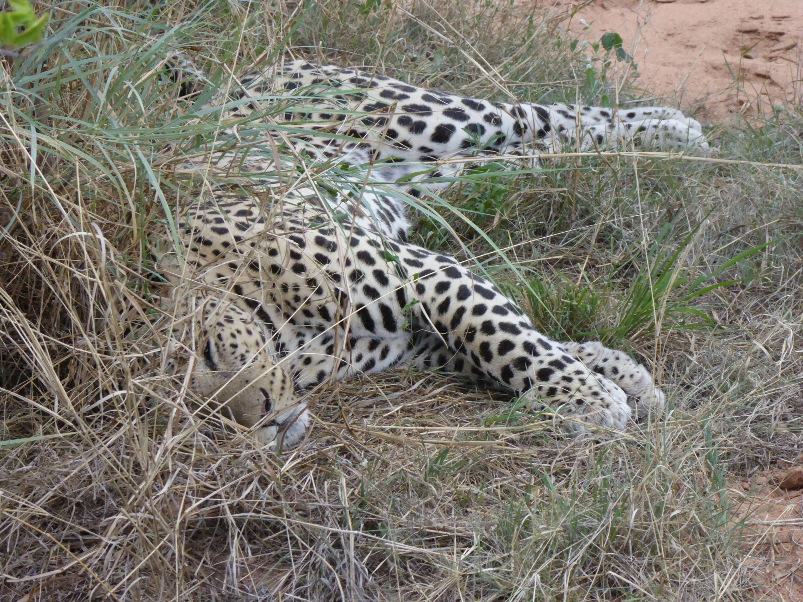
Peaceful until we rocked up!
Hunting for leopard
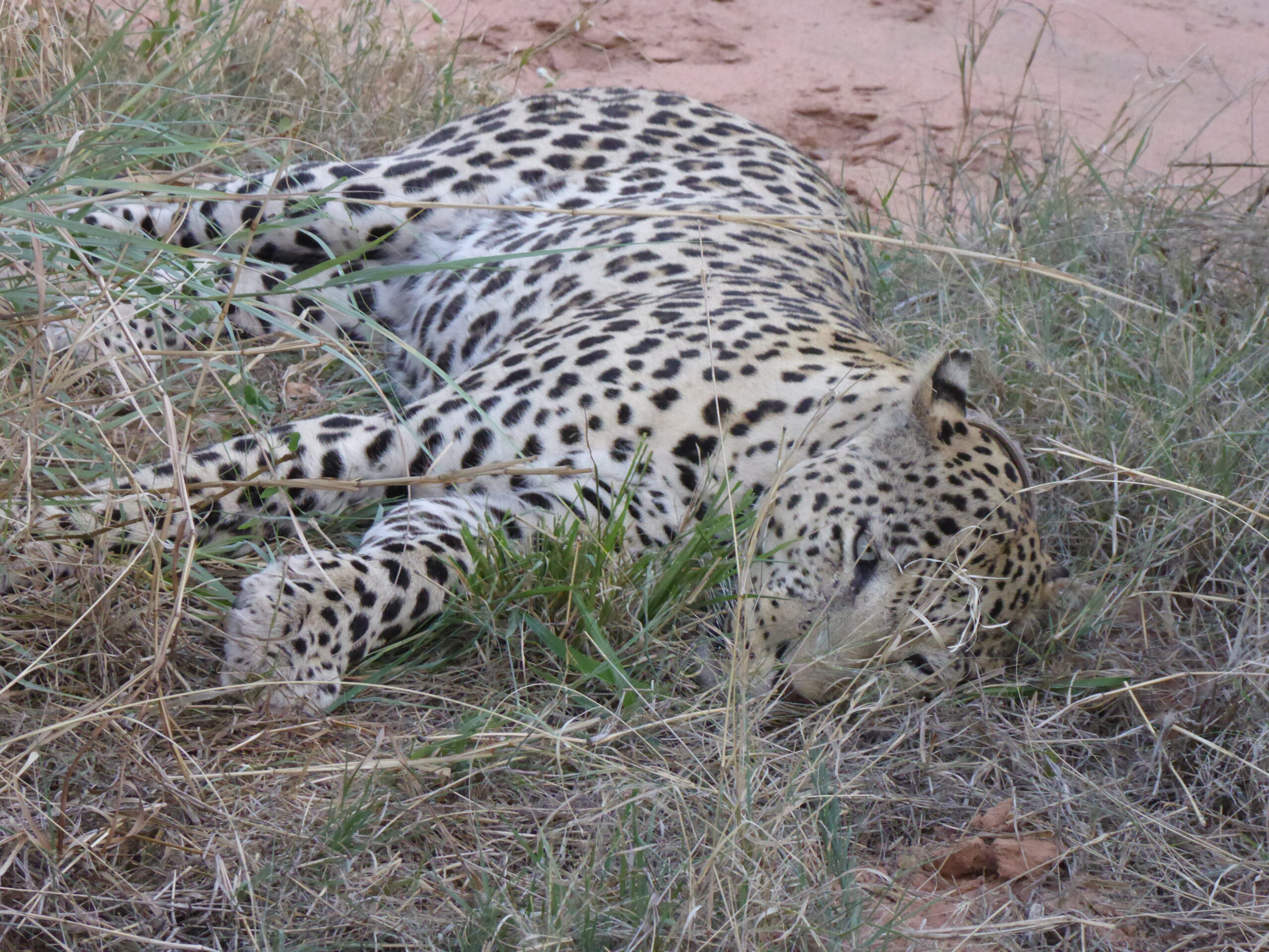
I can see you
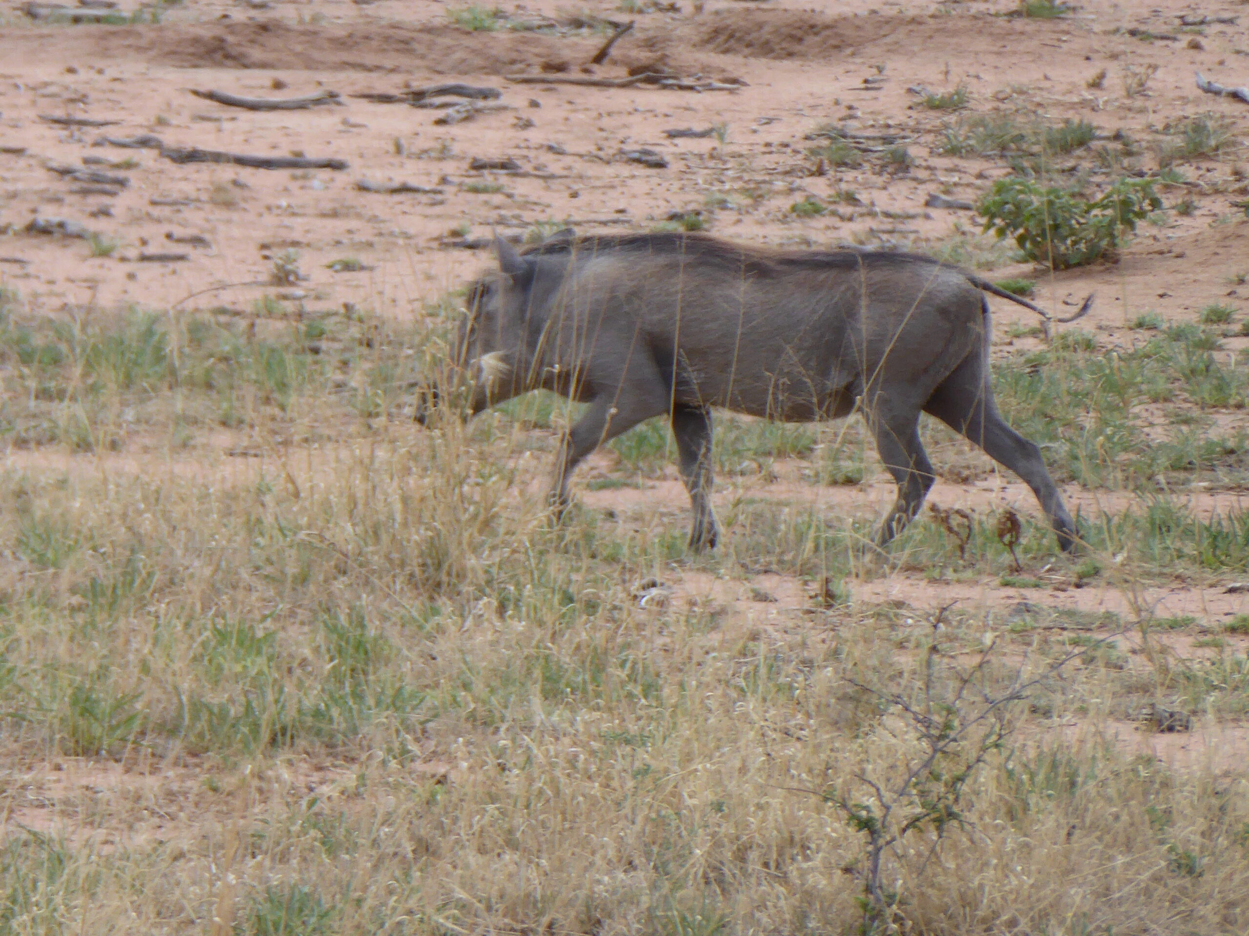
Warthog on a mission outside our patio
And a short hop to Windhoek, return of the trucks – no damage for us though one truck was damaged going off the road to avoid a collision with another of our group; also no punctures though the group did suffer nine or ten punctures overall. A short trip into Windhoek where the main street was closed for a Christmas market before an evening flight home.
Some other super photos taken by others in our party:
On the catamaran
At Sussusvlei
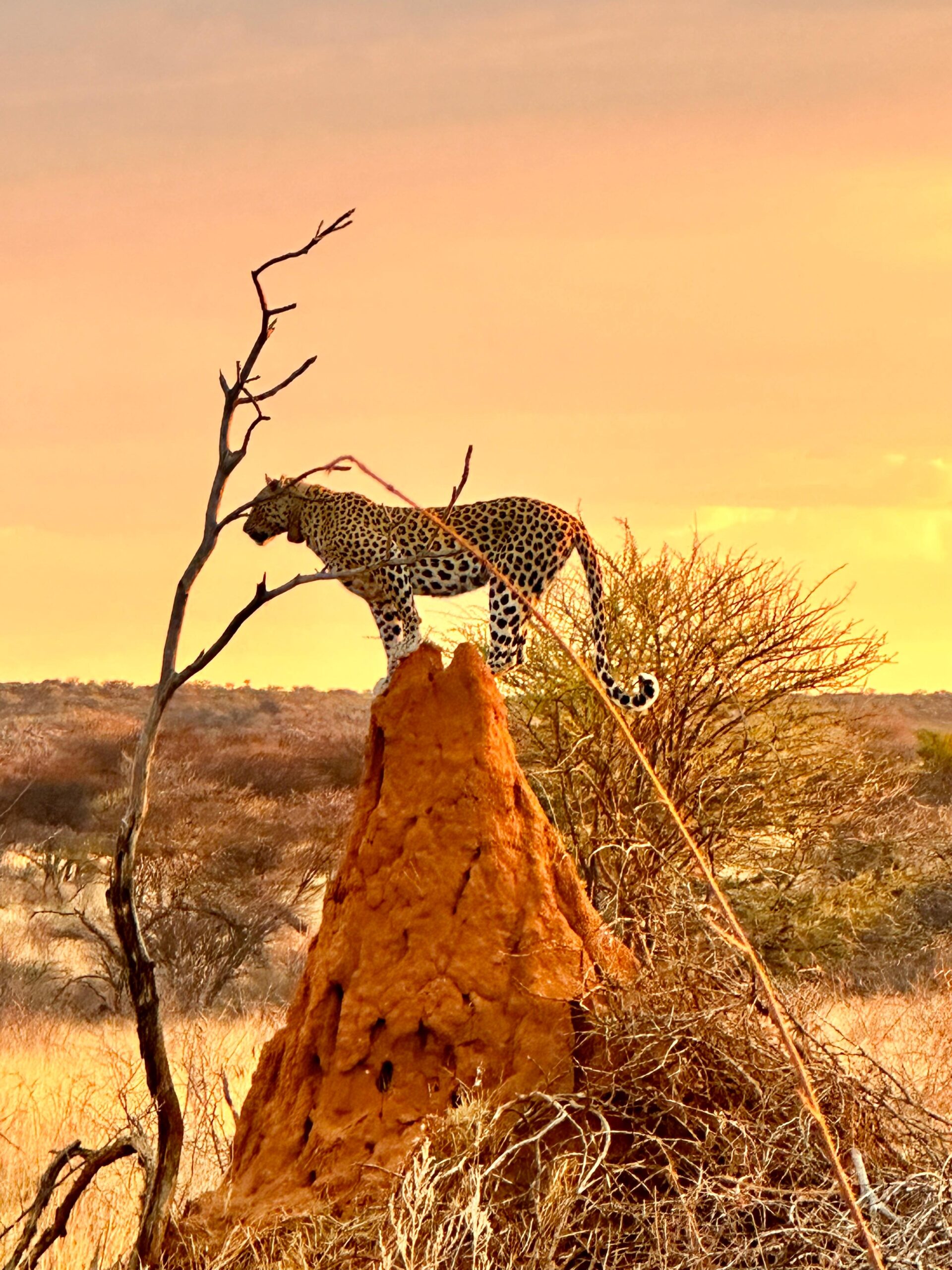
On a termite mound
New Zealand 2019
Posted by Peter in Rented locally on December 21, 2025
Our first trip in 2019 has started badly – the yellow Elan, making its first trip abroad since Tunisia in 2003 has been delayed in transit and will not arrive until a week after the trip starts.
 Great! And of course its no-one’s fault, everyone in shipping denies any wrong doing but they gave a shipping date, they controlled when it was loaded and unloaded but no, they’re blameless and not responsible! So we start in a hire car – I hope but if they are as good as organising that as they were the shipping then I guess we might be walking!

Auckland , Sky Tower from One Tree Hill
 Auckland Harbour and Sky Tower[/caption]
So we now have a hire car – but we can only use it in North Island. And as the local shipping agent says there’s no chance of the Elan being available by then, we have to drop the car off at the port in Wellington, go to South Island as foot passengers and hire another car the other side. Why make life easy?
Our first day’s drive has taken us to the west coast and overnight in Tairua on the Coromandel Peninsular. We chose the cross country route from west to east over the peninsular so our car is now the dirtiest around as it was gravel track and the dust gets everywhere. After the buildings of Auckland, we visited the natural sights of Cathedral Cove

Cathedral Cove
– a beach accessible only by cliff footpath or boat (a much easier option in the heat), with a huge rock arch. Then to Hot Water Beach

Digging for Hot Water
where superheated subterranean water lies just below the sand and half the world is digging little sand pools to soak in.
10th Jan – South to Taupo and its hot. First stop the Karangahake Gorge, now a peaceful river gorge with trees and ferns and clear running stream with deep dark pools.  100 years ago it was very different when it was the centre of the gold mining industry and miners dug tunnels into the mountains to extract ore which was then crushed by huge rollers and stamping (crushing) machines before the gold was drawn out using cyanide and mercury.

Remains of a stamping “battery”
. Then further on to the Wairere Falls, advertised as a 45 minute walk but nearer to 75 and pretty but …….

Wairere Falls
11th Jan – the first of two rest days based in Taupo. Today was a geothermal day so we started at Orakei Korako; we arrived at 9.00 and were amazed at the lack of traffic on the road and absence of visitors. There are 23 geysers – but not big water spouts, these are small holes in the ground which might send water about a foot into the air.

Orakei Korado
They produce pools of boiling water or mud, a stench of sulphur and clouds of steam in a barren silica landscape.

Orakei Korako

Orakei Korako
yet surrounded by lush bush. Asif that was not enough we then went to the Rotorua area and the Hells Gate complex, which also displayed a range of mud pools with temperatures of up to 120C on the surface, 145C one meter down and signs warning that people dropping litter would have to retrieve it themselves.

Hells Gate with mud volcano
12 Jan

Hobbiton – The Green Dragon

Hobbiton
13 Jan We left Taupo in the centre for Napier on the east coast; the morning was miserable and itrained as we drove through the desert to Wairou. The cloud lifted a little and we detoured to a ski resort for fancy pictures of grassy slopes and grazing cattle in vain, it was bleak and stony, all the shops were shut and it was completely deserted!

Not an Elan (sadly); ski resort in the distance
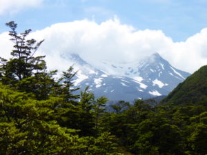
Mt Ruapehu, ski slope/volcano
Then to the National Army Museum which had a lot about the “New Zealand” wars of the 1860s, when Maoris and British clashed over land and authority, and the Gallipoli campaign of WW1. It was briefly sunny as we hit the Wine Trail then cloud and drizzle took over as we walked the streets of Napier viewing their collection of Art Deco buildings erected after the earthquake of 1931
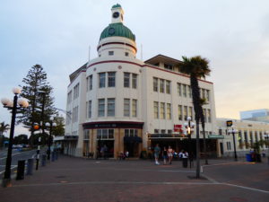
The Dome, Napier
Jan 14th – Our import agent had no good news for the Elan and remains convinced we will not see it during our trip. Frustratingly we were only 30 odd miles away from the port on Saturday when the container was sitting n the quayside waiting for administration to begin work on Monday (as we drove ever further away). Our destination was Wellington at the south of North Island. We took the long route via the west coast, stopping briefly at the largest vehicle museum in the southern hemisphere at Paraparaumu with over 250 vehicles, including an Esprit

At least this Lotus arrived!

Southward Car Musuem
Supper this evening was at a Persian fast food eatery – cheap as there was no booze!
Jan 15th – our hire car was not allowed to travel to South Island although the rest of our party with pre-booked cars could take theirs – thanks Mr Hertz! So after a drive around the scenic Marine Drive we said farewell to the Corolla and went to visit The Behive (NZ Parliament) and cable car.

Still not a Lotus on an overcast Marine Drive

Beehive and Parliament Buildings

Old Wellington Cable Car

And today’s version
We assuaged our cultural conscience with a visit to the Museum of New Zealand with replica Maori meeting house and a Gallipoli exhibition.
Jan 16th – Malcolm and Linda kindly took us to the ferry for the 3 1/2 hours to South Island; then to Mr Hertz to collect car number 2, a RAV4, complete with scratches and dents. Picton Port has the Edwin Fox – an 1850’s merchant sailing ship (the world’s second oldest) which served as convict transport, troop ship, coal hulk and cold storage depot. Now missing masts and deck, it sits in dry dock and under cover.

Inside the Edwin Fox

Marlborough Sounds from Picton Port
We took the scenic route to Nelson along Queen Charlotte’s Drive with a deviation to see some of the bays of the Sound

Marlborough Sounds
then on to our overnight at Nelson
Jan 17th – it was now or never for the Lotus – if we flew from Nelson to Auckland (and flights were available) and if the car had arrived and passed all its clearance requirements and there were spaces on the ferry from North Island to the South then this was about our last chance. The Auckland agent said “its not here yet but might arrive tomorrow midday (or not….). He strongly advised against; so the car after travelling half way round the world will now be shipped straight back home! We spent the morning on a sea kayak trip round Cable Bay and Pepin Island – for sale at NZ$16 million if you are interested. There are no known photos of this experience! In the afternoon we pottered round Nelson, recovering
Nelson

Botanical Hill – the centre of New Zealand
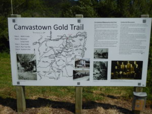
Jan 18th – the die was cast, returning to Auckland was ruled out so Allison drowned her sorrows with a wine tasting at Cloudy Bay vineyard and an expensive bottle of Pinot Noir but not before we had explored more remains of gold mining at Canvastown – amazing to think of the employment and industry at what is now a peaceful stream.

and today

Wine tasting at Cloudy Bay

Vines at Cloudy Bay
We also visited the Omaka Aviation Heritage Museum (sponsor Peter Jackson, Director of The Hobbit) for a selection of mainly replica WW1 fighter planes

The Red Baron’s plane
Jan 19th – after an overnight at Kaikoura we deviated from our route to Arthurs Pass to visit Hertz at Christchurch airport to return the hire car which now had stone chip damage on both driver’s and passenger’s sides of the windscreen. Now we had car number 3 – how far can we get? We reached our night’s stop in the rain and huddled in our rabbit hutch (cabin) as the rain clattered off the roof and flowed over the gutters
Car #3 near Arthurs Pass in the sunshine
Jan 20th – breakfast was late and slow and we left at 9.30. Transport and engineering were the first themes, getting road and rail over or through The New Zealand Alps. The tourist office recommended staying to watch the coal trains labouring up the incline and emerging from the Otira tunnel under load with sparks flying from their exhausts

Otira rail bridge and tunnel at Arthurs Pass

Turntable and boilers at Arthur’s Pass

Viaduct at Arthur’s Pass

The road back east

…and to the west
We continued to the west coast and Hokitika, where Jade (Greenstone) is worked into jewellery and artifacts
Hokitika beach
We continued down the coast to Ross and yet more goldmining relics

Water pipe at Jones Creek, Ross

Jones Creek in 1870
Our last visit of the day was to Okarito wildlife reserve where we came across this bird resting on a tree – a Bush Falcon.

Bush Falcon
Jan 21st – When we arrived at the hotel we were told we had been given a complimentary upgrade to the 5 star Te Wanoui – but we did not fancy their NZ$135 meals so we didn’t spend much time in our new found luxury as we wanted an early start to get to the Franz Josef Glacier. Have to say it was disappointing. Over the years the glacier has retreated and the “face” is now a mess of dirt and the contrast to the view from the 1906 face was frightening.

in 1906 the Face was here and the whole area was ice

and 10 years ago it was here
It was raining yesterday when we arrived and through the night and drizzled the whole time we were at the glacier but they have an annual rainfall of 16 metres of rain on the glacier and 6 metres in the village so hardly surprising. At Knights Point down the coast the NZ Conservation Department information boards encouraged us to go down to Jackson’s Bay, the most southerly coastal settlement on the west so we carried on for a cup of tea in the café.

Jacksons Bay cafe
The information boards there spoke of the Alpine fault line which runs along Jacksons River and is pushing the Southern Alps ever higher at the rate of 20 kilometres in 12 million years.

Jacksons River today
Our route to Queenstown took us past two huge lakes – Wanaka and Hawea before climbing the twisting Cardrona river road to our hotel.

Lake Wanaka
Lake Hawea
Jan 22nd – a rest day in Queenstown so we set off for Glenorchy , west and north along Lake Wakatipu along an excellent but at times narrow and winding road. The tarmac descended into gravel and mindful of my recent windscreen experiences we returned to the old gold mining town of Arrowtown; extreme contrast! The Glenorchy road is mountains and lakes whilst Arrowtown is tourism and spending.

Windy Lake Wakatipu

Forbes Mountains north of Glenorchy

Chinese Settlement Arrowtown 1860’s

Buckingham Street Arrowtown
Our evening meal was the first full group get-together since the start in Auckland at the Skyline Restaurant at the top of the gondola looking out over the town, its lake and ring of mountains. We also had an email – the Lotus should be back in UK on March 13th – sorry but this topic is still raw!
Jan 23rd – a short day’s drive to Te Anau, our jumping off point for a trip to Milford Sound tomorrow. Our first stop was Kingston and the sad story of the Kingston Flyer, a steam railway founded in 1878 and now defunct with locos and carriages gradually rotting in their sidings. In days of old it would link up with the SS Earnshaw, a steamship based in Queenstown and there is a poignant plaque commemorating the centenary of the Earnshaw and her “oldest friend” the train in 2012, just before the railway folded for the last time.

Artist’s impression

Reality

The End of the Line
Its wet and cold in Te Anau – and we have swopped the Queenstown Crown Plaza for a motel with a room half the size!
Jan 24th – Today is our trip to Milford Sound and a two hour boat trip – and its two hours each way to get to the boat! But first we booked ourselves a sightseeing flight for tomorrow. We tried the helicopter but they wanted 4 people; the sea-plane however gave us a two way option. If there were just two it would be a “Mystery Flight” but if two more came in off the street it would be a “Doubtful Flight” – where Doubtful is Doubtful Sound, so named because Captain Cook was doubtful that it was navigable under sail in 1770. Then we found our Kea – in a car park and again on the double yellow lines of the road – hardly surprising they are endangered.

Milford Sound

Milford Sound

Tagged Kea in a carpark

Kea in the middle of the road
Jan 25th – big expense day! We wandered down to the seaplane and it was moored up when it should have been out at Doubtful Sound. The pilot explained that the sea fog had come down and covered the Sound but had been held by the Southern Alps so the inland lakes were clear (if overcast) and we could go on our Mystery Trip along with a Portuguese couple. First time on a seaplane, this was a 1968 Cessna 6 seater with a 9 litre engine. The water was calm and take off easy; our flight lasted an hour including a 10 minute stroll along the Mystery Destination of Calm Bay. Apart from the sand flies, the Bay and the forest were deserted; I asked about the lack of birds and was told that the Department of Conservation put down some poison about 18 months ago to kill off rats and other vermin -totally safe for birds etc – just they all vanished and now the woods were silent. Strange that!

Up in the clouds

Silent Forest

Private Flight, private beach

Returning to Te Anau
-
- Our destination was Dunedin – 180 miles of generally easy roads and all at 100 kph; fortunately I found the cruise control so all I had to do then was steer and brake. We stopped for lunch near an old friend – another of the Kingston Flyer engines at Gore

at Gore
-
- We were not yet done with railways because one of Dunedin’s main sites is the old railway station, where we had supper.

Dunedin Station 1906
Jan 26th – drive to Christchurch and the end of the tour. Our first stop was the Moeraki Boulders – a collection of round boulders on the seashore, from what I understand of the geology they are formed from compressed mud “concretions created by the cementation of the Paleocene mudstone….” I think compressed mud is easier to understand!
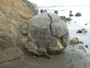
A Concretation
Our next stop was Oamaru and was surprisingly interesting. First up was Steampunk HQ – oddments created from scrap metal

Steampunk creation
 We wandered towards the engine shed and chatted to a volunteer who had just rolled up in his 1970 Mini; he told us the town had grown rapidly with the gold rush and the wool trade. Then it went bust along with the gold rush and was left with a number of imposing buildings, too costly to demolish in the post war years and now having a new life on the tourist trade – galleries, craft centres and tourist shops.

Harbour Street, Oamaru
Work in Progress, Oamaru engine sheds
Last stop was Timaru and the South Canterbury museum and its scale model of what might have been the world’s first flying machine designed by local farmer Richard Pearse and flown into his hedge in 1902

Flying machine?
There is no proof of its flight; the Museum curator told us that an attempt to reconstruct that fight ended when the main backer died of a heart attack – so maybe it was destined never to fly! We saw a lot of classic cars today – are there more in South Island or was it the equivalent of our Drive It Day?
Jan 27th – a day in Christchurch and we didn’t use the car at all! We tried to get the hop-on, hop-off bus but the bus that came past wouldn’t stop so we walked instead. 8 years on from the 2011 earthquake, most condemned buildings have been cleared – not sure if that’s the right phraseology as the Cathedral is still a sore sight!

Cathedral minus tower
They reckon 7 – 10 years to repair it but without saying when the clock started. The Earthquake Memorial by the river had names from around the world – European, American, Iraqi, Japanese and Chinese and the list at the Empty Chair display showed just two children and a lot in their 20’s/30’s

185 Empty White Chairs
There are an unusual number of empty plots around the centre and construction projects all over but the City is alive and dynamic (helped by sunshine!)
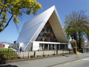
Cardboard Cathedral -temporary?

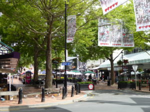
Bustling Regent Street
Tomorrow is our last day in NZ and the start of the long journey home. Its 30 degrees here, hope UK isn’t too cold!
Road to Ladakh
Posted by Peter in Rented locally on December 21, 2025
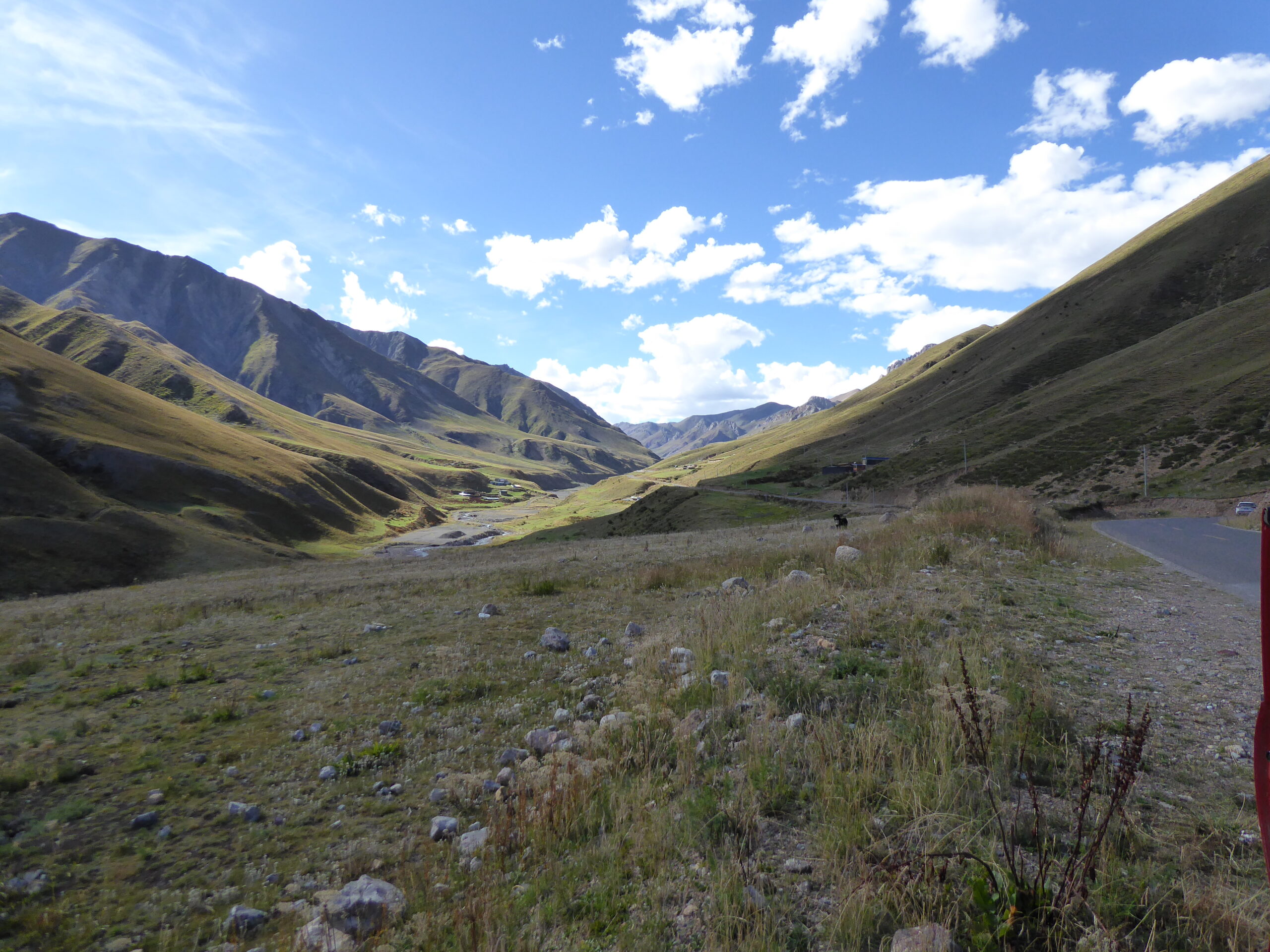
Saturday 12th July. Two cars left Kargil very early – we know as our room overlooked the car park. The rest of us left just after 7. We followed a river for some way, in a lush valley. Then we climbed and the road seemed reasonable. 
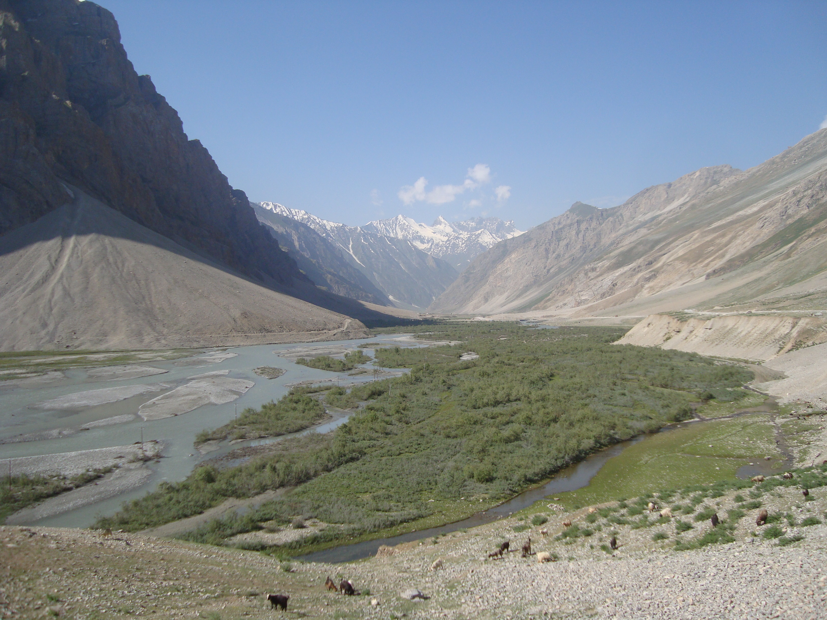 There were sheep, goats and shepherds at the roadside and women carrying large sacks of dung – probably for fuel. At one stage we saw the slightly incongruous sight of a dog herding sheep across some snow whilst we had the aircon on. A police check point required passport, visa and vehicle details and our route (a relatively common requirement on our way up to Jammu & Kashmir though not since we had arrived in Leh).
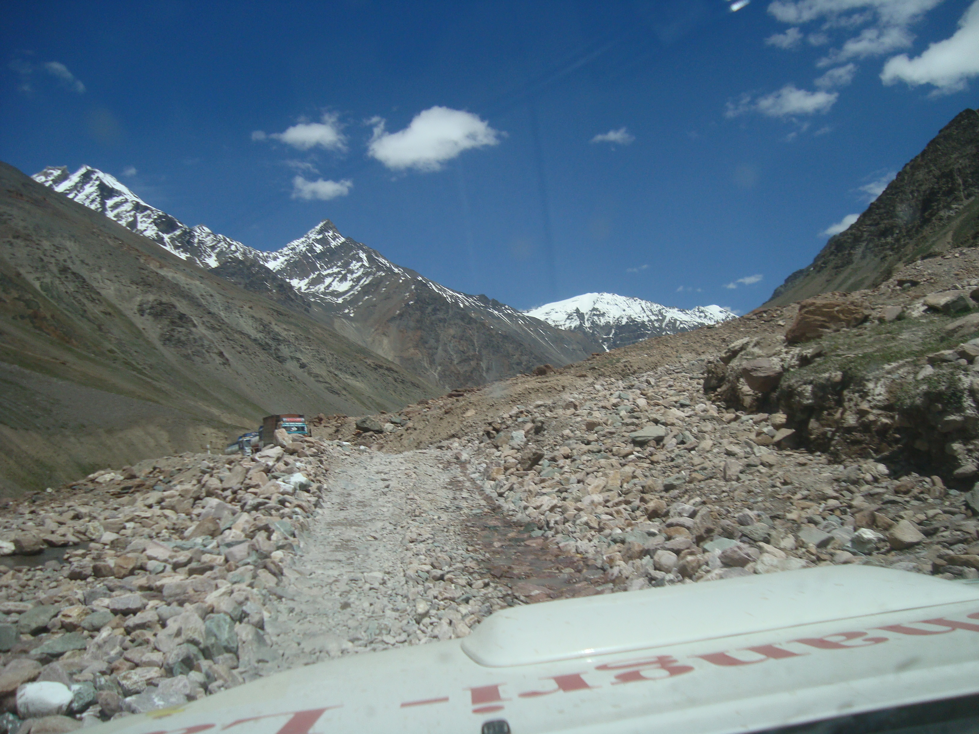
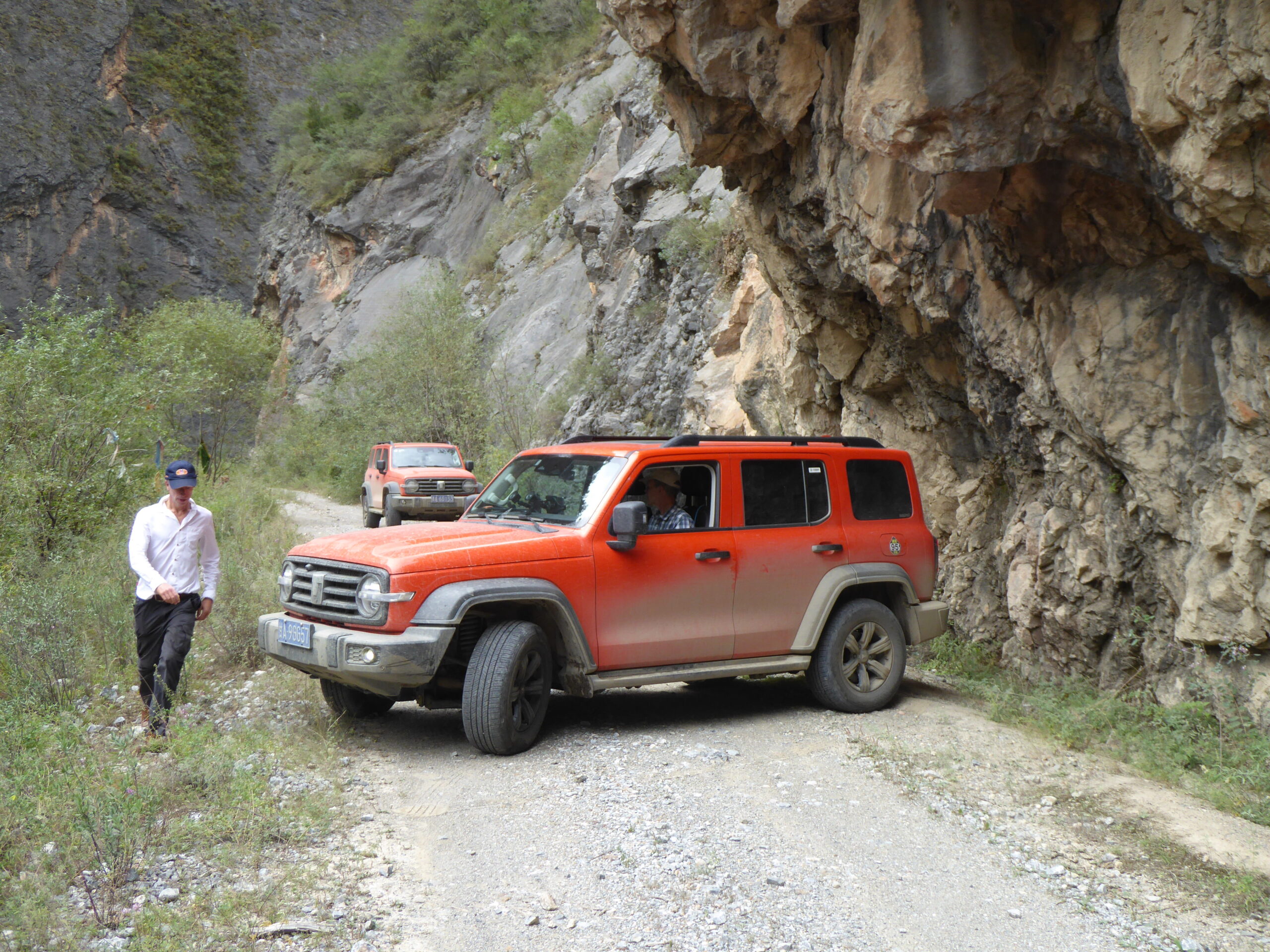
  Then the road deteriorated and was probably the worst quality we had encountered – though still labelled as NH1. We were heading for a Pass and the track
 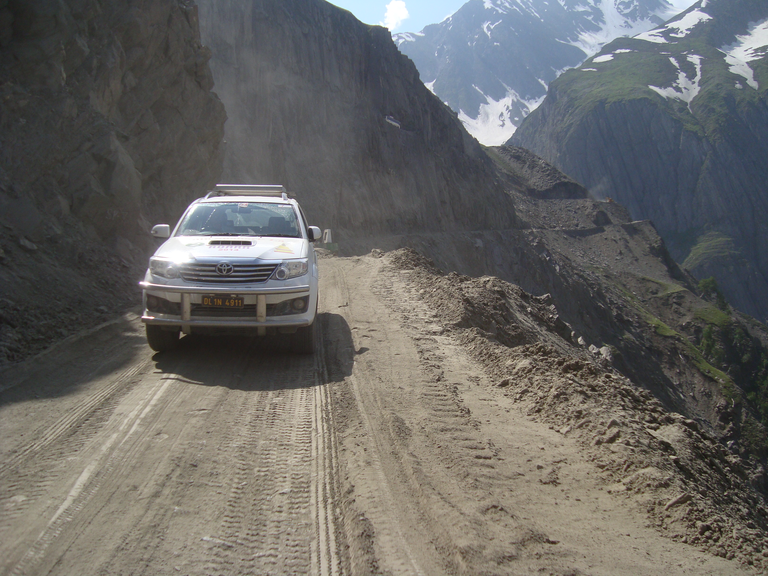 (to call it a road would be a misnomer) was very rough, unguarded steep sides, rocky, bumpy by turn sandy, always narrow with plenty of blind corners. Then we came to a junction (a signpost would make it too easy). Should we fork left and down or right and slightly up? Both looked so narrow that I decided it had to be a form f one way system. So as they drive on the left I headed left – Allison was not convinced and told me how difficult it would be to turn round – impossible actually. We continued, more from an act of faith on my part than anything logical. After a while we came up to a convoy of army vehicles, a jeep that soon vanished and two slow lorries
 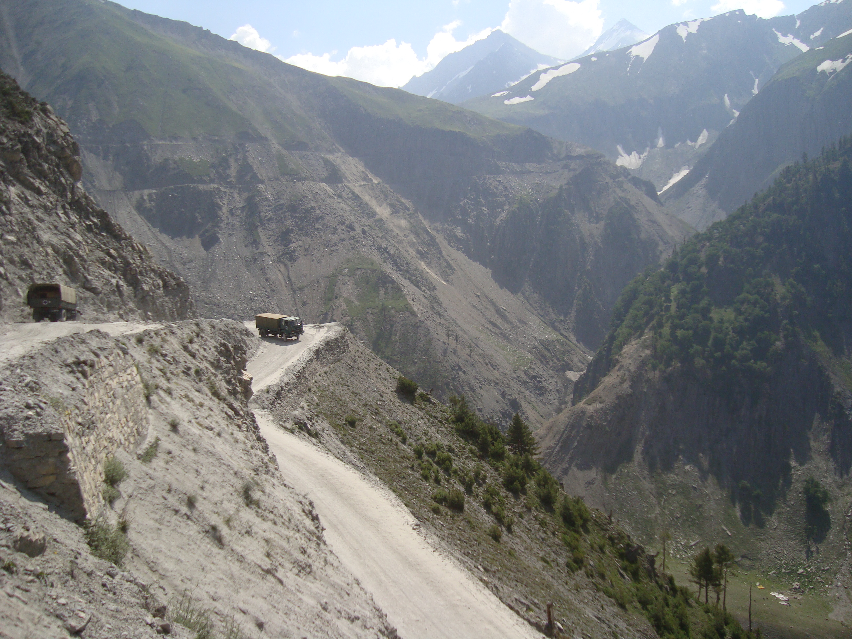 carrying hay – and horses. They let us past, kindly keeping to the exposed left side. Below we saw a huge encampment, not military, as we had seen so often, but a pilgrimage centre. A car had stopped and we asked where we were and where we wanted to be. They said we were ok and Srinagar was 100km in the direction we were travelling.
From here onwards there was a serious military presence; there were groups of soldiers at the roadside, military vehicles and large groups doing training exercises – in addition to military bases along the route. We continued and the track became a road and tourist facilities sprang up – horse riding, rafting and restaurants – with people beckoning us in and looking most aggrieved when we drove on by. We stopped for a cup of tea and the hotel owner tried to persuade us to book his houseboat in Srinagar to stay in.
As we approached Srinagar, the traffic worsened, not helped (as usual) by parked lorries, roadworks, busses picking up passengers and cars and rickshaws seeking every opportunity to block the road by diving into every conceivable gap in the traffic – oh and plain clothes men collecting “road tolls on behalf of the local council”. Hmm where did all that money end up? Signposts were an unnecessary luxury so we relied on the sat nav with much trepidation after Paul and Mary Ellen’s experience at Manali where they went on a 2 hour detour. Having stopped twice to ask the police (who knew nothing about anything) we reached the Taj hotel – wrong Taj, this one had been shut for decades! Can’t blame the sat nav, I had asked for the Taj. We checked the name of the hotel and again set off into the unknown. After more meanderings we were told we had arrived – no! We were now at the side of the lake in “hotel alley”, having seen plenty of Srinagar’s famed houseboats in a most unappealing green slime that passed for a lake. We asked and were pointed at a hill about 3km away. Eventually we arrived after a grilling by security. We had to assume this was our hotel as there was not s ingle signpost or even a name at the gate. Possibly this paranoia is because it was the Taj in Mumbai which was attacked by fundamentalists a few years ago.
We hand the cars back on Monday and ours is undamaged. Do we dare take it into town, where the locals are particularly aggressive drivers, or do we have to take taxis?
Friday 11th July. We changed our plans; we had been scheduled to spend tonight some 50kms from Leh followed by a night in Kargil and one in Srinagar. As we had already seen many of the sights in the first 30kms west of Leh, we decided to go straight to Kargil and spend 2 nights in Srinagar.
Our first visit was to Likir Monastery but it was closed – the monks had gone go see the Dalai Lama. 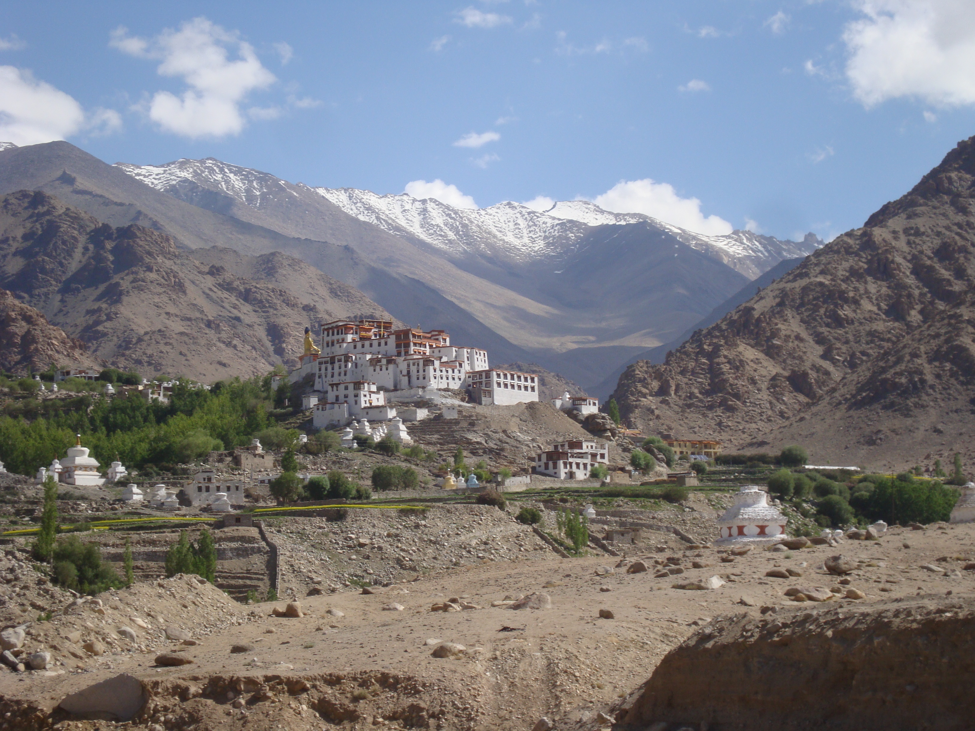 We carried on to Alchi, founded in the 11th century and, unusually, on the river’s edge, tucked away in the heart of the village. For the scholars and historians this monastery is important as it relates to a time when India and Kashmir were Buddhist. Half of the rally were arriving or leaving whilst we were there but our next visit in contrast was totally isolated. We followed a dead end road/track for 15kms to Mangyu Monastery and did not see any cars for the whole 30kms and only two people, one a hitch hiker who we picked up. The fact that the Monastery was closed when we got there was unfortunate.
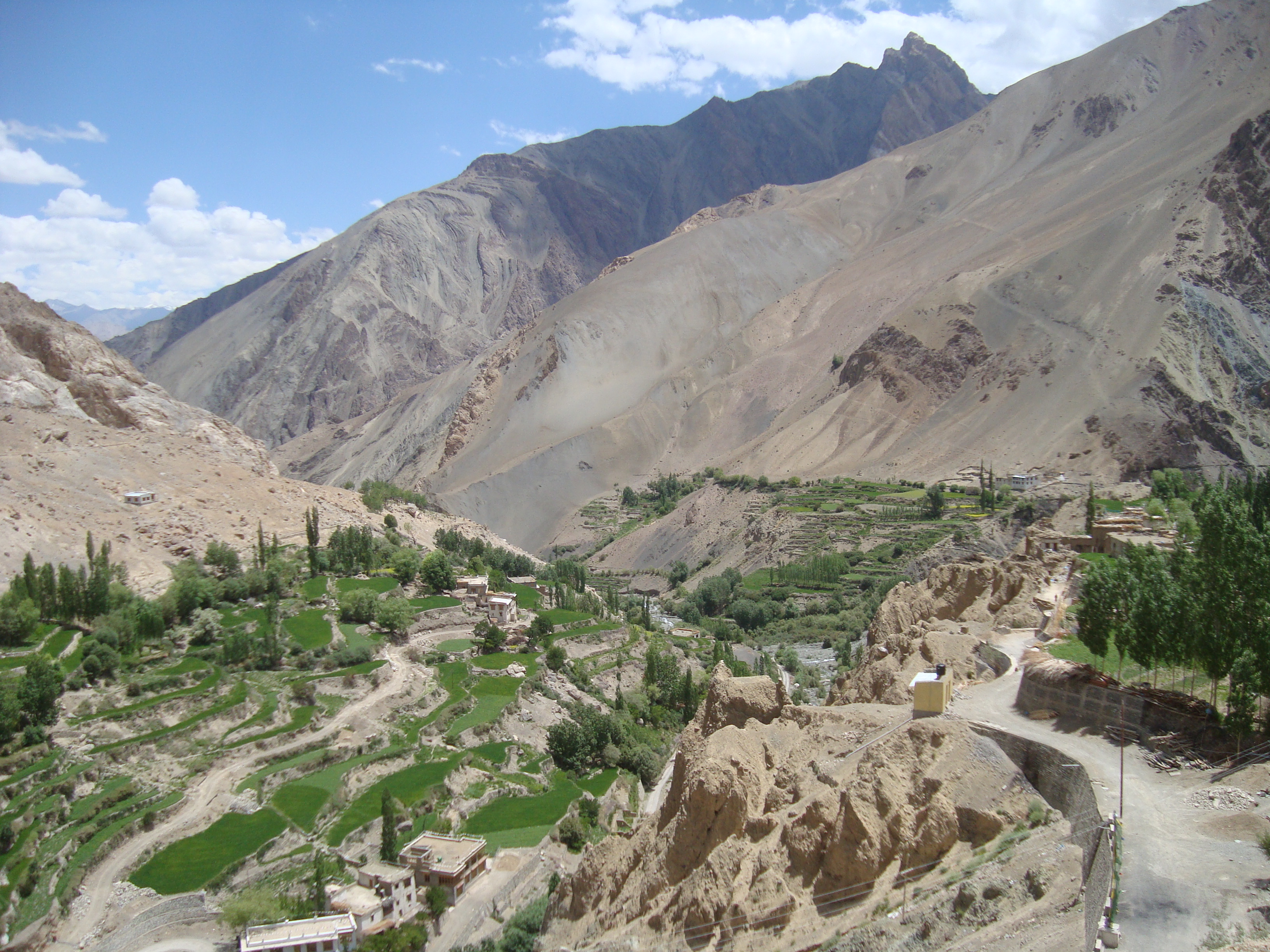

Rejoining the main road to Kargil, past more military camps and convoys, we stopped only at Lamayuru. This was again on a hilltop, just next to an area called Moonland – yellow and bleak. We reached Kargil at about 6pm and now the rally was in two halves, 5 cars in Kargil and 5 220 kms further east. We had not booked our early arrival and the hotel were very flexible in moving our reservation forward. However judging by the problems in parking our 5 cars plus the other residents’, I hate to think what would have happened if all 10 had arrived on the same day.
Thursday 10th July.  We continued our “radiation” from Leh and went west. First stop was Spituk, an old monastery now almost directly in the take-off path from the airport (not very busy). The 11th century temple was quiet, as were all the places we went to today, perhaps because the Dalai Lama was holding an initiation ceremony at which 120,000 people were expected. We had tea in the canteen where Allison was given a barley/cheese/sugar dough by a monk.
  Next stop was Phyang where a new wing was being added to the old complex.
  We continued up the valley in an attempt to find an old fort – we saw something which might have been an outpost but no more. We did find a surprising amount of new building at the dead end of the road.
Returning to the main road we set off along what started out as a good road along the Zanskar river – a fast flowing tributary of the Indus and home to white water rafting. The road soon deteriorated as we were stopped in two places where diggers were moving rocks and boulders and didn’t leave a very smooth track when they finished. Thereafter the road was narrow and wound around rocky outcrops. 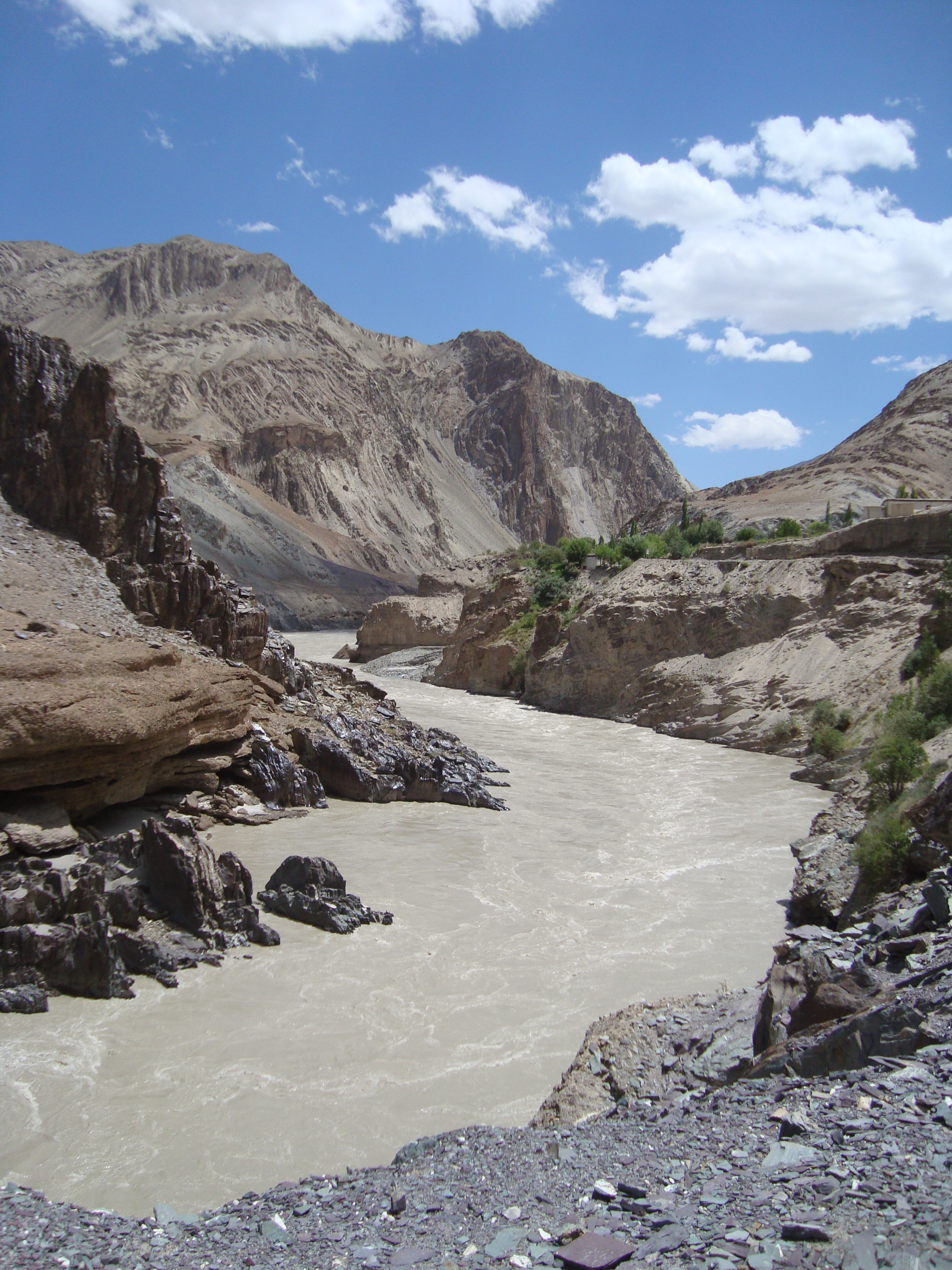 We stopped before the road ended for tea and noodles (70p) at a tea house on a terrace overlooking the muddy, swirling water.
The final visit was to Basgo, where a number of temples and  a pile of semi ruins are all that remain of a once mighty castle, which survived a three year siege in the 17th century. It seemed all locked up until, just as we were leaving, the caretaker emerged and showed us round 3 temples.
We returned to Leh in company with an army convoy, past three military bases – the area is full of military, having China to the East and Pakistan, further away to the West
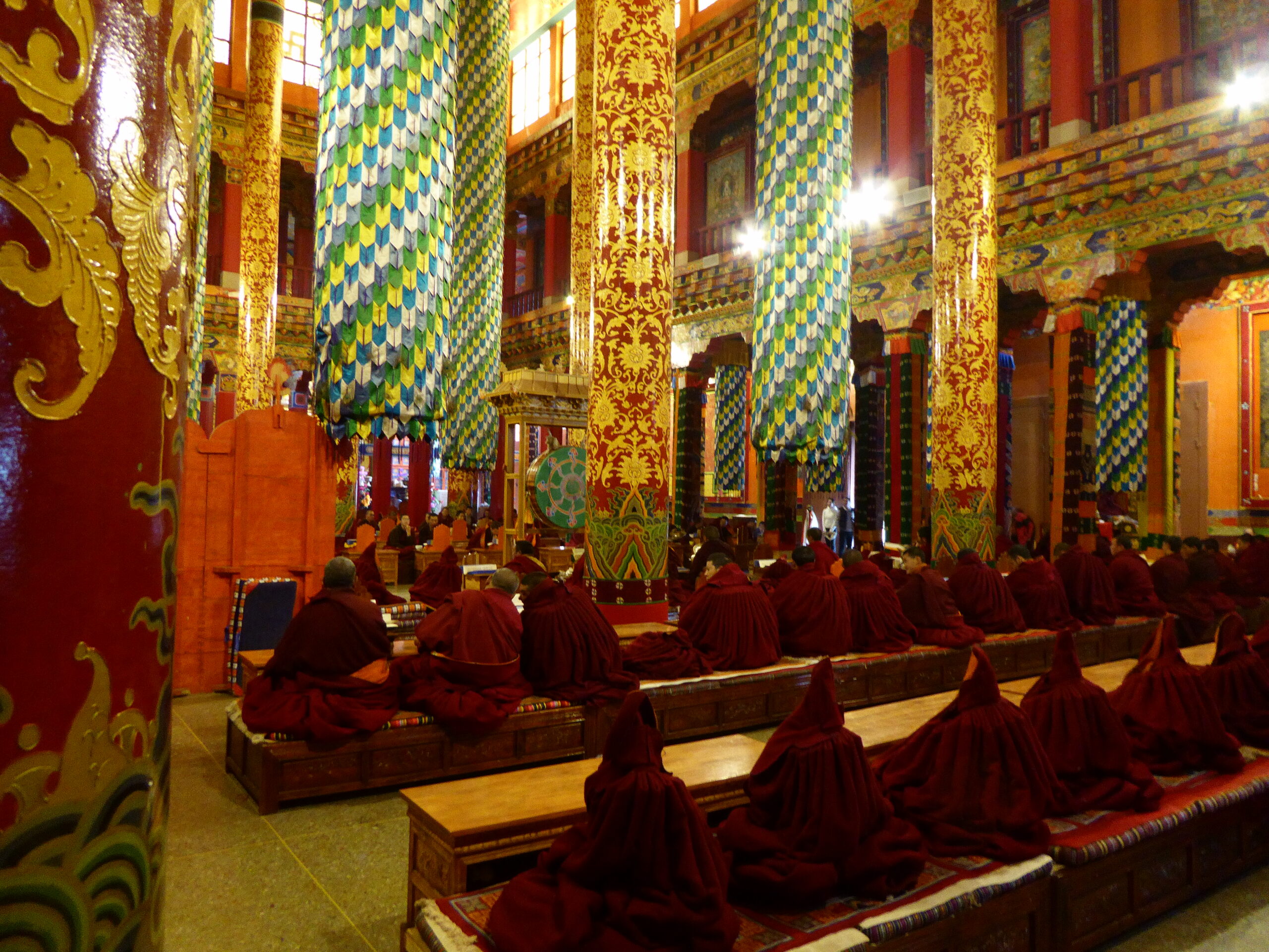
Wednesday 9th July. The morning was a visit to Chemdey Monastery. 
Chemdey – location, location!
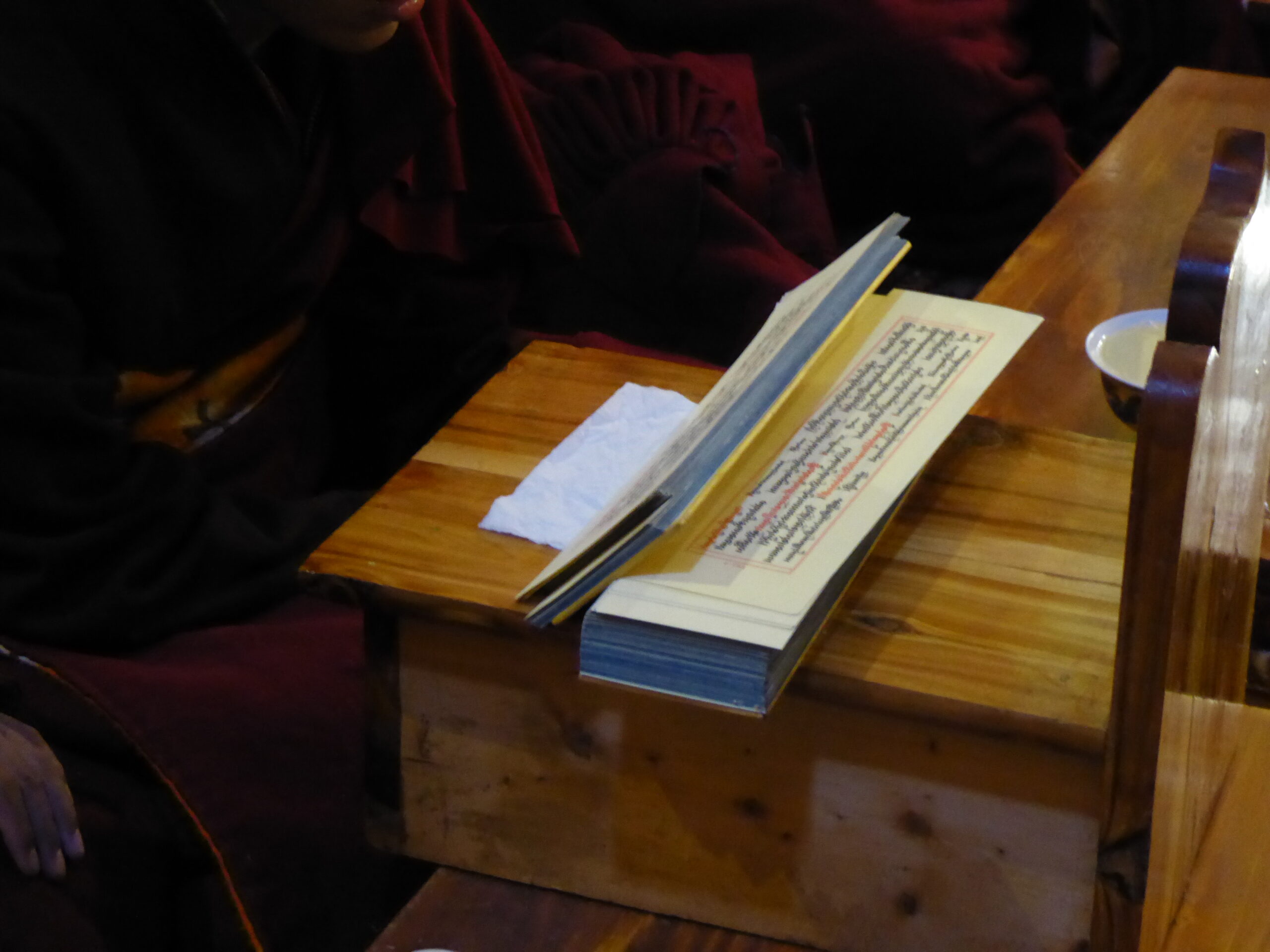
We were given instructions on the spelling to use for the GPS but it didn’t help as it was still not recognised. A police check point confirmed we were on the correct road and after two random right turns – a signpost to the left! As we drove through some trees, the monastery loomed up in front of us. The guide book said it was pleasant to park at the bottom and walk up; we found a shady spot, where were spotted by a girl from the nearest house. She came armed with a book (in English) and asked for one pen – then went away. 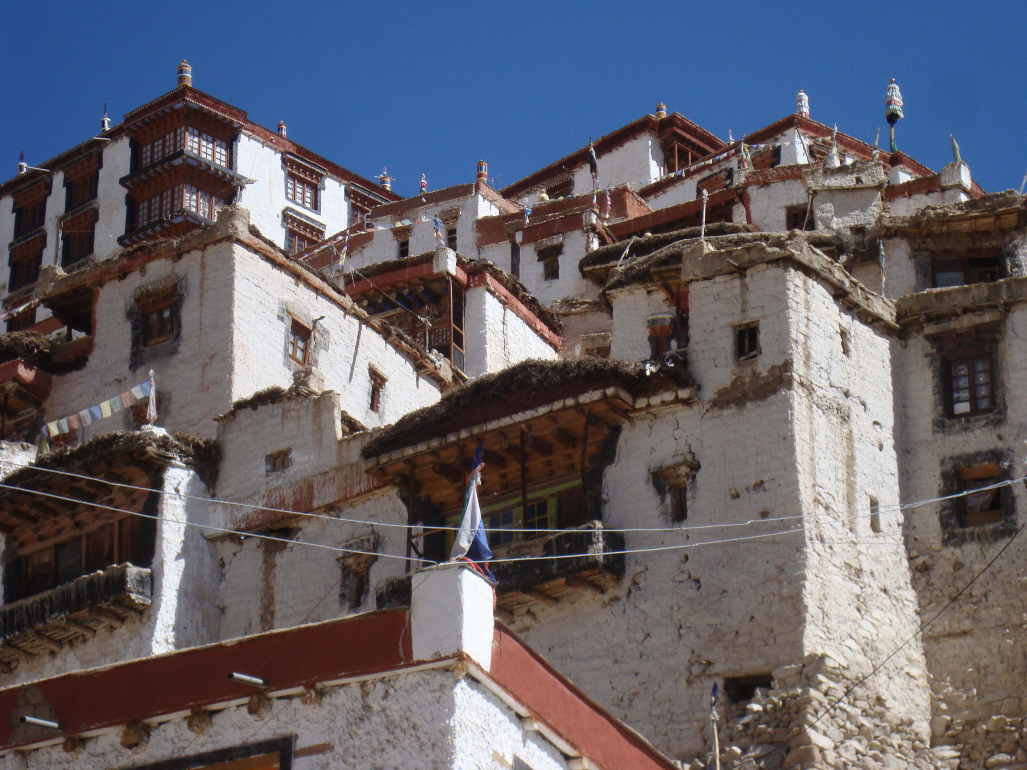 We carried on up winding steps past flat roofed, whitewashed buildings. The monastery was busy with visitors (probably all Tibetans apart from us) yet quiet and peaceful. Shoes were left at various points though it was often difficult to know which the correct places were – sometimes steps to upper floors seemed to be with and sometimes without shoes. Before leaving we had “butter tea” in the café, where we sat or squatted on low, cushioned plinths, without any formality of the “territoriality” that afflicts tables and chairs.
Driving back to Leh we were reminded of the roadside “proverbs” enjoining us to drive carefully. These notices are common on Indian roads – “I am curvaceous – go slow”, “Better to be Mr Late than the late Mr”, “Chance takers are accident makers”, “Drive slow and live longer”, “Alert today, alive tomorrow”, “Trees grow, CO2 gone”, “Prepare and prevent; don’t repair and repent”, “Stop accidents before they stop you”, “peep, peep, don’t sleep”, “Safety on the road; safe tea at home” and “Its not rally, enjoy the valley” They must be joking!
In the afternoon we had a guided tour round Leh. Allison was pleased to be allowed into the Friday Mosque, a brightly decorated building, whilst many Friday Mosques are more plain. The tour took us round the Old Town and the Royal Palace – now being restored and housing only a modern art exhibition and, much more interestingly, an exhibition of Czech Castles – why? I have no idea. The royal family was deposed many years ago and the King now runs an upmarket hotel further down the valley. 
 Later we were entertained by the Ladakh folk dance and song society, sipping beer in the cool air of the hotel garden.
Tuesday 8th July. Some concern overnight as our passports had not been returned to us after being required for a permit for today’s trip to Khardung-La, at 18500 feet the highest motorable pass in the world.  Happily they arrived at the end of breakfast along with the permit. In terms of driving this was much easier than those we had done already.
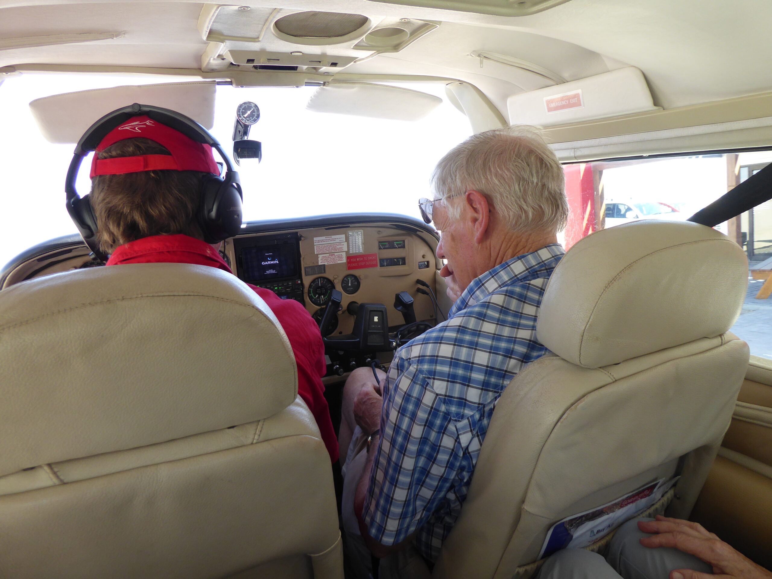
 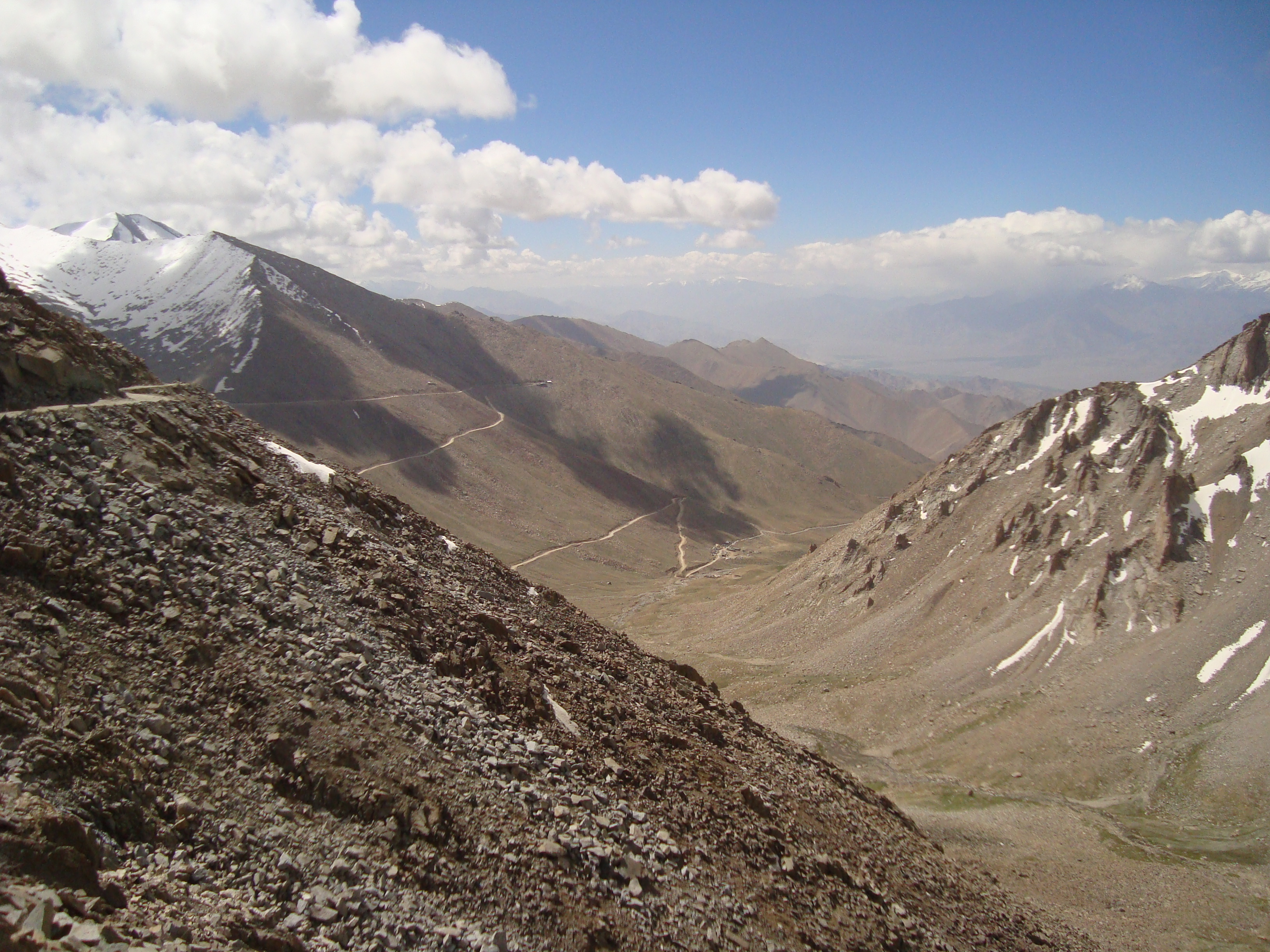 There was a long stretch of good tarmac and for the rough sections I had realised the significance of low ratio. This transformed the drive and we enjoyed a much more lively car. Traffic was light and our permit was not required as there was no-one there to do any checking. We had the rally photographer with us so a few stops for photo ops on the way. The top was chilly and snowy – as is to be expected and my sandals and shorts optimistic. We turned at the top and returned to the hotel for a late lunch and a lazy afternoon.
Monday 7th July. The first of four full days in Leh. Today was decidedly cultural. The Hemis Monastery,

Courtyard Hemis Monastery
 some 45km south of here hosts a celebration of the birthday of the founder of Tantric Buddhism in Ladakh. Nowadays the audience is entirely of foreigners
  and we sat in the baking sun watching some listless dancing, dirgelike monastic chanting, drums, long horns and trumpets. Then to another monastery at Thiksey,
 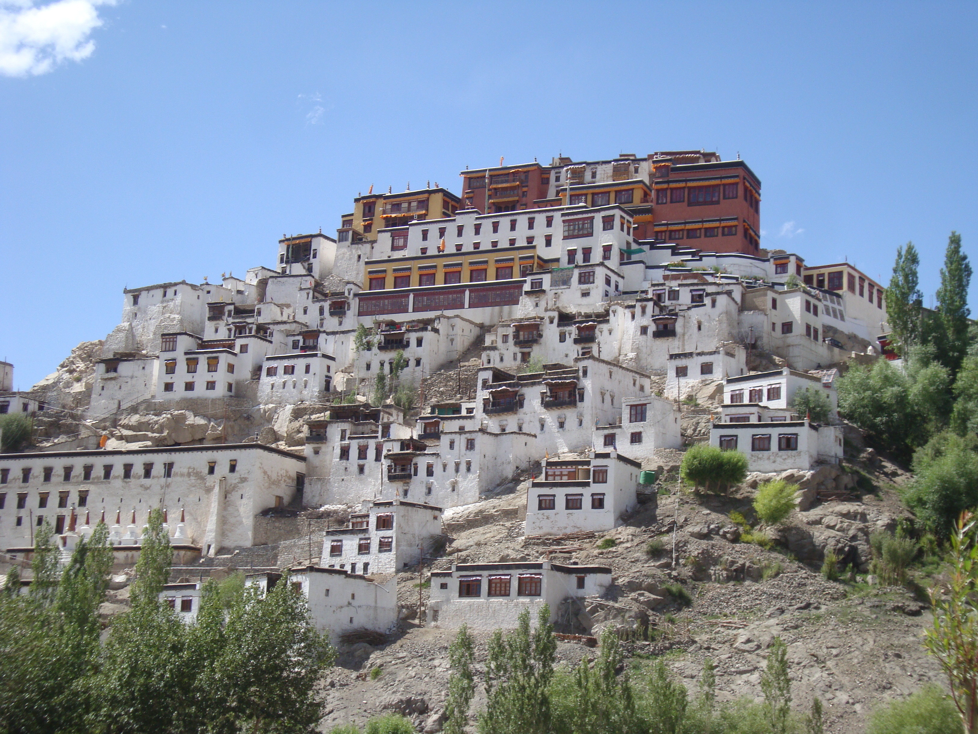 perched on a rock – all monasteries seem to be perched on rocks. Timing was excellent as we arrived just as they closed for lunch – an excuse for tea in the café, except that they didn’t serve tea at lunchtime. It was an interesting visit with Buddhas of different sizes and styles, some in dark rooms and barely visible and others brightly illuminated.
  The view from the rock was of the Indus river, a landscape of barren hillsides and fertile strips along the river.
Back to the hotel for more tea and postcard writing – the era of the postcard is not dead yet! Going to the central post office was interesting. It had just one counter and as soon as she had finished serving the guy in front of us the assistant picked up her handbag and headed for the exit (it was just 5pm). This produced a protest that we were inside before closing time and wanted to buy some stamps. Reluctantly she returned to the desk and we got our stamps.
Saturday 5th and Sunday 6th.

Picture postcard landscape
Two days of hard driving; not that we travelled that far – about 400 kms but it took nearly 16 hours and required continuous concentration! For some the first problem was to leave Manali as the MapMyIndia GPS sent them on a 2 hour deviation which ended up going past the hotel they had recently left. For one crew the day started badly with an overtaking argument with a lorry en route to the first Pass – the Rohtang. This Pass had only recently re-opened after its winter closure 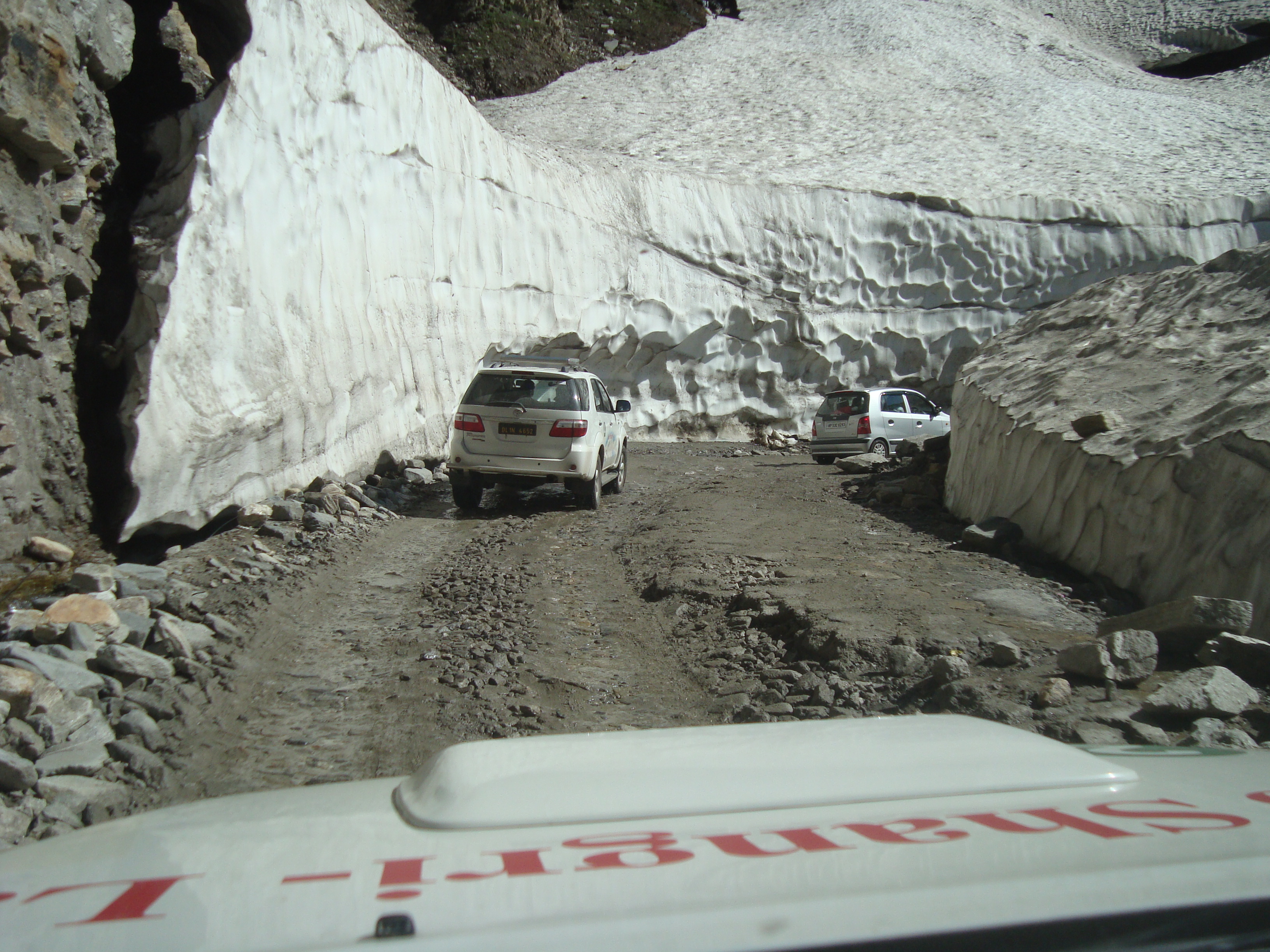
 and was busy, the surface ok in parts but bad in others following landslips earlier in the week. The car was driveable but the length of the passenger side was scratched with missing trim and the rear door almost pulled off its hinges.
 We drove through snow, rivers, mud, gravel and everything else you might expect on a hillside – sheep, cattle, horses. The Rohtang is a taster at 13,051 ft. This was followed by Baralacha La at 16,043 ft. Baralacha certainly made an impression – this was altitude and we were wobbly and unsteady as we descended to a tea house for sweet milky tea.
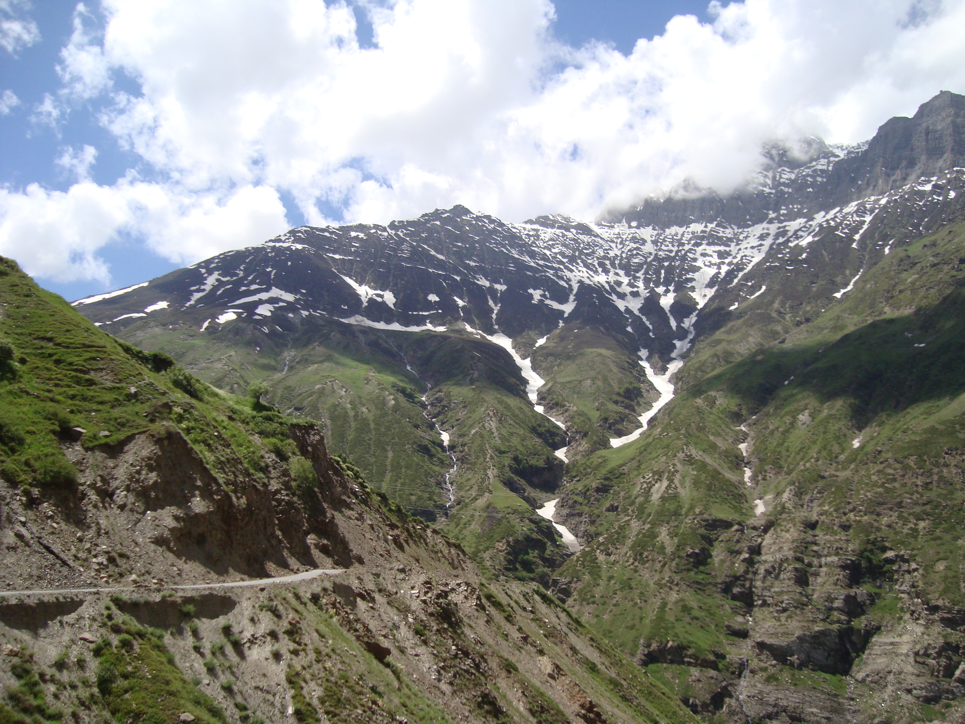

Our destination was the camp site in Sarchu – deluxe camping with en suite loo/washbasin and lights (whilst the generator was running). It was hot when we arrived but cooled as the sun set; shorts and sandals gave way to anorak, fleece, pullover, thick socks and walking boots. The evening meal was communal in a dimly lit tent, reminiscent of our time in Mongolia on the Peking to Paris. Next day we were one of the last to leave as we set out to Tahlang La, the second highest road in the world at 17,582 feet. The landscape was now more barren, the organiser says its like Tibet, to us it seemed like Mongolia with bare hillsides and narrow ribbons of green round the river. Shortly before our stop at Leh 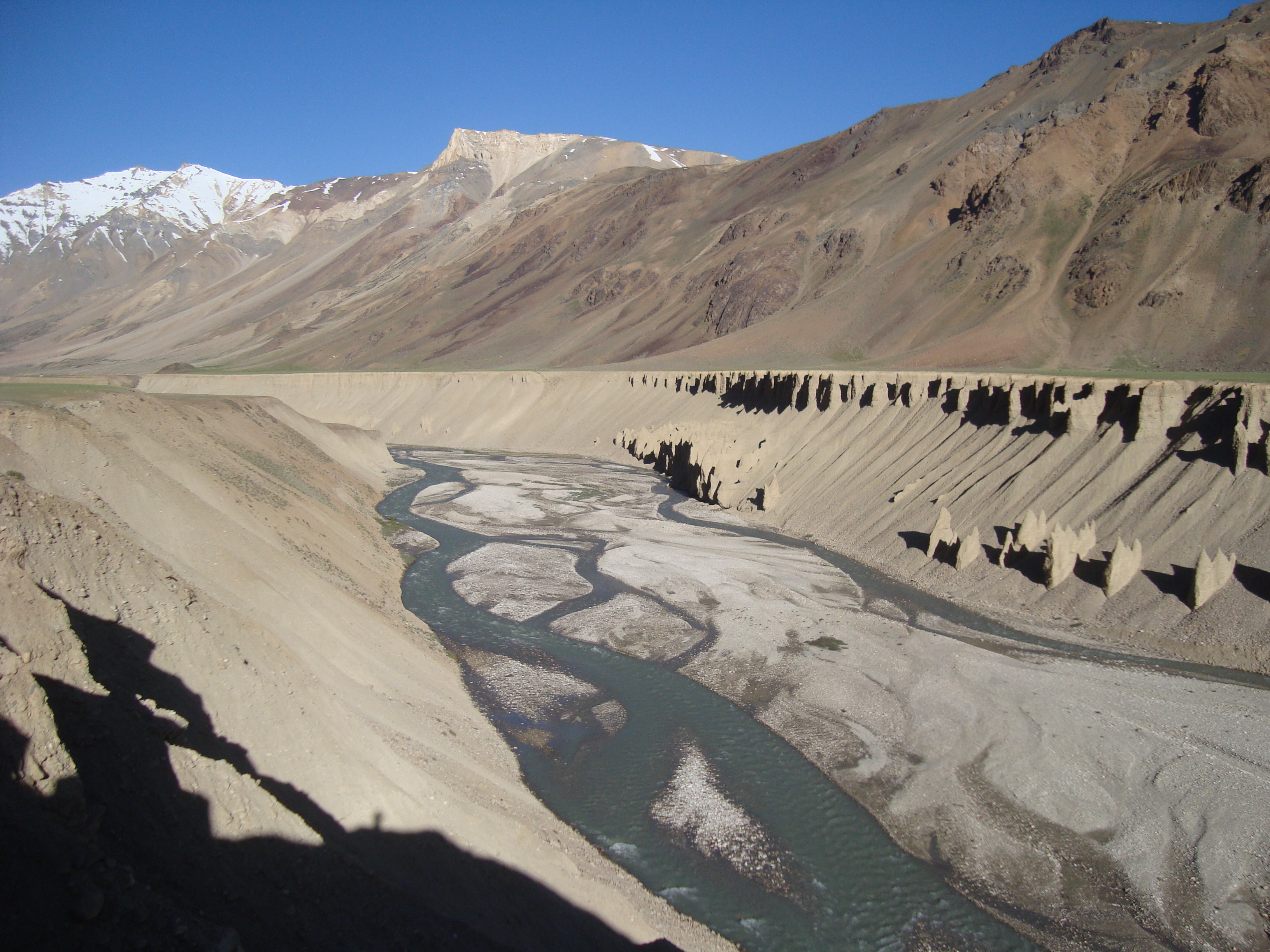 we visited the monastery at Stanka, on its rock in the middle of the valley floor. Arriving at the hotel
 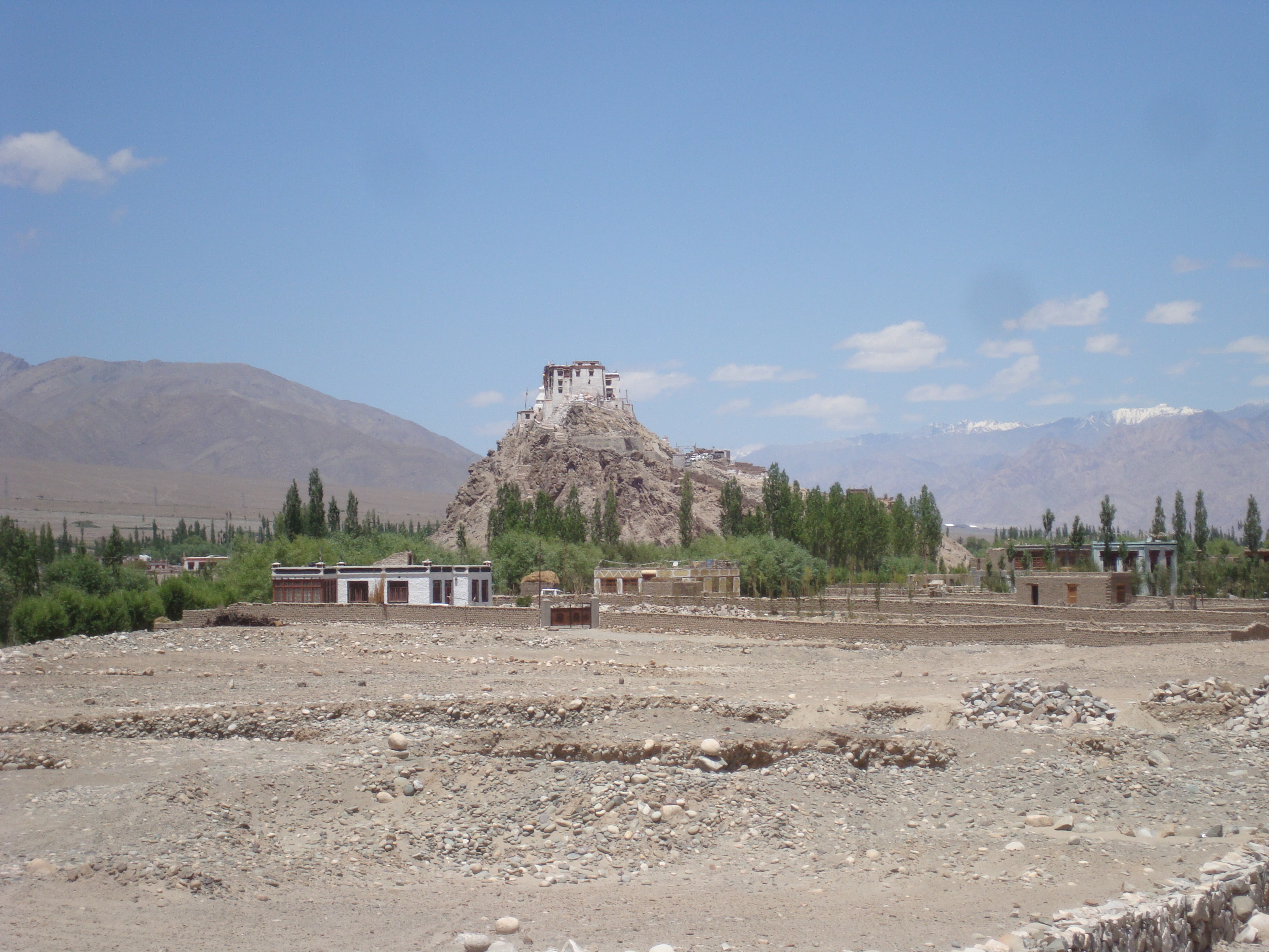 , we were told there was no booking for us – not a good start! We checked with some earlier arrivals who had rooms a nd were told by the desk clerk that all the rooms booked for that group were taken. Fortunately the local guide arrived and we were given rooms allotted to our group – it was all a “misunderstanding” but we didn’t ask what happened to the group whose rooms our rally had already taken……
Friday 4th July from Shimla to Manali. It was all of 270 kms and took 7 hours of hard driving! I was not the only driver to give a cheer when I reached the giddy heights of 4th gear. 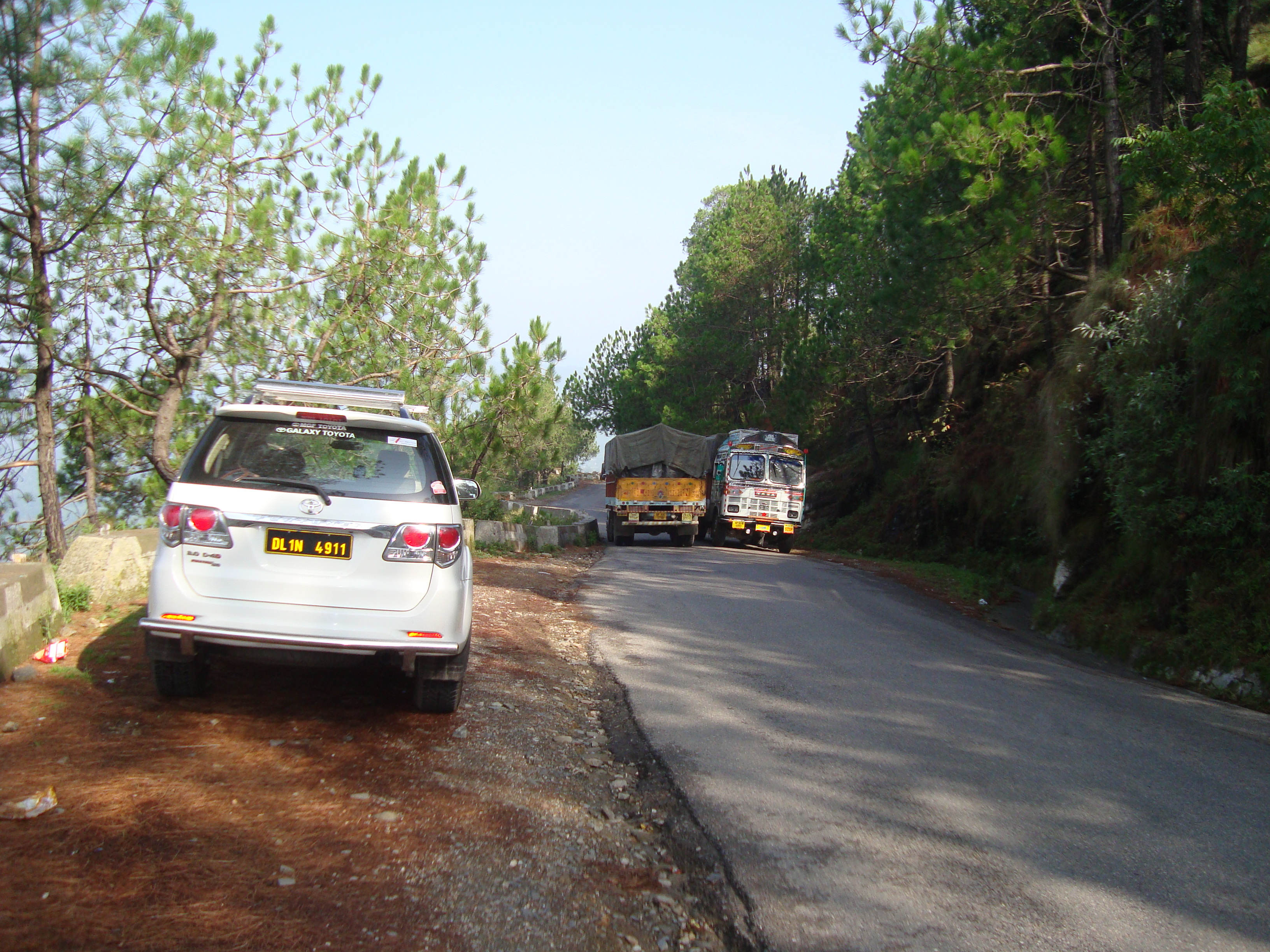 It was all narrow winding roads, through villages and countryside and full of traffic. One delay was caused by a flock of sheep crossing a narrow bridge, which was almost wide enough for two vehicles to pass. But once the sheep got there no-one dared to move so sheep have priority – right? The rain had stopped for most of the day but restarted in late afternoon – the effects of
No that was not the road
the earlier downpours were still being felt. At this time we had left the main road to visit a 16th century wood and stone palace (now a hotel) and the water was pouring off the hillside onto the road.
Tomorrow we head for an overnight camp site at Sarchu (4290 metres) taking in the Rohtang Pass at 3978m where 50 cars were trapped by landslides earlier this week and the Baralacha La at 4890m. So not only altitude problems but Sarchu is likely to be freezing overnight.
Thursday 3rd into the hills at Shimla.  The idea was to drive for 15 miles to the start of the Kalka to Shimla railway and take the narrow guage line for 102 kms and 103 tunnels whilst the car hire company drove the cars up the twisty mountain roads. It didn’t quite work out like that. We were told the train would be an hour late so we decided to drive.
It was slow and twisty and overtaking a bit of a gamble but our car had more grunt than most of the others so we made reasonable progress aside from a lengthy stop to pay for the local state tax. We would have missed this and driven past but tour company guide had asked for a lift so probably felt he had to do the right thing; that took 15 minutes. Then we were stopped for even longer when a police roadside check decided we were a commercial vehicle and had to pay (another) local tax. They were then persuaded we were not so we carried on. As we climbed it got cooler and murkier. The Times of India that morning had reported that Shimla had experienced 95mm of rain on Tuesday and several vehicles had got trapped in a landslide over the Rotang Pass – Friday’s route.
Shimla was in cloud when we got there, thunder was rumbling somewhere near by and it rained shortly after we arrived – what a contrast to the heat of Delhi! Tomorrow we head further into the hills; we should get to nearly 5000 metres over the weekend and the conversation is about how to avoid altitude sickness. We may yet regret our complete lack of preparation………. Sorry no photos today
Now in Chandigarh, about 5 hours north of Delhi. Not all plain sailing and some frustrating problems. BA were late leaving Heathrow after they found that something was trapped in one of the doors then they had to dip the fuel tanks to make sure they had enough fuel. Not very comforting as one would hope they had some gadgets that would tell them this – and if the fuel guage doesn’t work what else doesn’t? Unanswered questions but we arrived and the short delay wasn’t a problem.
Our cars arrived at the hotel during the afternoon – 10 newish Toyota Fortuners. Ours had done about 83000 kms, all white. People worked for a long time on them and now both sides have a sticker showing a map from Delhi to Ladakh. The bonnet has a number, a picture of a stupa and ROARR emblassoned across it. Just slightly visible!
In Delhi we visited the Red Fort, not a relic of the British Raj but preceding them by several hundred years.  Delhi was hot, about 35 degrees and humid. So our progress round the Fort was slow and we soon returned to our hotel.
Old friends arrived and we spent a happy(?) couple of hours whilst the hire car paperwork, complete with a photo of us and car, front and rear, was completed. I’ll leave you to work out whose front ant rear were required! That night we overslept and awoke at 8.40. The blessing of the cars was at 9.30 or was it 9.00? So we leapt out of bed to find it was 9.30. each car and the occupants were blessed, with the obligatory red paint.  The car also had to drive over a lemon and coconut which noisily exploded as we drove over them.
Then, after packing up we set out, on our own as most of the rest were long gone. Allison decided she did not want to risk damaging the car in Delhi traffic so she navigated and
had a problem deciding whether to follow the gps or the notes. The result was that we went via the narrowest, most congested streets around with rickshaws hand carts, bikes, ox carts, anything but progress. We consoled ourselves thinking that our Roadhawk in-car camera would capture the scene. But yes you’ve guessed it malfunctioned and we ended up with just the last few hours of the journey, the earlier part having written over itself. So frustrating!
Eventually the road began to live up to its name – Grand Trunk Road – a dual carriageway with local colour. Driving seems to be permitted on both sides of the road and in whichever lane is free – you just watch out for others who want the same space at the same time. Reaching Chandigarh, our hotel was close to the Nek Chand Rock Garden. This is a 40 acre site and is a garden made entirely of solid and static objects (saves on grass cutting and week control). 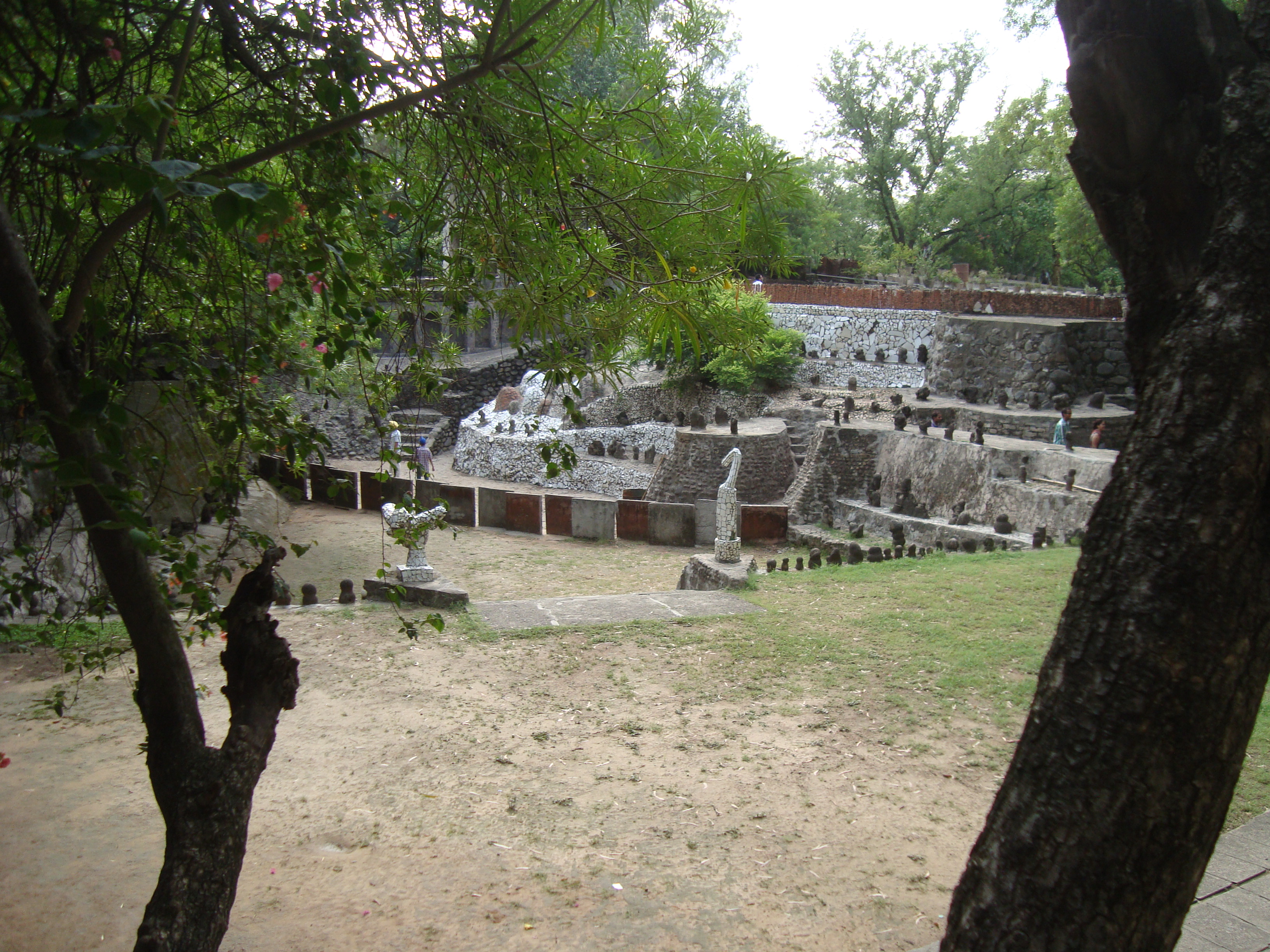

The Road to Lhasa
Posted by Peter in Rented locally on December 21, 2025
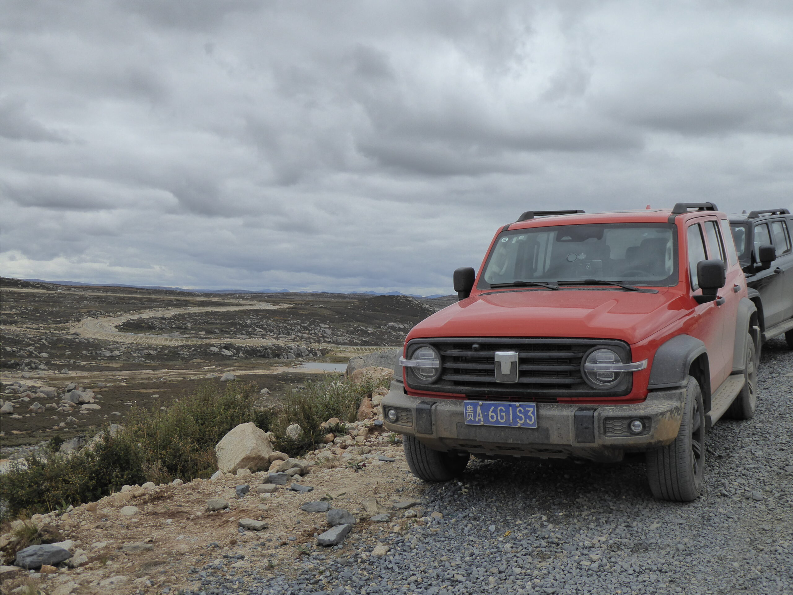
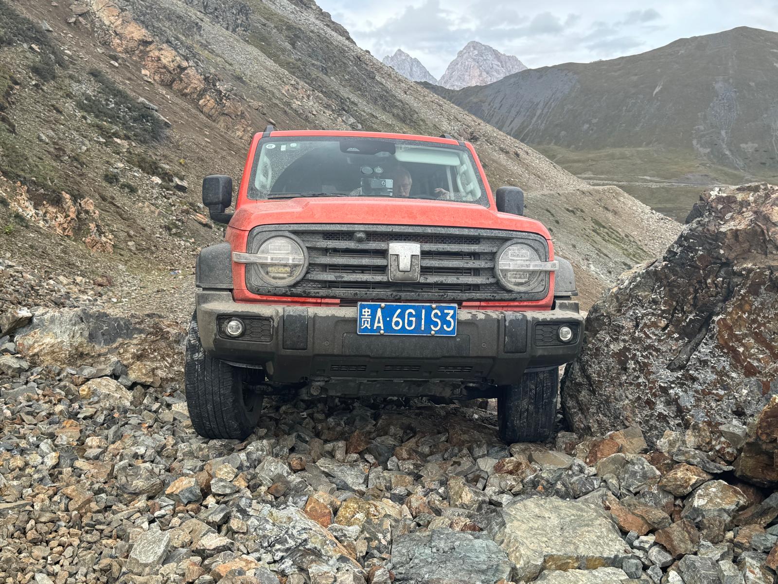
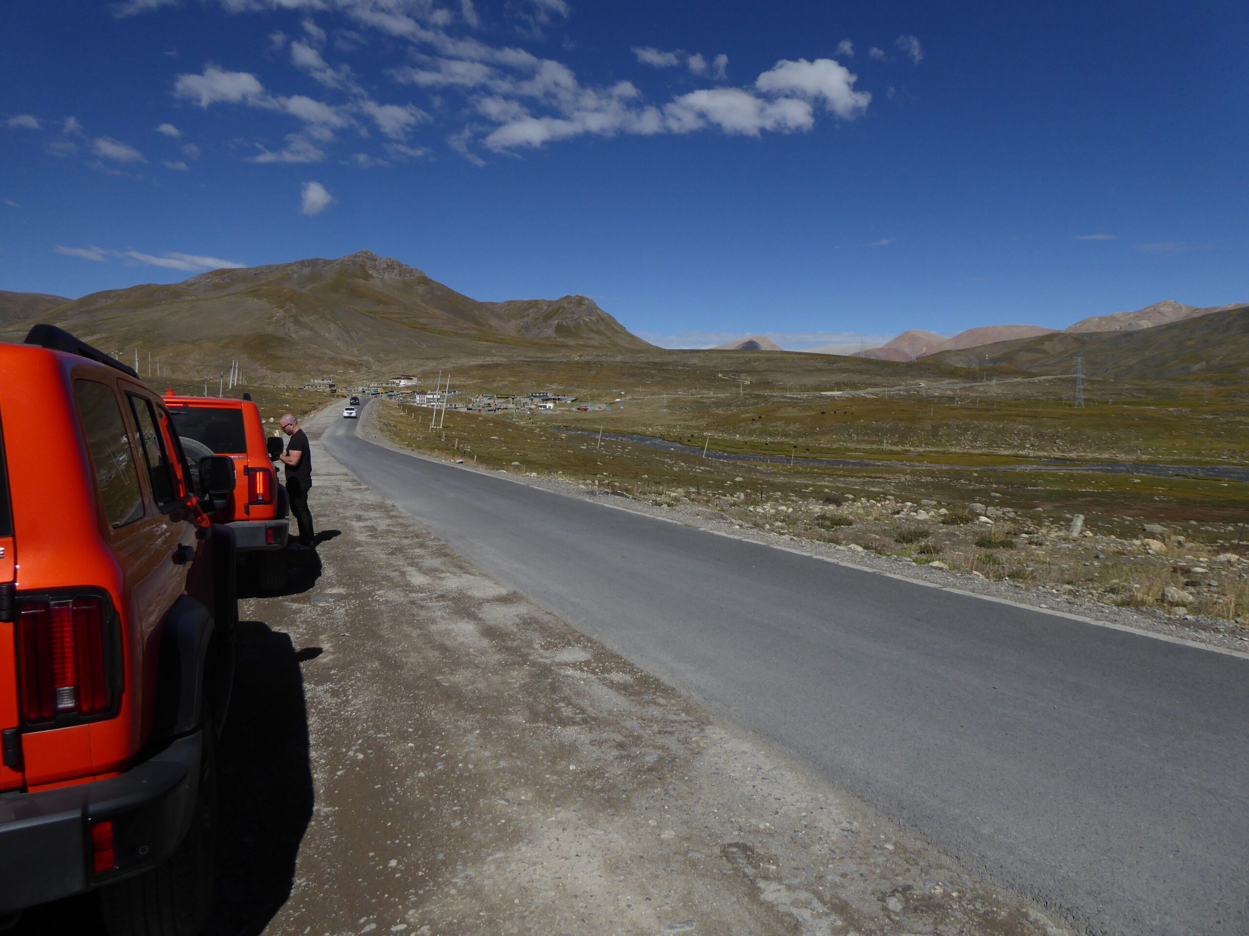
This trip had its origins back in 2018 when we signed up to take the Elan from Chengdu to Lhasa in May 2020. Covid intervened and the rally company folded so the outlook was bleak until Adrian proposed a similar trip in hired 4WDs and a much smaller group. Initially there were 4 cars but one couple dropped out, then Allison became unwell so eventually just 5 people did the trip with Adrian and his Landlady.
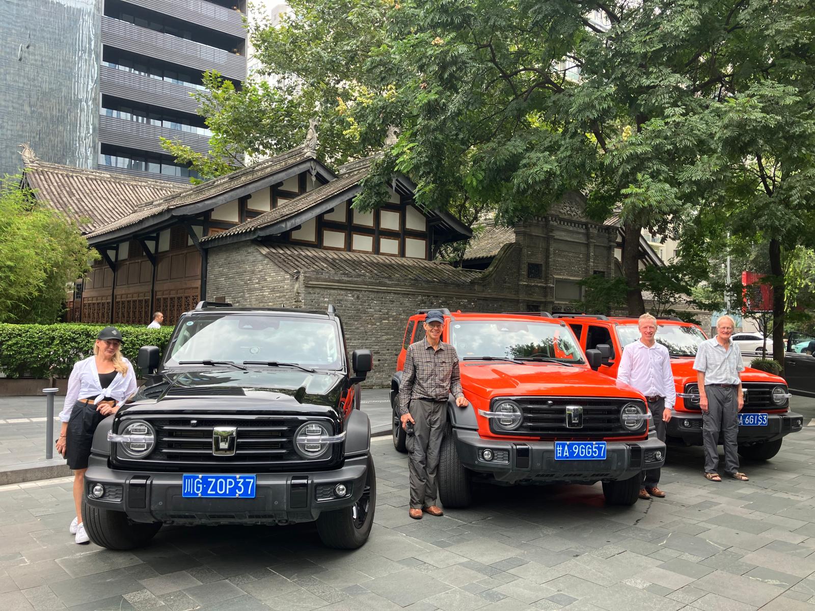
One car missing – in Chengdu
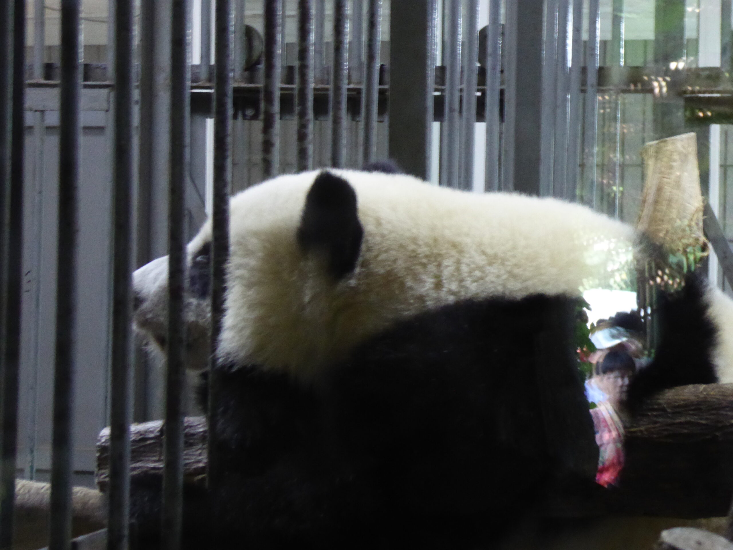
panda in shed

red panda in tree
Our first day was to visit pandas and then some old (tourist) streets. It was 38° and the black/white pandas were all snoozing in huts whilst the reds were sprawled out in the trees – so with all the crowds not much to see. In the afternoon we met our “Tanks” and were given supplies of water and an oxygen compressor – our route goes well over 5,000 metres.
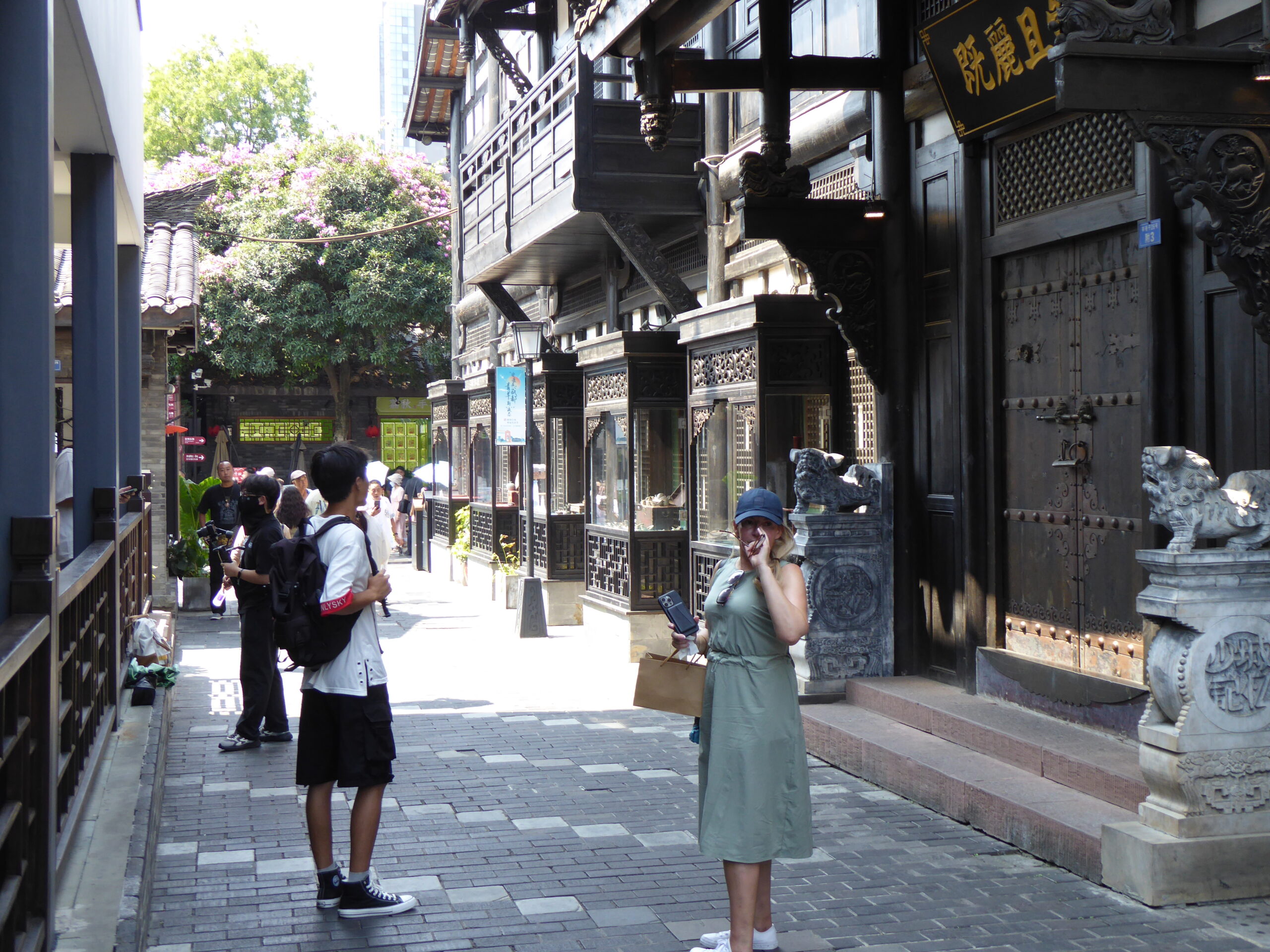
Chengdu historic street
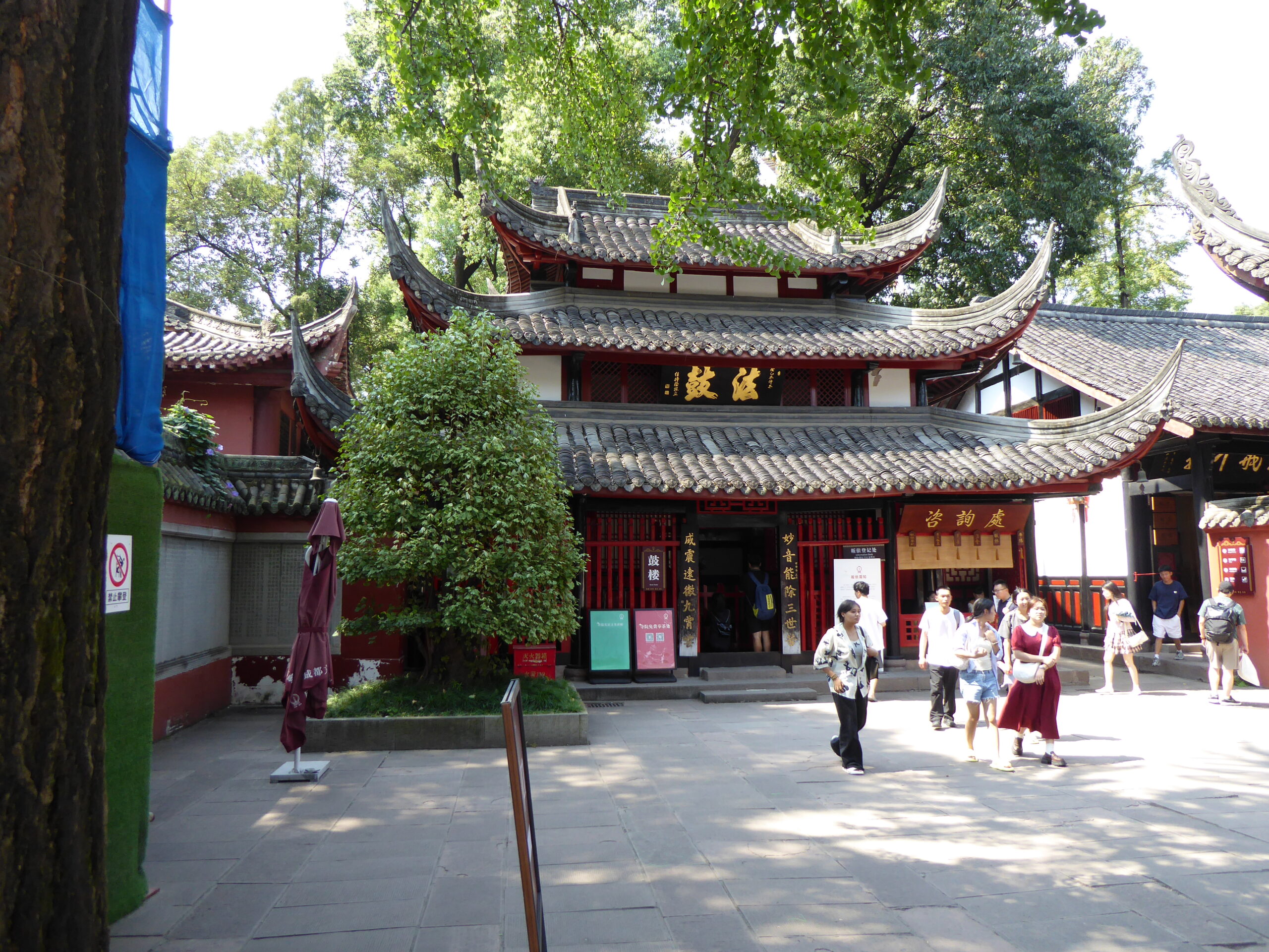
Chengdu temple

Tank in action
Our first day on the road was to Leibo and my first navigation error at a motorway intersection as I was following the wrong mapping app (see Technicalities). Lunch brought its own problems as we could not read the restaurant signs – so they gave us photos of the shop front in future but messed that up on day 2 by sending us to one location with a photo of another restaurant in the same town with the same name! After the motorway we were on ordinary roads with plenty of aggressive overtaking on roads cluttered with cars, lorries and bends. See the map, we started in Chengdu (top right) far west and south to Everest before returning east to Lhasa
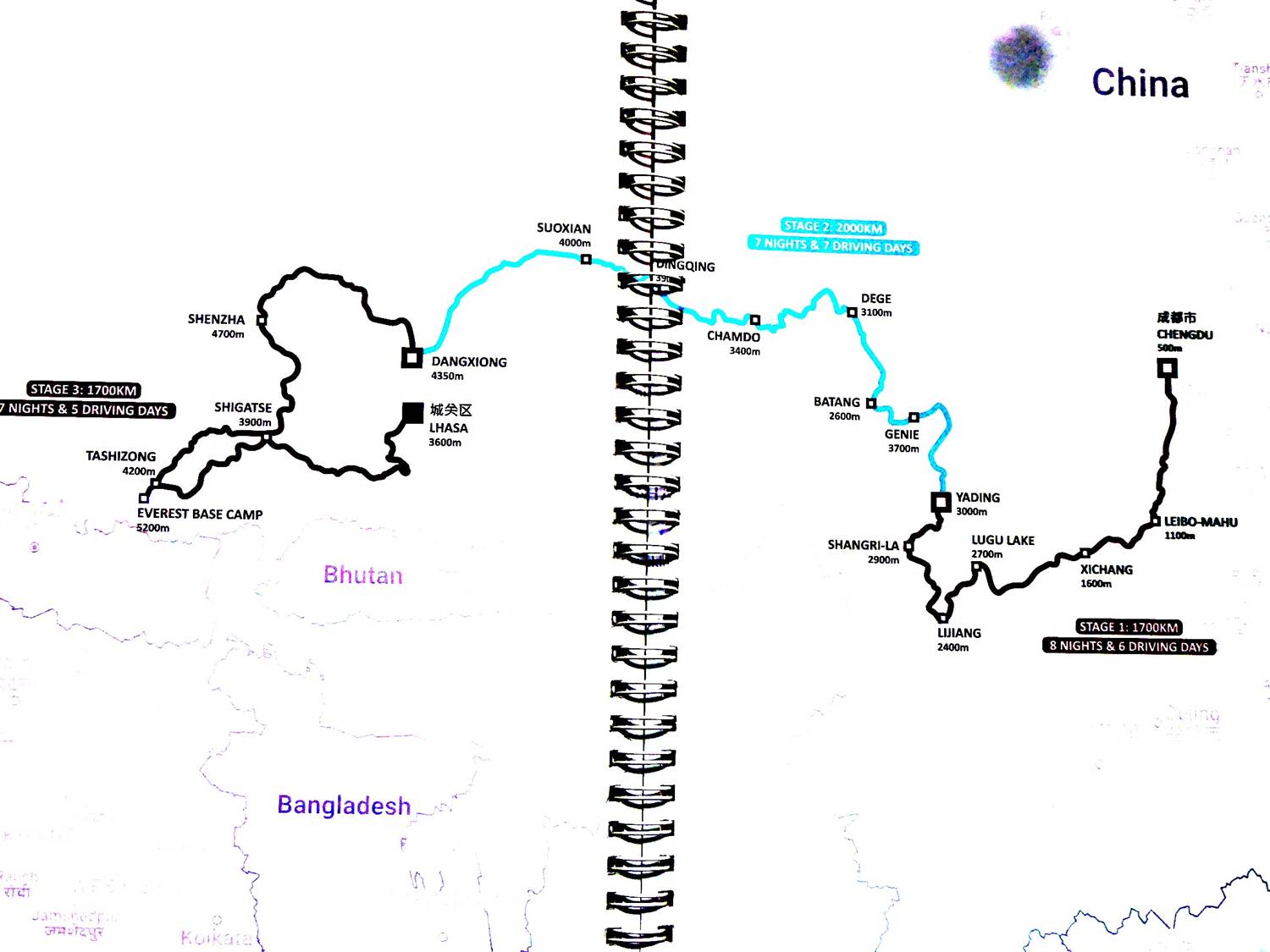
Our Route
In the first few days there were relatively few sights to see and driving occupied our full attention.
Day 1 view of Mahu Lake
Controlled footpath
Xichang Lake
ok plastic greenhouses
On a deviation
And on to Lugu Lake where we had the first rescheduling of the rally. Our planned hotel was deemed unsuitable so after hasty phone calls we went to another some miles away, arriving after dark – brand new and almost empty but somehow they conjured up beer and food.
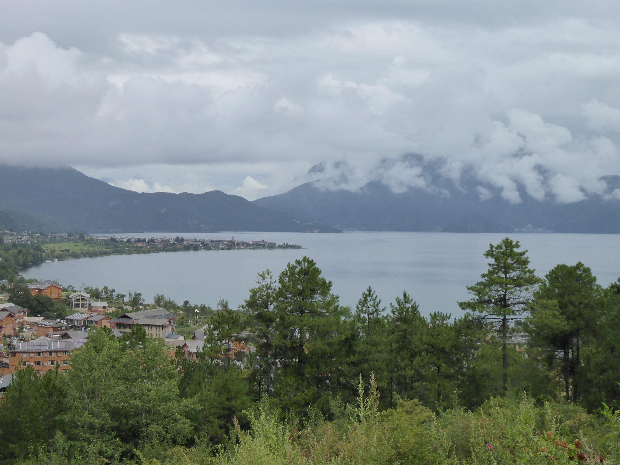
Lugu Lake
The meals were fairly consistent in that our guide ordered for us, gradually realising that we didn’t like it too spicy. I guess it was all air fried with loud extractor fans and plenty of oil which I invariably split on my trousers as we sat on low chairs and were using chopsticks. Pork and mushroom was a favourite along with stringy greens (always stuck in my teeth), broccoli and various beef and chicken dishes, accompanied by rice; relatively few noodles. Breakfasts in the larger more western hotels were standard buffets but became more challenging in the smaller Chinese hotels where everything was a random selection – steamed buns (aka dumplings) were safe and almost edible. Melons, dragon fruit and mangos were usually available.
Road to Baoshan
From Lugu our route included a side trip to Baoshan Stone village (lunch stop) to the ancient city of Lijiang, our furthest point south. A sign in Baoshan showed Tea Horse Road;
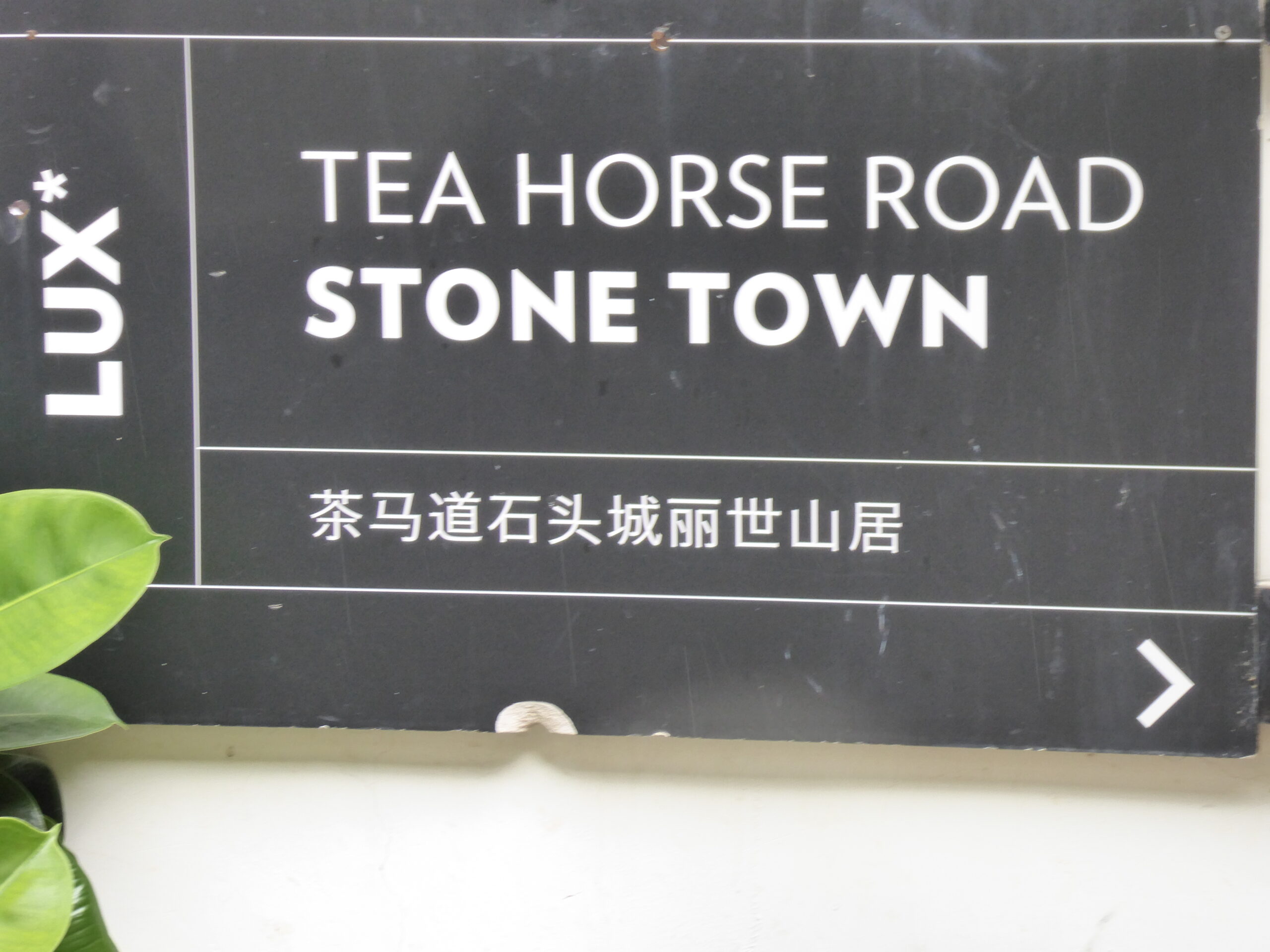
Tea Horse Road
In Baoshan
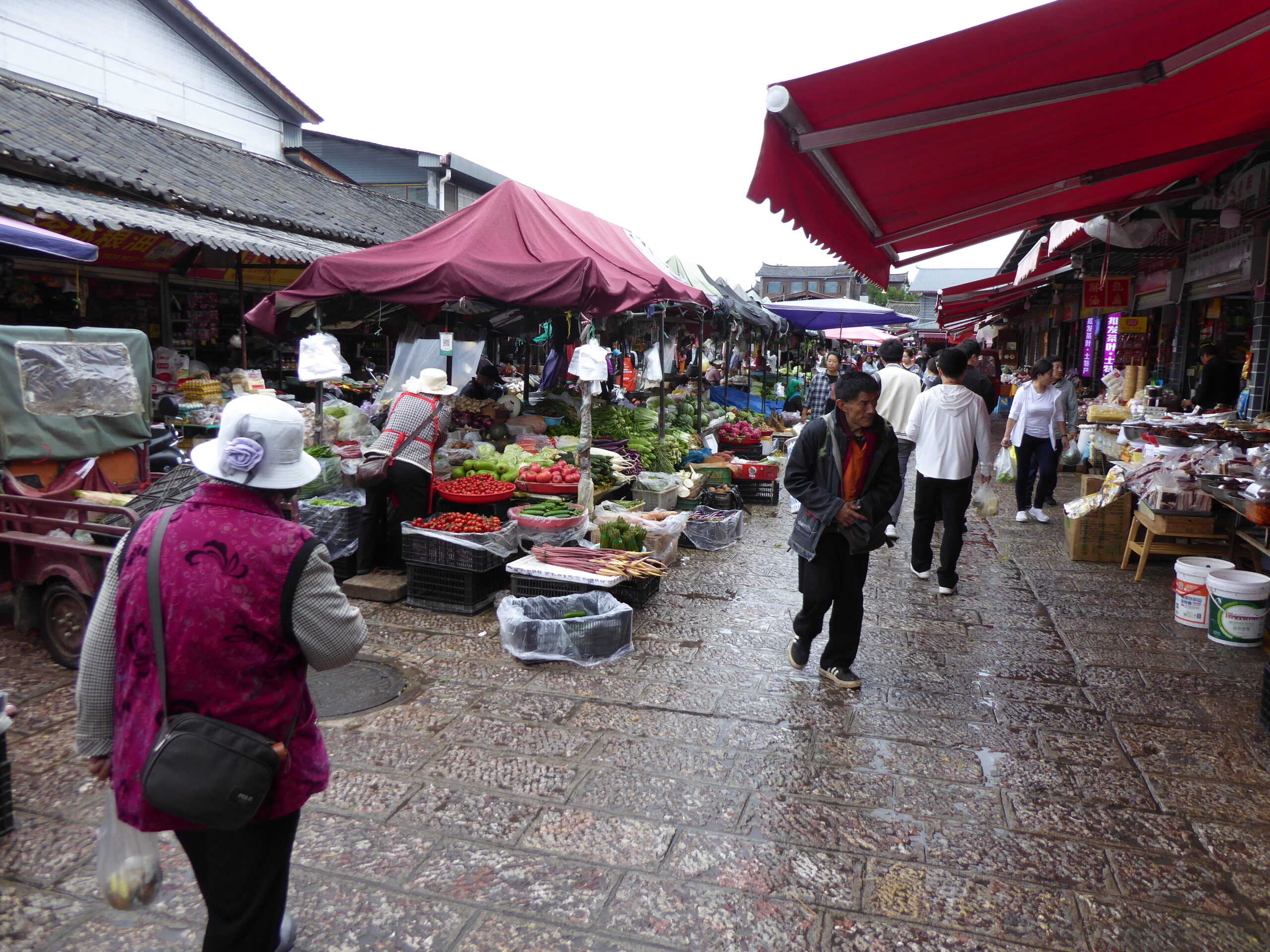
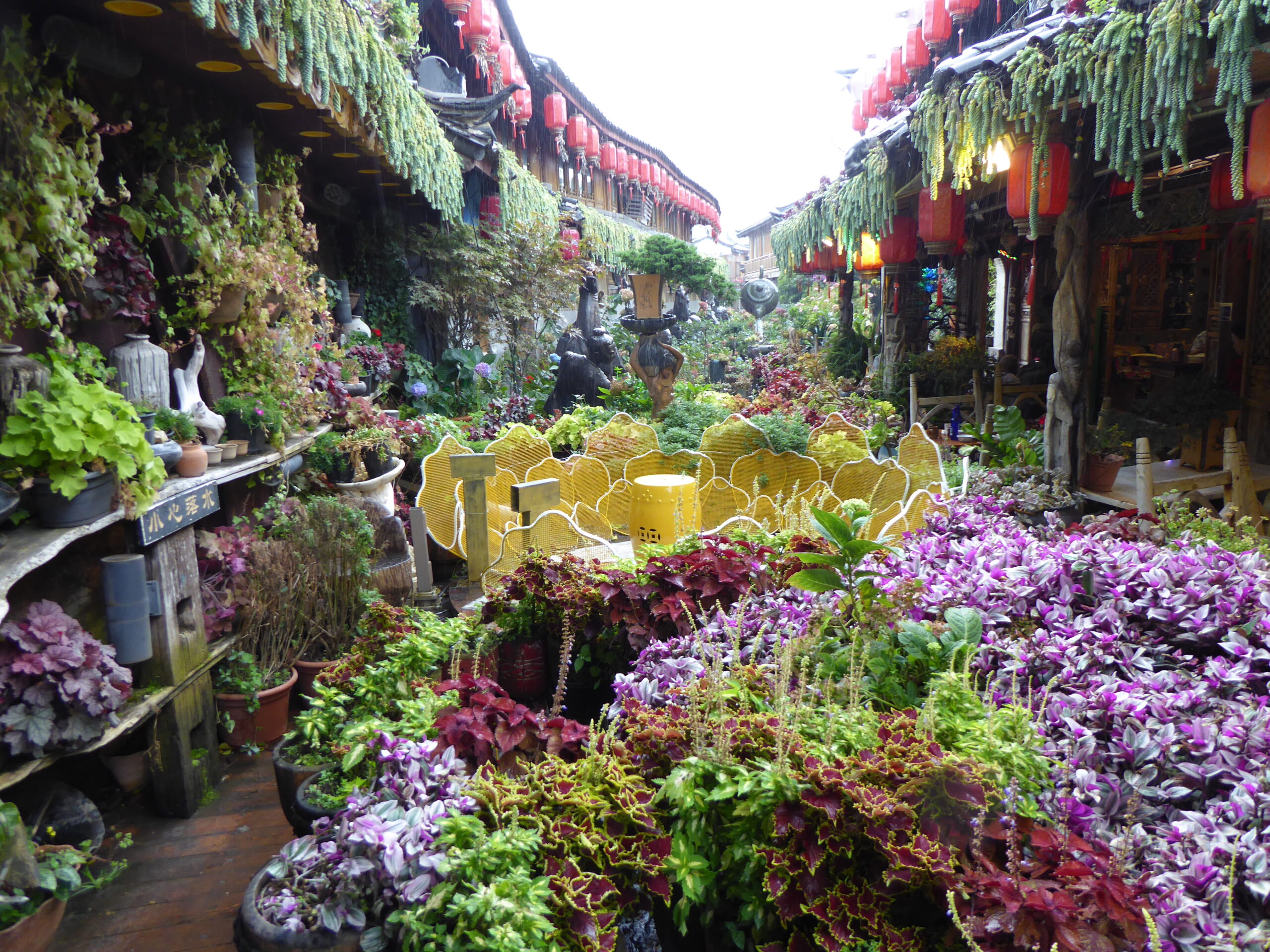
Damp Lijiang market
Lecture on teas
Lijiang Mu’s Mansion
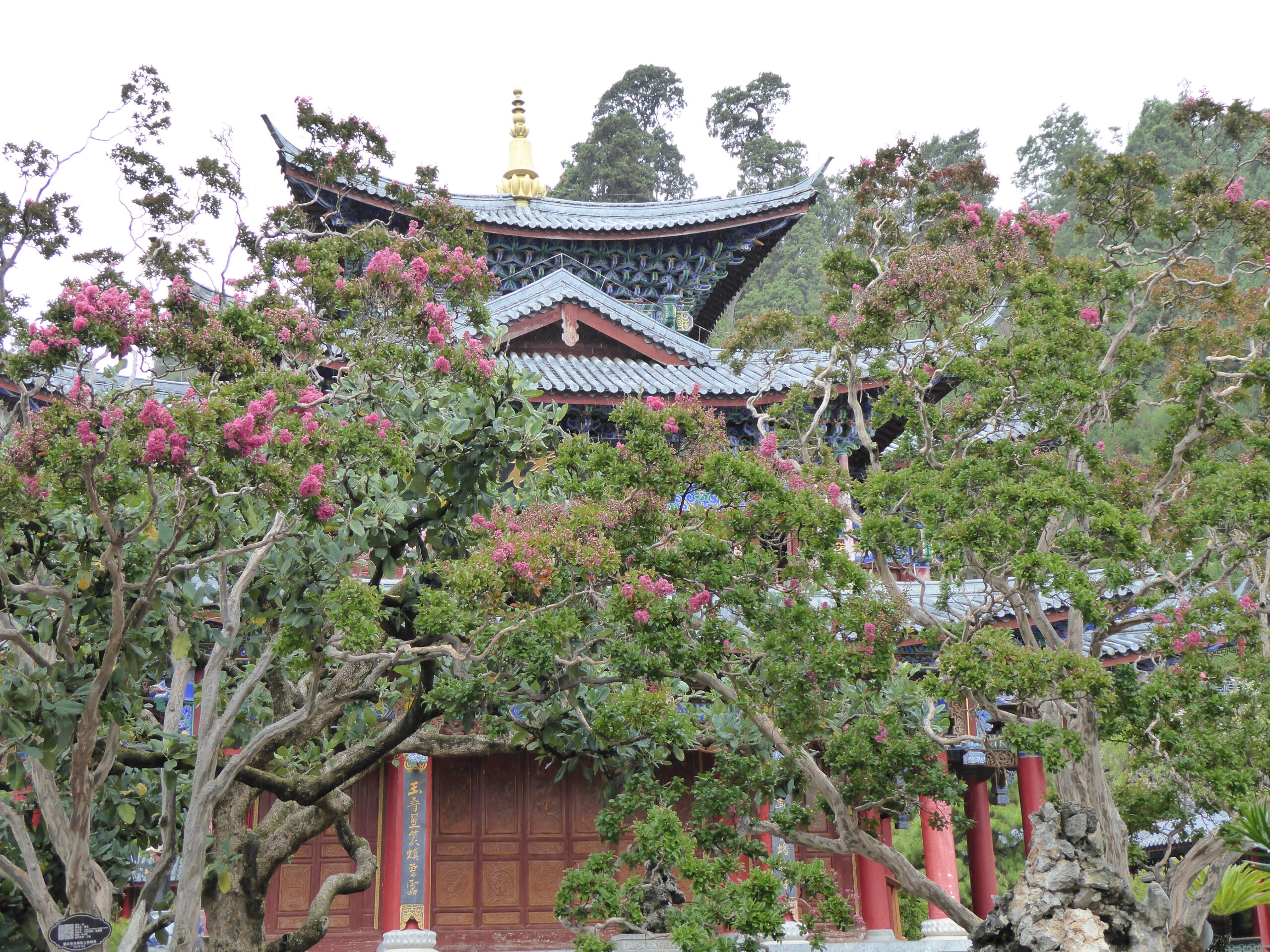
Temple in the gardens
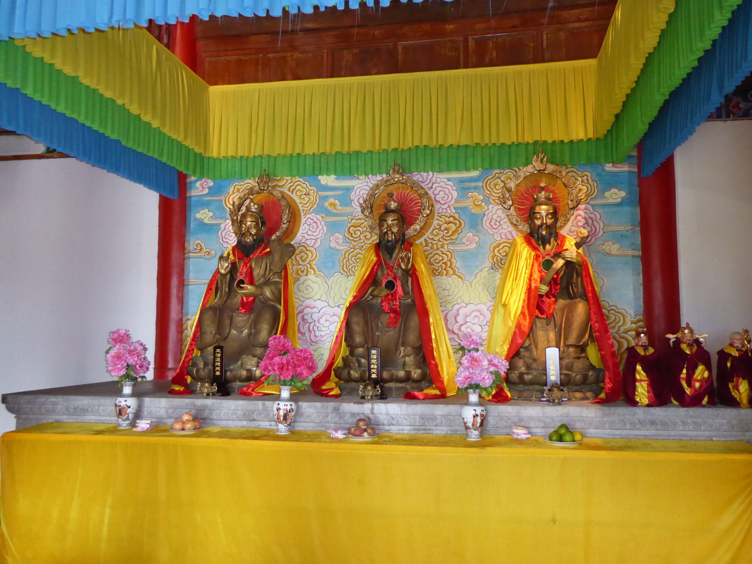
Temple
Canal outside our lunch stop
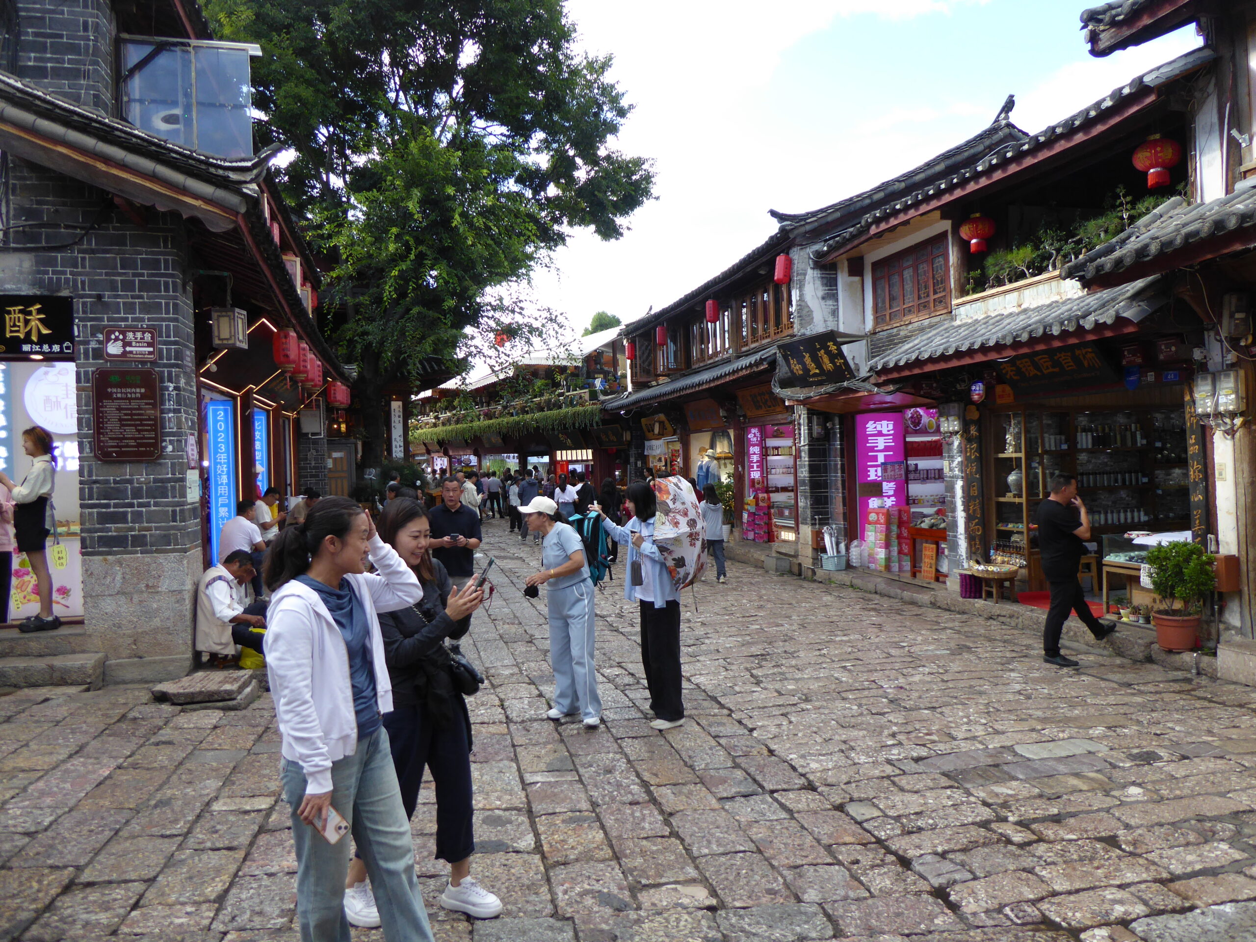
street in the old town
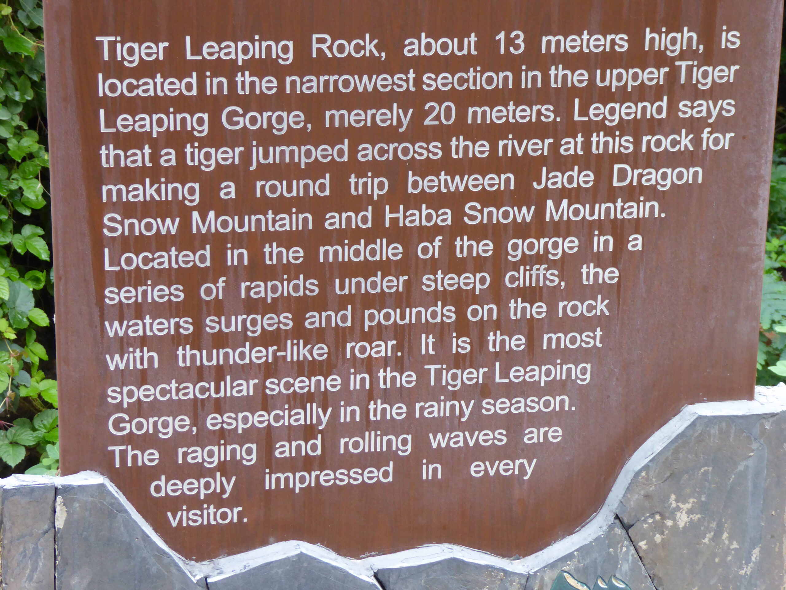
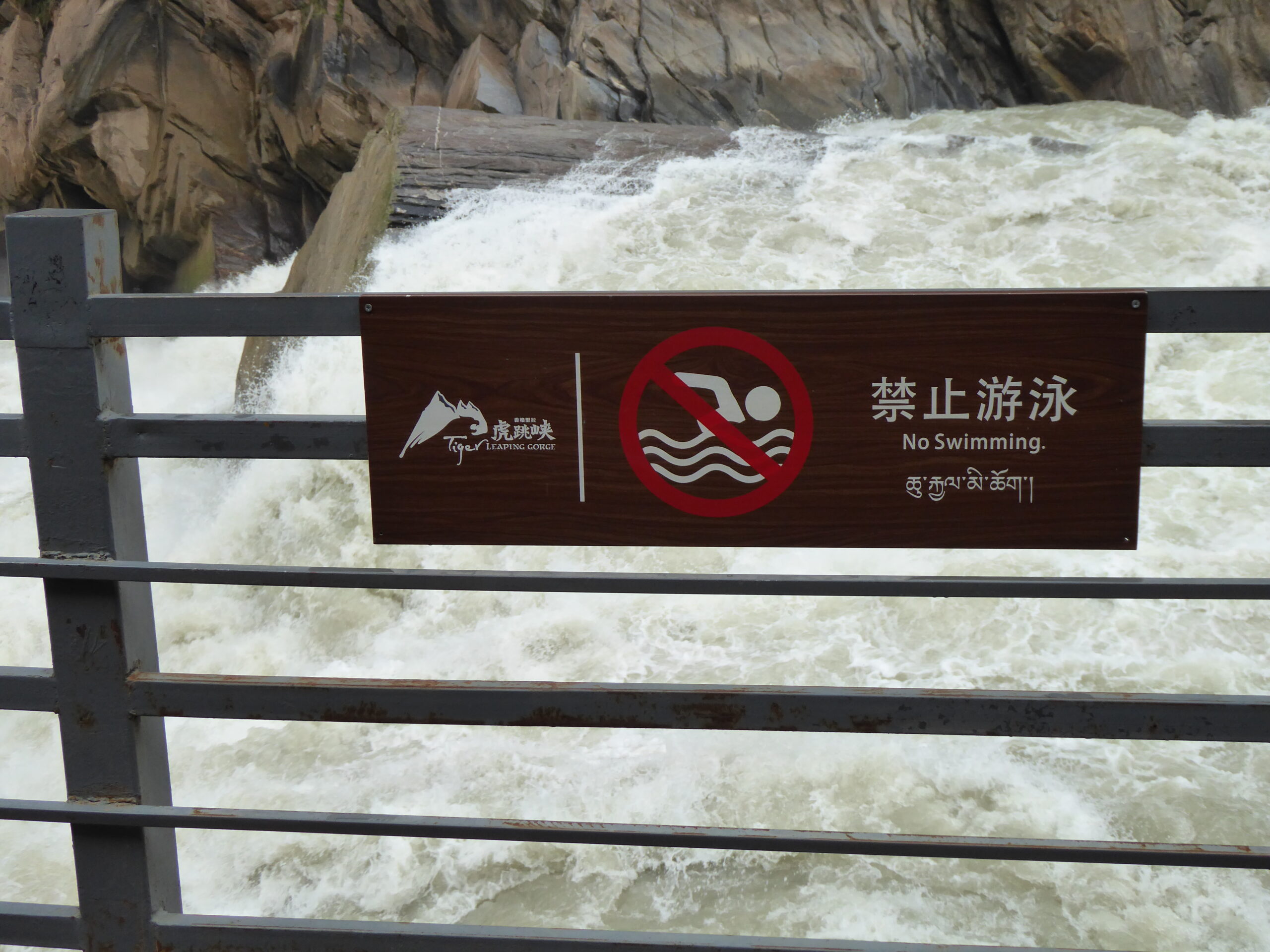
Our next stop was Shangri-La and the route was via Tiger Leaping Gorge – unsurprisingly where Tigers are said to have leapt across the gorge.
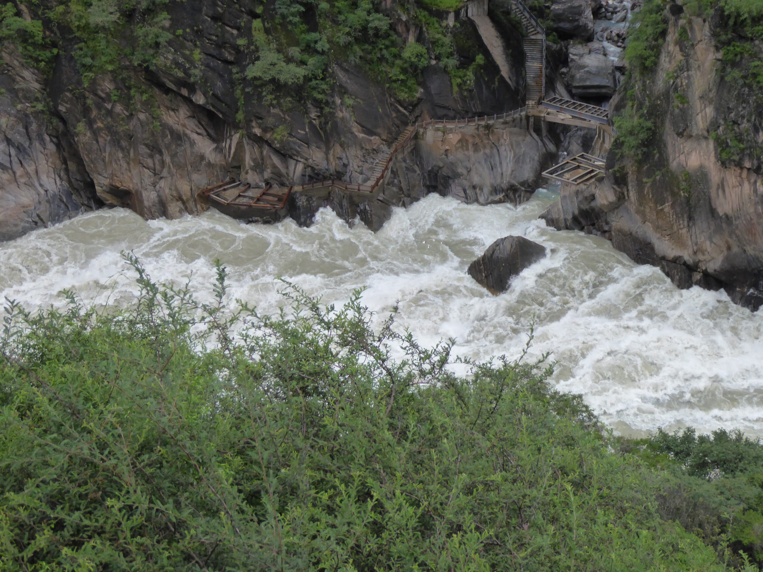
Rock for Tigers to leap onto and across
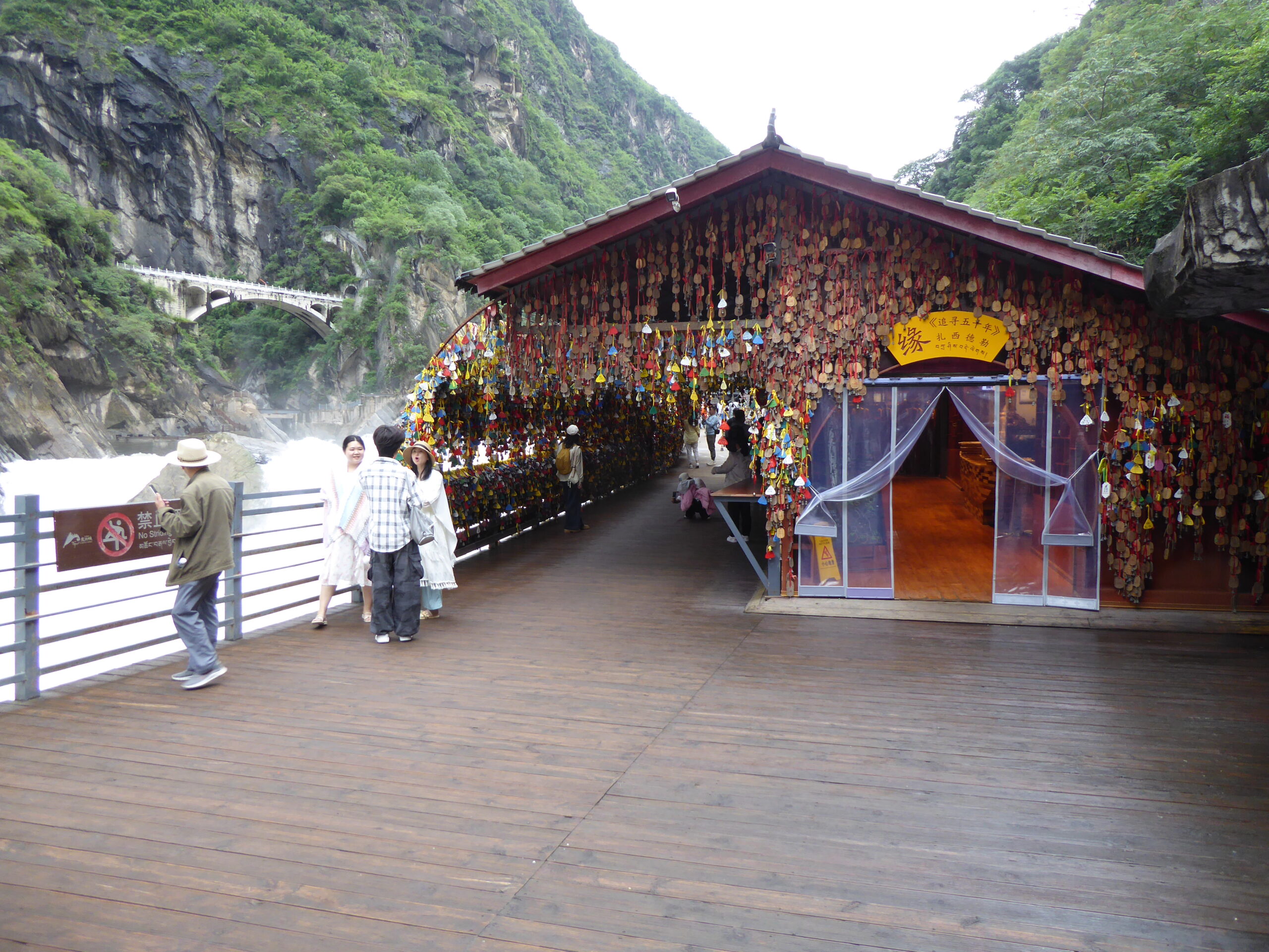
Viewing area; rock just visible. no tigers today
Explanation
Not that I was planning to
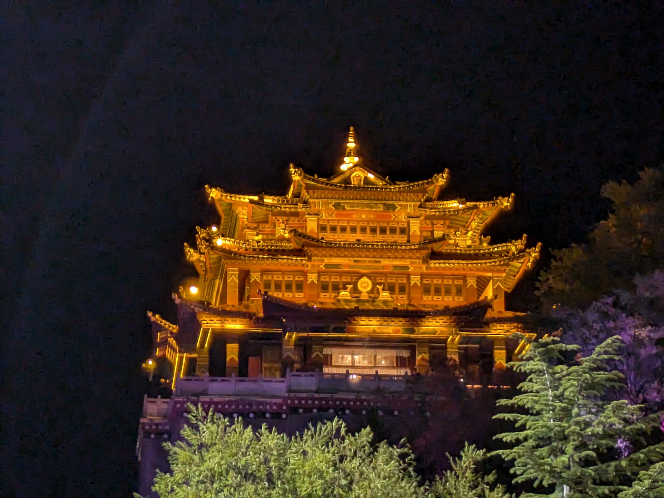
Shangri-la all lit up
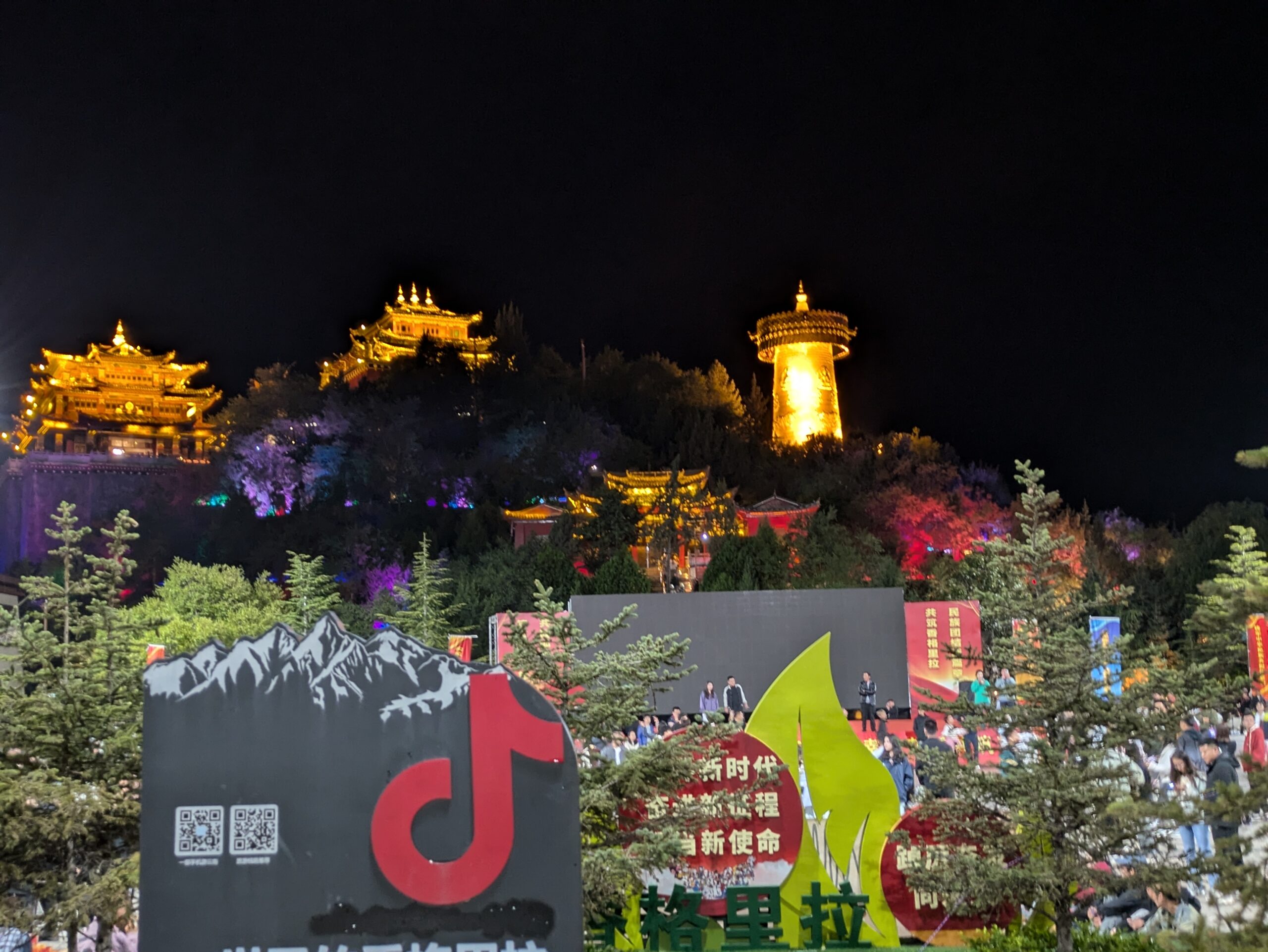
Shangri-la
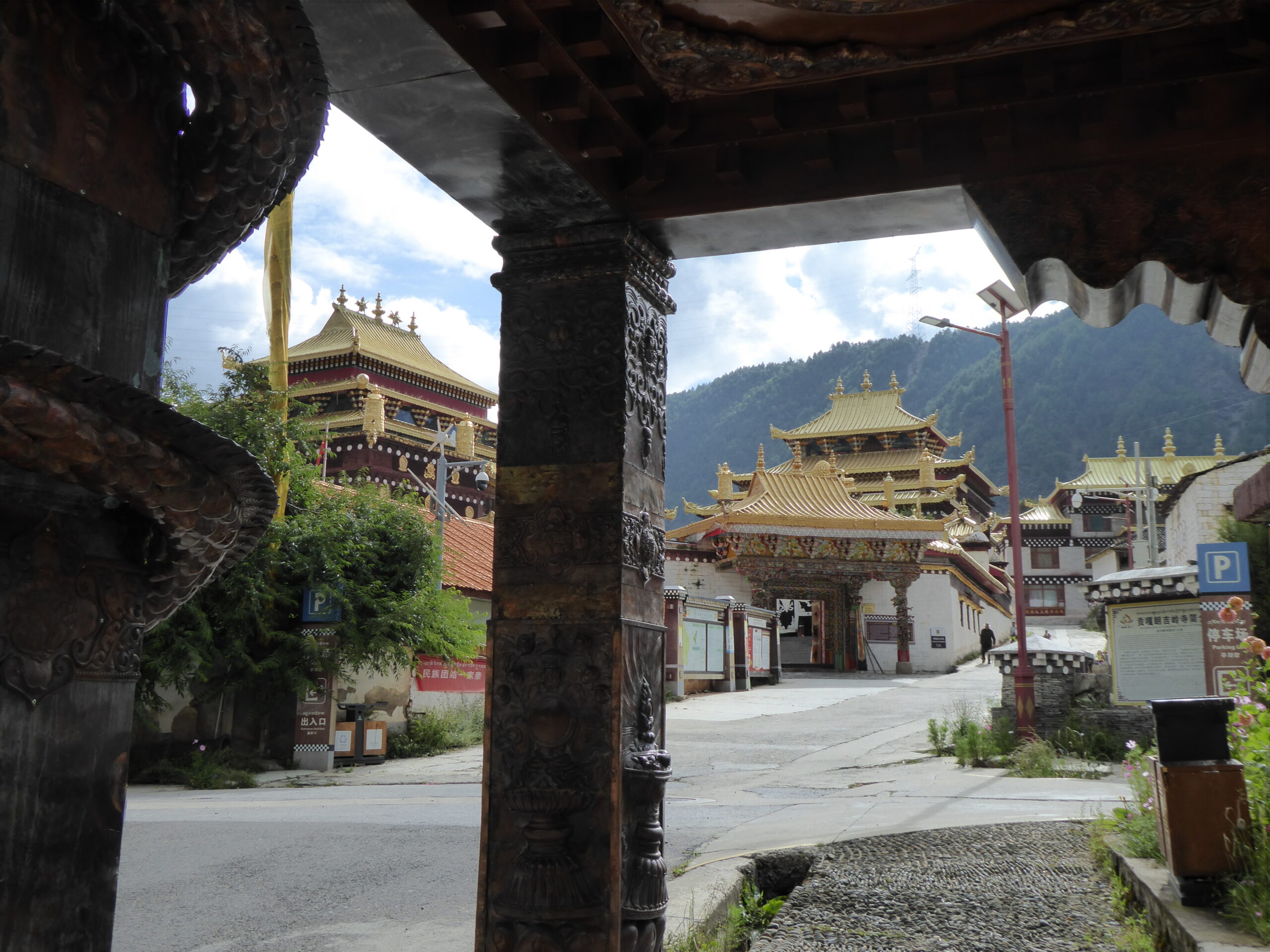
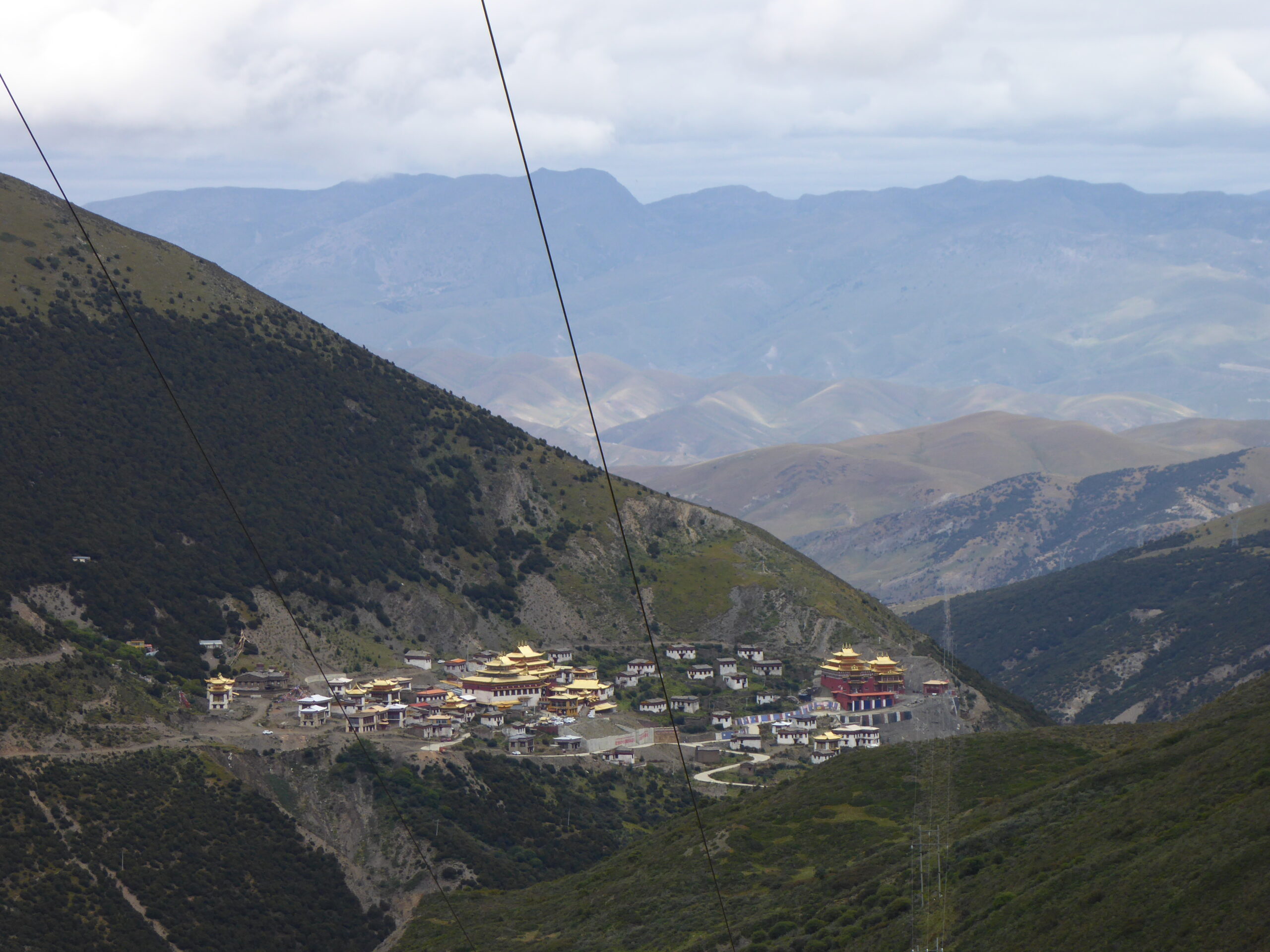
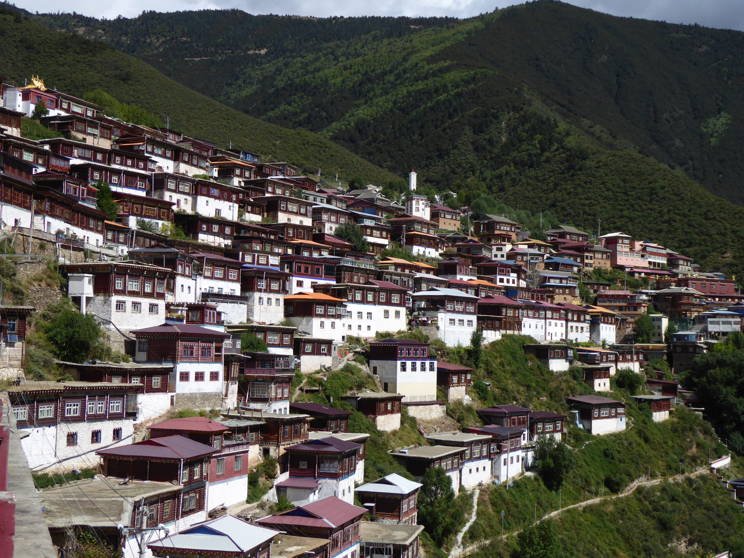
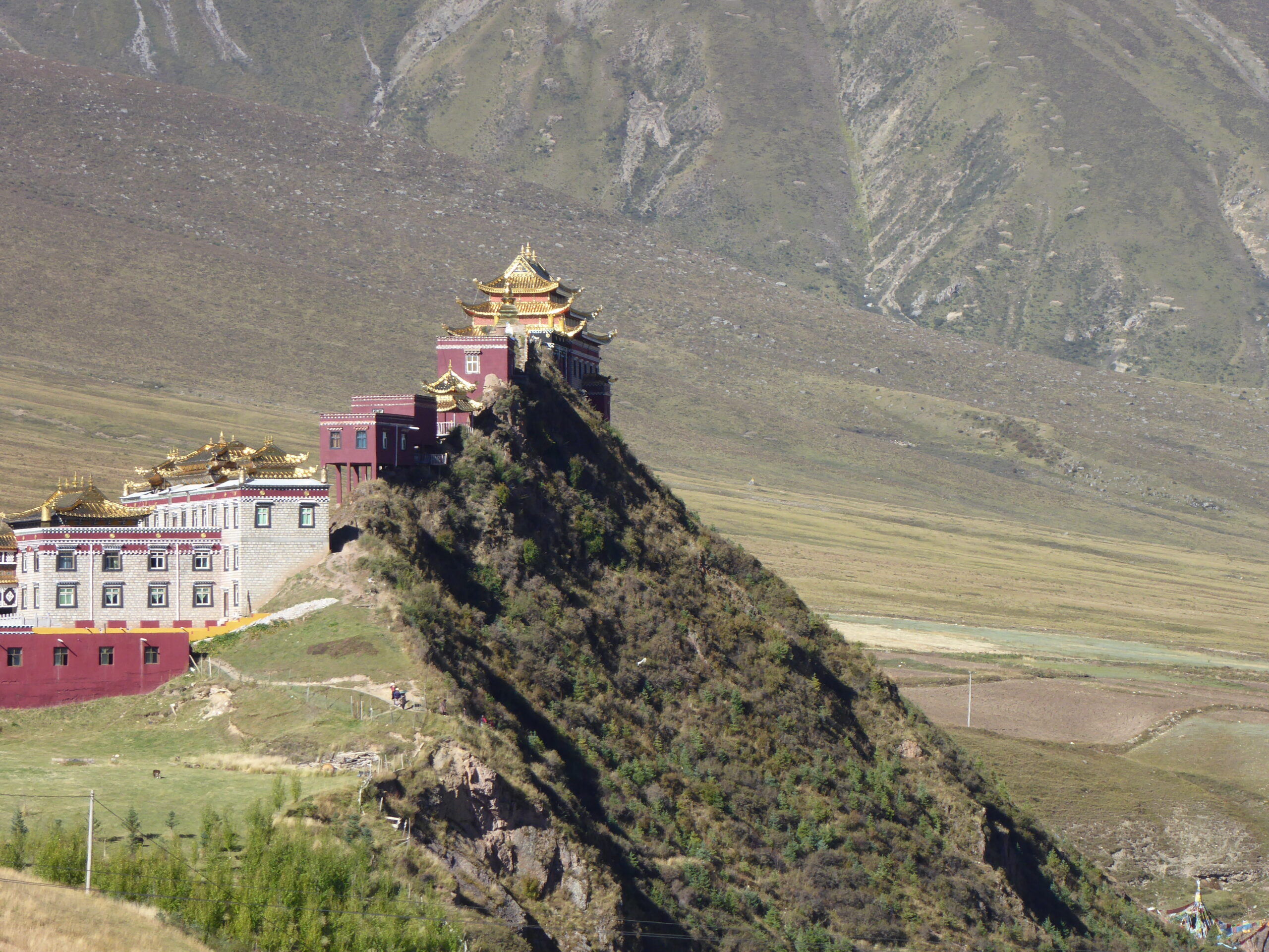
From Shangri-la we headed back north towards Yading, where a rest day was planned but that all changed as did our next couple of hotel stops. Our first stop was Songzanlin Monastery, from 1679, often known as Little Potala (after the Potala in Lhasa), this is an important place of study for Tibetan culture and religious history.
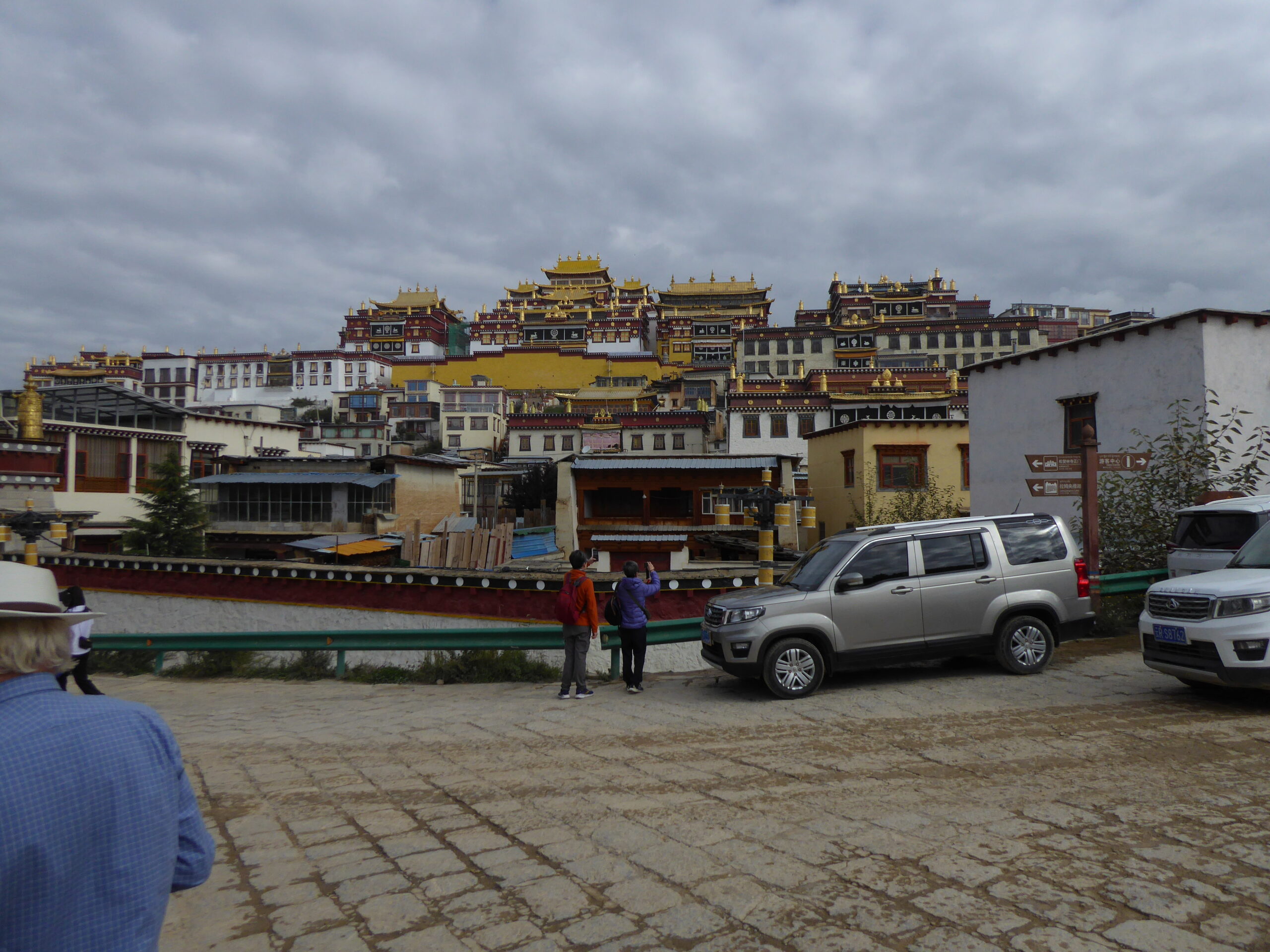
Songzanlin – unimpressive from below
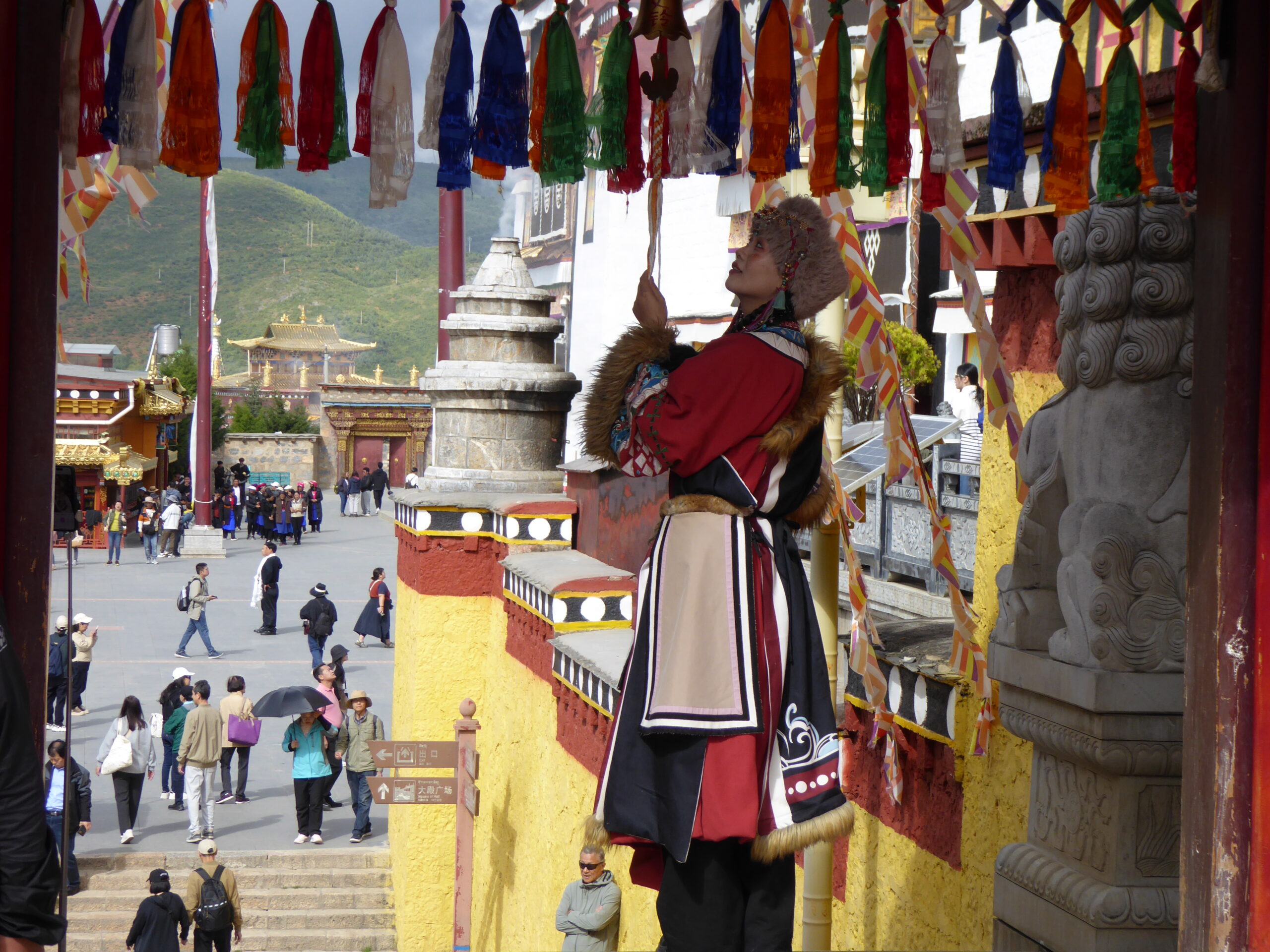
Songzanlin
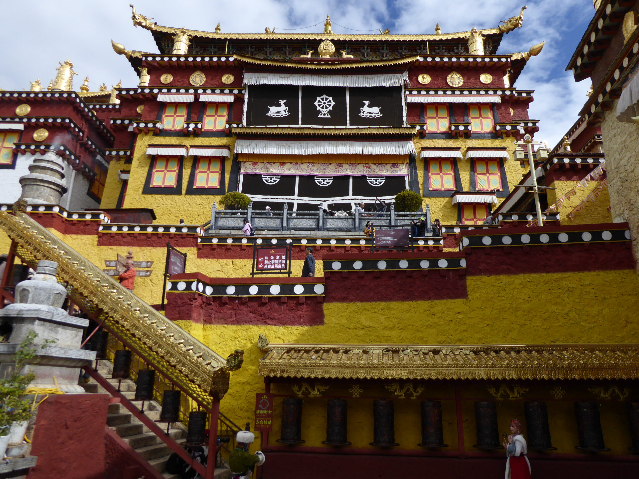
Songzanlin
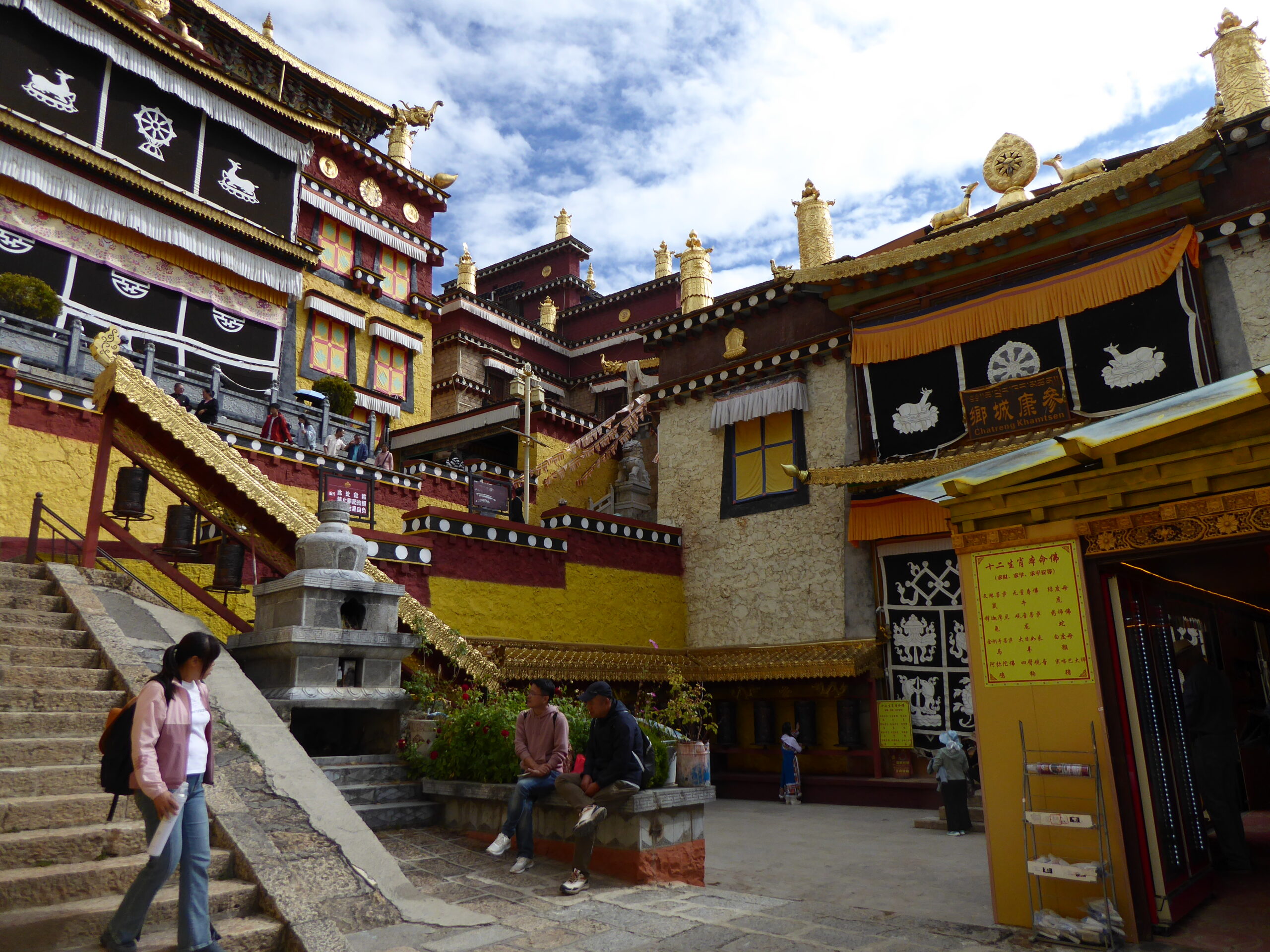
Songzanlin
remote road
In the middle of nowhere
Langjiling Monastery
House at Langjiling
scenic hairpins
….on narrow roads….
..to a monastery with no name..
…where Christina tried to explain..
distant temple
Prayer flags
Not a great picnic spot
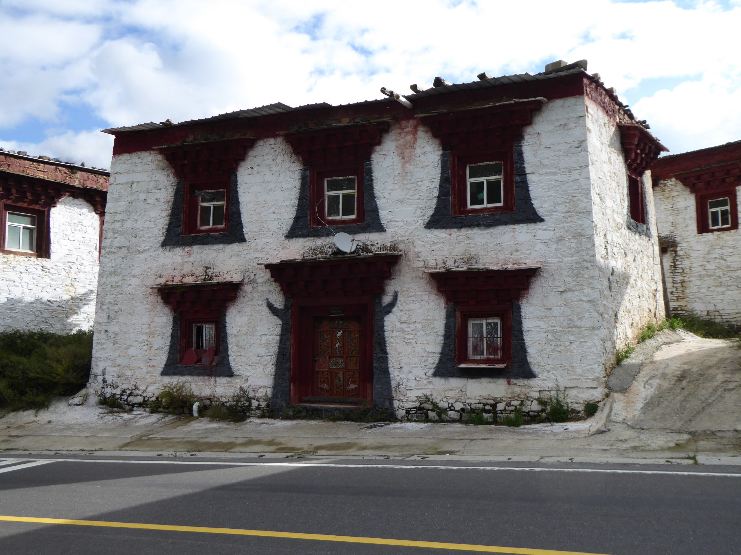
Litang had a different feel from other places we’d been to. There were police posts on junctions and groups of men standing around on the opposite corner.
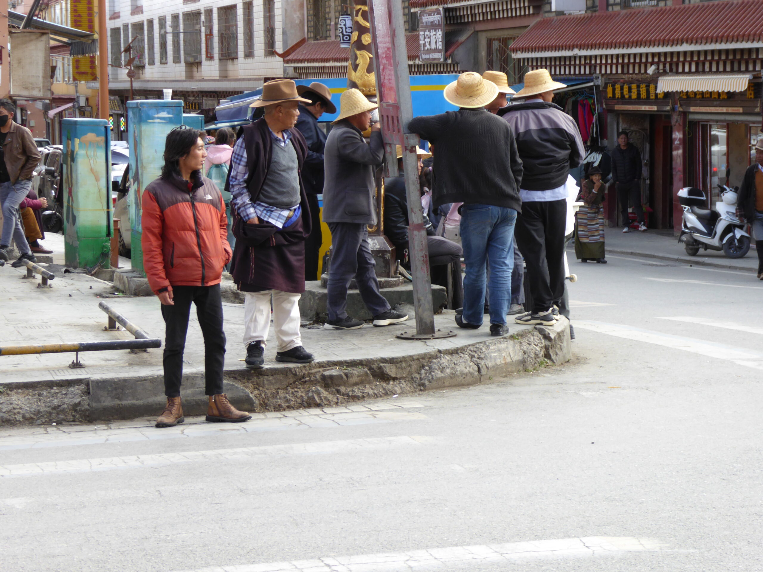
just hanging around
…watching the police
old square
traditional dress
hotel lobby
bedroom
back door onto old square
From Litang we continued in an at times bleak landscape, via another monastery whose name I’ve lost – it was on a detour off the planned route – to the Eye of Genie holy Mountain
Bleak landscape at c. 4200 metres
Interior of monastery
view from monastery
access road
water powered prayer wheels
the Eye of Genie with locals and drone
Genie Mountain
Looking back on the way up
tight squeeze
Batang street scene
Batang fast food
Batang street scene
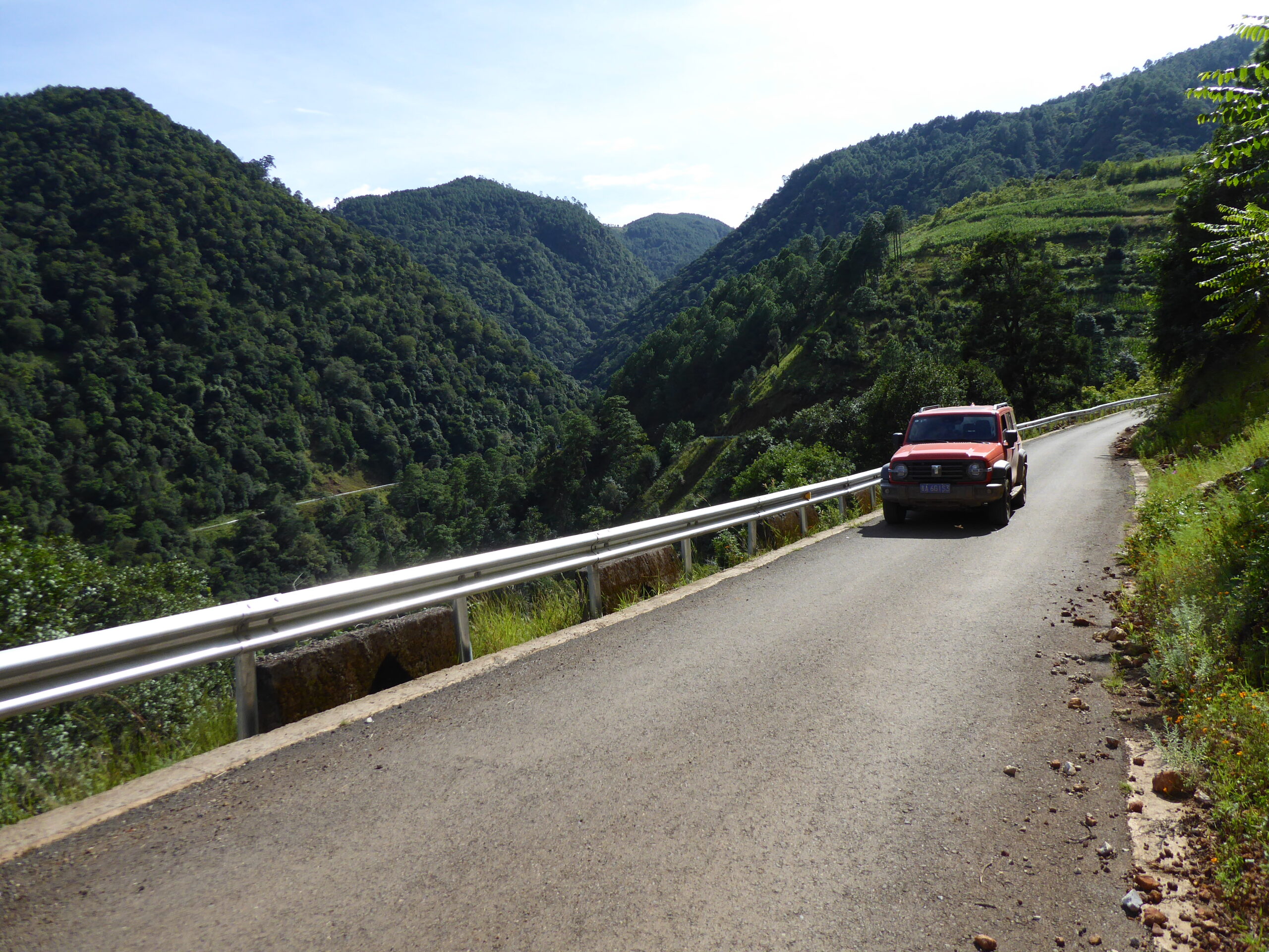
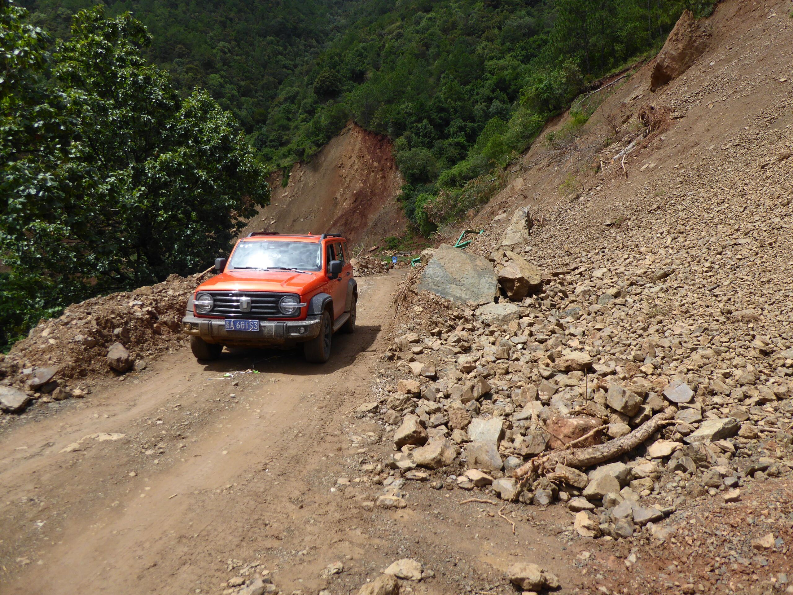
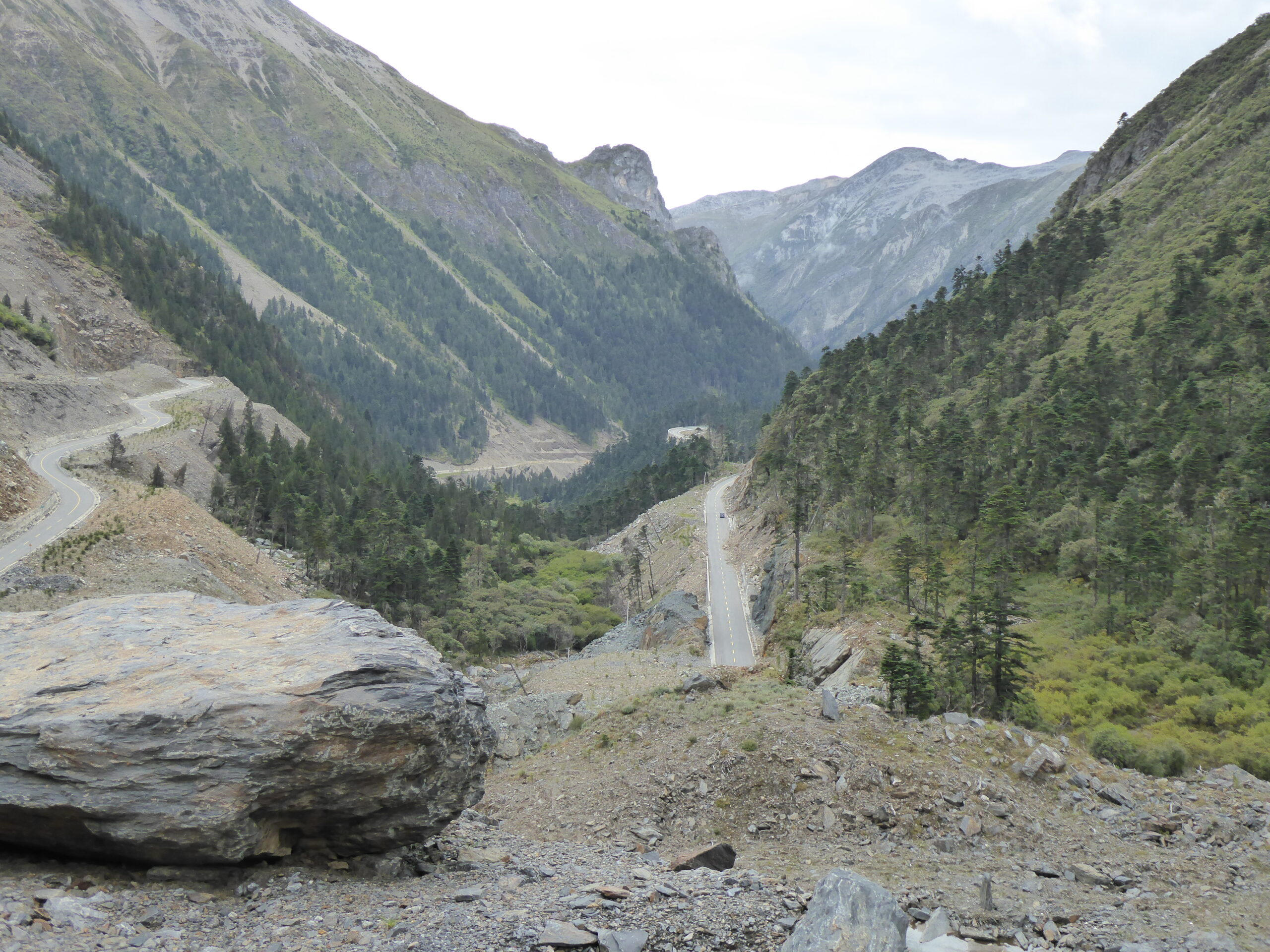
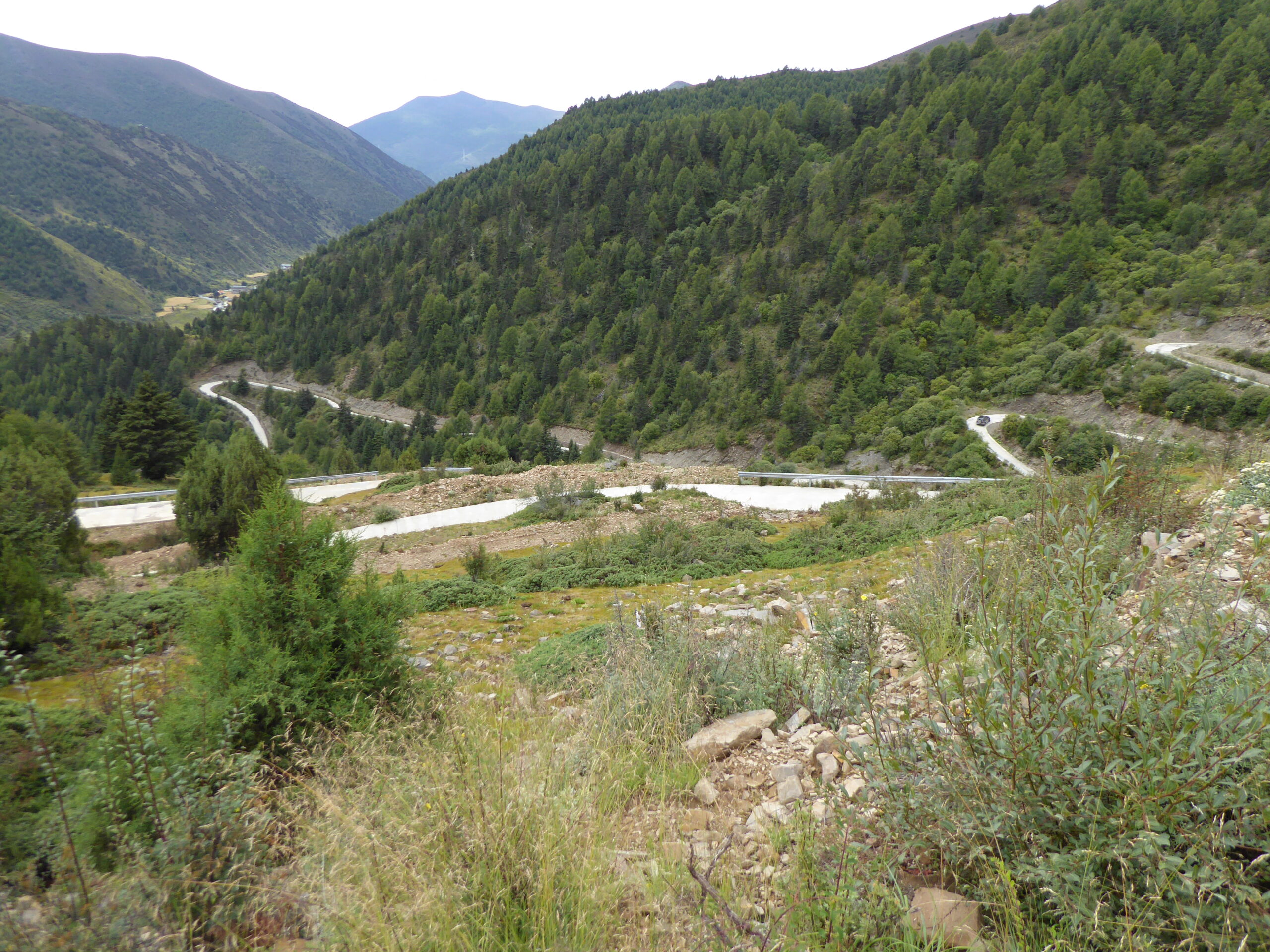
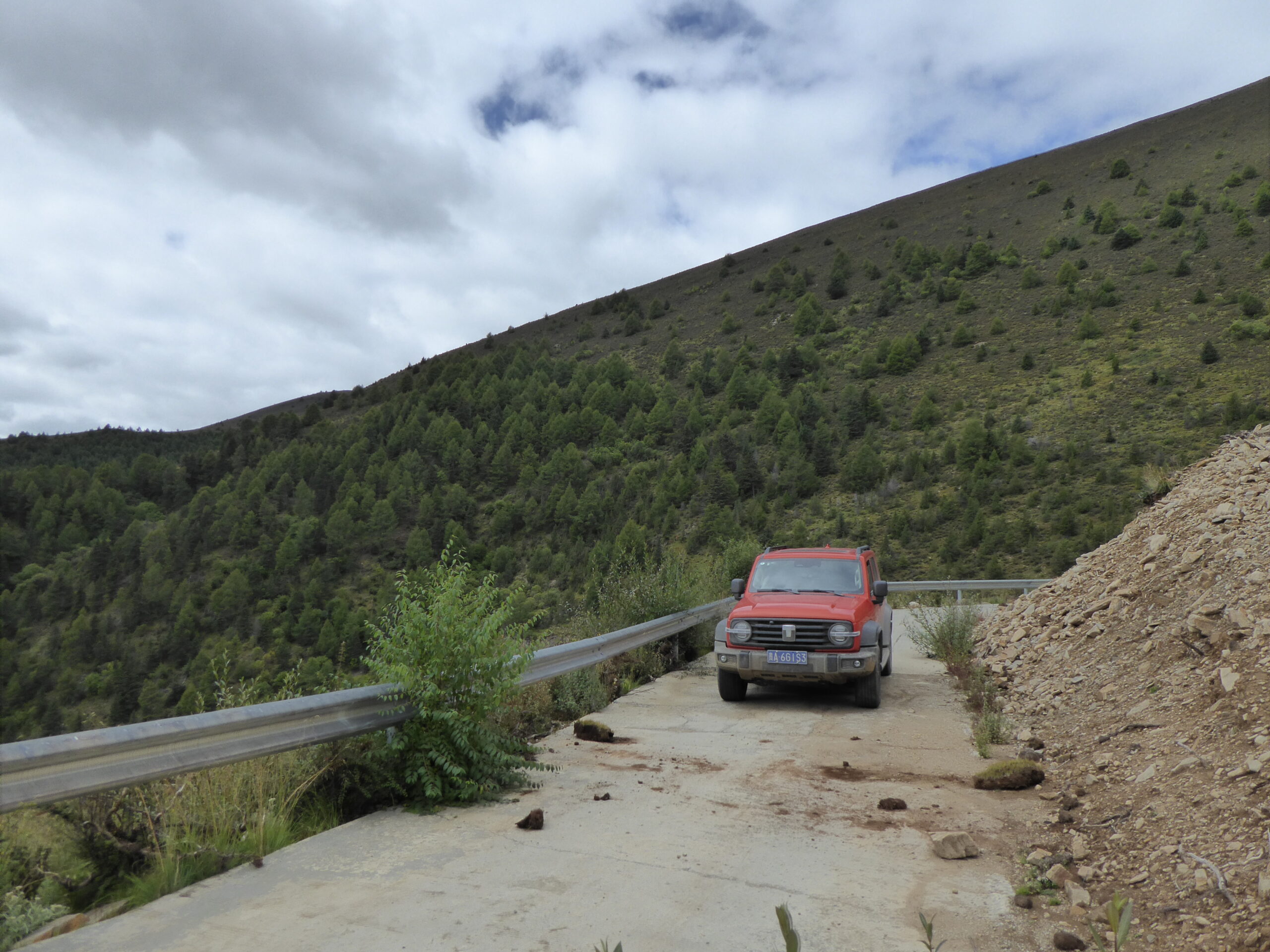
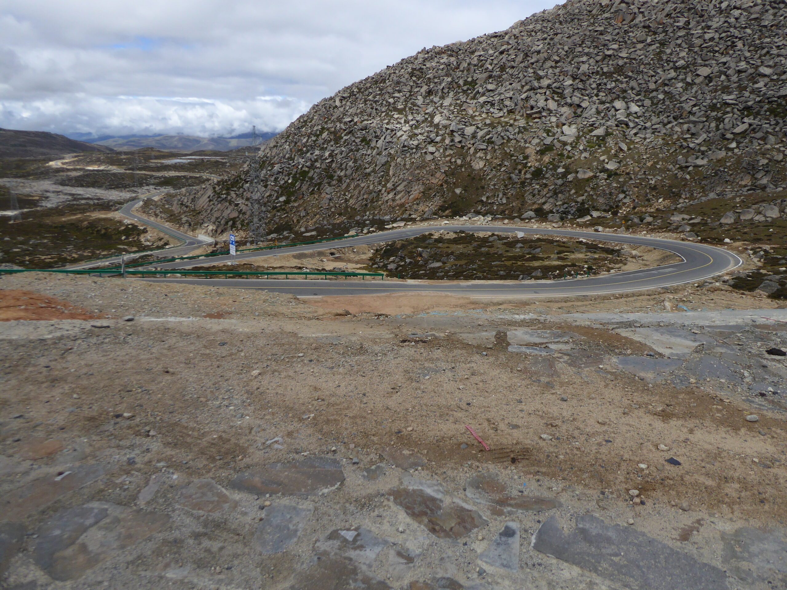
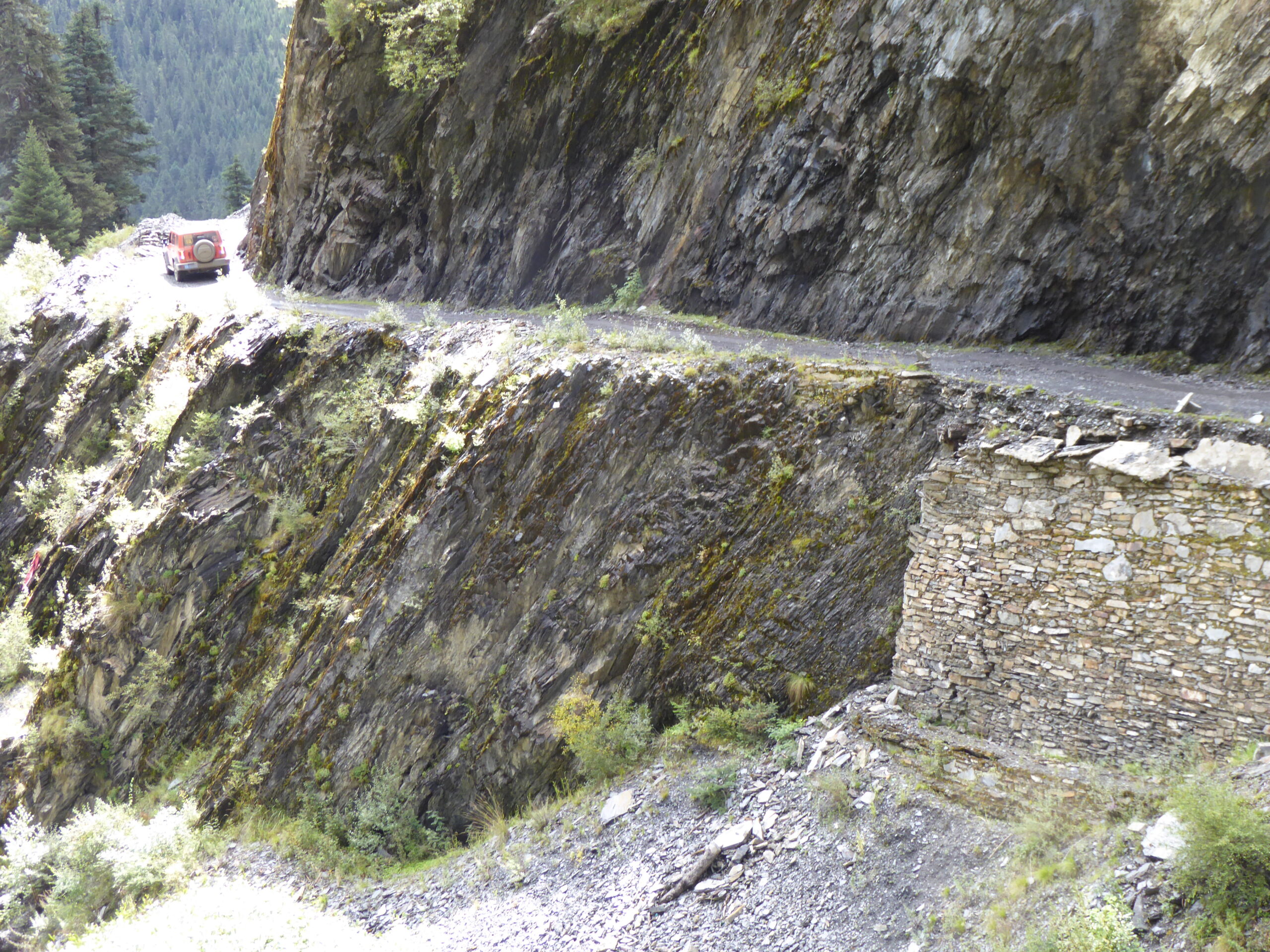
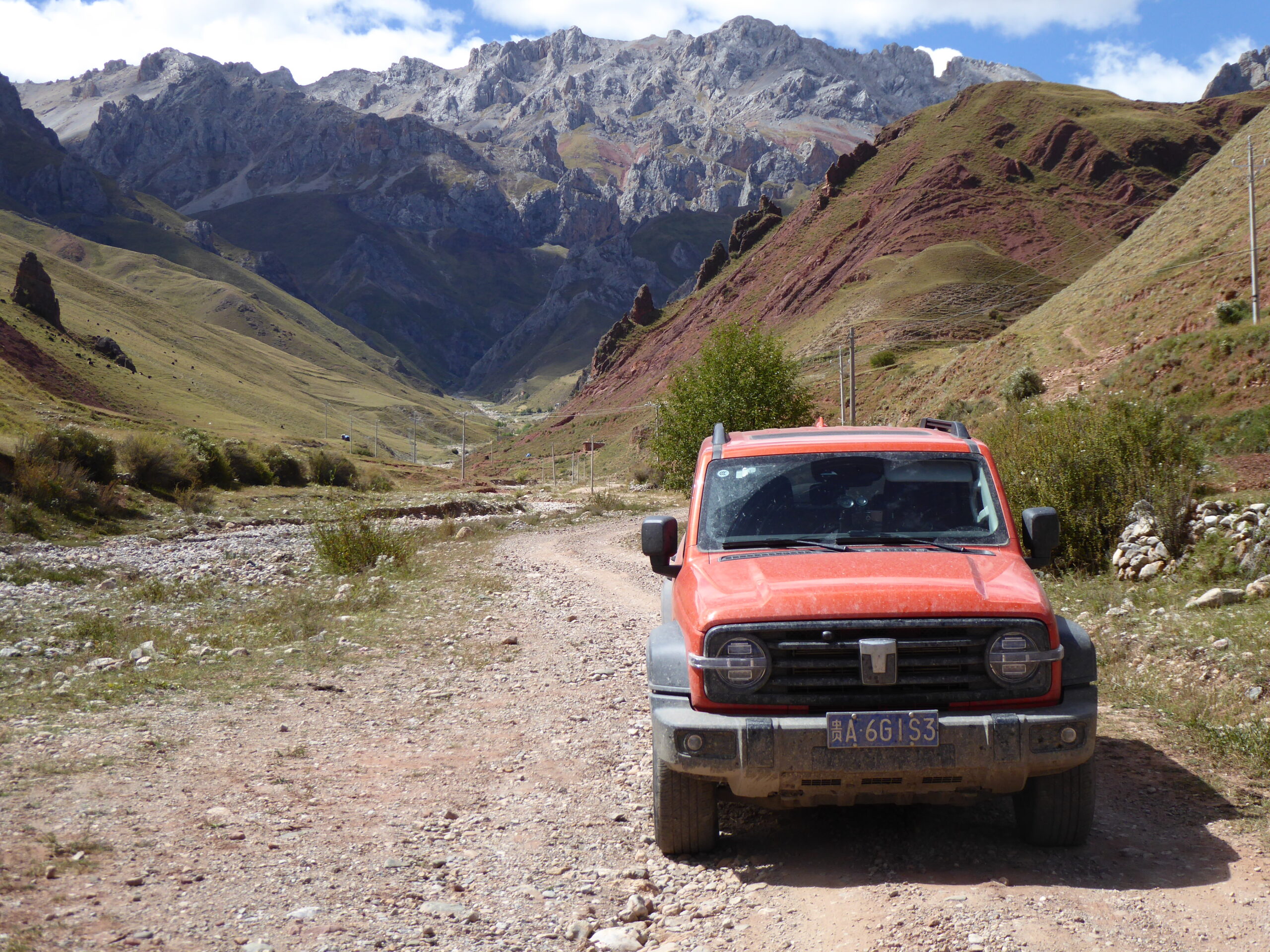
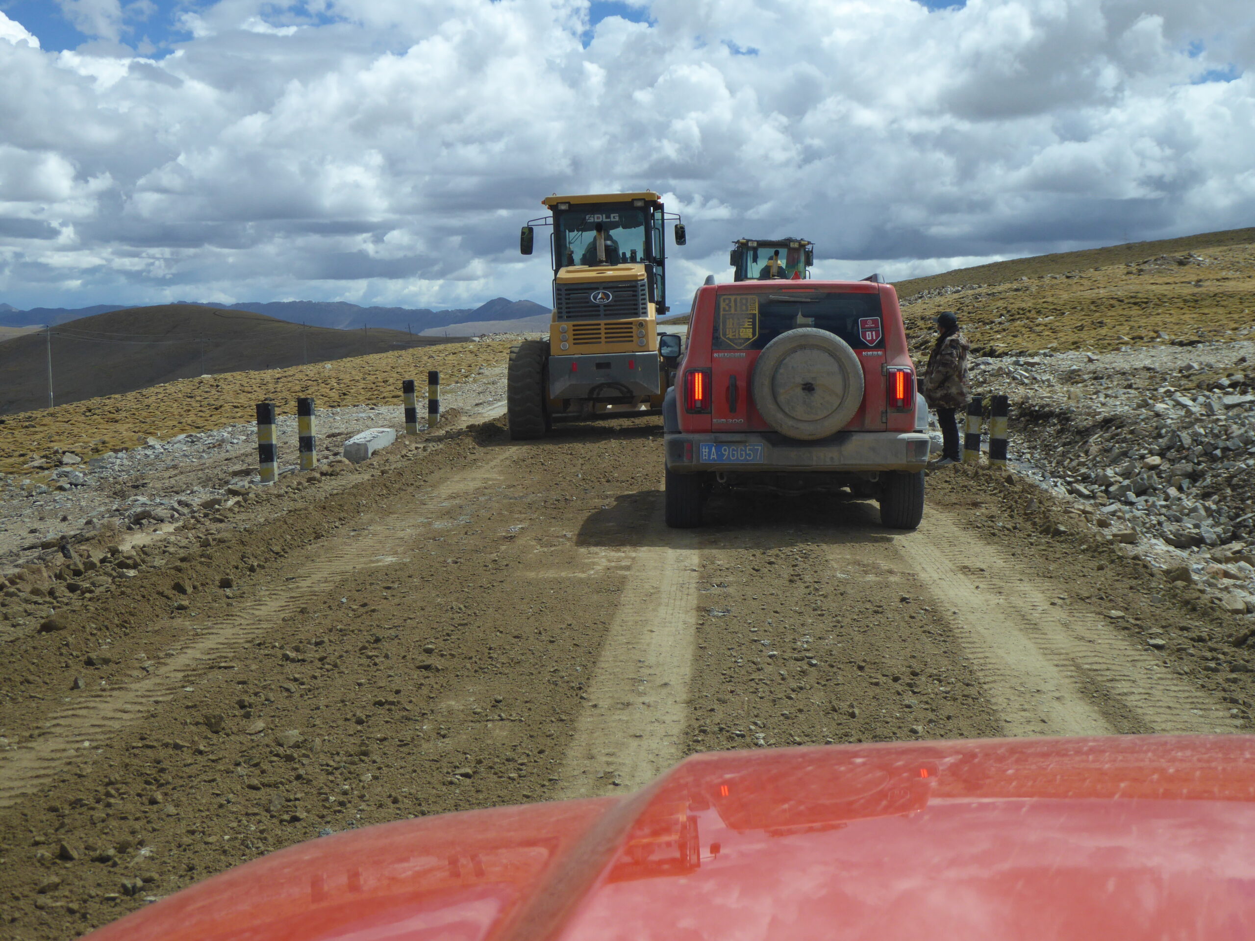
Leaving Batang, another deviation was suggested, running parallel to the busy main road but the other side of a river, along an empty gravel road. I was the lead car and came across this landslide
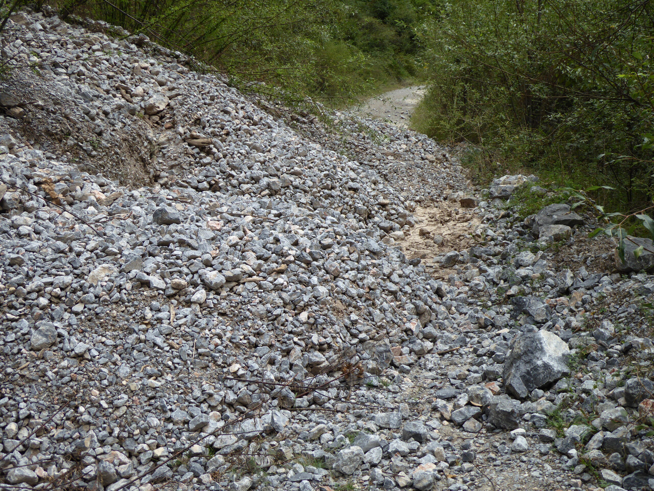
This is why the road was empty
Limited turning circle
Palyu Monastery
Baiyu Prayer wheel

Hillside scene
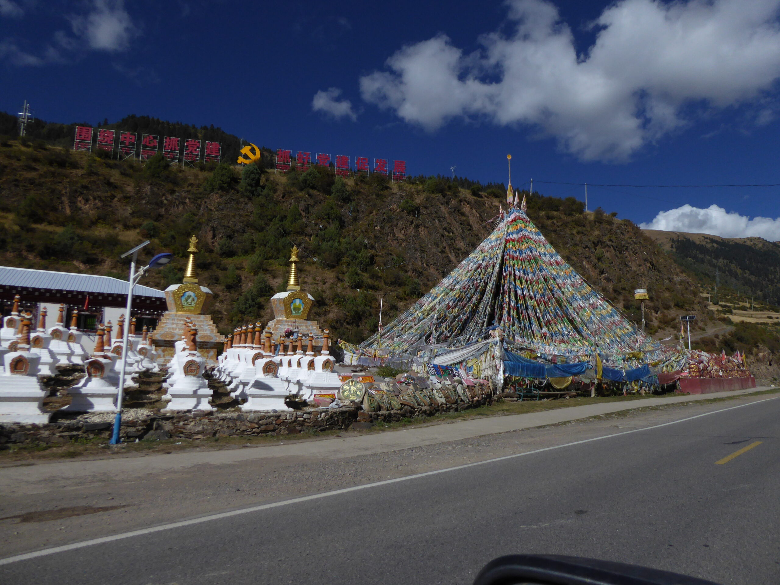
Roadside shrine near Dege
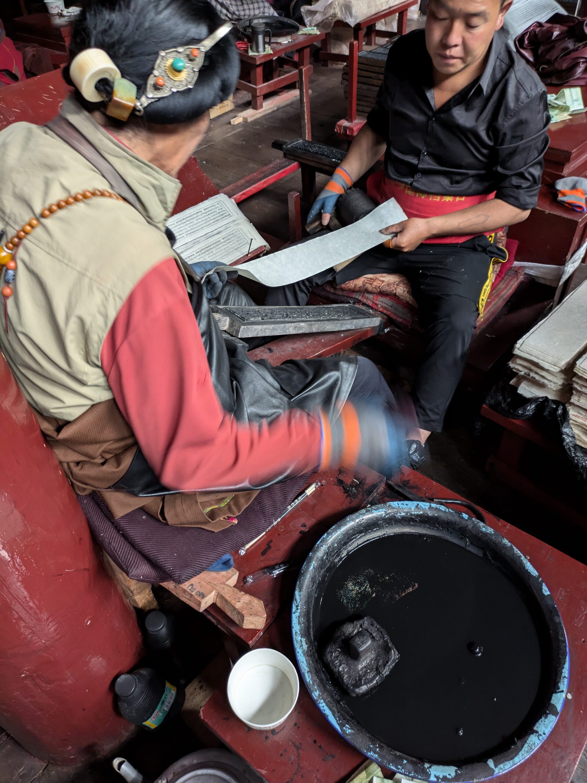
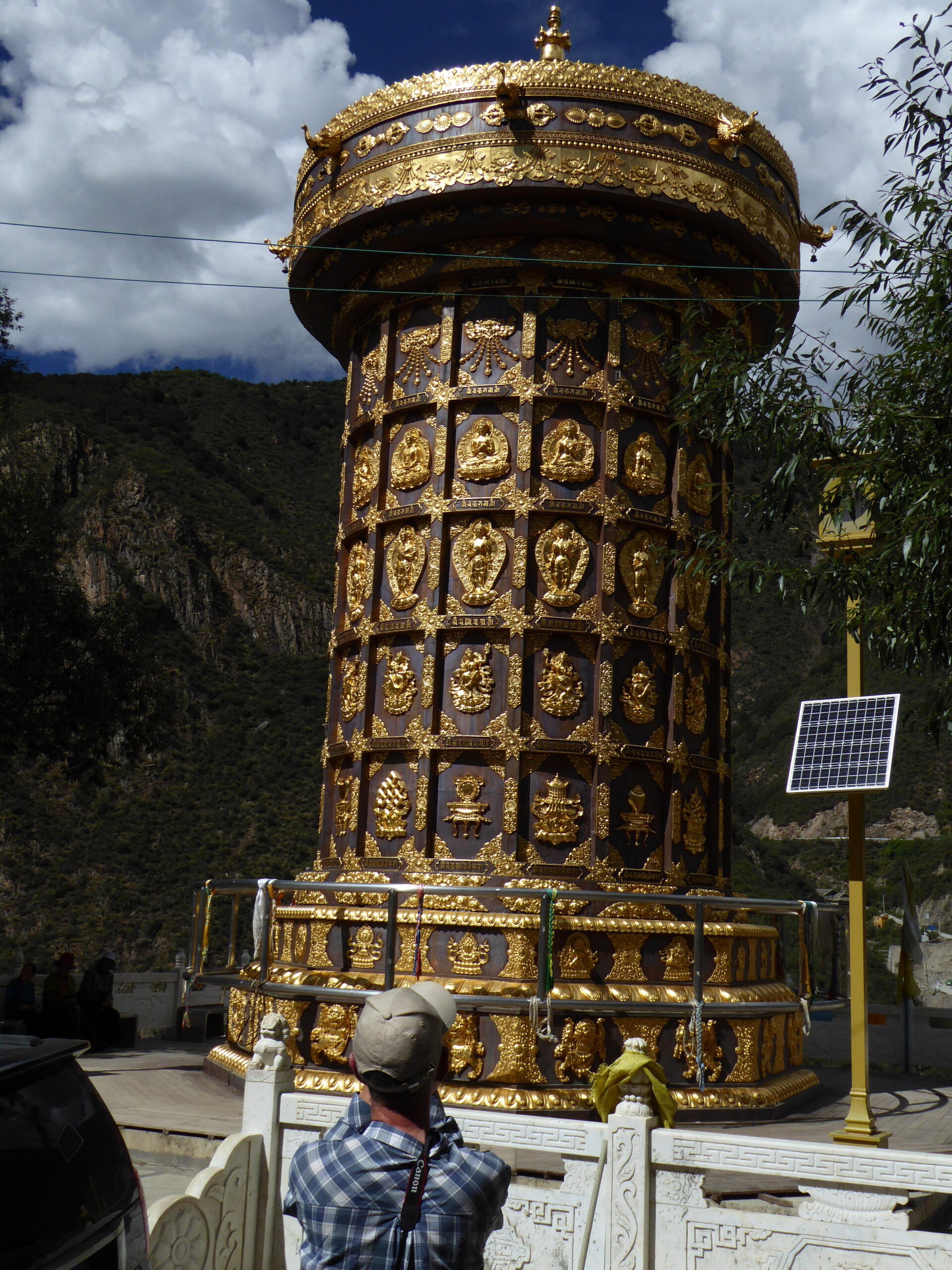
Woodblock printing
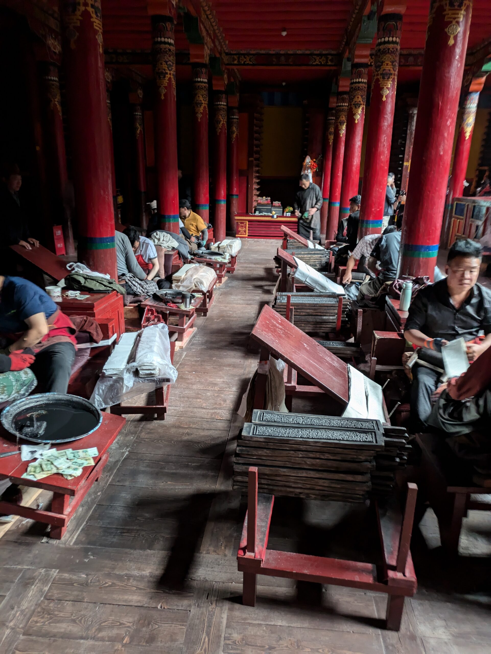
The printing hall
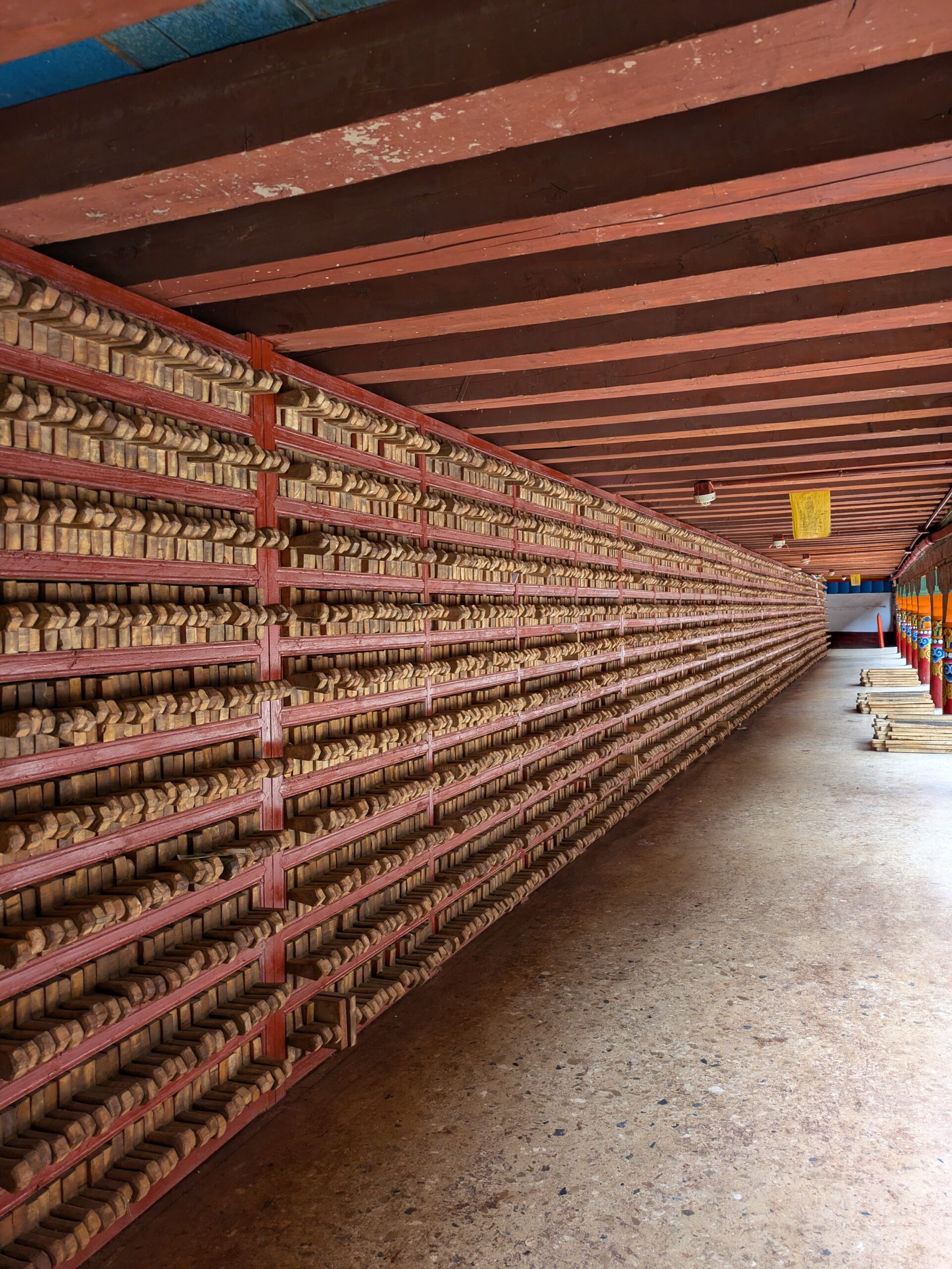
Woodblock storage
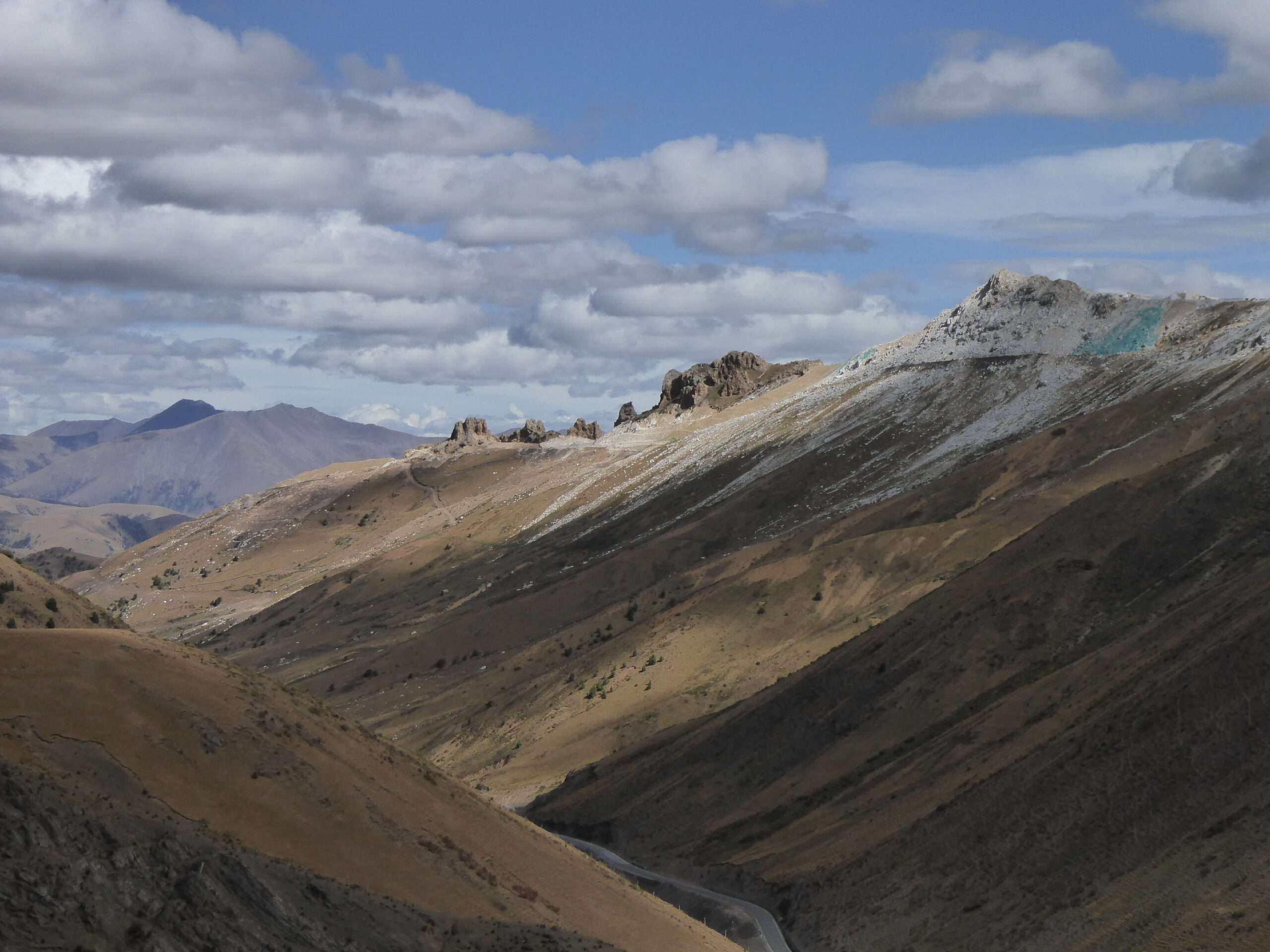
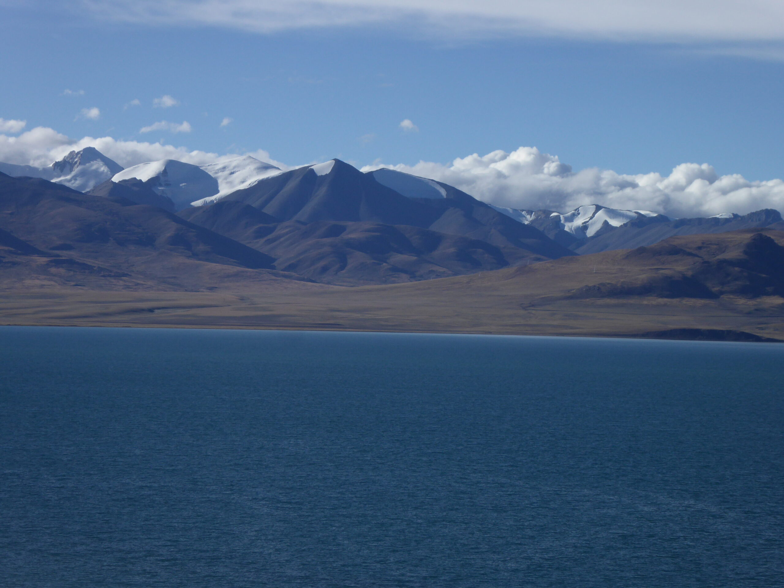
First view of Tibet
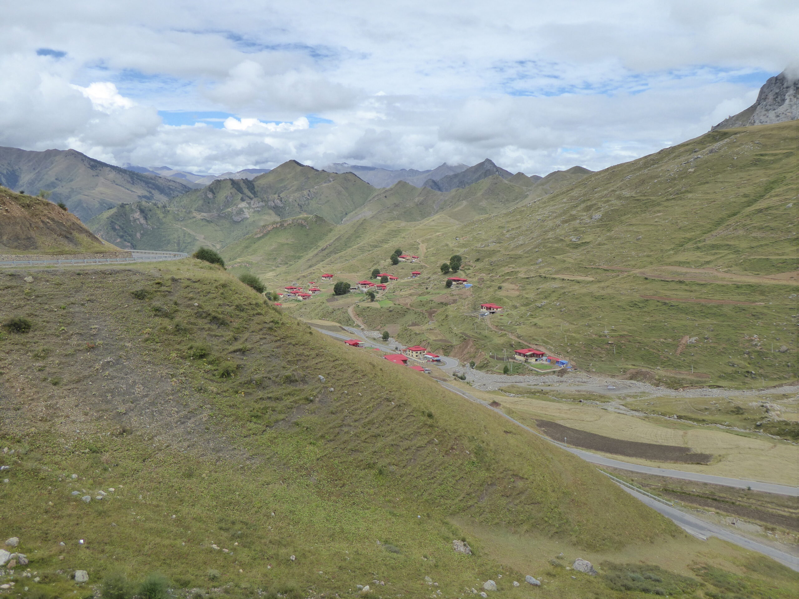
Roadside scenes
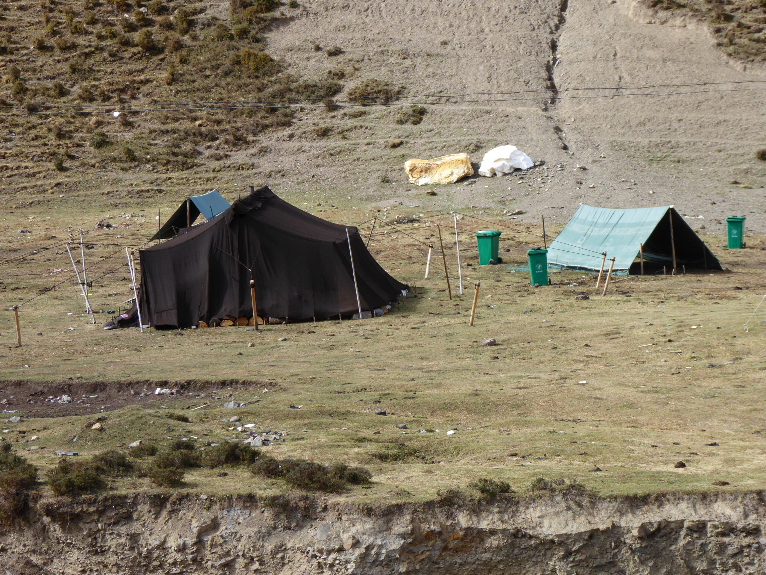
Tents with wheelie bins?
Landscape
The road to lunch
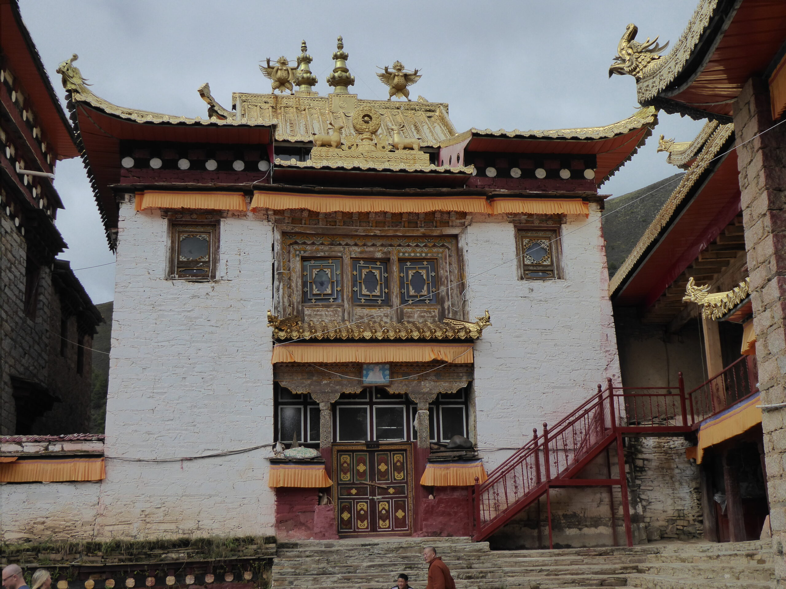
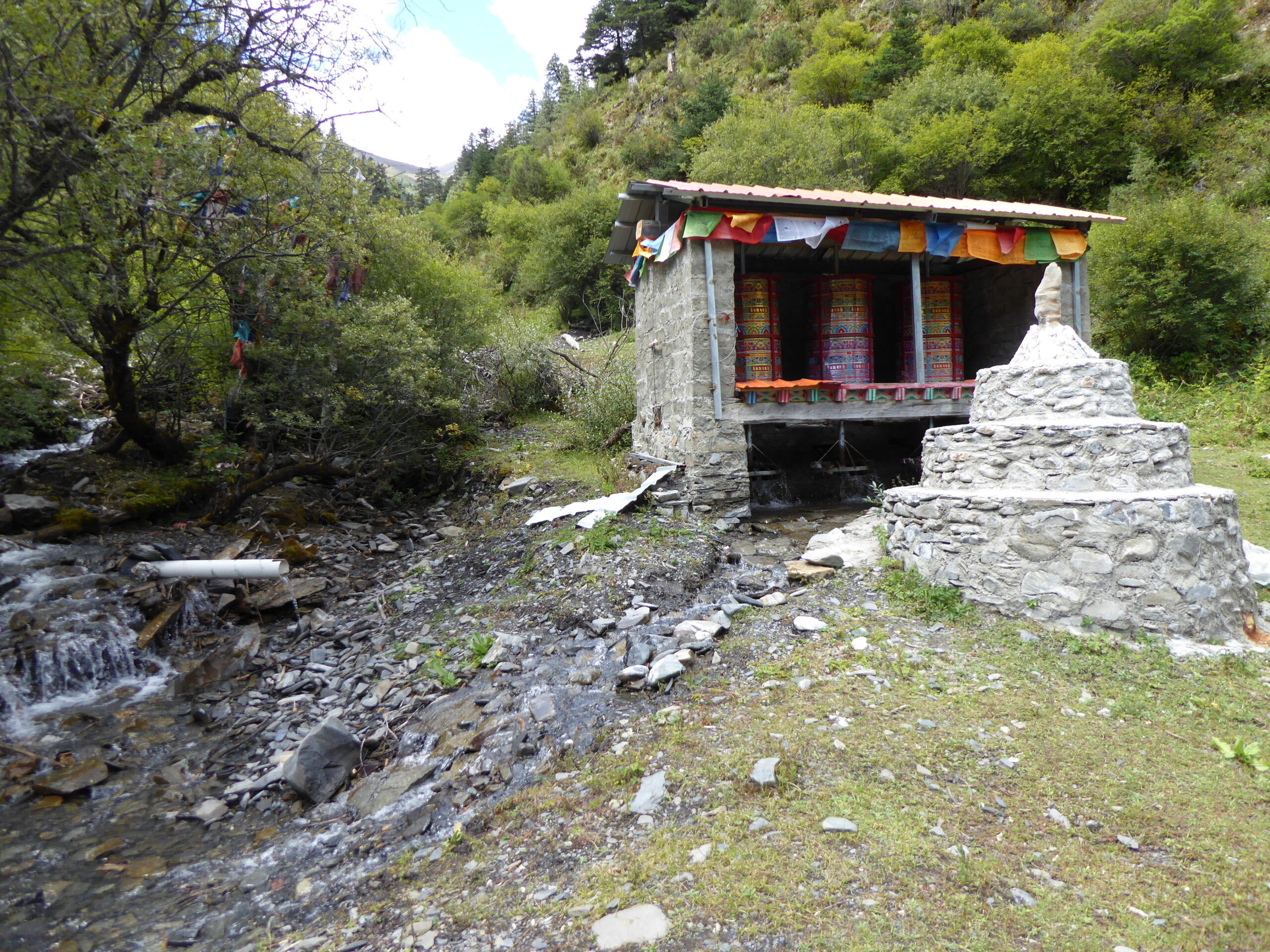
This was now day 2 in Tibet and we were off to the spectacular Zizhu Monastery, approached by a steep dusty road, in a queue of vehicles, having to drop back frequently as visibility was so poor – but the monastery was worth it!
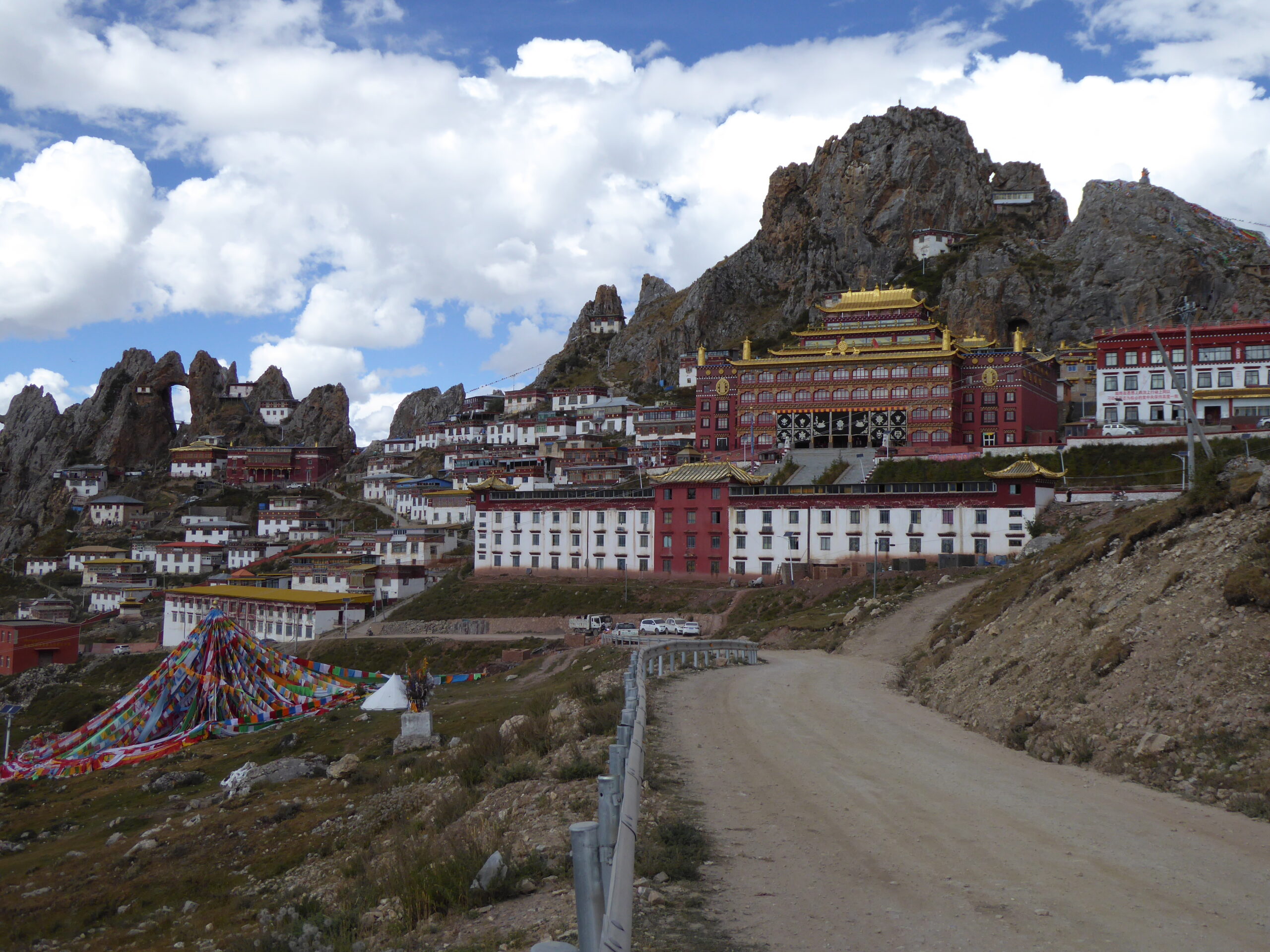
Spectacular Zizhu
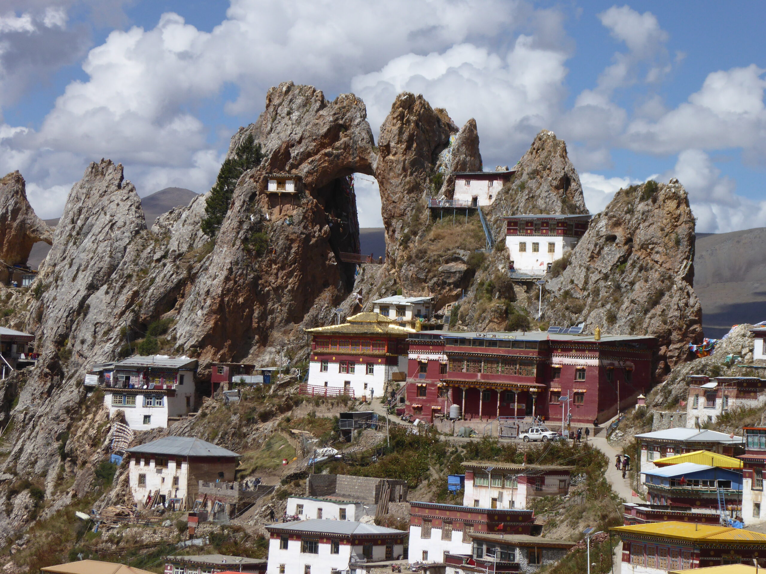
Zizhu
Monks at Zizhu
Printed Chant sheets
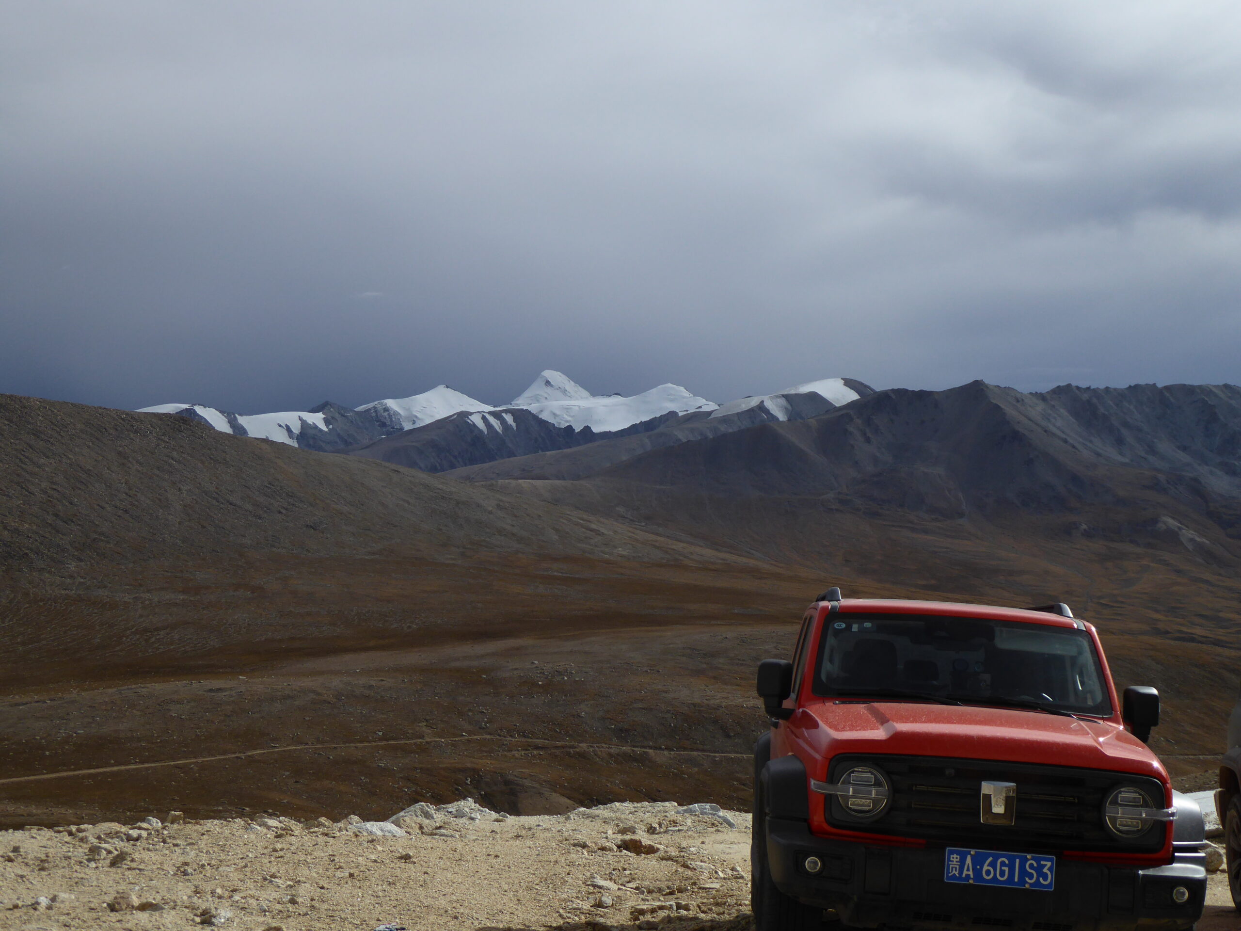
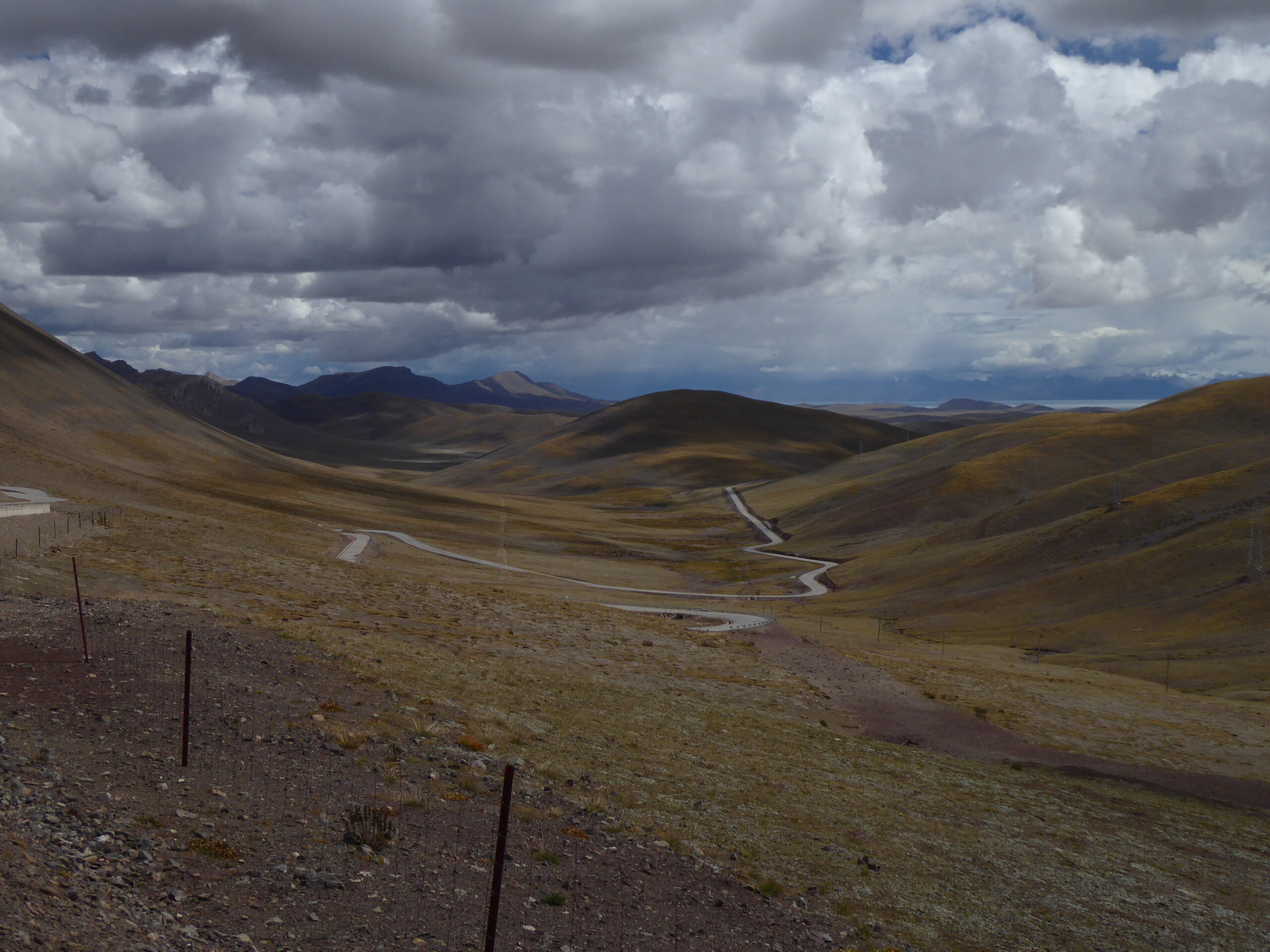
Road to Dingqing c. 4000 metres altitude
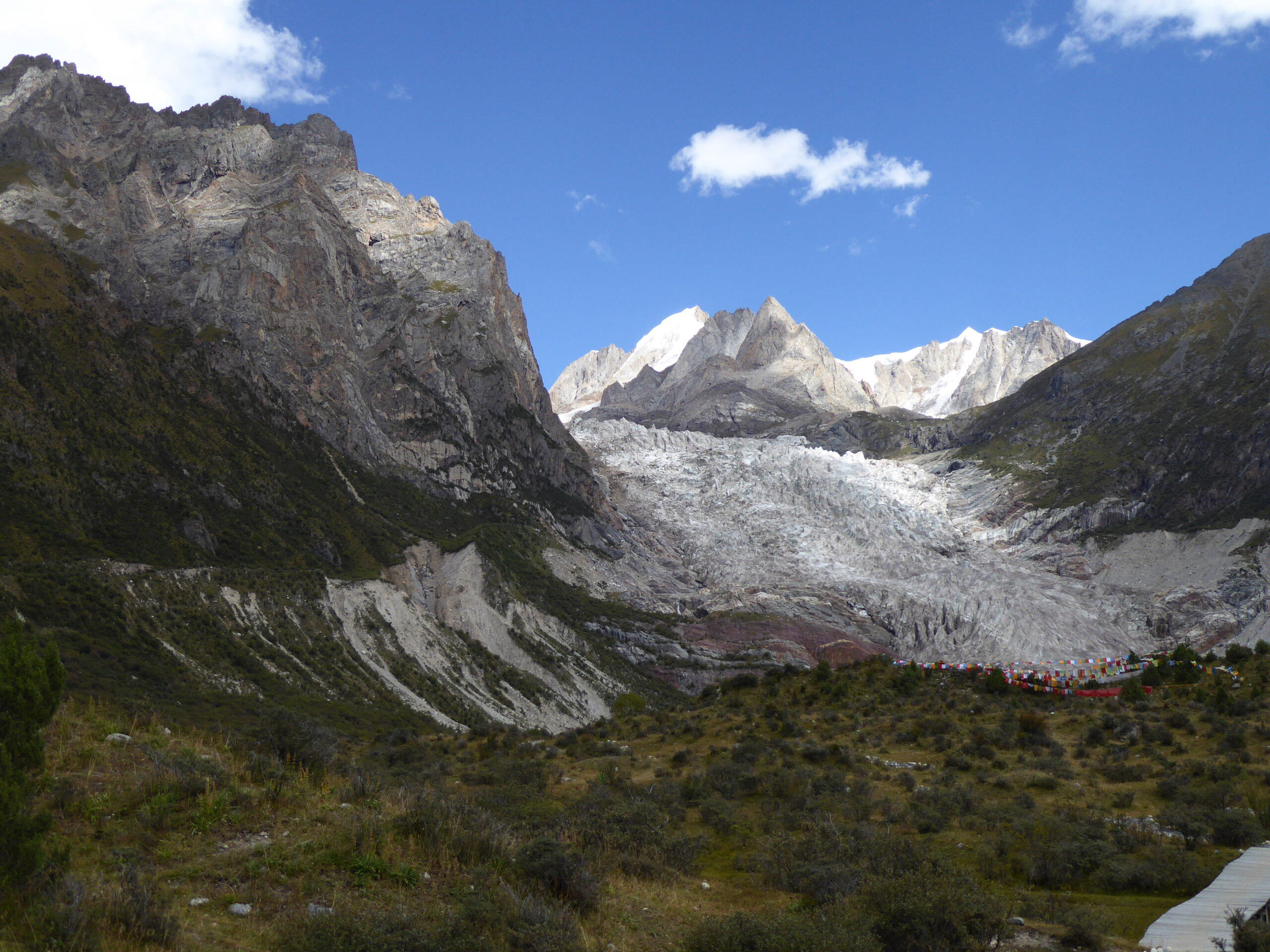
Bujia Glacier
Temple we passed by
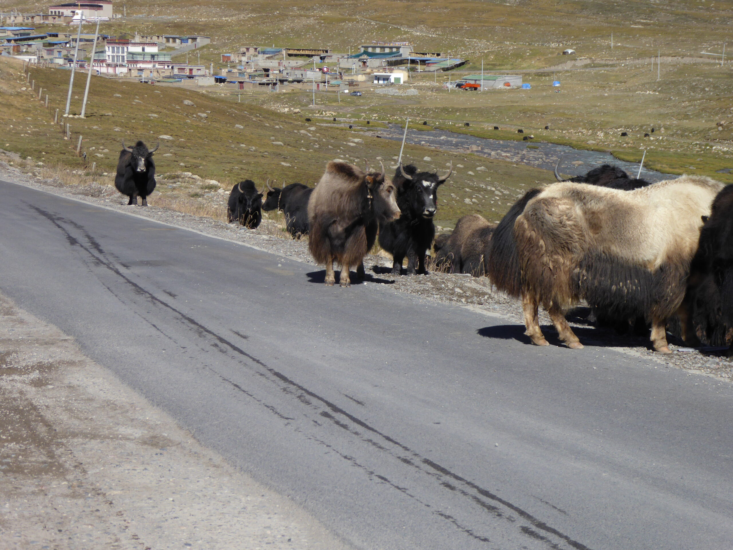
Yaks
Waiting at the roadside
The road just carries on
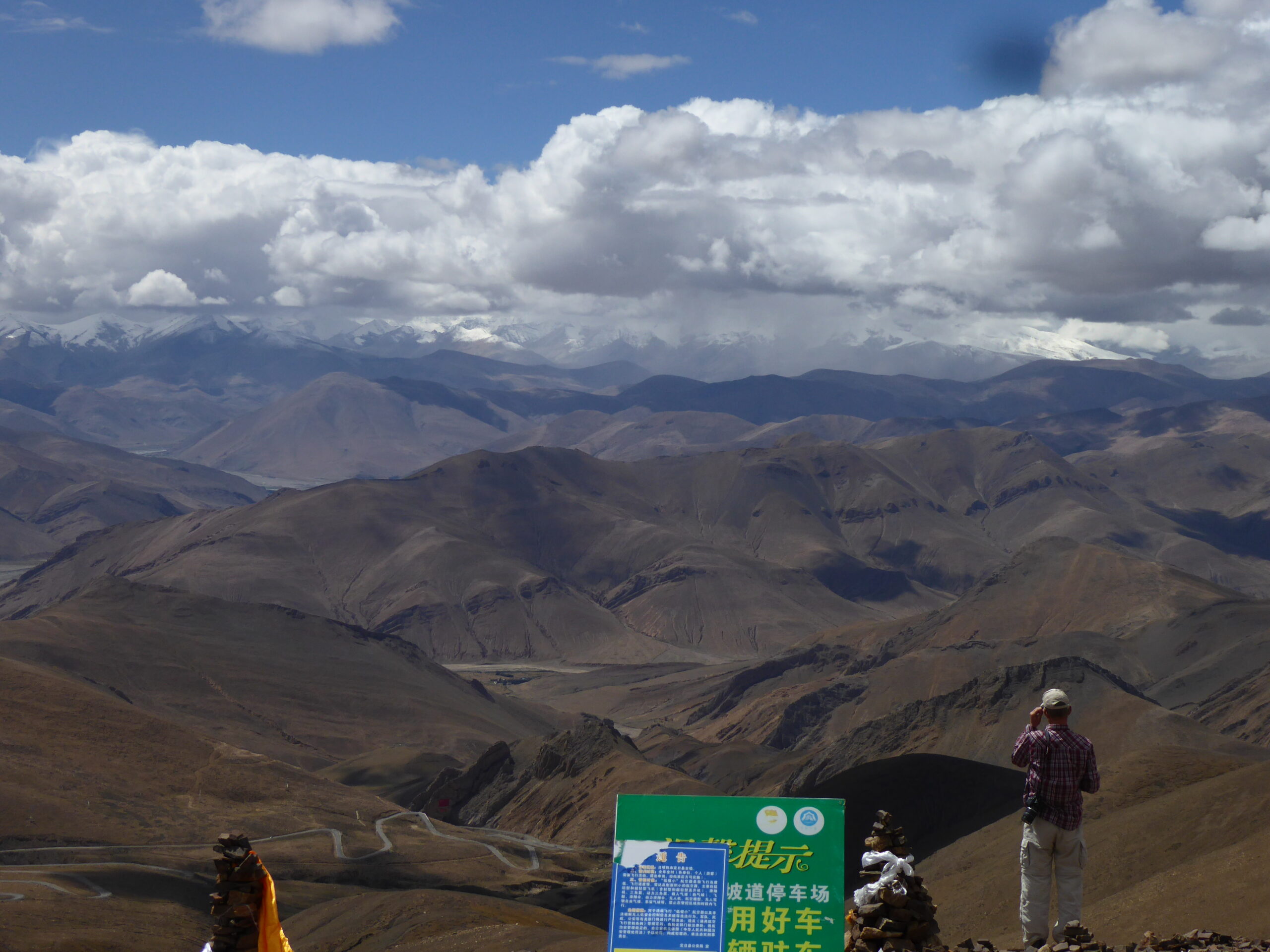
View at 5200 metres on deviation
Lake on the Great northern Route
Smooth gravel
The wildest part of Tibet?
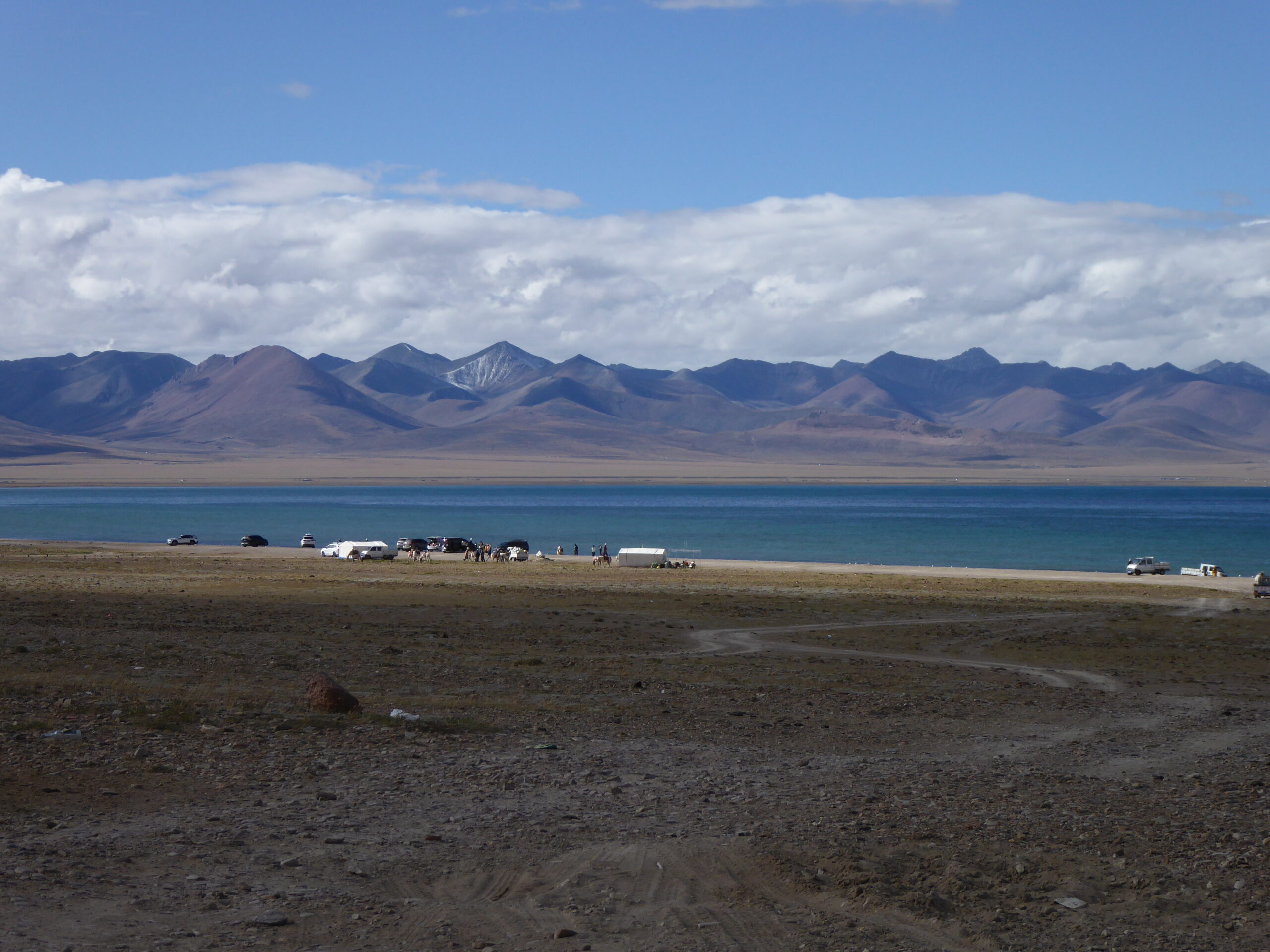
Geren Tso Lake near Shenza
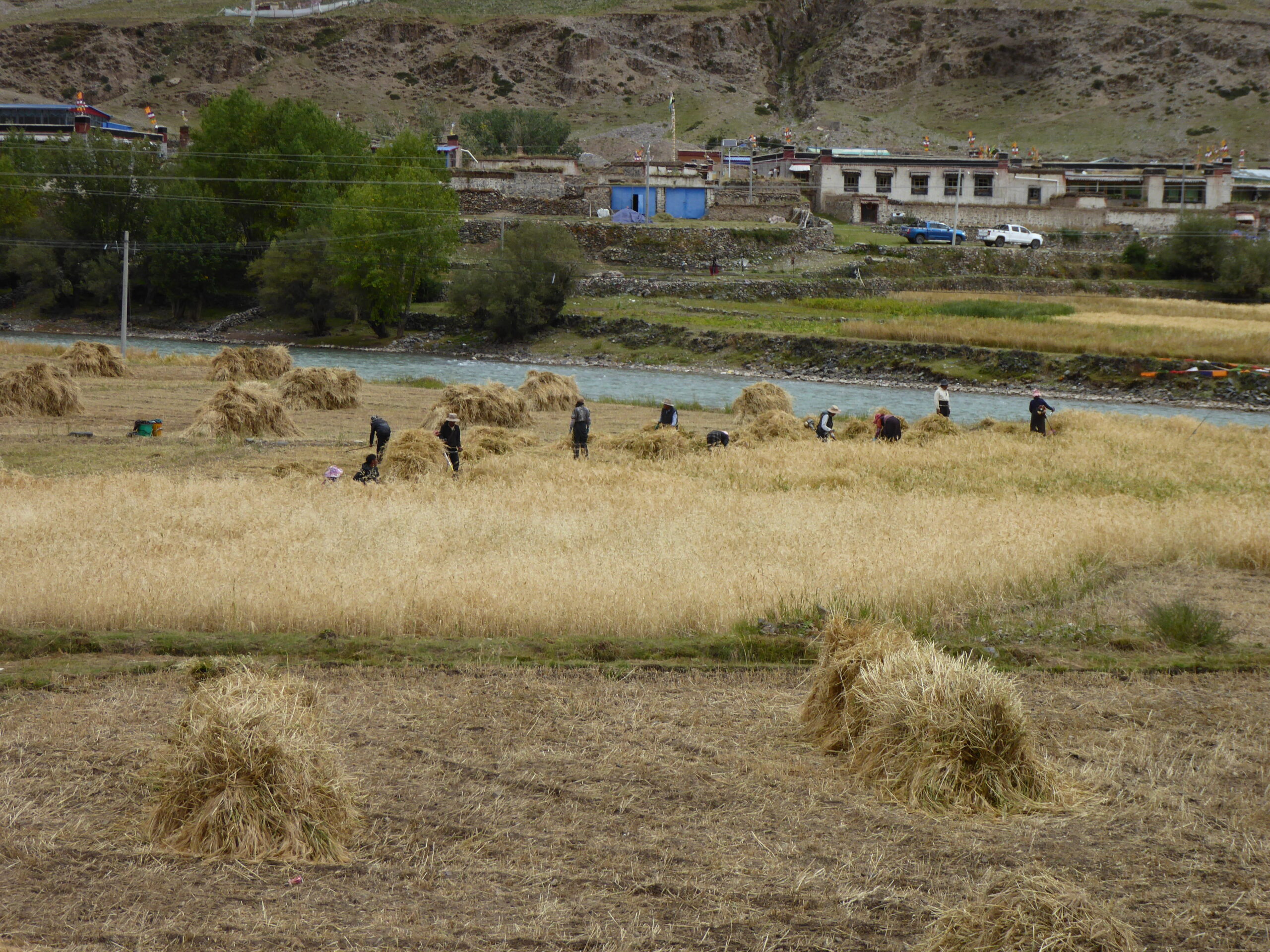
I think its barley
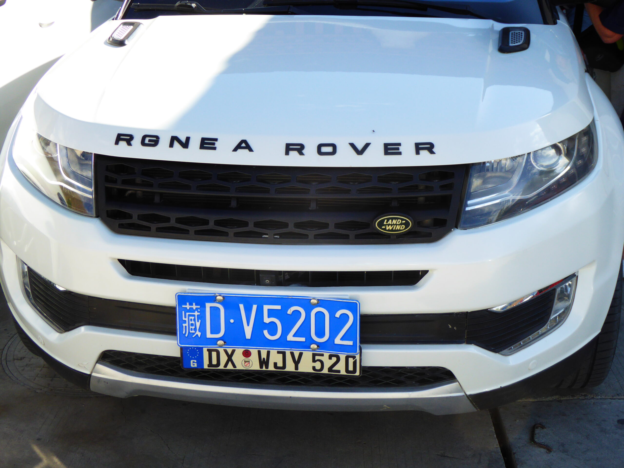
What sort of Rover?
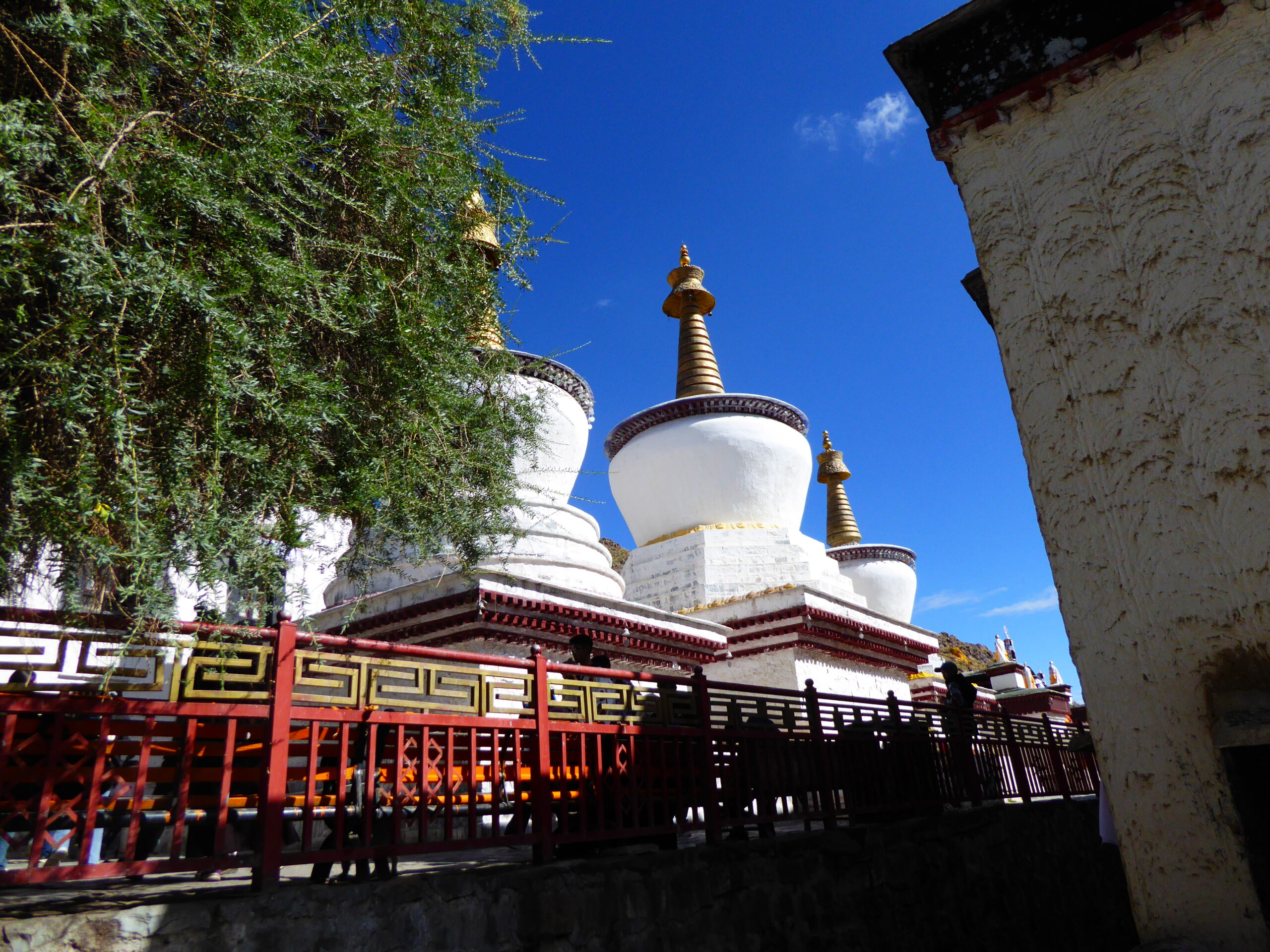
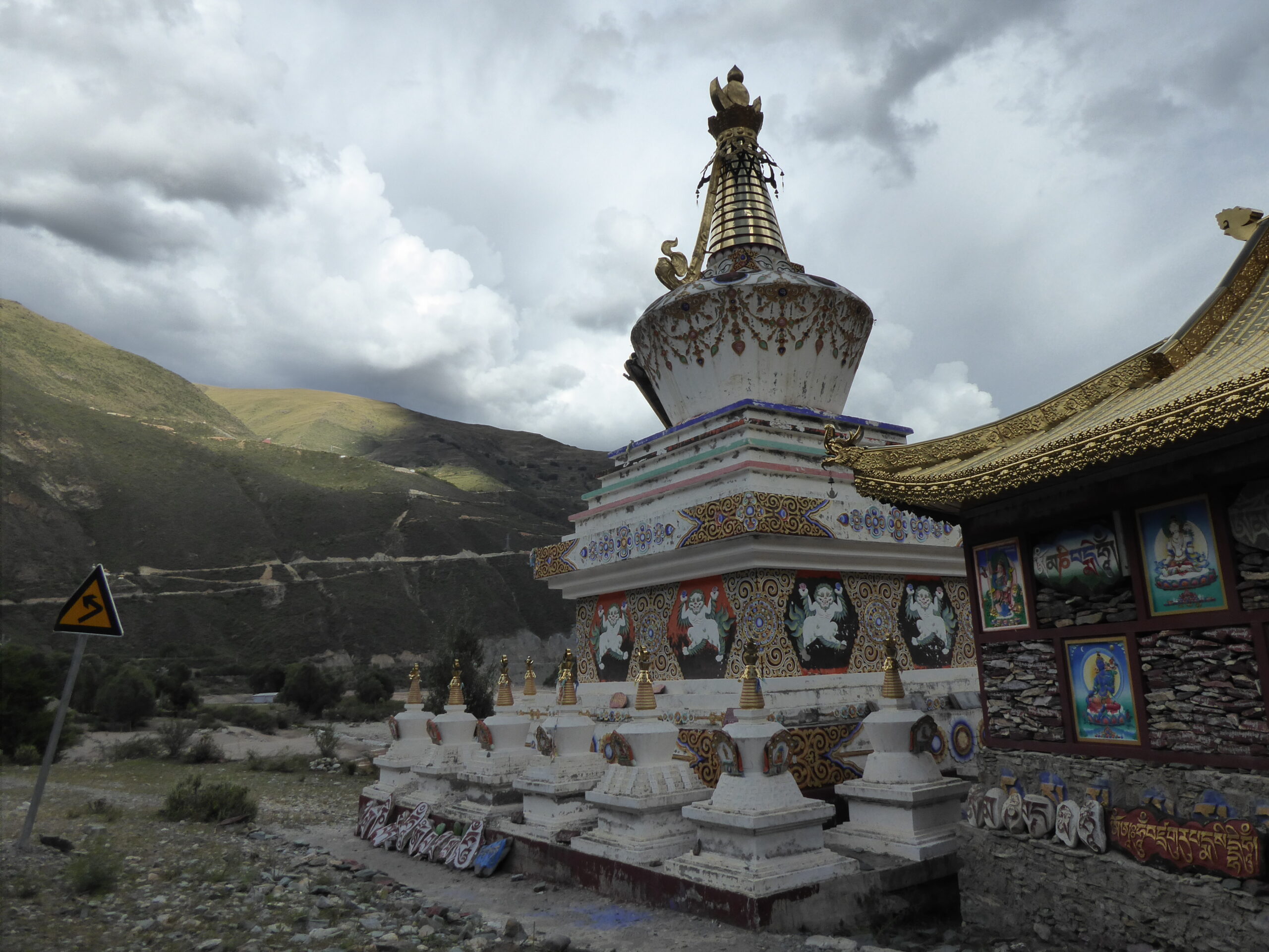
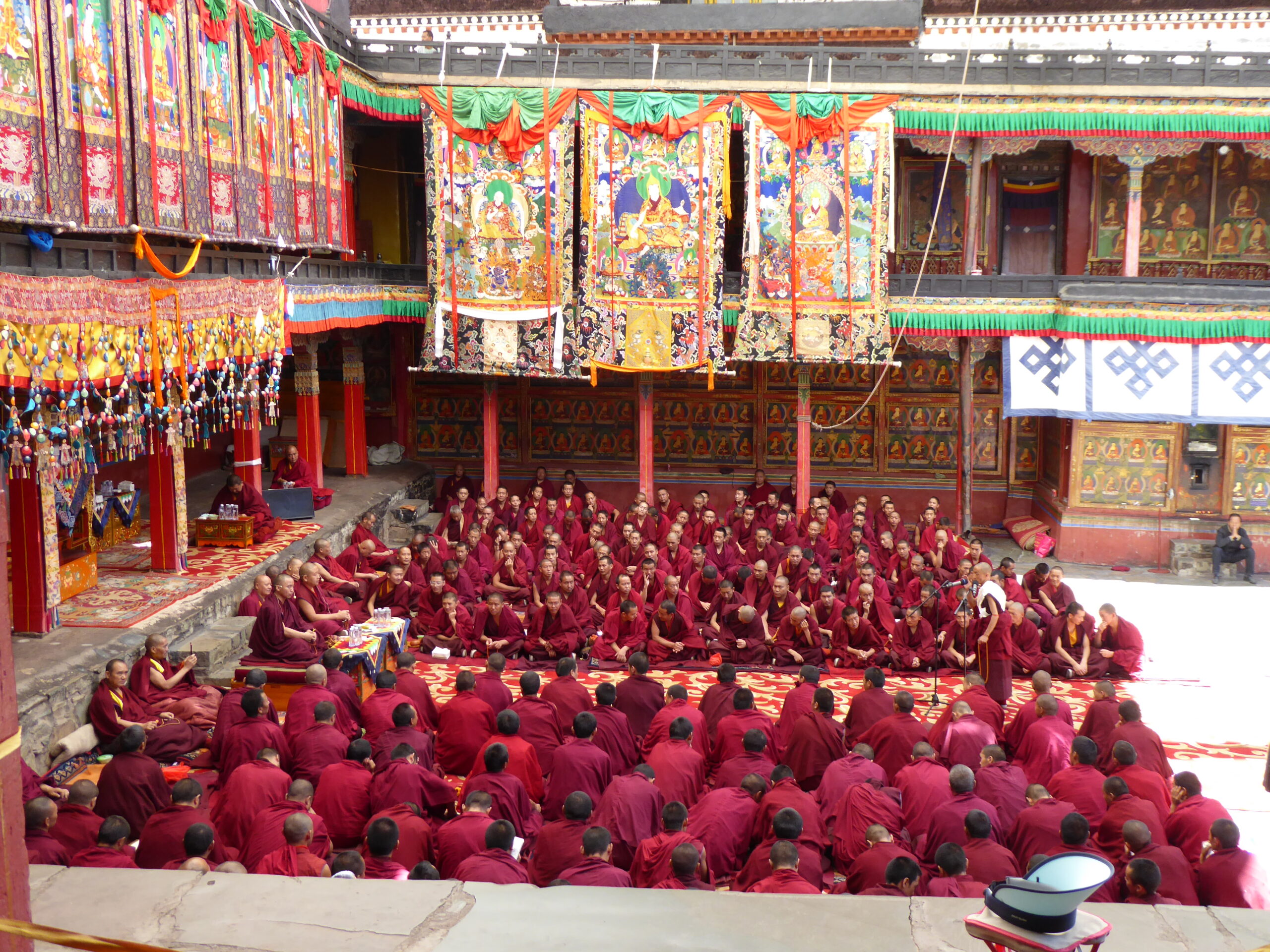
Stupas at Tashi Lhunpo
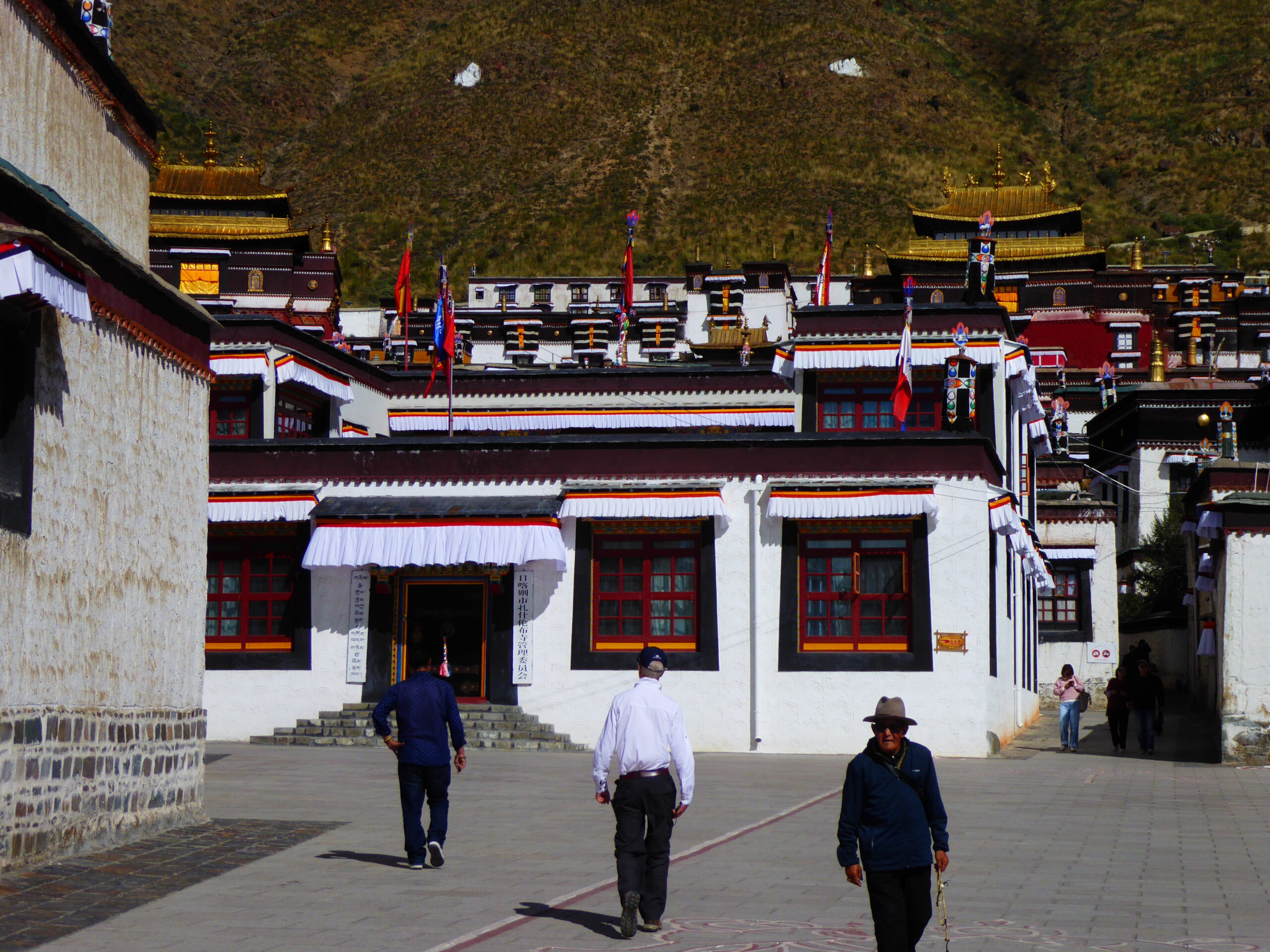
Tashi Lhunpo
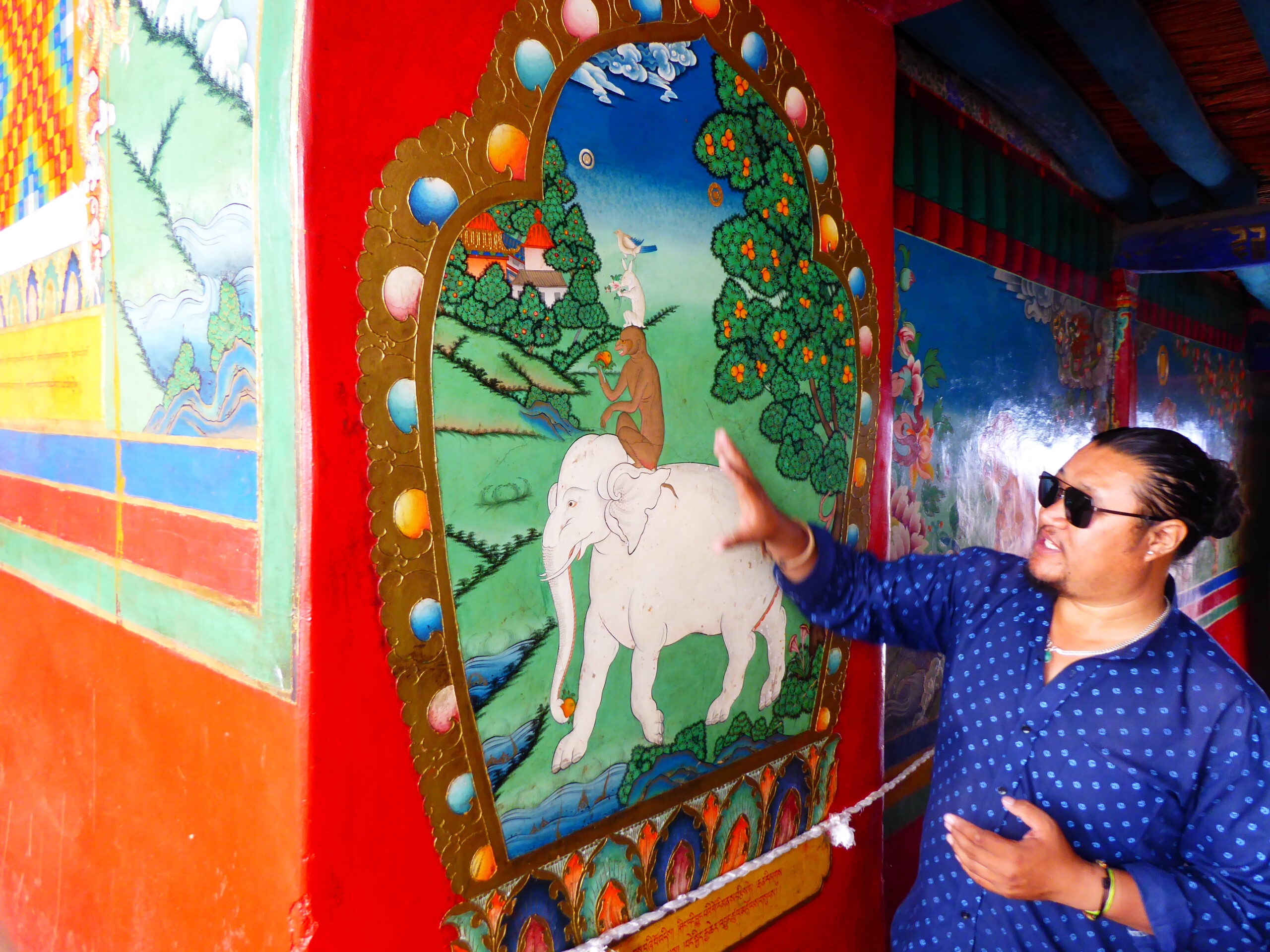
Explanation of a parable
Theological examination
Zhong
What were these gates for?
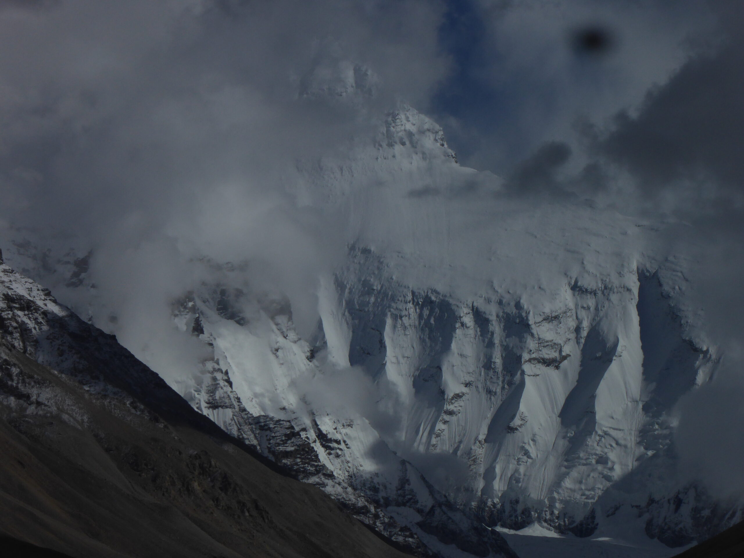
From Everest Viewing Platform c.30km by road
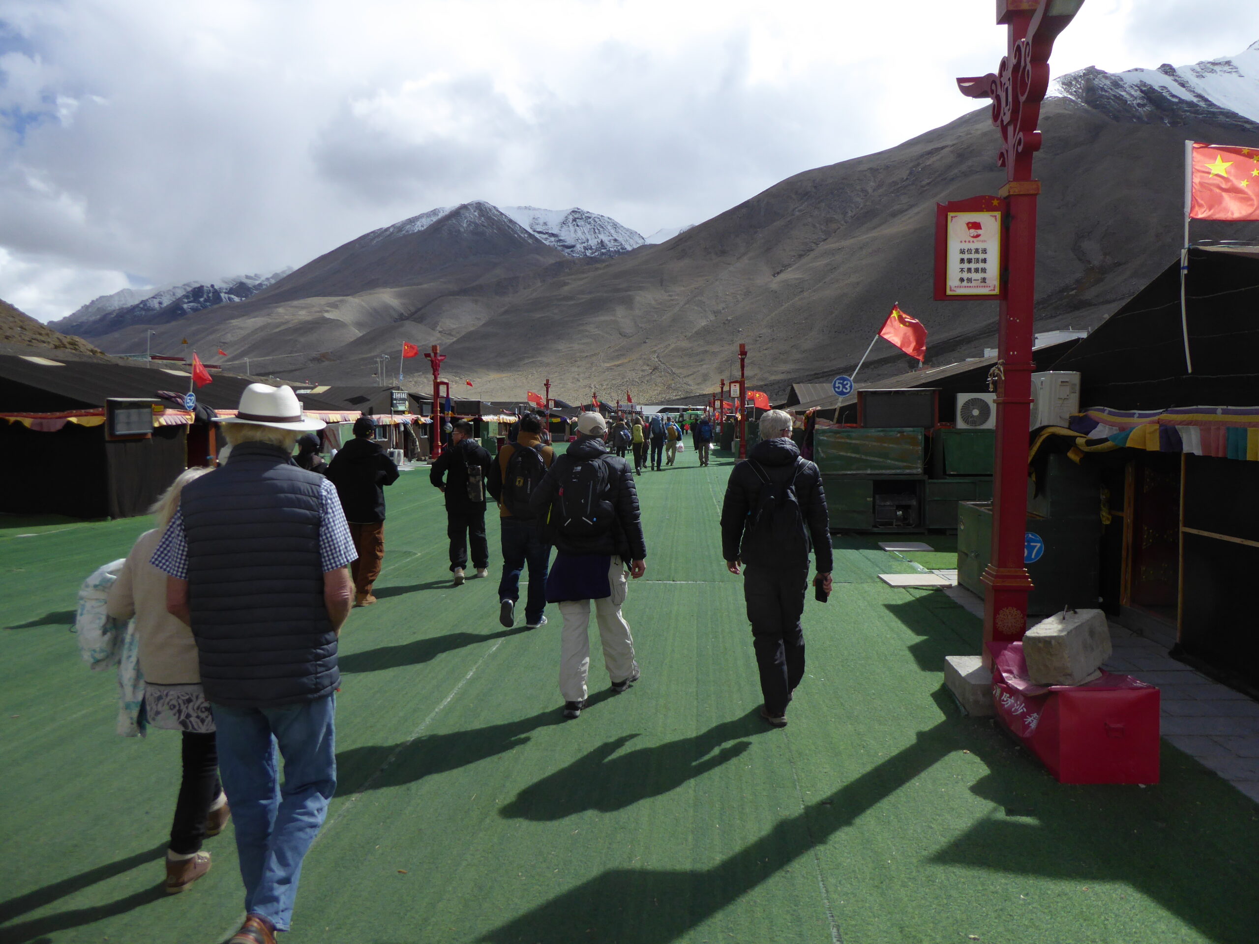
sanitised approach
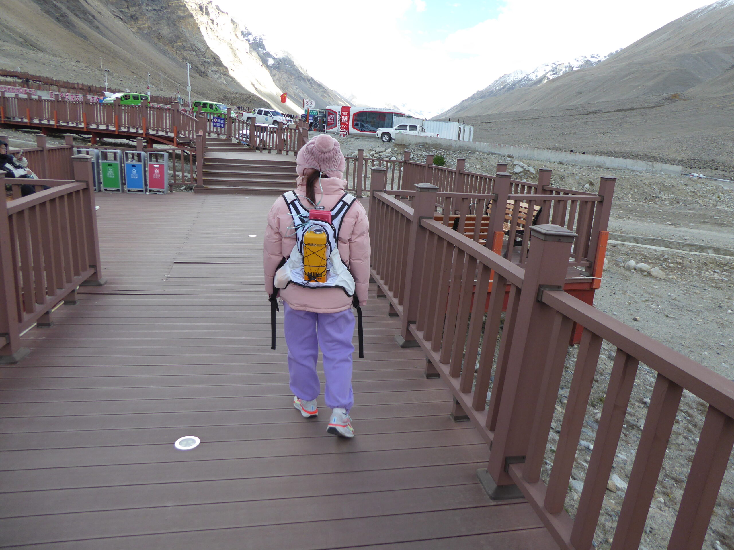
Boardwalk and backpack
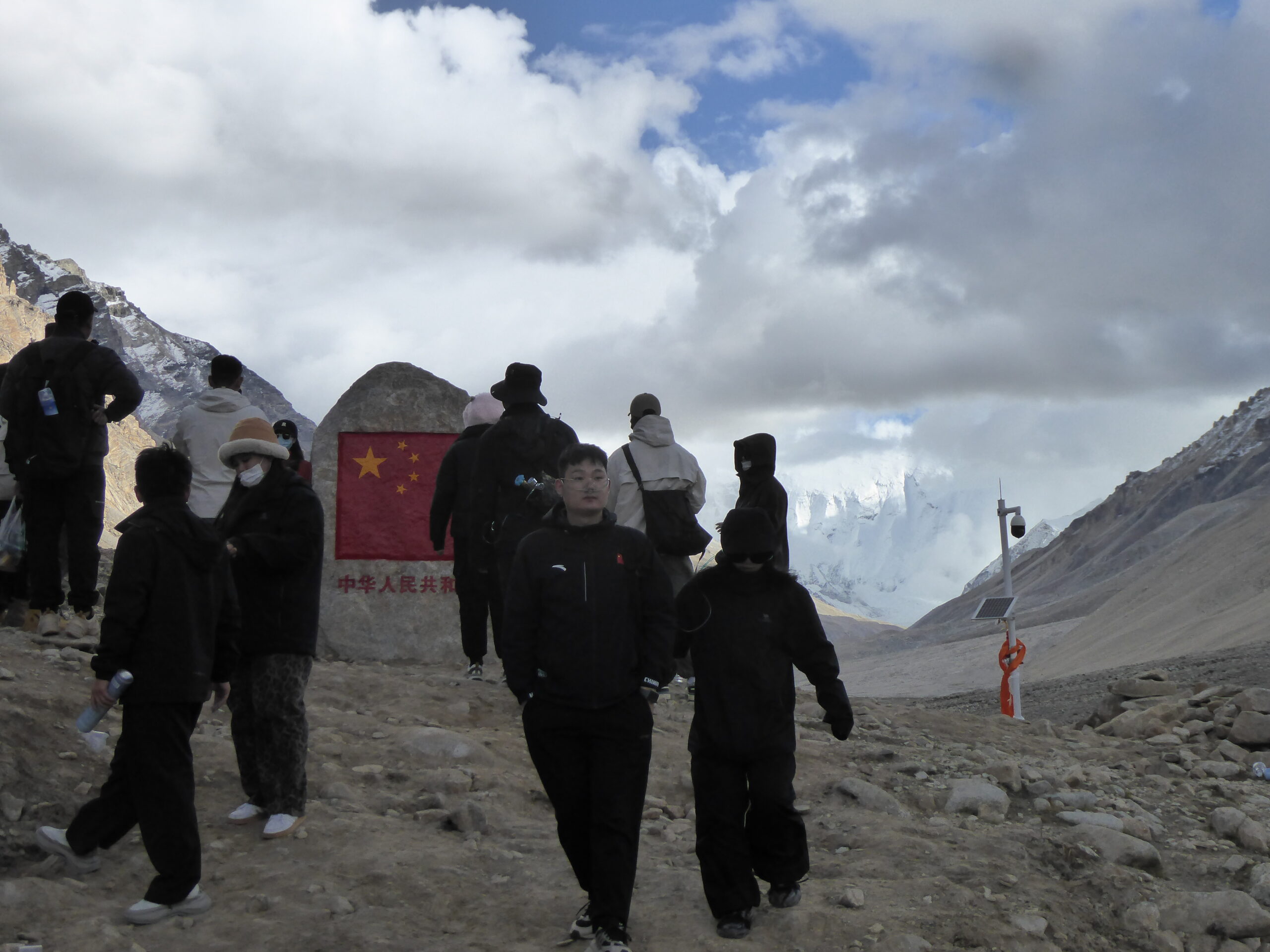
Only one flag allowed
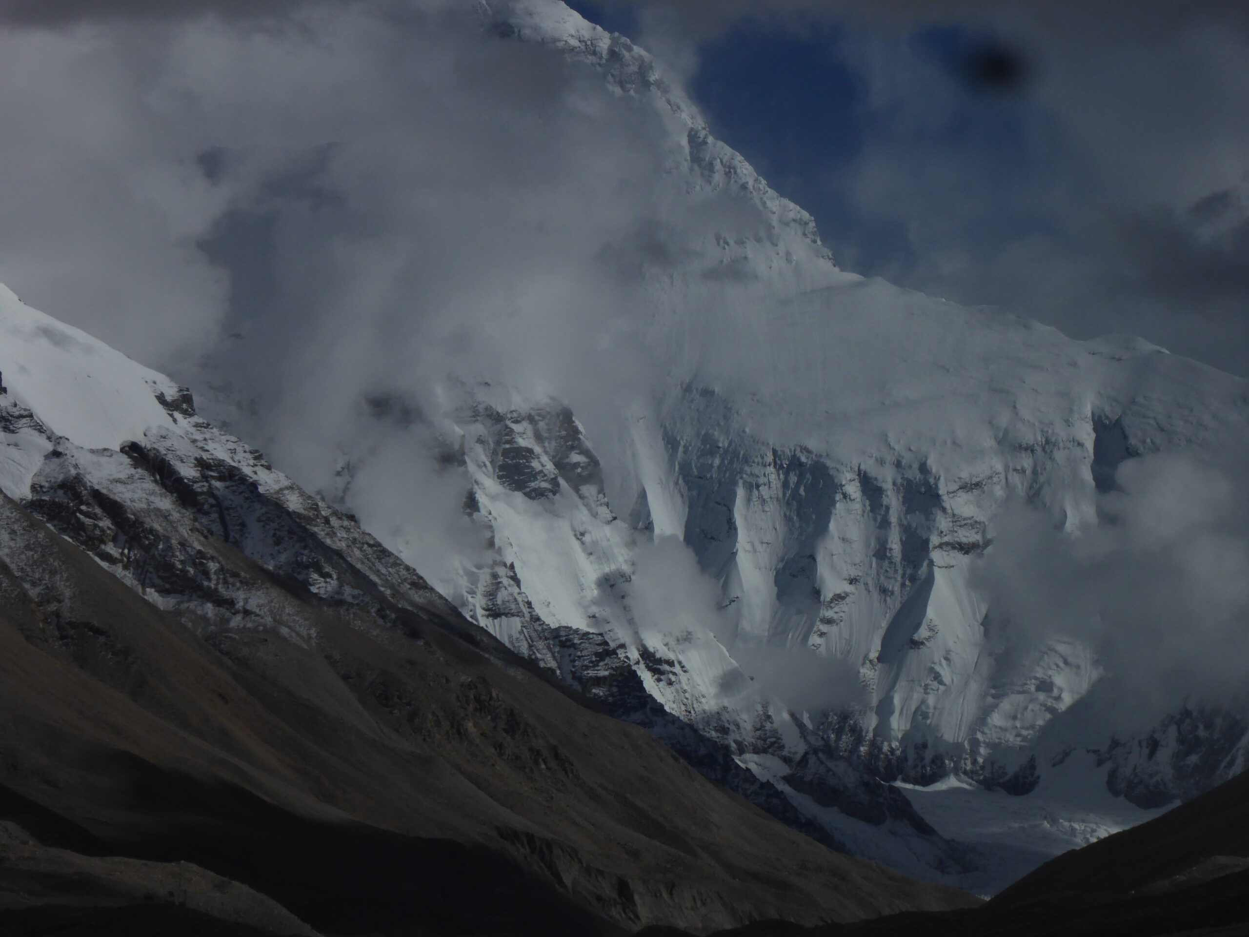
Everest is there somewhere!
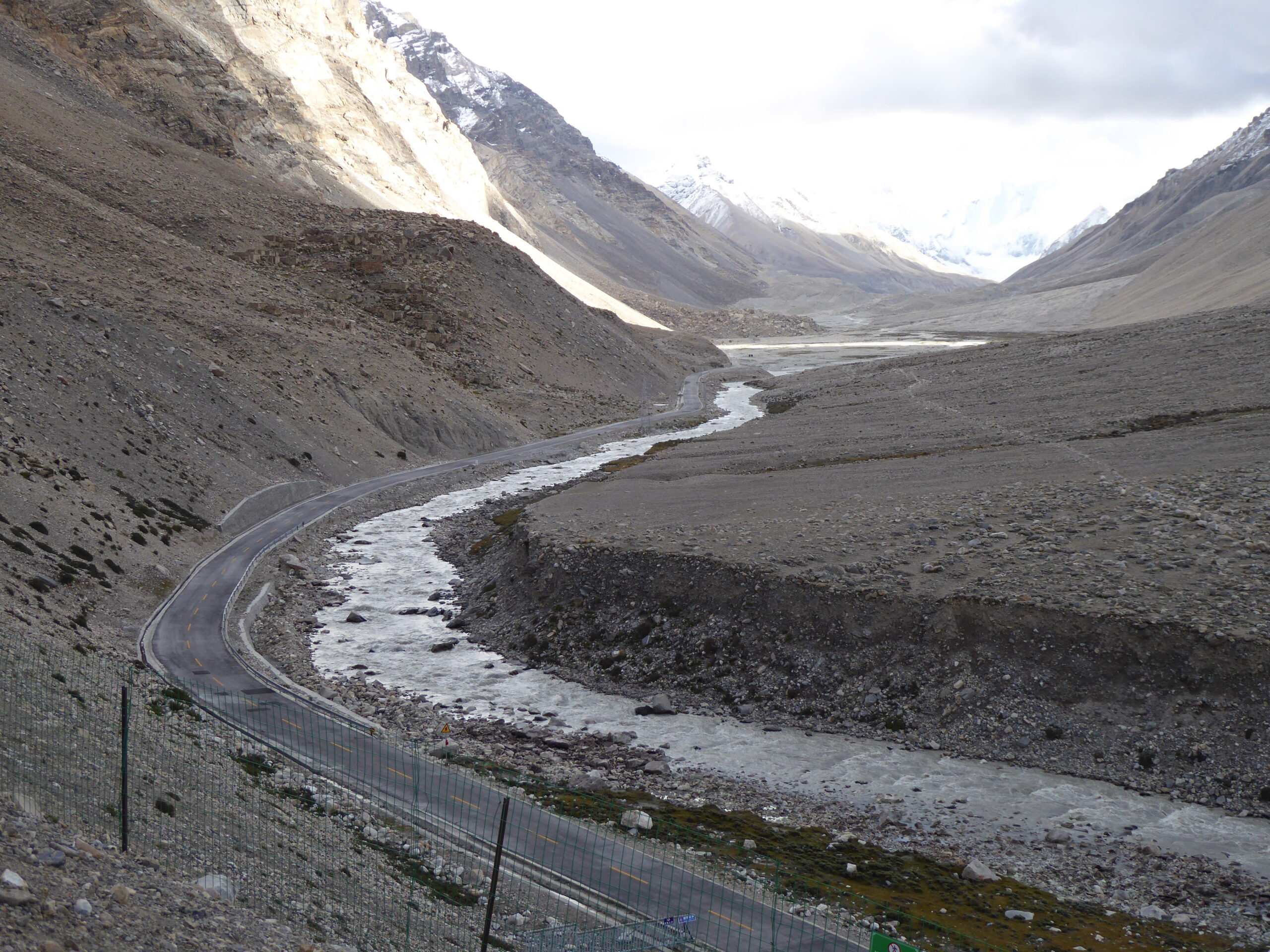
The road to the proper base camp
What we came to see
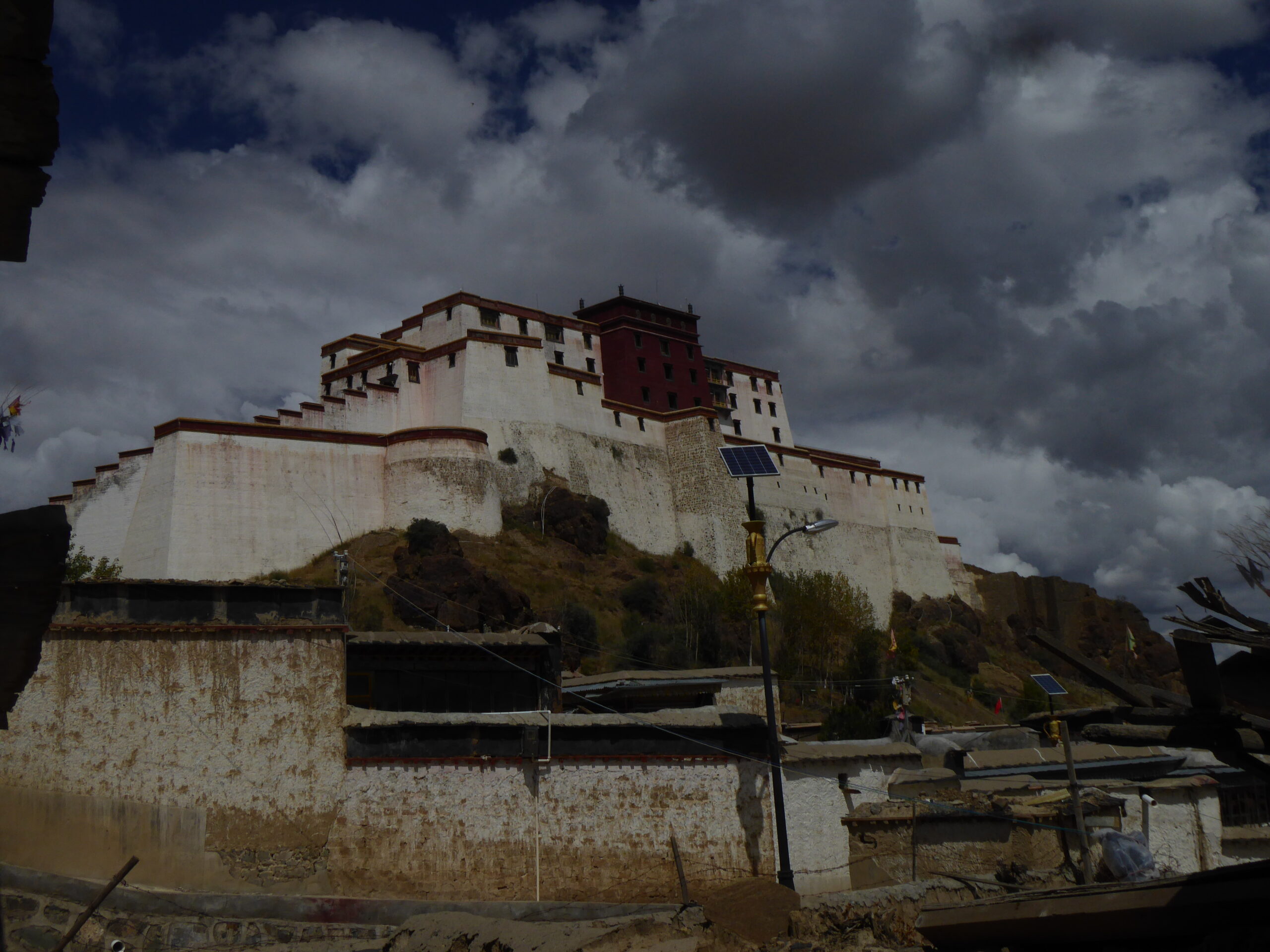
Sakya Monastery
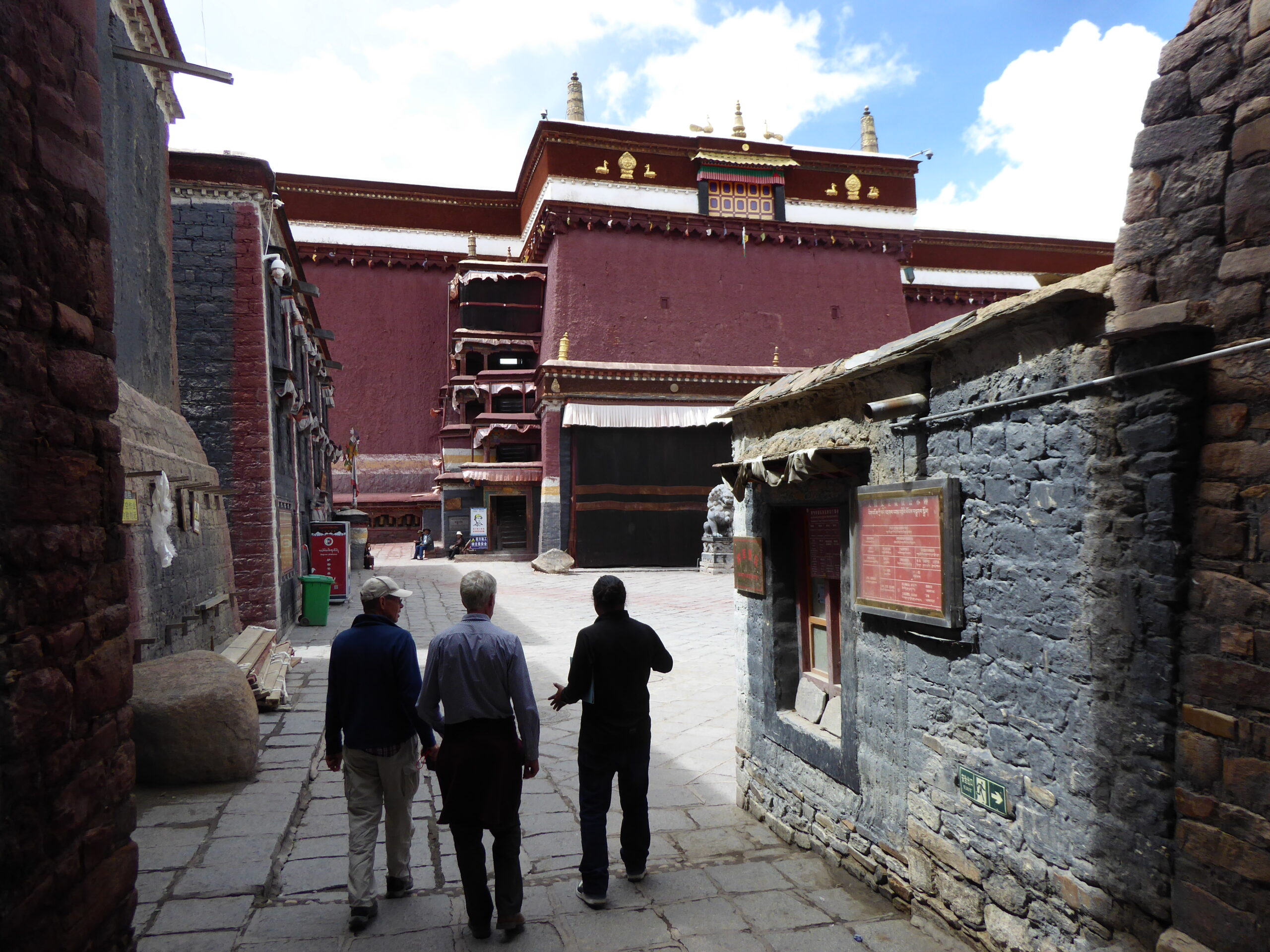 Leaving the monastery, I got lost and found myself heading towards the marked track but going through a checkpoint which was not in the routebook. Then I realised I was heading towards the outbound track from yesterday and not today’s return track! I went back through the checkpoint where I had to show my passport whilst I was on the radio to the group checking where I was. I dropped my passport on my knees – and that was the last time I saw it. Some hours later I realised it was no more but by that time, I’d taken a number of photos, driven along a lake
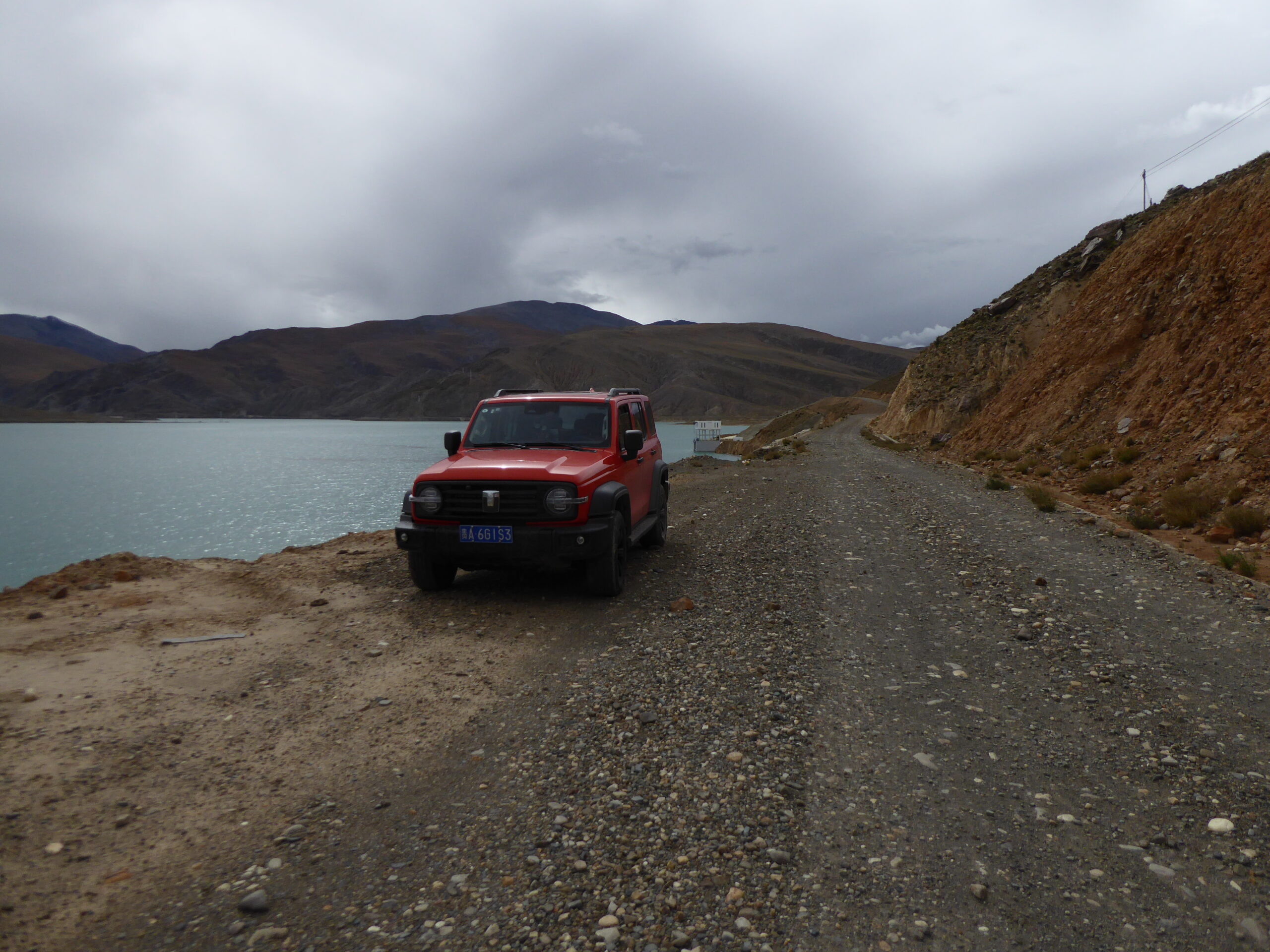
Another lake
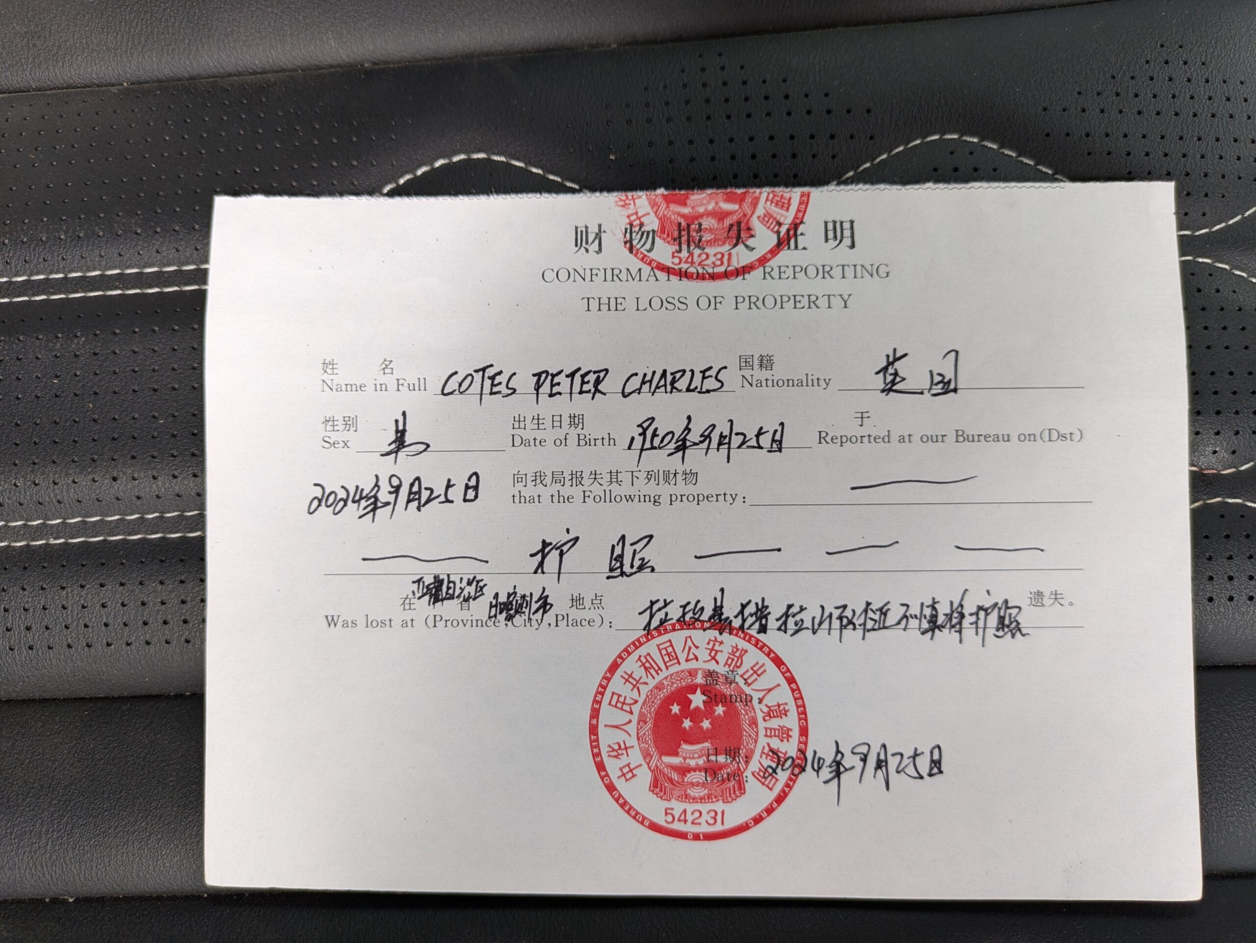
Lost Document Report
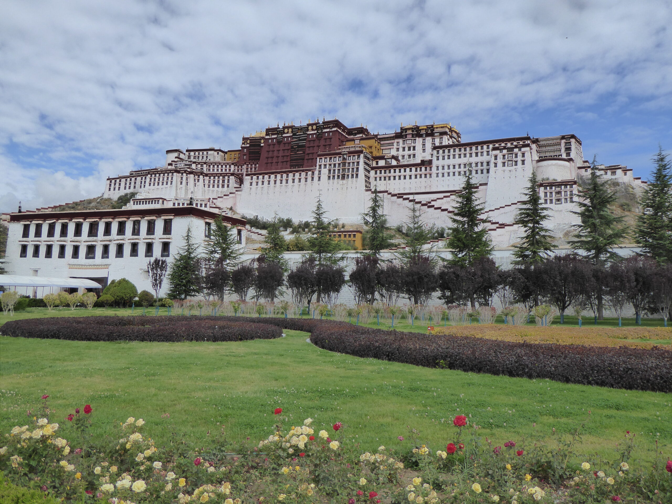
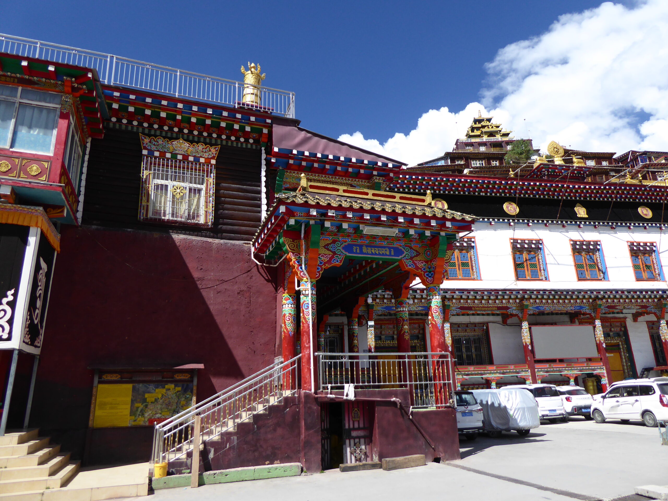
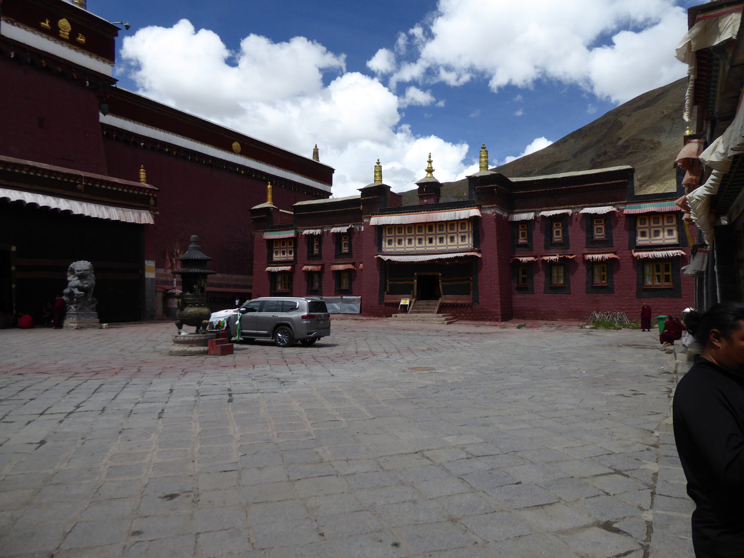
Potala Palace
Pilgrim
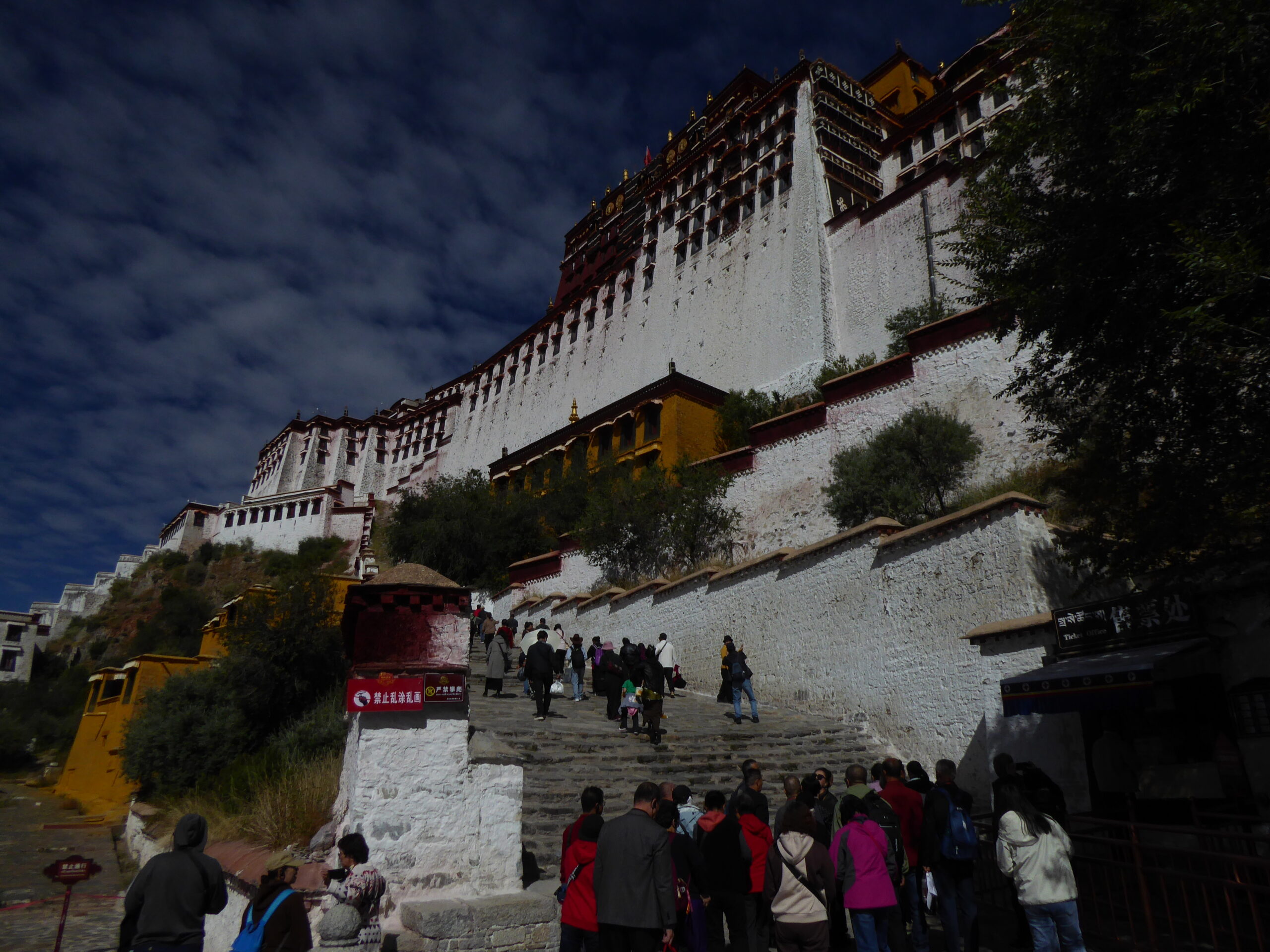
Potala Palace
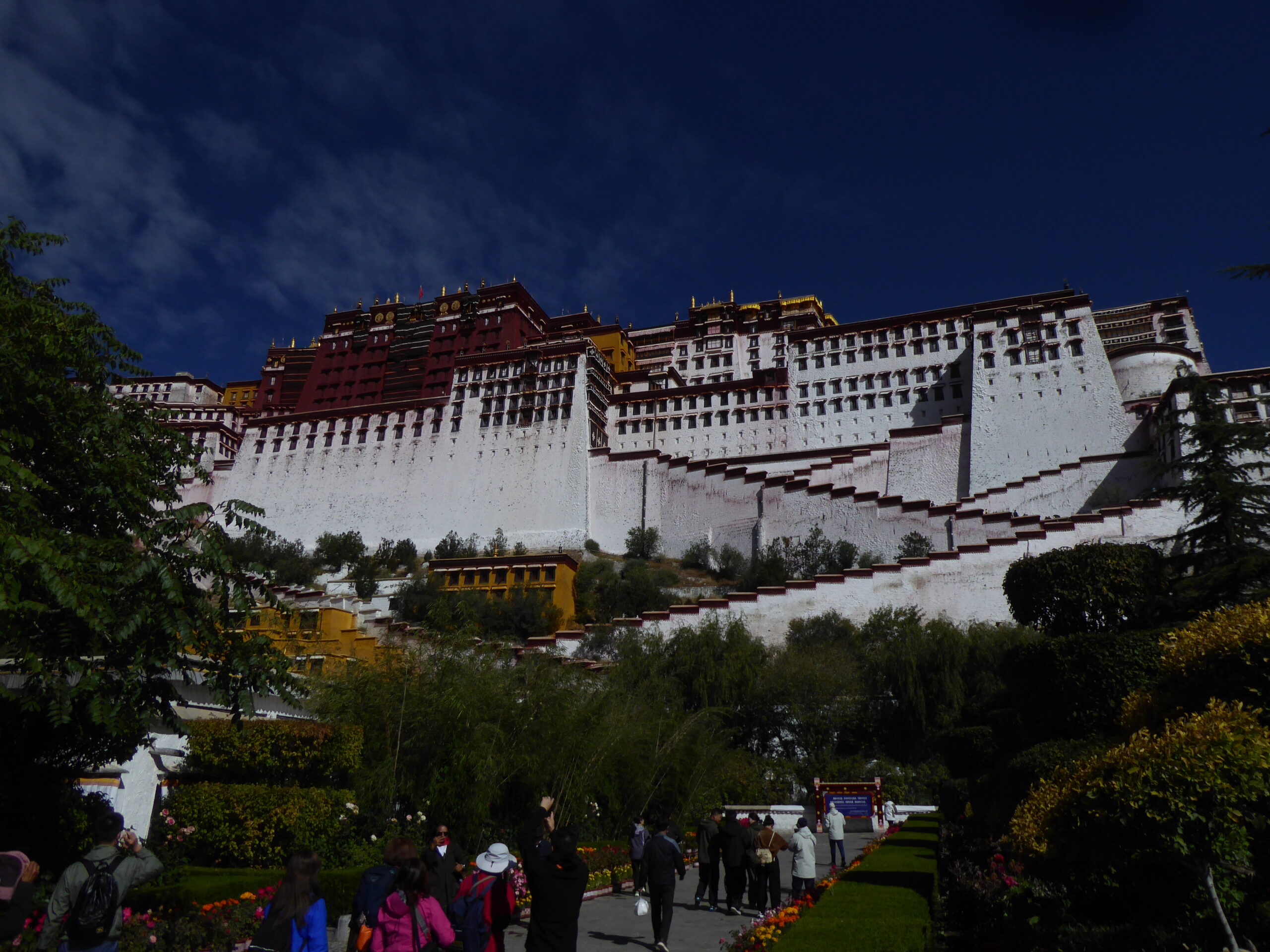
Potala Palace
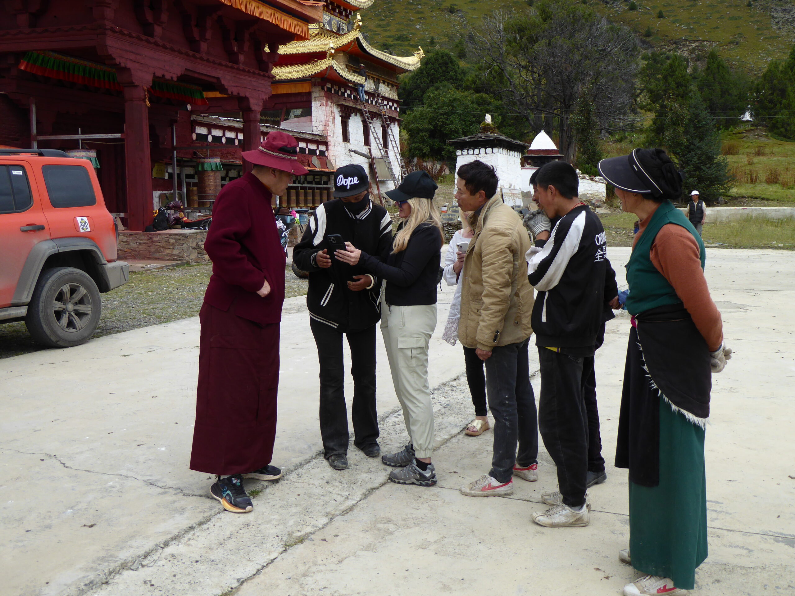
Arriving at the British Embassy, the passport was ready but I was told I had now to get a visa in the temporary passport (cost £100 and valid for one journey only). At the visa centre I was asked why I wanted to leave and told there was a 7 day processing time and a 7 day National holiday starting in a couple of days – say 3 weeks all told. This wasn’t looking good so I figured I would go back to Chengdu where I had arrived – they would have full details of my visa, plus I had a booked flight plus maybe they’d not be so strict and perhaps our guide was right that the police report was my “get out” card. In Chengdu I arrived in good time and got all the way to the departure Lounge, having gone through Immigration with no fuss and was relaxing with a cup of tea, thinking that this would work……when an airline official arrived and said Immigration would like a word with me. I answered a few questions and went back to my tea when I was again approached and taken right back to the airport entry hall. I was told that “our leaders have said that you must have a visa in your passport” and also that the man’s boss was very angry that I had taken up so much time. I was given the address of the nearest visa centre (not Chengdu) – but when the taxi got there – closed! Try again tomorrow. The driver found me a very nice hotel with marble pillars and reasonably cheap (definitely not on the tourist trail!). Next day I turned up and was told it was the wrong office and to go 1 km down the road. This was the right office but communication was difficult so I phoned the China guide who had what seemed to be a very animated conversation and the upshot was….they could not issue visas and I must go back to Chengdu! Back in Chengdu I was told the same 7 days story but really didn’t fancy an extra 3 weeks in China. Not only would I be completely on my own but Allison was already worked up about my predicament. Only one card left to play. I told the lady I was an old man (true) and all my group/friends had already left for home so I was all alone (true). Ok come back 4pm tomorrow!! But first she wanted to see my flight booking to ensure I was actually going to leave. Of course my flight had been and hone and no refund possible but booking.com did the necessary so that was all ok then? Not exactly. I see you’ve in Tibet may I see your Tibet travel permit. I didn’t have that so I texted the Tibet guide to send me a copy – which he did….on WhatsApp. What is banned in China? Yes WhatsApp! Fortunately the lady passed on that so an exit was possible. After a few more misunderstandings I finally got home only 3 days late. Moral-don’t ose your passport and whatever you do, don’t lose it in China and most certainly not in Tibet!
To Be Continued
Technicalities
The trip required preparation – from our end: Chinese visas, altitude insurance (our standard policy stopped at 4500 metres) but we would be going 1,000 metres higher, the balance between warm and cold weather clothing (Everest base camp could be cold but Chengdu was 38°/40°), arranging an E-Sim and a VPN (virtual private network), flights, London – Chengdu return and a single flight from Lhasa to Chengdu, plus the usual airport transfers, car parking, dogs into kennels, cash and credit cards – the list went on and was longer than usual and the arrangements continuously changed. For example we were told that anyone over a “certain age” had to take a Chinese driving test which would occupy our first day in Chengdu so there wouldn’t be time to see the pandas – and who would go to Chengdu and not go to see the pandas? So we booked an early return from Lhasa to Chengdu to see pandas but then our driving licences were arranged so we cancelled the early flight to have longer in Lhasa.
Then Allison was too ill to travel so I went alone, cancelling her flights, then the airport taxi didn’t arrive – “sorry we forgot” – so a rush to arrange 3 weeks airport parking and an unexpected drive to Heathrow.
Adrian had arranged Chinese Sim cards for us and helped set up the VPN so we could use WhatsApp for easy communication – but its banned in China so the VPN hides your location. We were told we had to use a Chinese phone app called WeChat (similar to WhatsApp) which had a payment feature as credit cards were not commonly used, the majority of payments being by phone. Being old fashioned I wanted some cash – the hotel didn’t have any and the local ATM promptly swallowed my card! I thought about going to the bank the next day but as the card was in Allison’s name, I decided that would require a lot of explanation so bye, bye card! Then my phone died as I exceeded my data allowance when the wifi failed whilst I was calling back to UK. That meant I couldn’t load my credit card onto the WeChat app because I couldn’t access the bank’s pass code – which was sent to my UK phone number……. Fortunately, Allison was able to pay off the mobile bill, Alastair had a spare phone (as mine couldn’t take 2 physical Sim cards) and a few days later I was back in operation. Too many dominoes!
Navigation is much easier when there’s a driver and a navigator in the car as I found out when I messed up a motorway intersection and was 20 minutes late for lunch. We had been given 3 mapping options:
• Guru maps which showed the track to follow but not speeds or instructions at junctions but it did show the “deviations” which Adrian liked to follow,
• AMaps, like a Chinese version of TomTom but in Chinese. This did show big white arrows at intersections and speeds but not the deviations
• WeMaps which the guides used but served only to confuse everyone else!
Speeding was a concern to us as China has overhead camera gantries all over the place, in towns and on country roads – and twice as many in Tibet as in China. Most flashed at you because you were there irrespective of speed, some were actual speed cameras and others were Average speed – but we weren’t told that till much later and how AMaps could tell us. However Adrian and our China guide were initially relaxed about speeding – foreigners could not collect penalty points so at the end we would be invoiced for the financial penalties and charged the cost of getting people to accept the points – there is a thriving black market in getting others to take your points in China. This relaxed attitude changed abruptly when the first penalty notices started arriving – one at over twice the limit. “Please slow down” a tearful China guide asked us! In the event, I had no penalties, one had £10 and one was about £750. Maybe the cameras were broken!